
How to get from Sugar Creek Air Park (Indiana) to Milwaukee (Wisconsin)
Calculate route from Sugar Creek Air Park (Indiana, United States) to Milwaukee (Wisconsin, United States).
The flight distance (as the crow flies) between Sugar Creek Air Park and Milwaukee is 396.0 km.
Roadmap (route) to go from Sugar Creek Air Park to Milwaukee detailed above, you can also see the course layout on the map.
While doing trip Sugar Creek Air Park - Milwaukee by car, the calculated route ends at a distance , or more straight.
Distance and duration of the route between Sugar Creek Air Park and Milwaukee
Calculation of distance and route from Milwaukee to Sugar Creek Air Park :
396.0474.0 km6h34mn
Continue onto 1100 E 0h1mn 598 mTurn right onto East 900 N 0h3mn 1.6 kmTurn left onto 1000 E 0h3mn 1.6 kmTurn right onto SR 234 0h26mn 25.5 kmTurn left onto West Broadway 0h1mn 553 mTurn sharp right onto North County Road 600 West 0h0mn 336 mTurn left onto 800 N 0h3mn 3.3 kmTurn right onto Oaklandon Road 0h0mn 452 mTurn left onto Fox Road 0h2mn 2.0 kmTurn right onto East 79th Street 0h9mn 9.0 kmKeep right and drive toward Allisonville Road 0h0mn 43 mTurn right onto Allisonville Road 0h0mn 236 mKeep left toward I 465 West 0h0mn 212 mKeep left 0h12mn 16.0 kmKeep left onto I 865 and take I 865 West toward Chicago 2h14mn 221.7 kmTurn left onto East 5th Avenue 0h2mn 2.6 kmTurn sharp right onto Broadway 0h0mn 157 mTurn left toward I 90 West 0h25mn 34.9 kmKeep left onto Chicago Skyway toward I 90 Express, I 94 Express 0h20mn 25.4 kmKeep right onto Edens Expressway and take I 94 West toward Milwaukee 0h16mn 21.8 kmKeep left onto Skokie Highway 0h24mn 30.6 kmContinue onto North Skokie Highway 1h40mn 63.1 kmKeep right onto I 41, I 94, US 41 and take I 41 North, I 43 South, I 894 Bypass toward Madison, Fond du Lac 0h1mn 1.4 kmKeep right and take I 43 North, I 94 West toward Milwaukee, Downtown 0h4mn 6.2 kmKeep right and drive toward Becher Street, Mitchell Street 0h0mn 159 mKeep left and drive toward Lapham Boulevard, Greenfield Avenue 0h1mn 850 mKeep right and drive toward Lapham Boulevard, Greenfield Avenue 0h0mn 312 mTurn slight left onto South 4th Street 0h0mn 308 mTurn right onto West Greenfield Avenue 0h0mn 228 mTurn left onto South 2nd Street 0h0mn 343 mTurn right onto West Washington Street 0h0mn 114 mTurn left onto South 1st Street 0h2mn 1.7 kmTurn right onto East Saint Paul Avenue 0h0mn 108 mTurn left onto North Broadway 0h1mn 409 mTurn sharp right onto East Wisconsin Avenue 0h0mn 104 mTurn left onto North Milwaukee Street 0h0mn 14 mArrive at destination 0h0mn 0 m
Travel from Sugar Creek Air Park (Wisconsin) to a selection of major cities.
Distances from Sugar Creek Air Park to biggest cities in Indiana
- Columbus,46,690 inhabitants.85 km
- West Lafayette,45,550 inhabitants.125 km
- Portage,36,738 inhabitants.227 km
- Westfield,36,738 inhabitants.47 km
- New Albany,36,732 inhabitants.183 km
- Richmond,35,854 inhabitants.61 km
- Merrillville,35,224 inhabitants.227 km
- Goshen,32,983 inhabitants.186 km
- Valparaiso,32,626 inhabitants.212 km
- Michigan City,31,459 inhabitants.227 km
- Plainfield,30,590 inhabitants.73 km
- Granger,30,465 inhabitants.208 km
- Marion,29,081 inhabitants.71 km
- Crown Point,28,879 inhabitants.223 km
- Schererville,28,791 inhabitants.234 km
- East Chicago,28,699 inhabitants.247 km
- Hobart,28,404 inhabitants.227 km
- Zionsville,26,296 inhabitants.57 km
- Brownsburg,24,996 inhabitants.69 km
- Franklin,24,598 inhabitants.63 km
Other major cities in country :
- Seattle [WA], 684,451 inhabitants. 3,043 km
- Denver [CO], 682,545 inhabitants. 1,654 km
- El Paso [TX], 681,124 inhabitants. 2,086 km
- Detroit [MI], 677,116 inhabitants. 343 km
- Boston [MA], 667,137 inhabitants. 1,247 km
- Memphis [TN], 655,770 inhabitants. 661 km
- New South Memphis [TN], 641,608 inhabitants. 667 km
- Portland [OR], 632,309 inhabitants. 3,067 km
- Oklahoma City [OK], 631,346 inhabitants. 1,160 km
- Las Vegas [NV], 623,747 inhabitants. 2,611 km
- Baltimore [MD], 621,849 inhabitants. 774 km
- Washington, D.C. [DC], 601,723 inhabitants. 745 km
- Milwaukee [WI], 600,155 inhabitants. 397 km
- South Boston [MA], 571,281 inhabitants. 1,247 km
- Albuquerque [NM], 559,121 inhabitants. 1,930 km
- Tucson [AZ], 531,641 inhabitants. 2,425 km
- Nashville [TN], 530,852 inhabitants. 431 km
- Fresno [CA], 520,052 inhabitants. 2,987 km
- Sacramento [CA], 490,712 inhabitants. 3,077 km
- Kansas City [MO], 475,378 inhabitants. 776 km
Route from Milwaukee to major cities (United States).
- Distance Milwaukee New York City1,179 km
- Distance Milwaukee Los Angeles2,806 km
- Distance Milwaukee Chicago134 km
- Distance Milwaukee Brooklyn1,186 km
- Distance Milwaukee Houston1,620 km
- Distance Milwaukee Queens1,194 km
- Distance Milwaukee Philadelphia1,115 km
- Distance Milwaukee Phoenix2,356 km
- Distance Milwaukee Manhattan1,180 km
- Distance Milwaukee San Antonio1,786 km
- Distance Milwaukee San Diego2,797 km
- Distance Milwaukee The Bronx1,186 km
- Distance Milwaukee Dallas1,382 km
- Distance Milwaukee San Jose2,938 km
- Distance Milwaukee Austin1,668 km
- Distance Milwaukee Jacksonville1,519 km
- Distance Milwaukee San Francisco2,962 km
- Distance Milwaukee Columbus533 km
- Distance Milwaukee Fort Worth1,413 km
- Distance Milwaukee Indianapolis392 km
Nearest cities to Sugar Creek Air Park :
- Chicago, 2,720,546 inhabitants. 275 km
- Columbus, 850,106 inhabitants. 222 km
- Indianapolis, 829,718 inhabitants. 51 km
- Detroit, 677,116 inhabitants. 343 km
- Lexington-Fayette, 314,488 inhabitants. 231 km
- Cincinnati, 296,943 inhabitants. 128 km
- Meads, 288,649 inhabitants. 301 km
- Ironville, 288,649 inhabitants. 299 km
- Toledo, 279,789 inhabitants. 259 km
- Fort Wayne, 260,326 inhabitants. 140 km
- Louisville, 243,639 inhabitants. 186 km
- Lexington, 225,366 inhabitants. 236 km
- Aurora, 200,661 inhabitants. 307 km
- Joliet, 147,861 inhabitants. 275 km
- Naperville, 147,100 inhabitants. 298 km
- Dayton, 140,599 inhabitants. 122 km
- Warren, 134,056 inhabitants. 359 km
- Sterling Heights, 132,052 inhabitants. 366 km
- Evansville, 119,943 inhabitants. 275 km
- Ann Arbor, 117,070 inhabitants. 305 km
- Lansing, 115,056 inhabitants. 325 km
- Elgin, 112,111 inhabitants. 326 km
- South Bend, 101,516 inhabitants. 204 km
- Kenosha, 99,858 inhabitants. 350 km
- Clinton Township, 99,753 inhabitants. 372 km
- Dearborn, 95,171 inhabitants. 336 km
- Livonia, 94,635 inhabitants. 331 km
- Carmel, 88,713 inhabitants. 45 km
- Waukegan, 88,475 inhabitants. 331 km
- Canton, 86,825 inhabitants. 320 km
- West Town, 86,429 inhabitants. 280 km
- Champaign, 86,096 inhabitants. 226 km
- Near North Side, 85,711 inhabitants. 279 km
- Bloomington, 84,067 inhabitants. 116 km
- Cicero, 83,886 inhabitants. 281 km
- Troy, 83,280 inhabitants. 362 km
- Westland, 82,000 inhabitants. 325 km
- Farmington Hills, 81,330 inhabitants. 341 km
- Belmont Cragin, 79,159 inhabitants. 289 km
- Racine, 77,742 inhabitants. 362 km
- Hammond, 77,614 inhabitants. 245 km
- Gary, 77,156 inhabitants. 237 km
- Fishers, 76,794 inhabitants. 36 km
- Kalamazoo, 76,041 inhabitants. 264 km
- Arlington Heights, 75,926 inhabitants. 313 km
- Waterford, 75,737 inhabitants. 359 km
- Evanston, 75,527 inhabitants. 294 km
- Wyoming, 75,275 inhabitants. 333 km
- Schaumburg, 74,693 inhabitants. 314 km
- Bolingbrook, 74,306 inhabitants. 287 km
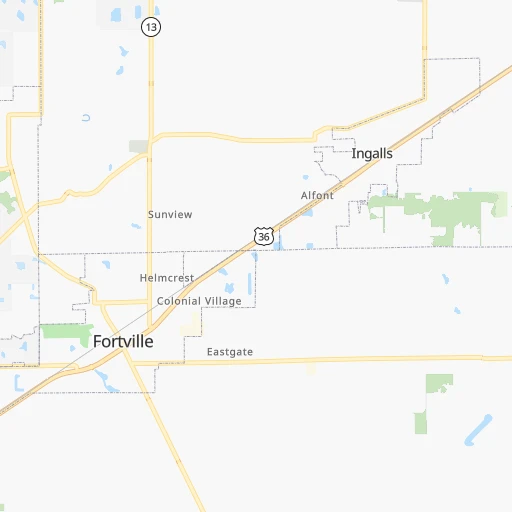
Location Sugar Creek Air Park (Indiana) :
| Country flag |  |
| Location | Sugar Creek Air Park |
| State | Indiana |
| County | Hancock County |
| Country | United States |
| Country code / ISO 2 | US |
| Latitude | 39.9220000 |
| Longitude | -85.5987900 |
| Altitude | 305 meters |
| Time zone | America/Indiana/Indianapolis |
Location Milwaukee (Wisconsin) :
| Country flag | |
| Location | Milwaukee |
| State | Wisconsin |
| County | Milwaukee County |
| Country | United States |
| Country code / ISO 2 | US |
| Latitude | 43.0389000 |
| Longitude | -87.9064700 |
| Altitude | 188 meters |
| Time zone | America/Chicago |


