

How to get from Phalaborwa (Limpopo) to Thohoyandou (Limpopo)
Calculate route from Phalaborwa (Limpopo, South Africa) to Thohoyandou (Limpopo, South Africa).
The flight distance (as the crow flies) between Phalaborwa and Thohoyandou is 131.1 km.
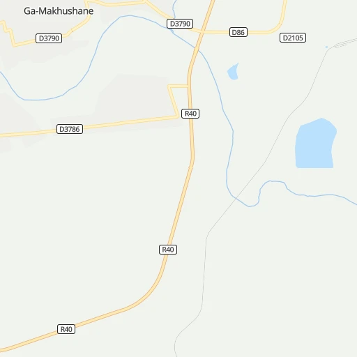
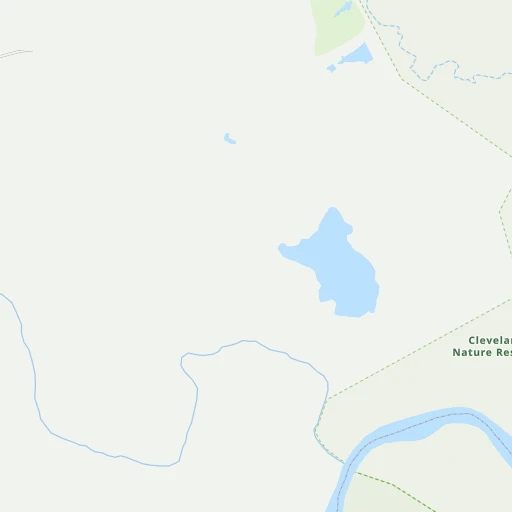
Roadmap (route) to go from Phalaborwa to Thohoyandou detailed above, you can also see the course layout on the map.
While doing trip Phalaborwa - Thohoyandou by car, the calculated route ends at a distance , or more straight.
Distance and duration of the route between Phalaborwa and Thohoyandou
Calculation of distance and route from Thohoyandou to Phalaborwa :
131.1165.0 km2h19mn
Continue 0h1mn 168 mTurn sharp left onto D2105 0h1mn 659 mTurn right onto D2105 0h3mn 1.5 kmTurn left onto D86 0h7mn 6.0 kmTurn left onto Calvin Ngobeni Road 0h5mn 4.6 kmTurn left onto R71 0h4mn 4.4 kmTurn right onto D3260 0h26mn 38.3 kmTurn left onto D3840 1h32mn 48.0 kmTurn right onto R81 1h37mn 36.8 kmTurn left onto D4 0h3mn 4.2 kmTurn right onto D3756 0h8mn 12.0 kmTurn left onto R524 0h5mn 4.9 kmTurn right 0h1mn 453 mTurn left 0h0mn 133 mTurn right 0h0mn 52 mTurn left 0h1mn 366 mTurn right 0h3mn 1.5 kmTurn right 0h0mn 216 mTurn left 0h1mn 366 mTurn slight right 0h0mn 151 mTurn left onto Khoroni street 0h1mn 256 mArrive at destination 0h0mn 0 m
Travel from Phalaborwa (Limpopo) to a selection of major cities.
Distances from Phalaborwa to biggest cities in Limpopo
Other major cities in country :
- Witbank [07], 262,491 inhabitants. 284 km
- Richards Bay [02], 252,968 inhabitants. 543 km
- Vanderbijlpark [06], 246,754 inhabitants. 449 km
- Centurion [06], 233,386 inhabitants. 362 km
- Uitenhage [05], 228,912 inhabitants. 1,223 km
- Roodepoort [06], 225,000 inhabitants. 407 km
- Paarl [11], 190,000 inhabitants. 1,604 km
- Springs [06], 186,394 inhabitants. 373 km
- Carletonville [06], 182,304 inhabitants. 459 km
- Klerksdorp [10], 178,921 inhabitants. 550 km
- Midrand [06], 173,009 inhabitants. 375 km
- Westonaria [06], 156,831 inhabitants. 436 km
- Middelburg [07], 154,706 inhabitants. 260 km
- Vryheid [02], 150,012 inhabitants. 424 km
- Orkney [10], 145,801 inhabitants. 558 km
- Kimberley [08], 142,089 inhabitants. 825 km
- eMbalenhle [07], 141,741 inhabitants. 351 km
- Nigel [06], 140,644 inhabitants. 381 km
- Mpumalanga [02], 140,121 inhabitants. 652 km
- Bhisho [05], 137,287 inhabitants. 1,051 km
Route from Thohoyandou to major cities (South Africa).
- Distance Thohoyandou Cape Town1,697 km
- Distance Thohoyandou Durban771 km
- Distance Thohoyandou Johannesburg439 km
- Distance Thohoyandou Soweto455 km
- Distance Thohoyandou Pretoria389 km
- Distance Thohoyandou Port Elizabeth1,315 km
- Distance Thohoyandou Pietermaritzburg743 km
- Distance Thohoyandou Benoni422 km
- Distance Thohoyandou Tembisa409 km
- Distance Thohoyandou East London1,149 km
- Distance Thohoyandou Vereeniging489 km
- Distance Thohoyandou Bloemfontein809 km
- Distance Thohoyandou Boksburg428 km
- Distance Thohoyandou Welkom675 km
- Distance Thohoyandou Newcastle539 km
- Distance Thohoyandou Krugersdorp444 km
- Distance Thohoyandou Diepsloot416 km
- Distance Thohoyandou Randburg431 km
- Distance Thohoyandou Botshabelo798 km
- Distance Thohoyandou Brakpan424 km
Nearest cities to Phalaborwa :
- Pretoria, 1,619,438 inhabitants. 355 km
- Benoni, 605,344 inhabitants. 374 km
- Tembisa, 511,655 inhabitants. 368 km
- Boksburg, 445,168 inhabitants. 380 km
- Brakpan, 305,692 inhabitants. 374 km
- Witbank, 262,491 inhabitants. 284 km
- Centurion, 233,386 inhabitants. 362 km
- Springs, 186,394 inhabitants. 373 km
- Midrand, 173,009 inhabitants. 375 km
- Middelburg, 154,706 inhabitants. 260 km
- eMbalenhle, 141,741 inhabitants. 351 km
- Nigel, 140,644 inhabitants. 381 km
- Polokwane, 123,749 inhabitants. 167 km
- Alberton, 121,536 inhabitants. 395 km
- Nelspruit, 110,159 inhabitants. 167 km
- Phalaborwa, 109,468 inhabitants. 5 km
- Bethal, 101,919 inhabitants. 322 km
- Mokopane, 101,090 inhabitants. 215 km
- Delmas, 92,046 inhabitants. 344 km
- Warmbaths, 90,210 inhabitants. 304 km
- Louis Trichardt, 86,854 inhabitants. 161 km
- Standerton, 74,021 inhabitants. 379 km
- Barberton, 67,927 inhabitants. 202 km
- Heidelberg, 64,199 inhabitants. 395 km
- Edenvale, 49,292 inhabitants. 384 km
- Balfour, 46,008 inhabitants. 392 km
- Thohoyandou, 44,046 inhabitants. 131 km
- Ermelo, 41,124 inhabitants. 307 km
- Ekangala, 37,650 inhabitants. 306 km
- Giyani, 37,024 inhabitants. 85 km
- Lebowakgomo, 33,308 inhabitants. 166 km
- Nkowakowa, 30,138 inhabitants. 84 km
- Bronkhorstspruit, 27,343 inhabitants. 315 km
- Siyabuswa, 26,236 inhabitants. 245 km
- Cullinan, 25,490 inhabitants. 322 km
- Midstream, 25,000 inhabitants. 365 km
- Duiwelskloof, 24,572 inhabitants. 104 km
- Lydenburg, 21,695 inhabitants. 142 km
- Modimolle, 20,527 inhabitants. 287 km
- Komatipoort, 20,508 inhabitants. 183 km
- Secunda, 20,418 inhabitants. 347 km
- Tzaneen, 16,954 inhabitants. 98 km
- White River, 15,954 inhabitants. 151 km
- Hendrina, 15,871 inhabitants. 281 km
- Kriel, 15,055 inhabitants. 319 km
- Ga-Kgapane, 13,000 inhabitants. 98 km
- Breyten, 12,550 inhabitants. 283 km
- Mankoeng, 12,499 inhabitants. 132 km
- Belfast, 11,916 inhabitants. 220 km
- Thulamahashi, 11,655 inhabitants. 84 km
Location Phalaborwa (Limpopo) :
| Country flag |  |
| Location | Phalaborwa |
| State | Limpopo |
| County | Mopani District Municipality |
| Country | South Africa |
| Country code / ISO 2 | ZA |
| Latitude | -23.9753400 |
| Longitude | 31.1120100 |
| Altitude | 0 meters |
| Time zone | Africa/Johannesburg |
Location Thohoyandou (Limpopo) :
| Country flag | |
| Location | Thohoyandou |
| State | Limpopo |
| County | Vhembe District Municipality |
| Country | South Africa |
| Country code / ISO 2 | ZA |
| Latitude | -22.9456400 |
| Longitude | 30.4849700 |
| Altitude | 0 meters |
| Time zone | Africa/Johannesburg |


