


How to get from Shakaskraal (KwaZulu-Natal) to Mpophomeni (KwaZulu-Natal)
Calculate route from Shakaskraal (KwaZulu-Natal, South Africa) to Mpophomeni (KwaZulu-Natal, South Africa).
The flight distance (as the crow flies) between Shakaskraal and Mpophomeni is 100.5 km.
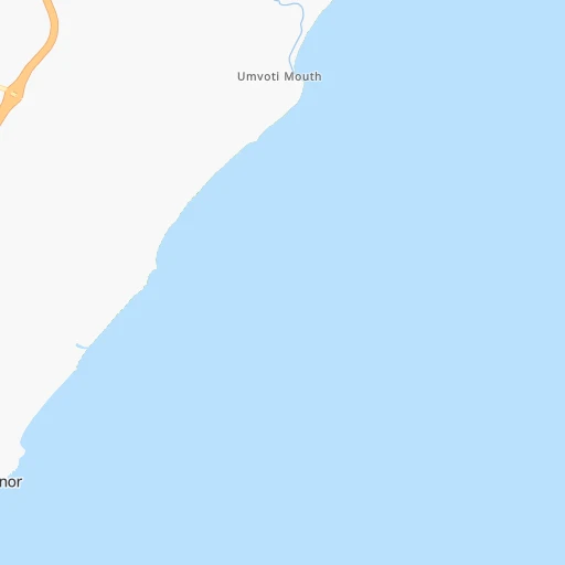
Roadmap (route) to go from Shakaskraal to Mpophomeni detailed above, you can also see the course layout on the map.
While doing trip Shakaskraal - Mpophomeni by car, the calculated route ends at a distance , or more straight.
Distance and duration of the route between Shakaskraal and Mpophomeni
Calculation of distance and route from Mpophomeni to Shakaskraal :
100.5151.4 km2h37mn
Continue onto Jasmine Drive 0h0mn 135 mTurn right onto Protea Road 0h1mn 390 mTurn left onto D382 0h0mn 21 mAt roundabout, take exit 2 onto R102 0h3mn 2.7 kmTurn left onto P330 0h0mn 260 mAt roundabout, take exit 1 onto P330 0h1mn 970 mTurn sharp right 0h27mn 48.2 kmKeep left and take N3 toward Pietermaritzburg, Johannesburg, Durban 0h0mn 250 mKeep right and take N3 toward Pietermaritzburg, Johannesburg 0h10mn 16.8 kmKeep right onto N3 0h28mn 49.0 kmKeep left toward R103 0h8mn 8.3 kmAt roundabout, take exit 2 onto Peter Brown Drive 0h0mn 142 mKeep left and take N3 toward Harrismith 0h8mn 12.9 kmKeep left and take R103 toward Underberg, Howick(South) 0h0mn 425 mKeep left and take R103 toward Underberg 0h0mn 38 mTurn slight left onto Zeederberg Road 0h8mn 8.8 kmKeep left 0h2mn 2.0 kmTurn right onto Mhlongo Road 0h0mn 95 mArrive at destination 0h0mn 0 m
Travel from Shakaskraal (KwaZulu-Natal) to a selection of major cities.
Distances from Shakaskraal to biggest cities in KwaZulu-Natal
Other major cities in country :
- Uitenhage [05], 228,912 inhabitants. 731 km
- Roodepoort [06], 225,000 inhabitants. 492 km
- Paarl [11], 190,000 inhabitants. 1,254 km
- Springs [06], 186,394 inhabitants. 451 km
- Carletonville [06], 182,304 inhabitants. 509 km
- Klerksdorp [10], 178,921 inhabitants. 532 km
- Midrand [06], 173,009 inhabitants. 491 km
- Westonaria [06], 156,831 inhabitants. 495 km
- Middelburg [07], 154,706 inhabitants. 444 km
- Orkney [10], 145,801 inhabitants. 524 km
- Kimberley [08], 142,089 inhabitants. 633 km
- eMbalenhle [07], 141,741 inhabitants. 387 km
- Nigel [06], 140,644 inhabitants. 431 km
- Bhisho [05], 137,287 inhabitants. 522 km
- Randfontein [06], 133,654 inhabitants. 502 km
- Worcester [11], 127,597 inhabitants. 1,209 km
- Rustenburg [10], 124,064 inhabitants. 575 km
- Polokwane [09], 123,749 inhabitants. 641 km
- Potchefstroom [10], 123,669 inhabitants. 506 km
- Virginia [03], 122,502 inhabitants. 450 km
Route from Mpophomeni to major cities (South Africa).
- Distance Mpophomeni Cape Town1,214 km
- Distance Mpophomeni Johannesburg430 km
- Distance Mpophomeni Soweto433 km
- Distance Mpophomeni Pretoria469 km
- Distance Mpophomeni Port Elizabeth653 km
- Distance Mpophomeni Benoni419 km
- Distance Mpophomeni Tembisa442 km
- Distance Mpophomeni East London440 km
- Distance Mpophomeni Vereeniging391 km
- Distance Mpophomeni Bloemfontein389 km
- Distance Mpophomeni Boksburg419 km
- Distance Mpophomeni Welkom380 km
- Distance Mpophomeni Krugersdorp455 km
- Distance Mpophomeni Diepsloot458 km
- Distance Mpophomeni Randburg442 km
- Distance Mpophomeni Botshabelo337 km
- Distance Mpophomeni Brakpan412 km
- Distance Mpophomeni Witbank422 km
- Distance Mpophomeni Vanderbijlpark393 km
- Distance Mpophomeni Centurion458 km
Nearest cities to Shakaskraal :
- Durban, 3,120,282 inhabitants. 49 km
- Pietermaritzburg, 750,845 inhabitants. 82 km
- Newcastle, 404,838 inhabitants. 226 km
- Richards Bay, 252,968 inhabitants. 109 km
- Vryheid, 150,012 inhabitants. 192 km
- eMbalenhle, 141,741 inhabitants. 387 km
- Mpumalanga, 140,121 inhabitants. 69 km
- Bethal, 101,919 inhabitants. 375 km
- Dundee, 84,413 inhabitants. 172 km
- Piet Retief, 84,349 inhabitants. 275 km
- Phuthaditjhaba, 84,258 inhabitants. 255 km
- Bethlehem, 83,654 inhabitants. 314 km
- Mthatha, 78,663 inhabitants. 333 km
- Standerton, 74,021 inhabitants. 341 km
- Heidelberg, 64,199 inhabitants. 432 km
- KwaDukuza, 59,899 inhabitants. 15 km
- Port Shepstone, 52,793 inhabitants. 161 km
- eSikhaleni, 49,265 inhabitants. 93 km
- Balfour, 46,008 inhabitants. 403 km
- Mondlo, 44,922 inhabitants. 170 km
- Volksrust, 43,378 inhabitants. 266 km
- Ermelo, 41,124 inhabitants. 347 km
- Harrismith, 35,108 inhabitants. 242 km
- Margate, 34,407 inhabitants. 177 km
- Richmond, 32,445 inhabitants. 103 km
- Howick, 28,725 inhabitants. 96 km
- Driefontein, 28,127 inhabitants. 281 km
- Empangeni, 28,093 inhabitants. 101 km
- Mpophomeni, 26,229 inhabitants. 101 km
- Kokstad, 25,373 inhabitants. 212 km
- Scottburgh, 23,949 inhabitants. 103 km
- Ulundi, 20,753 inhabitants. 126 km
- Secunda, 20,418 inhabitants. 381 km
- eMkhomazi, 20,410 inhabitants. 93 km
- Ballito, 17,218 inhabitants. 10 km
- Reitz, 16,637 inhabitants. 329 km
- Berea, 15,000 inhabitants. 50 km
- Eshowe, 14,786 inhabitants. 67 km
- Vrede, 14,622 inhabitants. 302 km
- Ekuvukeni, 14,331 inhabitants. 151 km
- Greytown, 13,912 inhabitants. 74 km
- Glencoe, 13,547 inhabitants. 176 km
- Sundumbili, 12,455 inhabitants. 39 km
- Villiers, 11,240 inhabitants. 372 km
- Mooirivier, 10,132 inhabitants. 122 km
- Port Saint John's, 5,939 inhabitants. 290 km
- Utrecht, 3,575 inhabitants. 218 km
Location Shakaskraal (KwaZulu-Natal) :
| Country flag |  |
| Location | Shakaskraal |
| State | KwaZulu-Natal |
| County | iLembe District Municipality |
| Country | South Africa |
| Country code / ISO 2 | ZA |
| Latitude | -29.4500000 |
| Longitude | 31.2166700 |
| Altitude | 0 meters |
| Time zone | Africa/Johannesburg |
Location Mpophomeni (KwaZulu-Natal) :
| Country flag | |
| Location | Mpophomeni |
| State | KwaZulu-Natal |
| County | uMgungundlovu District Municipality |
| Country | South Africa |
| Country code / ISO 2 | ZA |
| Latitude | -29.5682200 |
| Longitude | 30.1861800 |
| Altitude | 0 meters |
| Time zone | Africa/Johannesburg |

