

How to get from Wolwehoek (Orange Free State) to Carletonville (Gauteng)
Calculate route from Wolwehoek (Orange Free State, South Africa) to Carletonville (Gauteng, South Africa).
The flight distance (as the crow flies) between Wolwehoek and Carletonville is 74.6 km.
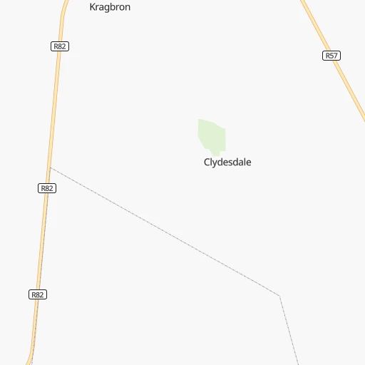
Roadmap (route) to go from Wolwehoek to Carletonville detailed above, you can also see the course layout on the map.
While doing trip Wolwehoek - Carletonville by car, the calculated route ends at a distance , or more straight.
Distance and duration of the route between Wolwehoek and Carletonville
Calculation of distance and route from Carletonville to Wolwehoek :
74.690.7 km2h58mn
Continue 0h1mn 510 mTurn right 0h1mn 682 mTurn left 0h3mn 1.6 kmTurn right 0h5mn 2.6 kmTurn right 0h17mn 8.3 kmTurn right onto R59 0h0mn 360 mKeep left 0h0mn 43 mTurn slight left 0h19mn 9.3 kmTurn right onto R42 0h2mn 2.3 kmTurn left 0h12mn 6.4 kmTurn left onto Potchefstroom Road 0h1mn 566 mTurn right 0h9mn 4.6 kmTurn right onto Main Road 0h4mn 5.8 kmTurn sharp left onto R54 0h11mn 12.1 kmTurn right onto R500 1h33mn 35.2 kmTurn left onto Kaolin Street 0h0mn 107 mTurn left onto Talc Road 0h0mn 103 mTurn right onto Calcite Crescent 0h0mn 194 mTurn left onto Zircon Street 0h0mn 52 mArrive at destination 0h0mn 0 m
Travel from Wolwehoek (Gauteng) to a selection of major cities.
Distances from Wolwehoek to biggest cities in Orange Free State
Other major cities in country :
- Centurion [06], 233,386 inhabitants. 123 km
- Uitenhage [05], 228,912 inhabitants. 796 km
- Roodepoort [06], 225,000 inhabitants. 84 km
- Paarl [11], 190,000 inhabitants. 1,138 km
- Springs [06], 186,394 inhabitants. 94 km
- Carletonville [06], 182,304 inhabitants. 75 km
- Klerksdorp [10], 178,921 inhabitants. 115 km
- Midrand [06], 173,009 inhabitants. 108 km
- Westonaria [06], 156,831 inhabitants. 69 km
- Middelburg [07], 154,706 inhabitants. 208 km
- Vryheid [02], 150,012 inhabitants. 309 km
- Orkney [10], 145,801 inhabitants. 114 km
- Kimberley [08], 142,089 inhabitants. 363 km
- eMbalenhle [07], 141,741 inhabitants. 131 km
- Nigel [06], 140,644 inhabitants. 85 km
- Mpumalanga [02], 140,121 inhabitants. 424 km
- Bhisho [05], 137,287 inhabitants. 661 km
- Randfontein [06], 133,654 inhabitants. 82 km
- Worcester [11], 127,597 inhabitants. 1,099 km
- Rustenburg [10], 124,064 inhabitants. 151 km
Route from Carletonville to major cities (South Africa).
- Distance Carletonville Cape Town1,205 km
- Distance Carletonville Durban528 km
- Distance Carletonville Port Elizabeth863 km
- Distance Carletonville Pietermaritzburg467 km
- Distance Carletonville East London742 km
- Distance Carletonville Bloemfontein329 km
- Distance Carletonville Welkom192 km
- Distance Carletonville Newcastle295 km
- Distance Carletonville Botshabelo330 km
- Distance Carletonville Witbank191 km
- Distance Carletonville Richards Bay531 km
- Distance Carletonville Uitenhage846 km
- Distance Carletonville Paarl1,153 km
- Distance Carletonville Klerksdorp91 km
- Distance Carletonville Middelburg217 km
- Distance Carletonville Vryheid371 km
- Distance Carletonville Orkney100 km
- Distance Carletonville Kimberley371 km
- Distance Carletonville eMbalenhle167 km
- Distance Carletonville Mpumalanga499 km
Nearest cities to Wolwehoek :
- Johannesburg, 2,026,469 inhabitants. 83 km
- Soweto, 1,695,047 inhabitants. 72 km
- Pretoria, 1,619,438 inhabitants. 136 km
- Pietermaritzburg, 750,845 inhabitants. 392 km
- Benoni, 605,344 inhabitants. 95 km
- Tembisa, 511,655 inhabitants. 110 km
- Vereeniging, 474,681 inhabitants. 29 km
- Bloemfontein, 463,064 inhabitants. 292 km
- Boksburg, 445,168 inhabitants. 90 km
- Welkom, 431,944 inhabitants. 159 km
- Newcastle, 404,838 inhabitants. 229 km
- Krugersdorp, 378,821 inhabitants. 93 km
- Diepsloot, 350,000 inhabitants. 111 km
- Randburg, 337,053 inhabitants. 93 km
- Botshabelo, 309,714 inhabitants. 283 km
- Brakpan, 305,692 inhabitants. 93 km
- Witbank, 262,491 inhabitants. 183 km
- Vanderbijlpark, 246,754 inhabitants. 23 km
- Centurion, 233,386 inhabitants. 123 km
- Roodepoort, 225,000 inhabitants. 84 km
- Springs, 186,394 inhabitants. 94 km
- Carletonville, 182,304 inhabitants. 75 km
- Klerksdorp, 178,921 inhabitants. 115 km
- Midrand, 173,009 inhabitants. 108 km
- Westonaria, 156,831 inhabitants. 69 km
- Middelburg, 154,706 inhabitants. 208 km
- Vryheid, 150,012 inhabitants. 309 km
- Orkney, 145,801 inhabitants. 114 km
- eMbalenhle, 141,741 inhabitants. 131 km
- Nigel, 140,644 inhabitants. 85 km
- Mpumalanga, 140,121 inhabitants. 424 km
- Randfontein, 133,654 inhabitants. 82 km
- Rustenburg, 124,064 inhabitants. 151 km
- Potchefstroom, 123,669 inhabitants. 75 km
- Virginia, 122,502 inhabitants. 162 km
- Brits, 122,497 inhabitants. 143 km
- Alberton, 121,536 inhabitants. 78 km
- Kroonstad, 103,992 inhabitants. 100 km
- Bethal, 101,919 inhabitants. 171 km
- Mokopane, 101,090 inhabitants. 326 km
- Mabopane, 97,417 inhabitants. 160 km
- Kutloanong, 95,008 inhabitants. 147 km
- Stilfontein, 93,110 inhabitants. 105 km
- Delmas, 92,046 inhabitants. 121 km
- Warmbaths, 90,210 inhabitants. 231 km
- Dundee, 84,413 inhabitants. 276 km
- Piet Retief, 84,349 inhabitants. 297 km
- Phuthaditjhaba, 84,258 inhabitants. 204 km
- Bethlehem, 83,654 inhabitants. 154 km
- Sasolburg, 77,016 inhabitants. 12 km
Location Wolwehoek (Orange Free State) :
| Country flag |  |
| Location | Wolwehoek |
| State | Orange Free State |
| County | Fezile Dabi District Municipality |
| Country | South Africa |
| Country code / ISO 2 | ZA |
| Latitude | -26.9169000 |
| Longitude | 27.8195400 |
| Altitude | 0 meters |
| Time zone | Africa/Johannesburg |
Location Carletonville (Gauteng) :
| Country flag | |
| Location | Carletonville |
| State | Gauteng |
| County | West Rand District Municipality |
| Country | South Africa |
| Country code / ISO 2 | ZA |
| Latitude | -26.3609400 |
| Longitude | 27.3976700 |
| Altitude | 0 meters |
| Time zone | Africa/Johannesburg |
