
How to get from Shawnigan Lake Railway Station (British Columbia) to Ladysmith (British Columbia)
Calculate route from Shawnigan Lake Railway Station (British Columbia, Canada) to Ladysmith (British Columbia, Canada).
The flight distance (as the crow flies) between Shawnigan Lake Railway Station and Ladysmith is 40.1 km.
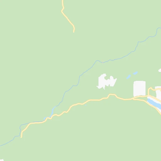
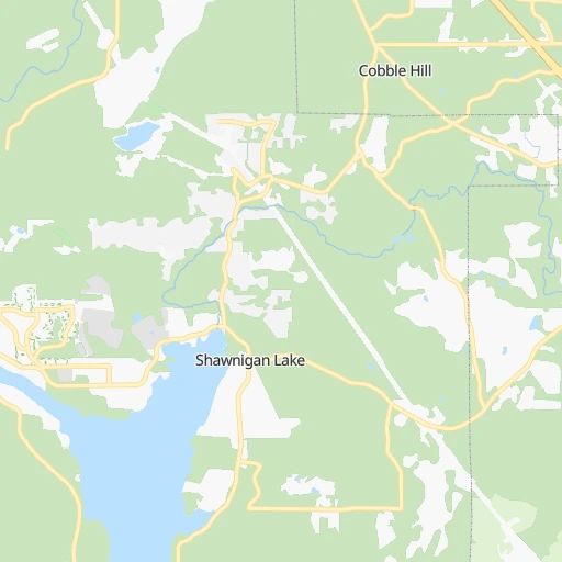
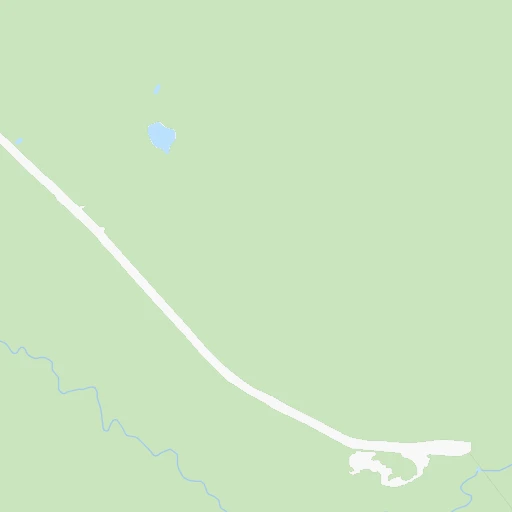
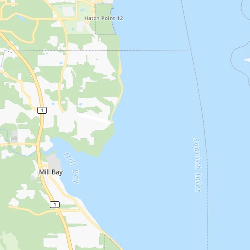
Roadmap (route) to go from Shawnigan Lake Railway Station to Ladysmith detailed above, you can also see the course layout on the map.
While doing trip Shawnigan Lake Railway Station - Ladysmith by car, the calculated route ends at a distance , or more straight.
Distance and duration of the route between Shawnigan Lake Railway Station and Ladysmith
Calculation of distance and route from Ladysmith to Shawnigan Lake Railway Station :
40.147.5 km1h42mn
Continue 0h0mn 110 mTurn left onto Heald Road 0h0mn 172 mTurn slight right onto Shawnigan Lake-Mill Bay Road 0h0mn 181 mTurn left onto Shawnigan Lake Road 0h1mn 519 mTurn right onto Shawnigan Lake Road 0h8mn 7.0 kmTurn left onto Trans-Canada Highway 1h31mn 39.0 kmTurn left 0h1mn 284 mTurn left onto 2nd Avenue 0h0mn 154 mTurn right 0h0mn 86 mArrive at destination 0h0mn 0 m
Travel from Shawnigan Lake Railway Station (British Columbia) to a selection of major cities.
Distances from Shawnigan Lake Railway Station to biggest cities in British Columbia
- Vernon,47,274 inhabitants.363 km
- West End,44,560 inhabitants.79 km
- West Vancouver,42,694 inhabitants.86 km
- Penticton,37,721 inhabitants.309 km
- Campbell River,33,430 inhabitants.192 km
- Courtenay,32,793 inhabitants.152 km
- North Cowichan,32,272 inhabitants.22 km
- West Kelowna,28,793 inhabitants.323 km
- Port Moody,27,512 inhabitants.90 km
- Walnut Grove,25,683 inhabitants.92 km
- Langley,23,606 inhabitants.87 km
- Langford,22,459 inhabitants.24 km
- Duncan,22,199 inhabitants.16 km
- Port Alberni,21,282 inhabitants.108 km
Other major cities in country :
- Vaughan [08], 238,866 inhabitants. 3,391 km
- Kitchener [08], 233,700 inhabitants. 3,336 km
- Longueuil [10], 229,330 inhabitants. 3,745 km
- Saskatoon [11], 198,958 inhabitants. 1,261 km
- Richmond Hill [08], 185,541 inhabitants. 3,394 km
- Barrie [08], 182,041 inhabitants. 3,353 km
- Nepean [08], 180,000 inhabitants. 3,594 km
- Regina [11], 176,183 inhabitants. 1,383 km
- Oakville [08], 165,697 inhabitants. 3,396 km
- Burlington [08], 164,415 inhabitants. 3,387 km
- Greater Sudbury [08], 157,857 inhabitants. 3,169 km
- Saguenay [10], 143,692 inhabitants. 3,796 km
- St. Catharines [08], 131,989 inhabitants. 3,441 km
- Sherbrooke [10], 129,447 inhabitants. 3,866 km
- Levis [10], 126,396 inhabitants. 3,855 km
- Cambridge [08], 120,372 inhabitants. 3,354 km
- Trois-Rivieres [10], 119,693 inhabitants. 3,778 km
- Guelph [08], 115,760 inhabitants. 3,349 km
- East York [08], 115,365 inhabitants. 3,410 km
- Kingston [08], 114,195 inhabitants. 3,592 km
Route from Ladysmith to major cities (Canada).
- Distance Ladysmith Toronto3,412 km
- Distance Ladysmith Montreal3,745 km
- Distance Ladysmith Calgary732 km
- Distance Ladysmith Ottawa3,600 km
- Distance Ladysmith Edmonton880 km
- Distance Ladysmith Mississauga3,400 km
- Distance Ladysmith North York3,409 km
- Distance Ladysmith Winnipeg1,923 km
- Distance Ladysmith Scarborough3,420 km
- Distance Ladysmith Quebec3,854 km
- Distance Ladysmith Hamilton3,403 km
- Distance Ladysmith Brampton3,388 km
- Distance Ladysmith Laval3,735 km
- Distance Ladysmith Halifax4,493 km
- Distance Ladysmith Etobicoke3,403 km
- Distance Ladysmith London3,315 km
- Distance Ladysmith Windsor3,220 km
- Distance Ladysmith Markham3,415 km
- Distance Ladysmith Oshawa3,444 km
- Distance Ladysmith Gatineau3,596 km
Nearest cities to Shawnigan Lake Railway Station :
- Vancouver, 600,000 inhabitants. 76 km
- Surrey, 394,976 inhabitants. 77 km
- Victoria, 289,625 inhabitants. 31 km
- Burnaby, 202,799 inhabitants. 84 km
- Ladner, 200,000 inhabitants. 63 km
- Richmond, 182,000 inhabitants. 68 km
- Abbotsford, 151,683 inhabitants. 110 km
- Anmore, 126,456 inhabitants. 93 km
- Coquitlam, 114,565 inhabitants. 95 km
- Delta, 101,668 inhabitants. 76 km
- Nanaimo, 84,905 inhabitants. 62 km
- Chilliwack, 77,000 inhabitants. 135 km
- Maple Ridge, 70,000 inhabitants. 98 km
- White Rock, 66,450 inhabitants. 73 km
- New Westminster, 58,549 inhabitants. 81 km
- North Vancouver, 48,000 inhabitants. 84 km
- West End, 44,560 inhabitants. 79 km
- West Vancouver, 42,694 inhabitants. 86 km
- Campbell River, 33,430 inhabitants. 192 km
- Courtenay, 32,793 inhabitants. 152 km
- North Cowichan, 32,272 inhabitants. 22 km
- Port Moody, 27,512 inhabitants. 90 km
- Walnut Grove, 25,683 inhabitants. 92 km
- Langley, 23,606 inhabitants. 87 km
- Langford, 22,459 inhabitants. 24 km
- Duncan, 22,199 inhabitants. 16 km
- Port Alberni, 21,282 inhabitants. 108 km
- Oak Bay, 18,015 inhabitants. 33 km
- Pitt Meadows, 17,410 inhabitants. 93 km
- Colwood, 14,687 inhabitants. 27 km
- Powell River, 12,779 inhabitants. 147 km
- Aldergrove, 12,363 inhabitants. 96 km
- Parksville, 12,000 inhabitants. 90 km
- North Saanich, 11,089 inhabitants. 15 km
- Whistler, 10,600 inhabitants. 170 km
- Ladysmith, 8,740 inhabitants. 40 km
- Merritt, 7,179 inhabitants. 262 km
- Gibsons, 6,821 inhabitants. 83 km
- Sooke, 6,145 inhabitants. 32 km
- Sechelt, 5,977 inhabitants. 92 km
- Metchosin, 4,803 inhabitants. 31 km
- Agassiz, 4,738 inhabitants. 150 km
- Hope, 4,598 inhabitants. 179 km
- Bowen Island, 3,551 inhabitants. 84 km
Location Shawnigan Lake Railway Station (British Columbia) :
| Country flag |  |
| Location | Shawnigan Lake Railway Station |
| State | British Columbia |
| County | Cowichan Valley Regional District |
| Country | Canada |
| Country code / ISO 2 | CA |
| Latitude | 48.6521400 |
| Longitude | -123.6269500 |
| Altitude | 0 meters |
| Time zone | America/Vancouver |
Location Ladysmith (British Columbia) :
| Country flag | |
| Location | Ladysmith |
| State | British Columbia |
| County | Cowichan Valley Regional District |
| Country | Canada |
| Country code / ISO 2 | CA |
| Latitude | 48.9901600 |
| Longitude | -123.8169900 |
| Altitude | 0 meters |
| Time zone | America/Vancouver |


