


How to get from Hoytsville (airport) (Utah) to Rexburg (Idaho)
Calculate route from Hoytsville (airport) (Utah, United States) to Rexburg (Idaho, United States).
The flight distance (as the crow flies) between Hoytsville (airport) and Rexburg is 329.4 km.
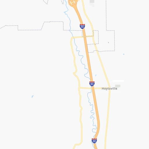
Roadmap (route) to go from Hoytsville Airport to Rexburg detailed above, you can also see the course layout on the map.
While doing trip Hoytsville (airport) - Rexburg by car, the calculated route ends at a distance , or more straight.
Distance and duration of the route between Hoytsville (airport) and Rexburg
Calculation of distance and route from Rexburg to Hoytsville (airport) :
329.4406.7 km4h47mn
Continue 0h1mn 232 mTurn left onto Brown's Lane 0h1mn 276 mTurn right onto South Hoytsville Road 0h4mn 4.0 kmTurn left onto 100 South 0h0mn 241 mKeep right and take I 80 East toward Cheyenne 0h5mn 7.5 kmKeep right and take I 84 West toward Ogden 1h11mn 125.1 kmKeep right onto Veterans Memorial Highway and take I 15 North, UT 30 East, I 84 West toward Pocatello, Boise 2h58mn 225.6 kmKeep right onto US 20 and take US 20 East, I 15 toward Rigby, West Yellowstone 0h0mn 434 mKeep right 0h25mn 41.1 kmKeep right and take ID 33 toward Salmon, Rexburg 0h0mn 469 mTurn right onto West Main Street 0h2mn 1.7 kmArrive at destination 0h0mn 0 m
Travel from Hoytsville (airport) (Idaho) to a selection of major cities.
Distances from Hoytsville Airport to biggest cities in Utah
- Roy,37,964 inhabitants.63 km
- Spanish Fork,37,935 inhabitants.88 km
- South Jordan Heights,37,141 inhabitants.60 km
- Kearns,35,731 inhabitants.58 km
- Cottonwood Heights,34,343 inhabitants.47 km
- Tooele,33,157 inhabitants.87 km
- Midvale,32,613 inhabitants.53 km
- Springville,32,286 inhabitants.82 km
- Holladay,30,864 inhabitants.44 km
- Herriman,30,835 inhabitants.69 km
- Clearfield,30,653 inhabitants.60 km
- Kaysville,30,472 inhabitants.50 km
- Cedar City,30,184 inhabitants.385 km
- American Fork,28,326 inhabitants.66 km
- Syracuse,27,395 inhabitants.62 km
- Eagle Mountain,27,332 inhabitants.82 km
- Magna,26,505 inhabitants.64 km
- Saratoga Springs,25,407 inhabitants.74 km
- South Salt Lake,24,788 inhabitants.47 km
- Washington,24,299 inhabitants.456 km
Other major cities in country :
- Charlotte [NC], 827,097 inhabitants. 2,735 km
- Seattle [WA], 684,451 inhabitants. 1,149 km
- Denver [CO], 682,545 inhabitants. 557 km
- El Paso [TX], 681,124 inhabitants. 1,105 km
- Detroit [MI], 677,116 inhabitants. 2,353 km
- Boston [MA], 667,137 inhabitants. 3,328 km
- Memphis [TN], 655,770 inhabitants. 1,970 km
- New South Memphis [TN], 641,608 inhabitants. 1,973 km
- Portland [OR], 632,309 inhabitants. 1,051 km
- Oklahoma City [OK], 631,346 inhabitants. 1,352 km
- Las Vegas [NV], 623,747 inhabitants. 617 km
- Baltimore [MD], 621,849 inhabitants. 2,947 km
- Washington, D.C. [DC], 601,723 inhabitants. 2,923 km
- Milwaukee [WI], 600,155 inhabitants. 1,951 km
- South Boston [MA], 571,281 inhabitants. 3,329 km
- Albuquerque [NM], 559,121 inhabitants. 766 km
- Tucson [AZ], 531,641 inhabitants. 964 km
- Nashville [TN], 530,852 inhabitants. 2,197 km
- Fresno [CA], 520,052 inhabitants. 861 km
- Sacramento [CA], 490,712 inhabitants. 903 km
Route from Rexburg to major cities (United States).
- Distance Rexburg New York City3,104 km
- Distance Rexburg Los Angeles1,222 km
- Distance Rexburg Chicago1,976 km
- Distance Rexburg Brooklyn3,111 km
- Distance Rexburg Houston2,136 km
- Distance Rexburg Queens3,119 km
- Distance Rexburg Philadelphia3,040 km
- Distance Rexburg Phoenix1,155 km
- Distance Rexburg Manhattan3,105 km
- Distance Rexburg San Antonio1,990 km
- Distance Rexburg San Diego1,322 km
- Distance Rexburg The Bronx3,111 km
- Distance Rexburg Dallas1,790 km
- Distance Rexburg San Jose1,117 km
- Distance Rexburg Austin1,953 km
- Distance Rexburg Jacksonville3,044 km
- Distance Rexburg San Francisco1,119 km
- Distance Rexburg Columbus2,412 km
- Distance Rexburg Fort Worth1,763 km
- Distance Rexburg Indianapolis2,165 km
Nearest cities to Hoytsville (airport) :
- Salt Lake City, 192,672 inhabitants. 45 km
- West Valley City, 136,208 inhabitants. 57 km
- Provo, 115,264 inhabitants. 76 km
- West Jordan, 111,946 inhabitants. 56 km
- Orem, 94,457 inhabitants. 70 km
- Sandy Hills, 89,575 inhabitants. 52 km
- Sandy, 87,461 inhabitants. 53 km
- Ogden, 85,444 inhabitants. 63 km
- Layton, 74,143 inhabitants. 54 km
- South Jordan, 66,648 inhabitants. 58 km
- Millcreek, 62,139 inhabitants. 47 km
- Taylorsville, 60,514 inhabitants. 53 km
- Grand Junction, 60,358 inhabitants. 314 km
- Idaho Falls, 59,184 inhabitants. 293 km
- Lehi, 58,486 inhabitants. 67 km
- Pocatello, 54,441 inhabitants. 239 km
- Logan, 50,371 inhabitants. 103 km
- Murray, 49,250 inhabitants. 49 km
- Draper, 46,774 inhabitants. 57 km
- Bountiful, 43,784 inhabitants. 42 km
- Riverton, 41,900 inhabitants. 62 km
- Pleasant Grove, 38,052 inhabitants. 65 km
- Roy, 37,964 inhabitants. 63 km
- Spanish Fork, 37,935 inhabitants. 88 km
- South Jordan Heights, 37,141 inhabitants. 60 km
- Kearns, 35,731 inhabitants. 58 km
- Cottonwood Heights, 34,343 inhabitants. 47 km
- Tooele, 33,157 inhabitants. 87 km
- Midvale, 32,613 inhabitants. 53 km
- Springville, 32,286 inhabitants. 82 km
- Holladay, 30,864 inhabitants. 44 km
- Herriman, 30,835 inhabitants. 69 km
- Clearfield, 30,653 inhabitants. 60 km
- Kaysville, 30,472 inhabitants. 50 km
- American Fork, 28,326 inhabitants. 66 km
- Rexburg, 27,663 inhabitants. 330 km
- Syracuse, 27,395 inhabitants. 62 km
- Eagle Mountain, 27,332 inhabitants. 82 km
- Magna, 26,505 inhabitants. 64 km
- Saratoga Springs, 25,407 inhabitants. 74 km
- South Salt Lake, 24,788 inhabitants. 47 km
- Rock Springs, 23,962 inhabitants. 198 km
- Farmington, 22,566 inhabitants. 44 km
- Clinton, 21,399 inhabitants. 64 km
- East Millcreek, 20,816 inhabitants. 42 km
- Clifton, 19,889 inhabitants. 319 km
- North Salt Lake, 19,796 inhabitants. 45 km
- Payson, 19,548 inhabitants. 98 km
- Brigham City, 18,752 inhabitants. 88 km
- North Ogden, 18,446 inhabitants. 68 km
Location Hoytsville (airport) (Utah) :
| Country flag |  |
| Location | Hoytsville (airport) |
| State | Utah |
| County | Summit County |
| Country | United States |
| Country code / ISO 2 | US |
| Latitude | 40.8778900 |
| Longitude | -111.3765600 |
| Altitude | 1771 meters |
| Time zone | America/Denver |
Location Rexburg (Idaho) :
| Country flag | |
| Location | Rexburg |
| State | Idaho |
| County | Madison County |
| Country | United States |
| Country code / ISO 2 | US |
| Latitude | 43.8260200 |
| Longitude | -111.7896900 |
| Altitude | 1483 meters |
| Time zone | America/Boise |

