


How to get from Zhytomyr (airport) (Zhytomyr) to Pervomays’k (Mykolaiv)
Calculate route from Zhytomyr (airport) (Zhytomyr, Ukraine) to Pervomays’k (Mykolaiv, Ukraine).
The flight distance (as the crow flies) between Zhytomyr (airport) and Pervomays’k is 291.1 km.
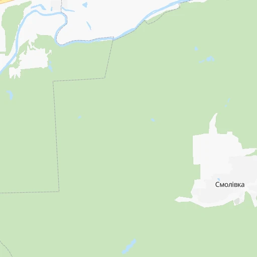
Roadmap (route) to go from Zhytomyr Airport to Pervomays’k detailed above, you can also see the course layout on the map.
While doing trip Zhytomyr (airport) - Pervomays’k by car, the calculated route ends at a distance , or more straight.
Distance and duration of the route between Zhytomyr (airport) and Pervomays’k
Calculation of distance and route from Pervomays’k to Zhytomyr (airport) :
291.1347.3 km5h30mn
Continue 0h1mn 267 mTurn left 0h1mn 383 mKeep left 0h2mn 727 mTurn right onto Київське шосе 0h4mn 3.9 kmKeep right and drive toward Вінниця 0h1mn 597 mTurn slight right onto Т-06-14 0h3mn 4.2 kmAt roundabout, take exit 2 onto Т-06-14 0h4mn 5.2 kmKeep right 0h0mn 418 mTurn sharp left onto вулиця Шевченка 1h24mn 92.4 kmTurn right onto Київська вулиця 0h1mn 735 mKeep left onto Н-02, Р-18 0h0mn 20 mTurn left onto Н-02 0h1mn 774 mTurn left onto Липовецька вулиця 0h20mn 21.9 kmTurn right onto Кооперативна вулиця 0h0mn 17 mKeep left onto Кооперативна вулиця 0h1mn 539 mTurn slight right onto Р-18 0h8mn 8.8 kmTurn left onto вулиця Коцюбинського 0h1mn 1.2 kmAt roundabout, take exit 1 onto Р-18 0h15mn 18.7 kmContinue and drive toward Одеса 0h0mn 212 mTurn right onto М-05 1h9mn 115.1 kmKeep right onto М-05 0h2mn 3.3 kmKeep right onto М-05 0h1mn 1.4 kmKeep right 0h0mn 265 mKeep right 0h0mn 246 mKeep left 0h0mn 95 mTurn slight left onto Т-02-07 0h0mn 503 mKeep right 1h50mn 64.6 kmAt roundabout, take exit 1 0h0mn 447 mAt roundabout, take exit 2 onto Театральна вулиця 0h0mn 164 mTurn right 0h0mn 119 mArrive at destination 0h0mn 0 m
Travel from Zhytomyr (airport) (Mykolaiv) to a selection of major cities.
Distances from Zhytomyr Airport to biggest cities in Zhytomyr
Other major cities in country :
- Sumy [21], 294,456 inhabitants. 434 km
- Horlivka [05], 278,550 inhabitants. 709 km
- Rivne [19], 255,106 inhabitants. 182 km
- Kropyvnytskyi [10], 249,454 inhabitants. 321 km
- Kamianske [04], 248,575 inhabitants. 468 km
- Chernivtsi [03], 236,250 inhabitants. 300 km
- Ternopil [22], 235,676 inhabitants. 239 km
- Kremenchuk [18], 227,494 inhabitants. 363 km
- Lutsk [24], 213,661 inhabitants. 246 km
- Ivano-Frankivsk [06], 204,200 inhabitants. 327 km
- Bila Tserkva [13], 199,163 inhabitants. 111 km
- Kramators'k [05], 173,700 inhabitants. 660 km
- Melitopol [26], 158,000 inhabitants. 619 km
- Kerch [11], 148,932 inhabitants. 796 km
- Nikopol [04], 130,500 inhabitants. 511 km
- Syevyerodonets'k [14], 130,000 inhabitants. 718 km
- Sloviansk [05], 124,800 inhabitants. 659 km
- Berdyansk [26], 118,284 inhabitants. 710 km
- Uzhgorod [25], 117,878 inhabitants. 501 km
- Alchevs'k [14], 116,000 inhabitants. 757 km
Route from Pervomays’k to major cities (Ukraine).
- Distance Pervomays’k Kyiv269 km
- Distance Pervomays’k Kharkiv449 km
- Distance Pervomays’k Dnipro314 km
- Distance Pervomays’k Donetsk517 km
- Distance Pervomays’k Odessa175 km
- Distance Pervomays’k Zaporizhia325 km
- Distance Pervomays’k Lviv537 km
- Distance Pervomays’k Kryvyi Rih189 km
- Distance Pervomays’k Mariupol513 km
- Distance Pervomays’k Luhansk629 km
- Distance Pervomays’k Sevastopol436 km
- Distance Pervomays’k Khmelnytskyi322 km
- Distance Pervomays’k Makiyivka526 km
- Distance Pervomays’k Vinnytsia219 km
- Distance Pervomays’k Simferopol425 km
- Distance Pervomays’k Kherson204 km
- Distance Pervomays’k Poltava321 km
- Distance Pervomays’k Chernihiv387 km
- Distance Pervomays’k Cherkasy178 km
- Distance Pervomays’k Sumy429 km
Nearest cities to Zhytomyr (airport) :
- Kyiv, 2,797,553 inhabitants. 128 km
- Khmelnytskyi, 398,346 inhabitants. 157 km
- Vinnytsia, 352,115 inhabitants. 117 km
- Chernihiv, 307,684 inhabitants. 226 km
- Zhytomyr, 282,192 inhabitants. 4 km
- Rivne, 255,106 inhabitants. 182 km
- Chernivtsi, 236,250 inhabitants. 300 km
- Bila Tserkva, 199,163 inhabitants. 111 km
- Kamianets-Podilskyi, 100,000 inhabitants. 235 km
- Brovary, 88,506 inhabitants. 149 km
- Uman, 87,658 inhabitants. 201 km
- Berdychiv, 86,250 inhabitants. 42 km
- Pervomays'k, 70,746 inhabitants. 292 km
- Korosten', 65,000 inhabitants. 77 km
- Novohrad-Volynskyi, 55,925 inhabitants. 87 km
- Boryspil', 55,000 inhabitants. 158 km
- Fastiv, 51,143 inhabitants. 87 km
- Shepetivka, 46,419 inhabitants. 120 km
- Bucha, 42,279 inhabitants. 109 km
- Voznesensk, 42,248 inhabitants. 356 km
- Varash, 42,000 inhabitants. 236 km
- Irpin, 40,789 inhabitants. 111 km
- Podil's'k, 40,664 inhabitants. 286 km
- Vasylkiv, 39,700 inhabitants. 113 km
- Yuzhnoukrains'k, 39,430 inhabitants. 326 km
- Pereyaslav-Khmel'nyts'kyy, 36,527 inhabitants. 195 km
- Zhmerynka, 35,960 inhabitants. 145 km
- Boyarka, 34,631 inhabitants. 111 km
- Starokostiantyniv, 33,897 inhabitants. 124 km
- Vyshneve, 33,183 inhabitants. 117 km
- Slavuta, 33,080 inhabitants. 133 km
- Netishyn, 33,063 inhabitants. 149 km
- Mohyliv-Podilskyi, 32,500 inhabitants. 214 km
- Obukhiv, 31,557 inhabitants. 135 km
- Kostopil', 30,500 inhabitants. 175 km
- Chortkiv, 28,855 inhabitants. 254 km
- Khmilnyk, 28,136 inhabitants. 97 km
- Sarny, 27,097 inhabitants. 192 km
- Malyn, 27,068 inhabitants. 66 km
- Kaniv, 25,666 inhabitants. 203 km
- Kozyatyn, 25,645 inhabitants. 62 km
- Korostyshiv, 25,099 inhabitants. 23 km
- Slavutych, 25,000 inhabitants. 197 km
- Haisyn, 24,687 inhabitants. 169 km
- Zdolbuniv, 23,697 inhabitants. 179 km
- Polonne, 22,348 inhabitants. 89 km
- Vyshhorod, 22,080 inhabitants. 129 km
- Ladyzhyn, 21,393 inhabitants. 180 km
- Krasyliv, 19,815 inhabitants. 144 km
- Vatutine, 19,407 inhabitants. 218 km
Location Zhytomyr (airport) (Zhytomyr) :
| Country flag |  |
| Location | Zhytomyr (airport) |
| State | Zhytomyr |
| County | |
| Country | Ukraine |
| Country code / ISO 2 | UA |
| Latitude | 50.2706900 |
| Longitude | 28.7388600 |
| Altitude | 0 meters |
| Time zone | Europe/Kiev |
Location Pervomays’k (Mykolaiv) :
| Country flag | |
| Location | Pervomays’k |
| State | Mykolaiv |
| County | |
| Country | Ukraine |
| Country code / ISO 2 | UA |
| Latitude | 48.0443300 |
| Longitude | 30.8507300 |
| Altitude | 0 meters |
| Time zone | Europe/Kiev |