
How to get from Lesparre Railway Station (Nouvelle-Aquitaine) to Angers (Pays de la Loire)
Calculate route from Lesparre Railway Station (Nouvelle-Aquitaine, France) to Angers (Pays de la Loire, France).
The flight distance (as the crow flies) between Lesparre Railway Station and Angers is 243.1 km.
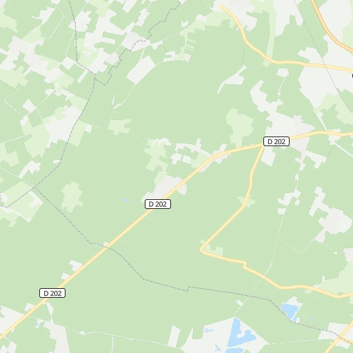
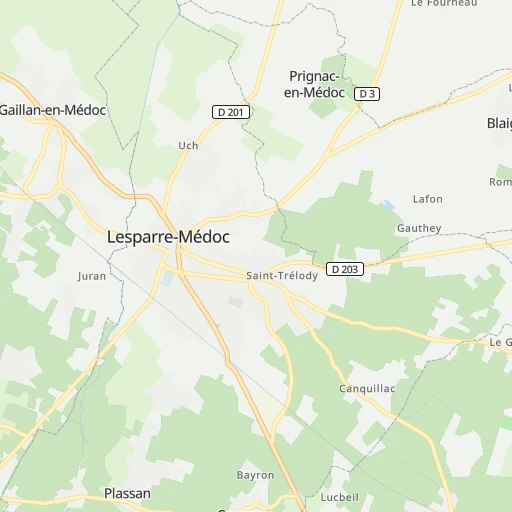
Roadmap (route) to go from Lesparre Railway Station to Angers detailed above, you can also see the course layout on the map.
While doing trip Lesparre Railway Station - Angers by car, the calculated route ends at a distance , or more straight.
Distance and duration of the route between Lesparre Railway Station and Angers
Calculation of distance and route from Angers to Lesparre Railway Station :
243.1299.1 km4h4mn
Continue 0h0mn 60 mTurn left onto Cours d'Alsace-Lorraine 0h0mn 60 mTurn sharp left onto Rue de la Gare 0h0mn 95 mTurn right onto Cours du Général Leclerc 0h1mn 458 mTurn sharp left onto Rue Pierre Curie 0h2mn 1.5 kmTurn right onto Route de Bourgueyraud 0h1mn 753 mTurn right onto Route de Bourgueyraud 0h0mn 38 mTurn left onto Route de Lesparre 0h0mn 93 mAt roundabout, take exit 2 onto Route de Soulac 0h27mn 31.2 kmAt roundabout, take exit 3 onto Rue Henri de Bournazel 0h3mn 2.7 kmKeep right 1h35mn 7.3 kmTurn right onto Rue de la Tartane 0h0mn 250 mTurn right onto Boulevard Thiers and drive toward Centre Ville, Office de Tourisme, Planet Exotica 0h0mn 143 mTurn slight right onto Rue Gambetta 0h1mn 284 mTurn left onto Rue des Bains and drive toward Parking Notre-Dame, Médiathèque 0h0mn 90 mAt roundabout, take exit 2 onto Rue d'Aunis 0h0mn 123 mTurn right onto Rue Alsace Lorraine and drive toward Parking Marché Central 0h1mn 343 mTurn left onto Rue Pasteur 0h0mn 68 mTurn right onto Rue des Violettes 0h0mn 77 mTurn left onto Rue Paul Doumer 0h2mn 1.4 kmAt roundabout, take exit 2 onto D 733 0h1mn 1.1 kmAt roundabout, take exit 2 onto Avenue de Rochefort 0h1mn 523 mAt roundabout, take exit 2 onto Route de Royan 0h1mn 996 mAt roundabout, take exit 2 onto D 733 0h1mn 616 mAt roundabout, take exit 2 onto Route de Royan 0h0mn 476 mContinue onto D 733 0h2mn 2.0 kmAt roundabout, take exit 2 onto Rond-Point de Fontbedeau 0h3mn 3.0 kmAt roundabout, take exit 2 onto D 733 0h3mn 3.7 kmAt roundabout, take exit 2 onto Rond-Point de la Légion d'Honneur 0h17mn 22.9 kmKeep left onto D 733 and drive toward Autres Directions 0h2mn 2.0 kmAt roundabout, take exit 2 onto Rond-Point Albert Bignon 0h2mn 1.3 kmAt roundabout, take exit 2 onto Boulevard Albert Bignon 0h1mn 1.5 kmAt roundabout, take exit 3 onto Route de La Rochelle 0h1mn 1.1 kmAt roundabout, take exit 1 0h18mn 27.7 kmKeep right and drive toward Poitiers, Nantes, Niort, La Roche sur Yon 0h0mn 245 mKeep right and drive toward Poitiers, Nantes, Niort, La Roche sur Yon 0h2mn 2.2 kmKeep right and take D 9 toward Chagnolet, Saint-Xandre, La Roche s/ Yon, Luçon, Villedoux 0h0mn 225 mAt roundabout, take exit 5 onto D 9 0h0mn 265 mAt roundabout, take exit 2 onto D 9 0h1mn 1.6 kmAt roundabout, take exit 2 onto D 9 0h2mn 2.6 kmAt roundabout, take exit 2 onto D 9 0h2mn 2.3 kmAt roundabout, take exit 3 onto D 9 0h1mn 1.1 kmAt roundabout, take exit 2 onto D 10 0h1mn 1.5 kmAt roundabout, take exit 2 onto D 9 0h5mn 6.3 kmAt roundabout, take exit 2 onto Route de Luçon 0h7mn 8.0 kmAt roundabout, take exit 2 onto D 10A 0h5mn 6.3 kmAt roundabout, take exit 3 onto D 137 0h4mn 4.8 kmAt roundabout, take exit 2 onto Les Quatres Chemins 0h0mn 236 mAt roundabout, take exit 2 onto Route de Luçon 0h2mn 1.6 kmAt roundabout, take exit 2 onto Rue Nationale 0h0mn 284 mContinue onto Rue Nationale 0h1mn 629 mAt roundabout, take exit 2 onto D 137 0h4mn 4.3 kmAt roundabout, take exit 2 onto D 137 0h1mn 714 mAt roundabout, take exit 3 0h1mn 409 mKeep left 0h0mn 293 mKeep left and drive toward Angers, Nantes, Cholet, La Roche-sur-Yon 0h17mn 32.4 kmKeep right and take A 87 toward Angers, Cholet, Les Herbiers, La Roche-sur-Yon 0h0mn 276 mKeep right and take A 87 toward Angers, Cholet, Les Herbiers 1h56mn 101.2 kmKeep right and take 18a toward Angers-Est 0h0mn 254 mKeep left 0h0mn 221 mKeep left 0h1mn 871 mAt roundabout, take exit 2 onto Avenue Montaigne 0h0mn 214 mAt roundabout, take exit 2 onto Avenue Montaigne 0h1mn 1.2 kmKeep right onto Rue Pierre Lise 0h0mn 367 mKeep left onto Boulevard Carnot 0h0mn 13 mKeep right onto Boulevard Carnot 0h0mn 66 mTurn right onto Rue Jules Guitton 0h0mn 165 mArrive at destination 0h0mn 0 m
Travel from Lesparre Railway Station (Pays de la Loire) to a selection of major cities.
Distances from Lesparre Railway Station to biggest cities in Nouvelle-Aquitaine
- Saintes,29,512 inhabitants.55 km
- Rochefort,29,427 inhabitants.70 km
- Bergerac,28,317 inhabitants.123 km
- La Teste-de-Buch,27,253 inhabitants.77 km
- Villeneuve-sur-Lot,25,869 inhabitants.164 km
- Gradignan,24,385 inhabitants.65 km
- Libourne,24,240 inhabitants.71 km
- Le Bouscat,24,232 inhabitants.56 km
- Begles,23,504 inhabitants.63 km
- Lormont,22,636 inhabitants.58 km
- Cenon,22,393 inhabitants.60 km
- Dax,22,305 inhabitants.178 km
- Eysines,21,394 inhabitants.52 km
- Cognac,20,868 inhabitants.65 km
- Bressuire,20,743 inhabitants.176 km
Other major cities in country :
- Saint-Quentin-en-Yvelines [11], 146,598 inhabitants. 447 km
- Brest [53], 144,899 inhabitants. 437 km
- Le Mans [52], 144,515 inhabitants. 313 km
- Amiens [32], 143,086 inhabitants. 567 km
- Tours [24], 141,621 inhabitants. 265 km
- Clermont-Ferrand [84], 138,681 inhabitants. 319 km
- Villeurbanne [84], 131,445 inhabitants. 457 km
- Besancon [27], 128,426 inhabitants. 578 km
- Orleans [24], 124,149 inhabitants. 362 km
- Metz [44], 123,914 inhabitants. 685 km
- Rouen [28], 112,787 inhabitants. 486 km
- Mulhouse [44], 111,430 inhabitants. 690 km
- Perpignan [76], 110,706 inhabitants. 423 km
- Caen [28], 110,624 inhabitants. 434 km
- Boulogne-Billancourt [11], 108,782 inhabitants. 462 km
- Nancy [44], 105,334 inhabitants. 659 km
- Argenteuil [11], 101,475 inhabitants. 472 km
- Saint-Denis [11], 96,128 inhabitants. 476 km
- Roubaix [32], 95,721 inhabitants. 674 km
- Tourcoing [32], 91,574 inhabitants. 676 km
Route from Angers to major cities (France).
- Distance Angers Paris264 km
- Distance Angers Marseille656 km
- Distance Angers Lyon455 km
- Distance Angers Toulouse458 km
- Distance Angers Nice739 km
- Distance Angers Strasbourg629 km
- Distance Angers Montpellier551 km
- Distance Angers Bordeaux293 km
- Distance Angers Lille439 km
- Distance Angers Rennes110 km
- Distance Angers Reims392 km
- Distance Angers Le Havre230 km
- Distance Angers Cergy-Pontoise261 km
- Distance Angers Saint-Etienne441 km
- Distance Angers Toulon701 km
- Distance Angers Grenoble546 km
- Distance Angers Dijon420 km
- Distance Angers Nimes557 km
- Distance Angers Aix-en-Provence641 km
- Distance Angers Saint-Quentin-en-Yvelines239 km
Nearest cities to Lesparre Railway Station :
- Toulouse, 433,055 inhabitants. 268 km
- Nantes, 277,269 inhabitants. 218 km
- Bordeaux, 231,844 inhabitants. 59 km
- Rennes, 209,375 inhabitants. 318 km
- Angers, 168,279 inhabitants. 243 km
- Le Mans, 144,515 inhabitants. 313 km
- Tours, 141,621 inhabitants. 265 km
- Limoges, 141,176 inhabitants. 181 km
- Orleans, 124,149 inhabitants. 362 km
- Poitiers, 85,960 inhabitants. 173 km
- Pau, 82,697 inhabitants. 228 km
- La Rochelle, 76,810 inhabitants. 97 km
- Merignac, 69,791 inhabitants. 58 km
- Saint-Nazaire, 67,054 inhabitants. 241 km
- La Roche-sur-Yon, 59,410 inhabitants. 156 km
- Lorient, 58,112 inhabitants. 329 km
- Pessac, 57,944 inhabitants. 60 km
- Niort, 54,660 inhabitants. 120 km
- Vannes, 54,020 inhabitants. 297 km
- Blois, 53,660 inhabitants. 309 km
- Brive-la-Gaillarde, 53,466 inhabitants. 195 km
- Chateauroux, 53,301 inhabitants. 264 km
- Cholet, 53,160 inhabitants. 196 km
- Montauban, 52,434 inhabitants. 232 km
- Tarbes, 52,106 inhabitants. 245 km
- Laval, 50,489 inhabitants. 309 km
- Angouleme, 49,468 inhabitants. 94 km
- Saint-Herblain, 46,898 inhabitants. 220 km
- Bayonne, 44,396 inhabitants. 207 km
- Talence, 42,579 inhabitants. 62 km
- Anglet, 40,658 inhabitants. 208 km
- Reze, 39,248 inhabitants. 214 km
- Joue-les-Tours, 37,466 inhabitants. 260 km
- Chatellerault, 37,210 inhabitants. 202 km
- Mont-de-Marsan, 36,205 inhabitants. 161 km
- Perigueux, 34,770 inhabitants. 131 km
- Agen, 34,367 inhabitants. 175 km
- Saumur, 33,229 inhabitants. 228 km
- Biarritz, 33,188 inhabitants. 209 km
- Colomiers, 31,363 inhabitants. 261 km
- Villenave-d'Ornon, 30,347 inhabitants. 67 km
- Saint-Medard-en-Jalles, 29,742 inhabitants. 49 km
- Saintes, 29,512 inhabitants. 55 km
- Rochefort, 29,427 inhabitants. 70 km
- Saint-Sebastien-sur-Loire, 29,238 inhabitants. 216 km
- Tournefeuille, 29,124 inhabitants. 262 km
- Bergerac, 28,317 inhabitants. 123 km
- La Teste-de-Buch, 27,253 inhabitants. 77 km
- Villeneuve-sur-Lot, 25,869 inhabitants. 164 km
- Orvault, 25,338 inhabitants. 225 km
Location Lesparre Railway Station (Nouvelle-Aquitaine) :
| Country flag |  |
| Location | Lesparre Railway Station |
| State | Nouvelle-Aquitaine |
| County | Gironde |
| Country | France |
| Country code / ISO 2 | FR |
| Latitude | 45.3037100 |
| Longitude | -0.9457200 |
| Altitude | 0 meters |
| Time zone | Europe/Paris |
Location Angers (Pays de la Loire) :
| Country flag | |
| Location | Angers |
| State | Pays de la Loire |
| County | Département de Maine-et-Loire |
| Country | France |
| Country code / ISO 2 | FR |
| Latitude | 47.4738100 |
| Longitude | -0.5477400 |
| Altitude | 0 meters |
| Time zone | Europe/Paris |


