
How to get from Nonancourt Railway Station (Normandy) to Alençon (Normandy)
Calculate route from Nonancourt Railway Station (Normandy, France) to Alençon (Normandy, France).
The flight distance (as the crow flies) between Nonancourt Railway Station and Alençon is 89.2 km.
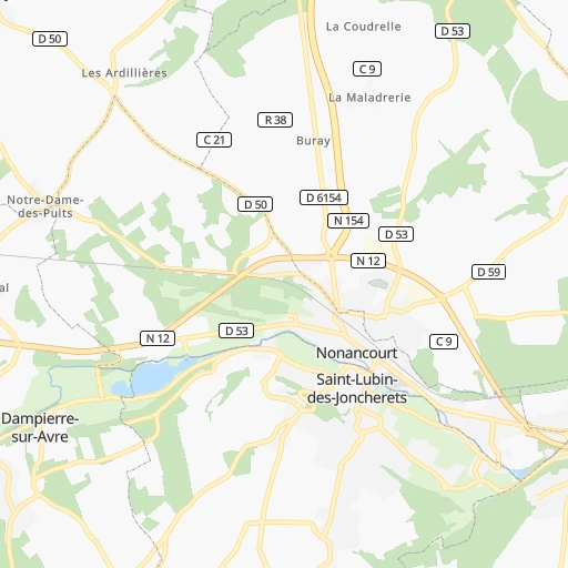
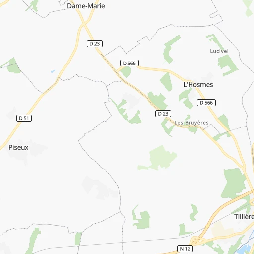
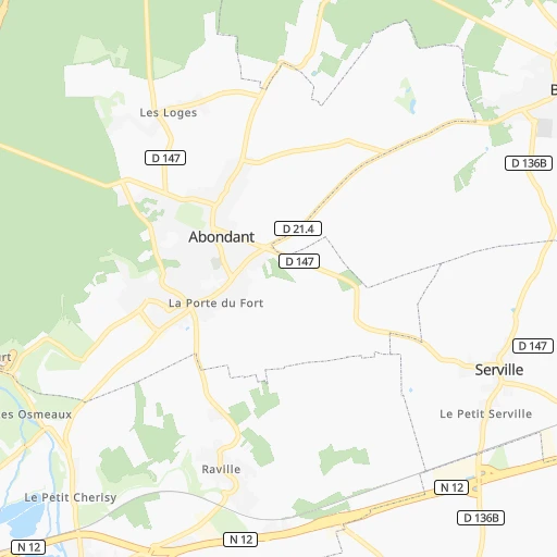
Roadmap (route) to go from Nonancourt Railway Station to Alençon detailed above, you can also see the course layout on the map.
While doing trip Nonancourt Railway Station - Alençon by car, the calculated route ends at a distance , or more straight.
Distance and duration of the route between Nonancourt Railway Station and Alençon
Calculation of distance and route from Alençon to Nonancourt Railway Station :
89.295.5 km1h11mn
Continue 0h0mn 59 mTurn slight right 0h0mn 98 mTurn right onto Route de Damville 0h0mn 15 mTurn slight right onto Rue de la Gare 0h0mn 337 mTurn sharp right onto Rue Hippolyte Lozier 0h2mn 2.2 kmTurn left onto N 12 0h15mn 19.3 kmAt roundabout, take exit 2 onto N 12 0h27mn 33.7 kmKeep right onto N 12 and drive toward Alençon, Mortagne-au-Perche 0h22mn 36.3 kmKeep right onto N 12 0h0mn 301 mAt roundabout, take exit 4 0h0mn 292 mAt roundabout, take exit 1 onto D 112 0h1mn 861 mAt roundabout, take exit 1 onto Avenue de Quakenbrück 0h3mn 2.0 kmAt roundabout, take exit 2 onto Place du Général de Gaulle 0h0mn 53 mTurn slight right onto Boulevard de Strasbourg 0h0mn 35 mArrive at destination 0h0mn 0 m
Travel from Nonancourt Railway Station (Normandy) to a selection of major cities.
Distances from Nonancourt Railway Station to biggest cities in Normandy
Other major cities in country :
- Saint-Quentin-en-Yvelines [11], 146,598 inhabitants. 61 km
- Brest [53], 144,899 inhabitants. 420 km
- Le Mans [52], 144,515 inhabitants. 113 km
- Amiens [32], 143,086 inhabitants. 149 km
- Tours [24], 141,621 inhabitants. 158 km
- Limoges [75], 141,176 inhabitants. 328 km
- Clermont-Ferrand [84], 138,681 inhabitants. 363 km
- Villeurbanne [84], 131,445 inhabitants. 436 km
- Besancon [27], 128,426 inhabitants. 397 km
- Orleans [24], 124,149 inhabitants. 111 km
- Metz [44], 123,914 inhabitants. 366 km
- Mulhouse [44], 111,430 inhabitants. 469 km
- Perpignan [76], 110,706 inhabitants. 689 km
- Boulogne-Billancourt [11], 108,782 inhabitants. 78 km
- Nancy [44], 105,334 inhabitants. 367 km
- Argenteuil [11], 101,475 inhabitants. 80 km
- Saint-Denis [11], 96,128 inhabitants. 88 km
- Roubaix [32], 95,721 inhabitants. 257 km
- Tourcoing [32], 91,574 inhabitants. 259 km
- Montreuil [11], 90,652 inhabitants. 92 km
Route from Alençon to major cities (France).
- Distance Alençon Paris172 km
- Distance Alençon Marseille703 km
- Distance Alençon Lyon468 km
- Distance Alençon Toulouse548 km
- Distance Alençon Nice764 km
- Distance Alençon Nantes183 km
- Distance Alençon Strasbourg564 km
- Distance Alençon Montpellier611 km
- Distance Alençon Bordeaux403 km
- Distance Alençon Lille325 km
- Distance Alençon Rennes136 km
- Distance Alençon Reims303 km
- Distance Alençon Cergy-Pontoise160 km
- Distance Alençon Saint-Etienne467 km
- Distance Alençon Toulon744 km
- Distance Alençon Angers117 km
- Distance Alençon Grenoble562 km
- Distance Alençon Dijon388 km
- Distance Alençon Nimes609 km
- Distance Alençon Aix-en-Provence685 km
Nearest cities to Nonancourt Railway Station :
- Paris, 2,138,551 inhabitants. 85 km
- Nantes, 277,269 inhabitants. 268 km
- Lille, 228,328 inhabitants. 247 km
- Rennes, 209,375 inhabitants. 224 km
- Reims, 196,565 inhabitants. 214 km
- Le Havre, 185,972 inhabitants. 112 km
- Cergy-Pontoise, 183,430 inhabitants. 71 km
- Angers, 168,279 inhabitants. 194 km
- Saint-Quentin-en-Yvelines, 146,598 inhabitants. 61 km
- Le Mans, 144,515 inhabitants. 113 km
- Amiens, 143,086 inhabitants. 149 km
- Tours, 141,621 inhabitants. 158 km
- Limoges, 141,176 inhabitants. 328 km
- Clermont-Ferrand, 138,681 inhabitants. 363 km
- Orleans, 124,149 inhabitants. 111 km
- Rouen, 112,787 inhabitants. 75 km
- Caen, 110,624 inhabitants. 122 km
- Boulogne-Billancourt, 108,782 inhabitants. 78 km
- Argenteuil, 101,475 inhabitants. 80 km
- Saint-Denis, 96,128 inhabitants. 88 km
- Roubaix, 95,721 inhabitants. 257 km
- Tourcoing, 91,574 inhabitants. 259 km
- Montreuil, 90,652 inhabitants. 92 km
- Asnieres-sur-Seine, 86,742 inhabitants. 81 km
- Nanterre, 86,719 inhabitants. 75 km
- Poitiers, 85,960 inhabitants. 252 km
- Versailles, 85,416 inhabitants. 69 km
- Courbevoie, 85,158 inhabitants. 79 km
- Creteil, 84,833 inhabitants. 93 km
- Colombes, 82,300 inhabitants. 79 km
- Vitry-sur-Seine, 81,001 inhabitants. 89 km
- Aulnay-sous-Bois, 80,615 inhabitants. 97 km
- La Rochelle, 76,810 inhabitants. 340 km
- Champigny-sur-Marne, 76,726 inhabitants. 96 km
- Rueil-Malmaison, 76,616 inhabitants. 74 km
- Saint-Maur-des-Fosses, 75,402 inhabitants. 95 km
- Calais, 74,433 inhabitants. 247 km
- Dunkerque, 71,287 inhabitants. 265 km
- Aubervilliers, 70,914 inhabitants. 89 km
- Bourges, 67,987 inhabitants. 209 km
- Drancy, 62,488 inhabitants. 93 km
- Noisy-le-Grand, 62,420 inhabitants. 101 km
- Villeneuve-d'Ascq, 62,400 inhabitants. 249 km
- Levallois-Perret, 62,178 inhabitants. 81 km
- Issy-les-Moulineaux, 61,447 inhabitants. 80 km
- Neuilly-sur-Seine, 61,300 inhabitants. 80 km
- Troyes, 60,785 inhabitants. 220 km
- Antony, 59,845 inhabitants. 81 km
- La Roche-sur-Yon, 59,410 inhabitants. 306 km
- Sarcelles, 57,979 inhabitants. 91 km
Location Nonancourt Railway Station (Normandy) :
| Country flag |  |
| Location | Nonancourt Railway Station |
| State | Normandy |
| County | Département de l'Eure |
| Country | France |
| Country code / ISO 2 | FR |
| Latitude | 48.7758200 |
| Longitude | 1.1922700 |
| Altitude | 0 meters |
| Time zone | Europe/Paris |
Location Alençon (Normandy) :
| Country flag | |
| Location | Alençon |
| State | Normandy |
| County | Département de l'Orne |
| Country | France |
| Country code / ISO 2 | FR |
| Latitude | 48.4347600 |
| Longitude | 0.0931100 |
| Altitude | 0 meters |
| Time zone | Europe/Paris |


