


How to get from Bruyères Railway Station (Grand Est) to Bar-le-Duc (Grand Est)
Calculate route from Bruyères Railway Station (Grand Est, France) to Bar-le-Duc (Grand Est, France).
The flight distance (as the crow flies) between Bruyères Railway Station and Bar-le-Duc is 130.9 km.
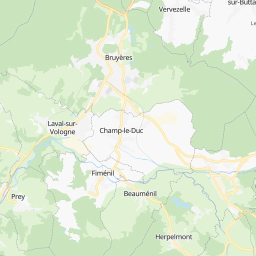
Roadmap (route) to go from Bruyères Railway Station to Bar-le-Duc detailed above, you can also see the course layout on the map.
While doing trip Bruyères Railway Station - Bar-le-Duc by car, the calculated route ends at a distance , or more straight.
Distance and duration of the route between Bruyères Railway Station and Bar-le-Duc
Calculation of distance and route from Bar-le-Duc to Bruyères Railway Station :
130.9157.2 km2h9mn
Continue 0h0mn 11 mTurn right 0h0mn 14 mTurn left onto Avenue Chanzy 0h1mn 403 mTurn right onto Rue Jules Ferry 0h0mn 223 mKeep left onto Rue Jules Ferry 0h0mn 11 mTurn left onto Avenue du Cameroun 0h0mn 18 mTurn right onto Rue Général de Gaulle 0h1mn 1.3 kmKeep left onto Rue de Vielsalm 0h0mn 20 mTurn left onto D 420 and drive toward Grandvillers, Épinal 0h10mn 10.1 kmTurn right onto Route de Dompierre and drive toward Dompierre, Thaon les Vosges 0h5mn 5.3 kmTurn slight left onto Route de Châtel and drive toward Villoncourt, Thaon les Vosges, Châtel sur Moselle 0h6mn 5.8 kmTurn sharp left onto Rue de la Tuilerie 0h1mn 239 mTurn left onto Rue de Richarpont 0h4mn 3.6 kmAt roundabout, take exit 1 onto D 10 0h5mn 5.1 kmAt roundabout, take exit 4 onto Avenue du 13e Bataillon de Génie 0h1mn 478 mTurn right onto Rue de l'Estrey and take D 10 toward Vincey, Charmes, Mirecourt, Nancy 0h1mn 603 mTurn right onto Rue de Lorraine and drive toward Vincey, Charmes, Mirecourt, Nancy 0h1mn 1.0 kmAt roundabout, take exit 2 onto Rue Bernard Gobet 0h0mn 246 mKeep left and take N 57 toward Nancy 0h10mn 16.3 kmTurn right and take D 904 toward Vézelise, Gripport, Colline de Sion - Vaudémont 0h0mn 425 mKeep left and drive toward Vézelise, Colline de Sion - Vaudémont 0h0mn 18 mTurn left onto D 904 0h10mn 9.6 kmContinue onto D 904 0h2mn 1.8 kmKeep left onto D 904 0h3mn 2.9 kmKeep left onto Avenue Jacques Leclerc and drive toward A 31, Autres directions, Centre ville 0h0mn 35 mTurn left onto Rue du Maréchal Foch 0h1mn 511 mTurn right onto Rue Jean-Baptiste de la Salle 0h11mn 10.1 kmTurn left onto D 4 0h4mn 4.0 kmTurn right onto C 6 0h3mn 2.8 kmTurn left onto Rue Étienne Olry 0h1mn 400 mAt roundabout, take exit 2 0h0mn 514 mAt roundabout, take exit 2 0h0mn 241 mKeep right 0h7mn 13.2 kmKeep right and take N 4 toward Paris, Reims, Bar le Duc, Toul-Centre 0h27mn 44.5 kmKeep right onto N 4 and take N 135 toward Bar-le-Duc, Neufchâteau, Ligny-en-Barrois 0h0mn 312 mAt roundabout, take exit 2 onto Rue Leroux 0h4mn 3.0 kmAt roundabout, take exit 1 onto N 135 0h4mn 4.7 kmAt roundabout, take exit 2 onto N 135 0h1mn 1.1 kmAt roundabout, take exit 3 onto D 935 0h3mn 3.6 kmAt roundabout, take exit 2 onto Rue Ernest Bradfer 0h2mn 1.5 kmAt roundabout, take exit 1 onto Rue Ernest Bradfer 0h1mn 671 mTurn right onto Boulevard de la Rochelle 0h1mn 423 mTurn left onto Rue Saint-Antoine 0h0mn 58 mArrive at destination 0h0mn 0 m
Travel from Bruyères Railway Station (Grand Est) to a selection of major cities.
Distances from Bruyères Railway Station to biggest cities in Grand Est
- Sarreguemines,24,446 inhabitants.104 km
- Verdun,21,798 inhabitants.145 km
- Luneville,21,582 inhabitants.47 km
- Forbach,21,358 inhabitants.110 km
- Saint-Louis,20,871 inhabitants.93 km
- Sedan,20,620 inhabitants.211 km
Other major cities in country :
- Brest [53], 144,899 inhabitants. 829 km
- Le Mans [52], 144,515 inhabitants. 485 km
- Amiens [32], 143,086 inhabitants. 373 km
- Tours [24], 141,621 inhabitants. 459 km
- Limoges [75], 141,176 inhabitants. 491 km
- Clermont-Ferrand [84], 138,681 inhabitants. 386 km
- Villeurbanne [84], 131,445 inhabitants. 305 km
- Besancon [27], 128,426 inhabitants. 119 km
- Orleans [24], 124,149 inhabitants. 360 km
- Rouen [28], 112,787 inhabitants. 434 km
- Perpignan [76], 110,706 inhabitants. 682 km
- Caen [28], 110,624 inhabitants. 531 km
- Boulogne-Billancourt [11], 108,782 inhabitants. 337 km
- Argenteuil [11], 101,475 inhabitants. 339 km
- Saint-Denis [11], 96,128 inhabitants. 331 km
- Roubaix [32], 95,721 inhabitants. 378 km
- Tourcoing [32], 91,574 inhabitants. 381 km
- Montreuil [11], 90,652 inhabitants. 324 km
- Avignon [93], 89,769 inhabitants. 496 km
- Marseille 13 [93], 89,316 inhabitants. 553 km
Route from Bar-le-Duc to major cities (France).
- Distance Bar-le-Duc Paris206 km
- Distance Bar-le-Duc Marseille610 km
- Distance Bar-le-Duc Lyon337 km
- Distance Bar-le-Duc Toulouse643 km
- Distance Bar-le-Duc Nice587 km
- Distance Bar-le-Duc Nantes529 km
- Distance Bar-le-Duc Montpellier583 km
- Distance Bar-le-Duc Bordeaux619 km
- Distance Bar-le-Duc Lille256 km
- Distance Bar-le-Duc Rennes510 km
- Distance Bar-le-Duc Le Havre377 km
- Distance Bar-le-Duc Cergy-Pontoise228 km
- Distance Bar-le-Duc Saint-Etienne376 km
- Distance Bar-le-Duc Toulon632 km
- Distance Bar-le-Duc Angers448 km
- Distance Bar-le-Duc Grenoble403 km
- Distance Bar-le-Duc Dijon162 km
- Distance Bar-le-Duc Nimes553 km
- Distance Bar-le-Duc Aix-en-Provence584 km
- Distance Bar-le-Duc Saint-Quentin-en-Yvelines231 km
Nearest cities to Bruyères Railway Station :
- Lyon, 472,317 inhabitants. 308 km
- Strasbourg, 274,845 inhabitants. 87 km
- Reims, 196,565 inhabitants. 229 km
- Saint-Etienne, 176,280 inhabitants. 356 km
- Dijon, 149,782 inhabitants. 161 km
- Villeurbanne, 131,445 inhabitants. 305 km
- Besancon, 128,426 inhabitants. 119 km
- Metz, 123,914 inhabitants. 109 km
- Mulhouse, 111,430 inhabitants. 68 km
- Nancy, 105,334 inhabitants. 66 km
- Colmar, 65,405 inhabitants. 49 km
- Chambery, 61,640 inhabitants. 300 km
- Troyes, 60,785 inhabitants. 195 km
- Venissieux, 57,584 inhabitants. 312 km
- Belfort, 54,562 inhabitants. 64 km
- Charleville-Mezieres, 52,415 inhabitants. 227 km
- Chalons-en-Champagne, 51,257 inhabitants. 192 km
- Annecy, 49,232 inhabitants. 260 km
- Chalon-sur-Saone, 47,251 inhabitants. 212 km
- Bourg-en-Bresse, 45,340 inhabitants. 250 km
- Thionville, 44,311 inhabitants. 136 km
- Caluire-et-Cuire, 42,763 inhabitants. 304 km
- Saint-Priest, 41,641 inhabitants. 310 km
- Roanne, 39,840 inhabitants. 314 km
- Epinal, 39,518 inhabitants. 20 km
- Haguenau, 38,721 inhabitants. 104 km
- Saint-Chamond, 38,014 inhabitants. 347 km
- Bron, 37,825 inhabitants. 307 km
- Vaulx-en-Velin, 37,489 inhabitants. 302 km
- Macon, 35,484 inhabitants. 254 km
- Maubeuge, 33,684 inhabitants. 305 km
- Villefranche-sur-Saone, 32,994 inhabitants. 290 km
- Vienne, 32,293 inhabitants. 331 km
- Schiltigheim, 32,289 inhabitants. 88 km
- Saint-Dizier, 31,918 inhabitants. 139 km
- Vandoeuvre-les-Nancy, 31,785 inhabitants. 63 km
- Thonon-les-Bains, 31,684 inhabitants. 205 km
- Saint-Leu, 29,278 inhabitants. 234 km
- Chaumont, 28,981 inhabitants. 118 km
- Meyzieu, 28,929 inhabitants. 301 km
- Montbeliard, 28,865 inhabitants. 77 km
- Annemasse, 28,275 inhabitants. 227 km
- Rillieux-la-Pape, 28,076 inhabitants. 300 km
- Aix-les-Bains, 27,651 inhabitants. 286 km
- Illkirch-Graffenstaden, 27,261 inhabitants. 82 km
- Epernay, 27,082 inhabitants. 224 km
- Montigny-les-Metz, 26,369 inhabitants. 108 km
- Dole, 25,878 inhabitants. 153 km
- Oyonnax, 25,697 inhabitants. 231 km
- Oullins, 25,592 inhabitants. 313 km
Location Bruyères Railway Station (Grand Est) :
| Country flag |  |
| Location | Bruyères Railway Station |
| State | Grand Est |
| County | Vosges |
| Country | France |
| Country code / ISO 2 | FR |
| Latitude | 48.2049300 |
| Longitude | 6.7188800 |
| Altitude | 0 meters |
| Time zone | Europe/Paris |
Location Bar-le-Duc (Grand Est) :
| Country flag | |
| Location | Bar-le-Duc |
| State | Grand Est |
| County | Meuse |
| Country | France |
| Country code / ISO 2 | FR |
| Latitude | 48.7727500 |
| Longitude | 5.1610800 |
| Altitude | 0 meters |
| Time zone | Europe/Paris |
