
How to get from Kay (airport) (Tennessee) to Columbus (Ohio)
Calculate route from Kay (airport) (Tennessee, United States) to Columbus (Ohio, United States).
The flight distance (as the crow flies) between Kay (airport) and Columbus is 391.3 km.
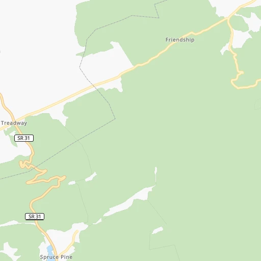
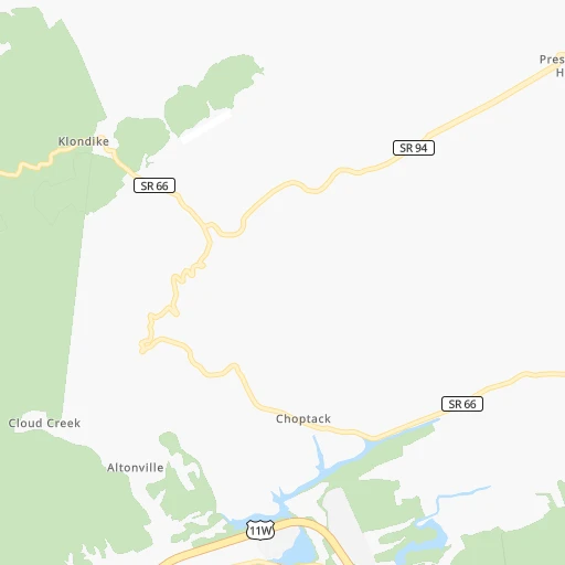
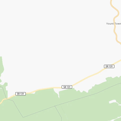
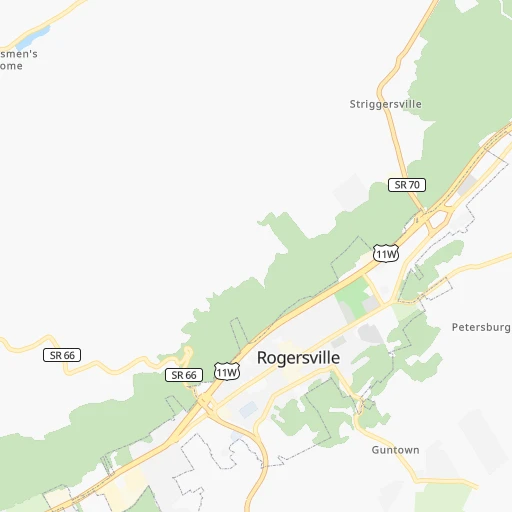
Roadmap (route) to go from Kay Airport to Columbus detailed above, you can also see the course layout on the map.
While doing trip Kay (airport) - Columbus by car, the calculated route ends at a distance , or more straight.
Distance and duration of the route between Kay (airport) and Columbus
Calculation of distance and route from Columbus to Kay (airport) :
391.3515.5 km7h9mn
Continue onto Price Road 0h1mn 692 mTurn left onto Price Road 0h1mn 490 mTurn sharp right onto TN-66 0h8mn 8.2 kmTurn right onto Clinch Valley Road 0h13mn 10.7 kmTurn right onto Clinch Valley Road 0h0mn 23 mTurn left onto TN-70 0h8mn 9.0 kmTurn right onto Kyles Ford Highway 0h17mn 17.2 kmTurn sharp left onto Berrytown Road 0h3mn 1.5 kmKeep left onto Berrytown Road 0h5mn 2.4 kmTurn right onto Canton Road 0h5mn 4.2 kmTurn slight right onto Pattonsville Road 0h2mn 1.7 kmKeep left onto Pattonsville Road 0h5mn 4.1 kmTurn right onto Duff Patt Highway 0h1mn 1.4 kmTurn sharp left onto US 23 1h30mn 113.3 kmContinue onto US 23, US 119, US 460, KY 80, KY 1426 0h1mn 1.7 kmKeep right and take KY 1384 toward Pikeville 0h0mn 357 mKeep left and take KY 1384 toward Pikeville 0h0mn 30 mTurn left onto Hambley Boulevard 0h11mn 11.0 kmTurn left onto North Mayo Trail 1h34mn 39.4 kmTurn right onto KY 1428 0h1mn 1.3 kmContinue onto KY 1428 0h4mn 4.0 kmTurn right onto Euclid Avenue 0h0mn 310 mTurn left onto Tutor Key Road 0h4mn 3.6 kmTurn sharp left onto Whippoorwill Road 0h6mn 2.9 kmTurn sharp left onto KY 993 0h0mn 38 mTurn right onto Paintsville Road 1h3mn 74.0 kmTurn slight right onto Louisa Street 0h7mn 8.4 kmContinue onto Winchester Avenue 0h3mn 2.6 kmTurn right onto 13th Street 0h1mn 750 mKeep left 0h0mn 43 mKeep right 0h23mn 38.6 kmKeep right onto Southern Ohio Veterans Memorial Highway and take SR 823 North toward Chillicothe 0h16mn 26.4 kmKeep right and take US 23 North toward Chillicothe 1h41mn 54.8 kmKeep right onto US 23 and take US 23 North toward Columbus 1h45mn 62.1 kmTurn slight right onto South High Street 0h9mn 7.8 kmTurn right onto East State Street 0h0mn 231 mTurn sharp left onto East State Street 0h0mn 32 mKeep right 0h0mn 63 mArrive at destination 0h0mn 0 m
Travel from Kay (airport) (Ohio) to a selection of major cities.
Distances from Kay Airport to biggest cities in Tennessee
- Spring Hill,36,055 inhabitants.352 km
- La Vergne,34,794 inhabitants.315 km
- Gallatin,34,334 inhabitants.299 km
- Cookeville,32,113 inhabitants.217 km
- Mount Juliet,31,540 inhabitants.307 km
- Brentwood Estates,31,279 inhabitants.333 km
- Lebanon,30,262 inhabitants.286 km
- Morristown,29,478 inhabitants.30 km
- Oak Ridge,29,302 inhabitants.115 km
- Maryville,28,464 inhabitants.109 km
- Bristol,26,666 inhabitants.84 km
- Farragut,21,919 inhabitants.112 km
- Shelbyville,21,317 inhabitants.320 km
- East Ridge,20,979 inhabitants.250 km
Other major cities in country :
- Charlotte [NC], 827,097 inhabitants. 245 km
- Seattle [WA], 684,451 inhabitants. 3,430 km
- Denver [CO], 682,545 inhabitants. 1,946 km
- El Paso [TX], 681,124 inhabitants. 2,211 km
- Detroit [MI], 677,116 inhabitants. 656 km
- Boston [MA], 667,137 inhabitants. 1,226 km
- Portland [OR], 632,309 inhabitants. 3,436 km
- Oklahoma City [OK], 631,346 inhabitants. 1,301 km
- Las Vegas [NV], 623,747 inhabitants. 2,860 km
- Baltimore [MD], 621,849 inhabitants. 653 km
- Washington, D.C. [DC], 601,723 inhabitants. 601 km
- Milwaukee [WI], 600,155 inhabitants. 841 km
- South Boston [MA], 571,281 inhabitants. 1,226 km
- Albuquerque [NM], 559,121 inhabitants. 2,126 km
- Tucson [AZ], 531,641 inhabitants. 2,590 km
- Fresno [CA], 520,052 inhabitants. 3,256 km
- Sacramento [CA], 490,712 inhabitants. 3,373 km
- Kansas City [MO], 475,378 inhabitants. 1,051 km
- Long Beach [CA], 474,140 inhabitants. 3,191 km
- Mesa [AZ], 471,825 inhabitants. 2,632 km
Route from Columbus to major cities (United States).
- Distance Columbus New York City767 km
- Distance Columbus Los Angeles3,180 km
- Distance Columbus Chicago444 km
- Distance Columbus Brooklyn772 km
- Distance Columbus Houston1,598 km
- Distance Columbus Queens781 km
- Distance Columbus Philadelphia668 km
- Distance Columbus Phoenix2,681 km
- Distance Columbus Manhattan771 km
- Distance Columbus San Antonio1,836 km
- Distance Columbus San Diego3,147 km
- Distance Columbus The Bronx780 km
- Distance Columbus Dallas1,470 km
- Distance Columbus San Jose3,367 km
- Distance Columbus Austin1,718 km
- Distance Columbus Jacksonville1,079 km
- Distance Columbus San Francisco3,398 km
- Distance Columbus Fort Worth1,513 km
- Distance Columbus Indianapolis271 km
- Distance Columbus Charlotte560 km
Nearest cities to Kay (airport) :
- Charlotte, 827,097 inhabitants. 245 km
- Atlanta, 463,878 inhabitants. 321 km
- Lexington-Fayette, 314,488 inhabitants. 215 km
- Cincinnati, 296,943 inhabitants. 323 km
- Meads, 288,649 inhabitants. 222 km
- Ironville, 288,649 inhabitants. 227 km
- Louisville, 243,639 inhabitants. 309 km
- Winston-Salem, 241,218 inhabitants. 260 km
- Lexington, 225,366 inhabitants. 211 km
- Knoxville, 185,291 inhabitants. 90 km
- Chattanooga, 176,588 inhabitants. 252 km
- East Chattanooga, 154,024 inhabitants. 247 km
- Columbia, 133,803 inhabitants. 331 km
- Athens, 116,714 inhabitants. 277 km
- Sandy Springs, 105,330 inhabitants. 303 km
- Roswell, 94,501 inhabitants. 292 km
- Asheville, 88,512 inhabitants. 106 km
- Concord, 87,696 inhabitants. 255 km
- Johns Creek, 83,335 inhabitants. 286 km
- Gastonia, 74,543 inhabitants. 218 km
- Rock Hill, 71,548 inhabitants. 253 km
- Johnson City, 66,027 inhabitants. 69 km
- Greenville, 64,579 inhabitants. 188 km
- Alpharetta, 63,693 inhabitants. 284 km
- Hamilton, 62,407 inhabitants. 353 km
- Marietta, 59,067 inhabitants. 306 km
- Smyrna, 56,146 inhabitants. 312 km
- Kingsport, 53,014 inhabitants. 51 km
- Huntersville, 52,704 inhabitants. 234 km
- Brookhaven, 51,910 inhabitants. 309 km
- Stonecrest, 50,000 inhabitants. 318 km
- Charleston, 49,736 inhabitants. 249 km
- Dunwoody, 48,733 inhabitants. 299 km
- Huntington, 48,638 inhabitants. 228 km
- Jeffersonville, 46,960 inhabitants. 309 km
- Columbus, 46,690 inhabitants. 394 km
- Kannapolis, 46,144 inhabitants. 248 km
- Blacksburg, 44,215 inhabitants. 256 km
- Cleveland, 43,898 inhabitants. 214 km
- Augusta, 43,459 inhabitants. 347 km
- Fairfield, 42,767 inhabitants. 347 km
- Covington, 40,997 inhabitants. 319 km
- Peachtree Corners, 40,978 inhabitants. 293 km
- Sumter, 40,816 inhabitants. 377 km
- North Atlanta, 40,456 inhabitants. 308 km
- Hickory, 40,374 inhabitants. 178 km
- Gainesville, 38,712 inhabitants. 247 km
- Spartanburg, 37,867 inhabitants. 197 km
- Milton, 37,547 inhabitants. 279 km
- Mableton, 37,115 inhabitants. 321 km
Location Kay (airport) (Tennessee) :
| Country flag |  |
| Location | Kay (airport) |
| State | Tennessee |
| County | Hawkins County |
| Country | United States |
| Country code / ISO 2 | US |
| Latitude | 36.4413300 |
| Longitude | -83.1110100 |
| Altitude | 365 meters |
| Time zone | America/New_York |
Location Columbus (Ohio) :
| Country flag | |
| Location | Columbus |
| State | Ohio |
| County | Franklin County |
| Country | United States |
| Country code / ISO 2 | US |
| Latitude | 39.9611800 |
| Longitude | -82.9987900 |
| Altitude | 235 meters |
| Time zone | America/New_York |


