


How to get from Southfork (airport) (Tennessee) to Florence (Alabama)
Calculate route from Southfork (airport) (Tennessee, United States) to Florence (Alabama, United States).
The flight distance (as the crow flies) between Southfork (airport) and Florence is 129.2 km.
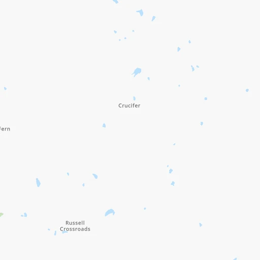
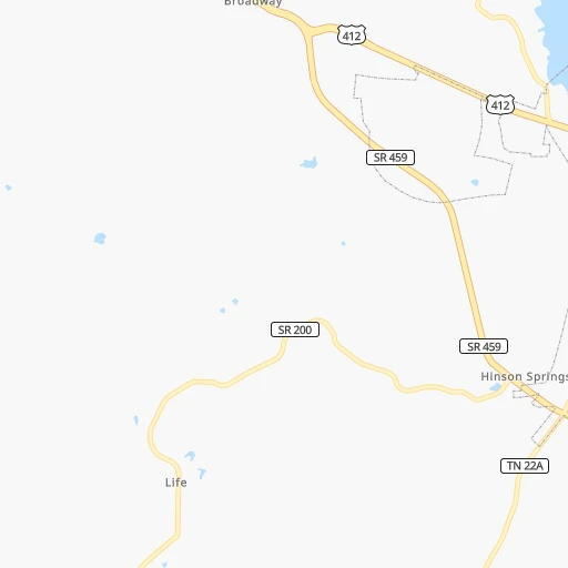
Roadmap (route) to go from Southfork Airport to Florence detailed above, you can also see the course layout on the map.
While doing trip Southfork (airport) - Florence by car, the calculated route ends at a distance , or more straight.
Distance and duration of the route between Southfork (airport) and Florence
Calculation of distance and route from Florence to Southfork (airport) :
129.2153.0 km3h31mn
Continue 0h1mn 226 mTurn right onto Beech Bluff Road 0h3mn 2.6 kmTurn right onto Ranger Road 0h6mn 3.1 kmTurn left onto McAbee Road 0h5mn 2.3 kmTurn right onto Beech Bluff Road 0h1mn 936 mTurn left onto Mifflin Road 0h7mn 6.7 kmTurn right onto TN 200 0h0mn 404 mKeep left onto Glendale Road 0h8mn 6.7 kmTurn left onto Glendale Road 0h3mn 2.8 kmTurn sharp left onto Howard Road 0h4mn 2.1 kmTurn left onto TN 100 0h2mn 1.9 kmTurn sharp right onto TN 22A 0h20mn 19.7 kmKeep right 0h0mn 47 mTurn slight right onto TN 22, TN 69 0h1mn 1.6 kmTurn left onto TN 69 0h13mn 17.2 kmTurn left onto US 64, SR 22, SR 69 1h12mn 80.3 kmTurn left onto Waterloo Road 0h4mn 3.1 kmKeep right 0h0mn 108 mTurn slight right onto North Cedar Street 0h1mn 672 mTurn left onto West Tuscaloosa Street 0h0mn 129 mTurn right onto North Pine Street 0h0mn 313 mArrive at destination 0h0mn 0 m
Travel from Southfork (airport) (Alabama) to a selection of major cities.
Distances from Southfork Airport to biggest cities in Tennessee
- Spring Hill,36,055 inhabitants.160 km
- La Vergne,34,794 inhabitants.196 km
- Gallatin,34,334 inhabitants.220 km
- Cookeville,32,113 inhabitants.295 km
- Mount Juliet,31,540 inhabitants.207 km
- Brentwood Estates,31,279 inhabitants.179 km
- Lebanon,30,262 inhabitants.227 km
- Morristown,29,478 inhabitants.492 km
- Oak Ridge,29,302 inhabitants.402 km
- Maryville,28,464 inhabitants.428 km
- Bristol,26,666 inhabitants.595 km
- Farragut,21,919 inhabitants.412 km
- Shelbyville,21,317 inhabitants.203 km
- East Ridge,20,979 inhabitants.320 km
Other major cities in country :
- Charlotte [NC], 827,097 inhabitants. 714 km
- Seattle [WA], 684,451 inhabitants. 3,070 km
- Denver [CO], 682,545 inhabitants. 1,504 km
- El Paso [TX], 681,124 inhabitants. 1,700 km
- Detroit [MI], 677,116 inhabitants. 893 km
- Boston [MA], 667,137 inhabitants. 1,696 km
- Portland [OR], 632,309 inhabitants. 3,050 km
- Oklahoma City [OK], 631,346 inhabitants. 799 km
- Las Vegas [NV], 623,747 inhabitants. 2,378 km
- Baltimore [MD], 621,849 inhabitants. 1,143 km
- Washington, D.C. [DC], 601,723 inhabitants. 1,095 km
- Milwaukee [WI], 600,155 inhabitants. 830 km
- South Boston [MA], 571,281 inhabitants. 1,696 km
- Albuquerque [NM], 559,121 inhabitants. 1,629 km
- Tucson [AZ], 531,641 inhabitants. 2,083 km
- Fresno [CA], 520,052 inhabitants. 2,783 km
- Sacramento [CA], 490,712 inhabitants. 2,915 km
- Kansas City [MO], 475,378 inhabitants. 649 km
- Long Beach [CA], 474,140 inhabitants. 2,697 km
- Mesa [AZ], 471,825 inhabitants. 2,130 km
Route from Florence to major cities (United States).
- Distance Florence New York City1,369 km
- Distance Florence Los Angeles2,797 km
- Distance Florence Chicago785 km
- Distance Florence Brooklyn1,371 km
- Distance Florence Houston915 km
- Distance Florence Queens1,381 km
- Distance Florence Philadelphia1,245 km
- Distance Florence Phoenix2,248 km
- Distance Florence Manhattan1,376 km
- Distance Florence San Antonio1,181 km
- Distance Florence San Diego2,729 km
- Distance Florence The Bronx1,386 km
- Distance Florence Dallas874 km
- Distance Florence San Jose3,075 km
- Distance Florence Austin1,070 km
- Distance Florence Jacksonville752 km
- Distance Florence San Francisco3,117 km
- Distance Florence Columbus708 km
- Distance Florence Fort Worth921 km
- Distance Florence Indianapolis569 km
Nearest cities to Southfork (airport) :
- Memphis, 655,770 inhabitants. 133 km
- New South Memphis, 641,608 inhabitants. 137 km
- Nashville, 530,852 inhabitants. 183 km
- Louisville, 243,639 inhabitants. 393 km
- Birmingham, 212,461 inhabitants. 290 km
- Huntsville, 190,582 inhabitants. 216 km
- Clarksville, 149,176 inhabitants. 158 km
- Murfreesboro, 126,118 inhabitants. 210 km
- Evansville, 119,943 inhabitants. 282 km
- Tuscaloosa, 98,332 inhabitants. 287 km
- Hoover, 84,848 inhabitants. 300 km
- Jonesboro, 73,907 inhabitants. 183 km
- Franklin, 72,639 inhabitants. 169 km
- Jackson, 66,975 inhabitants. 11 km
- Bowling Green, 63,616 inhabitants. 254 km
- Owensboro, 59,042 inhabitants. 279 km
- Bartlett, 58,579 inhabitants. 116 km
- Hendersonville, 56,018 inhabitants. 202 km
- Decatur, 55,437 inhabitants. 192 km
- Southaven, 52,589 inhabitants. 138 km
- Collierville, 48,863 inhabitants. 108 km
- Madison, 46,962 inhabitants. 204 km
- Jeffersonville, 46,960 inhabitants. 397 km
- Smyrna, 46,607 inhabitants. 201 km
- Belleville, 42,034 inhabitants. 343 km
- Brentwood, 41,763 inhabitants. 179 km
- Florence, 40,026 inhabitants. 129 km
- Cape Girardeau, 39,462 inhabitants. 202 km
- Germantown, 39,240 inhabitants. 117 km
- Columbia, 36,800 inhabitants. 150 km
- New Albany, 36,732 inhabitants. 392 km
- Oakville, 36,143 inhabitants. 349 km
- Gadsden, 36,084 inhabitants. 303 km
- Spring Hill, 36,055 inhabitants. 160 km
- Olive Branch, 36,010 inhabitants. 126 km
- Wildwood, 35,899 inhabitants. 374 km
- East Florence, 35,733 inhabitants. 131 km
- Tupelo, 35,680 inhabitants. 151 km
- La Vergne, 34,794 inhabitants. 196 km
- Gallatin, 34,334 inhabitants. 220 km
- Vestavia Hills, 34,174 inhabitants. 298 km
- Alabaster, 32,707 inhabitants. 315 km
- Hopkinsville, 32,205 inhabitants. 177 km
- Greenville, 32,156 inhabitants. 327 km
- Mount Juliet, 31,540 inhabitants. 207 km
- Brentwood Estates, 31,279 inhabitants. 179 km
- Ballwin, 30,577 inhabitants. 370 km
- Lebanon, 30,262 inhabitants. 227 km
- Elizabethtown, 29,678 inhabitants. 343 km
- O'Fallon, 29,002 inhabitants. 349 km
Location Southfork (airport) (Tennessee) :
| Country flag |  |
| Location | Southfork (airport) |
| State | Tennessee |
| County | Madison County |
| Country | United States |
| Country code / ISO 2 | US |
| Latitude | 35.6117400 |
| Longitude | -88.6963900 |
| Altitude | 119 meters |
| Time zone | America/Chicago |
Location Florence (Alabama) :
| Country flag | |
| Location | Florence |
| State | Alabama |
| County | Lauderdale County |
| Country | United States |
| Country code / ISO 2 | US |
| Latitude | 34.7998100 |
| Longitude | -87.6772500 |
| Altitude | 167 meters |
| Time zone | America/Chicago |


