
How to get from Dawson's (airport) (Arkansas) to El Dorado (Arkansas)
Calculate route from Dawson's (airport) (Arkansas, United States) to El Dorado (Arkansas, United States).
The flight distance (as the crow flies) between Dawson's (airport) and El Dorado is 265.7 km.
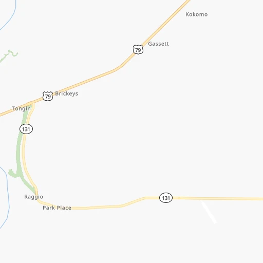
Roadmap (route) to go from Dawson's Airport to El Dorado detailed above, you can also see the course layout on the map.
While doing trip Dawson's (airport) - El Dorado by car, the calculated route ends at a distance , or more straight.
Distance and duration of the route between Dawson's (airport) and El Dorado
Calculation of distance and route from El Dorado to Dawson's (airport) :
265.7314.1 km5h39mn
Continue onto State Highway 131 0h10mn 8.2 kmTurn left onto US 79 0h17mn 18.3 kmTurn left onto Forrest Avenue 0h0mn 387 mTurn right onto West Chestnut Street 2h51mn 122.4 kmKeep right 0h0mn 154 mContinue onto West Front Street 0h19mn 21.0 kmContinue onto West 6th Avenue 0h0mn 116 mTurn left onto South Cypress Street 0h1mn 819 mTurn right onto West 13th Avenue 0h0mn 289 mTurn left onto South Hazel Street 0h0mn 412 mTurn right onto West 17th Avenue 0h2mn 2.0 kmTurn slight left onto South Blake Street 1h54mn 59.8 kmContinue onto US 79, US 167 0h6mn 6.6 kmKeep left onto US 167 1h52mn 68.6 kmTurn left onto North West Avenue 0h5mn 5.1 kmTurn right onto West Hillsboro Street 0h0mn 83 mTurn right onto Barton Street 0h0mn 21 mArrive at destination 0h0mn 0 m
Travel from Dawson's (airport) (Arkansas) to a selection of major cities.
Distances from Dawson's Airport to biggest cities in Arkansas
- West Memphis,25,052 inhabitants.48 km
- Searcy,24,196 inhabitants.118 km
- Van Buren,23,081 inhabitants.352 km
Other major cities in country :
- Charlotte [NC], 827,097 inhabitants. 885 km
- Seattle [WA], 684,451 inhabitants. 2,988 km
- Denver [CO], 682,545 inhabitants. 1,388 km
- El Paso [TX], 681,124 inhabitants. 1,520 km
- Detroit [MI], 677,116 inhabitants. 1,059 km
- Boston [MA], 667,137 inhabitants. 1,885 km
- Memphis [TN], 655,770 inhabitants. 58 km
- New South Memphis [TN], 641,608 inhabitants. 53 km
- Portland [OR], 632,309 inhabitants. 2,955 km
- Oklahoma City [OK], 631,346 inhabitants. 638 km
- Las Vegas [NV], 623,747 inhabitants. 2,227 km
- Baltimore [MD], 621,849 inhabitants. 1,332 km
- Washington, D.C. [DC], 601,723 inhabitants. 1,284 km
- Milwaukee [WI], 600,155 inhabitants. 942 km
- South Boston [MA], 571,281 inhabitants. 1,885 km
- Albuquerque [NM], 559,121 inhabitants. 1,468 km
- Tucson [AZ], 531,641 inhabitants. 1,910 km
- Nashville [TN], 530,852 inhabitants. 372 km
- Fresno [CA], 520,052 inhabitants. 2,637 km
- Sacramento [CA], 490,712 inhabitants. 2,780 km
Route from El Dorado to major cities (United States).
- Distance El Dorado New York City1,853 km
- Distance El Dorado Los Angeles2,366 km
- Distance El Dorado Chicago1,059 km
- Distance El Dorado Brooklyn1,855 km
- Distance El Dorado Houston461 km
- Distance El Dorado Queens1,865 km
- Distance El Dorado Philadelphia1,731 km
- Distance El Dorado Phoenix1,803 km
- Distance El Dorado Manhattan1,859 km
- Distance El Dorado San Antonio696 km
- Distance El Dorado San Diego2,284 km
- Distance El Dorado The Bronx1,869 km
- Distance El Dorado Dallas389 km
- Distance El Dorado San Jose2,685 km
- Distance El Dorado Austin581 km
- Distance El Dorado Jacksonville1,089 km
- Distance El Dorado San Francisco2,732 km
- Distance El Dorado Columbus1,144 km
- Distance El Dorado Fort Worth438 km
- Distance El Dorado Indianapolis934 km
Nearest cities to Dawson's (airport) :
- Memphis, 655,770 inhabitants. 58 km
- New South Memphis, 641,608 inhabitants. 53 km
- Little Rock, 197,992 inhabitants. 159 km
- Jackson, 170,674 inhabitants. 284 km
- Springfield, 166,810 inhabitants. 363 km
- Tuscaloosa, 98,332 inhabitants. 329 km
- Jonesboro, 73,907 inhabitants. 113 km
- Jackson, 66,975 inhabitants. 180 km
- North Little Rock, 66,504 inhabitants. 157 km
- Conway, 64,980 inhabitants. 175 km
- Bartlett, 58,579 inhabitants. 74 km
- Southaven, 52,589 inhabitants. 52 km
- Monroe, 49,598 inhabitants. 297 km
- Collierville, 48,863 inhabitants. 84 km
- Pine Bluff, 44,772 inhabitants. 149 km
- Florence, 40,026 inhabitants. 262 km
- Meridian, 39,661 inhabitants. 324 km
- Cape Girardeau, 39,462 inhabitants. 291 km
- Germantown, 39,240 inhabitants. 73 km
- Olive Branch, 36,010 inhabitants. 67 km
- East Florence, 35,733 inhabitants. 265 km
- Tupelo, 35,680 inhabitants. 181 km
- Hot Springs, 35,635 inhabitants. 232 km
- Hot Springs National Park, 35,193 inhabitants. 233 km
- Benton, 34,177 inhabitants. 189 km
- Greenville, 32,156 inhabitants. 165 km
- Sherwood, 30,517 inhabitants. 153 km
- Russellville, 29,166 inhabitants. 241 km
- Jacksonville, 28,643 inhabitants. 143 km
- Paragould, 27,900 inhabitants. 137 km
- Horn Lake, 26,915 inhabitants. 49 km
- Pearl, 26,462 inhabitants. 287 km
- Carbondale, 26,399 inhabitants. 344 km
- Madison, 25,799 inhabitants. 267 km
- Cabot, 25,587 inhabitants. 135 km
- Starkville, 25,366 inhabitants. 221 km
- Clinton, 25,254 inhabitants. 278 km
- West Memphis, 25,052 inhabitants. 48 km
- Paducah, 24,864 inhabitants. 306 km
- Northport, 24,772 inhabitants. 327 km
- Ridgeland, 24,351 inhabitants. 270 km
- Searcy, 24,196 inhabitants. 118 km
- Brandon, 23,529 inhabitants. 289 km
- Columbus, 23,168 inhabitants. 245 km
- Vicksburg, 23,131 inhabitants. 278 km
- Ruston, 22,340 inhabitants. 322 km
- Oxford, 22,314 inhabitants. 108 km
- Nixa, 20,984 inhabitants. 349 km
- Bryant, 19,986 inhabitants. 179 km
- Ozark, 19,120 inhabitants. 342 km
Location Dawson's (airport) (Arkansas) :
| Country flag |  |
| Location | Dawson's (airport) |
| State | Arkansas |
| County | Lee County |
| Country | United States |
| Country code / ISO 2 | US |
| Latitude | 34.8310900 |
| Longitude | -90.5484600 |
| Altitude | 59 meters |
| Time zone | America/Chicago |
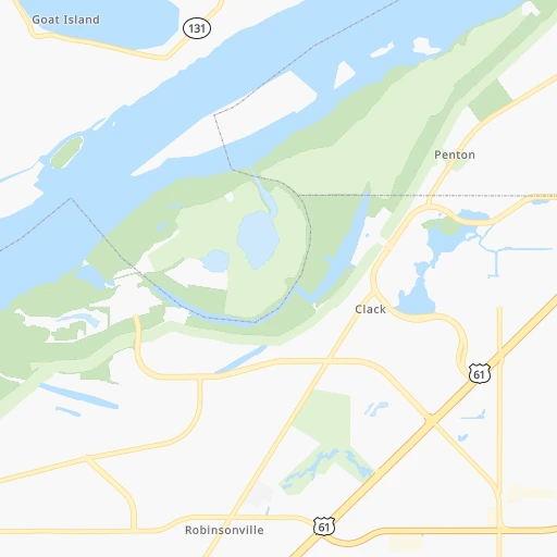
Location El Dorado (Arkansas) :
| Country flag | |
| Location | El Dorado |
| State | Arkansas |
| County | Union County |
| Country | United States |
| Country code / ISO 2 | US |
| Latitude | 33.2076300 |
| Longitude | -92.6662700 |
| Altitude | 82 meters |
| Time zone | America/Chicago |


