


Home
››
Umpqua RV Park Fly In Airport
››
Roadmap from Umpqua RV Park Fly In Airport to Battle Ground
How to get from Umpqua RV Park Fly In (airport) (Oregon) to Battle Ground (Washington)
Calculate route from Umpqua RV Park Fly In (airport) (Oregon, United States) to Battle Ground (Washington, United States).
The flight distance (as the crow flies) between Umpqua RV Park Fly In (airport) and Battle Ground is 262.8 km.
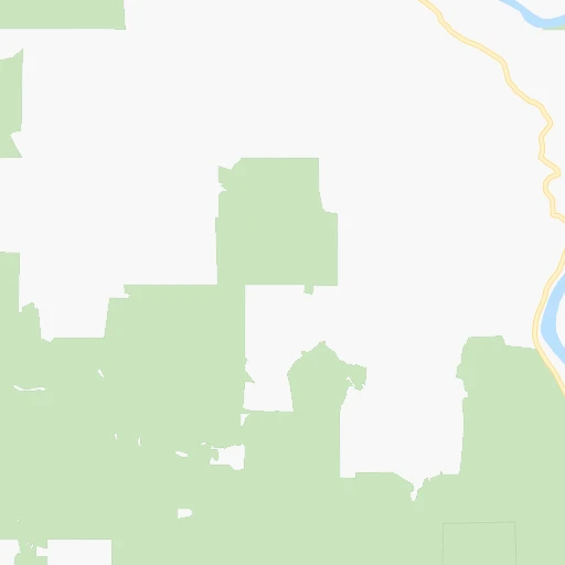
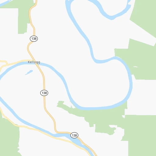
Roadmap (route) to go from Umpqua RV Park Fly In Airport to Battle Ground detailed above, you can also see the course layout on the map.
While doing trip Umpqua RV Park Fly In (airport) - Battle Ground by car, the calculated route ends at a distance , or more straight.
Distance and duration of the route between Umpqua RV Park Fly In (airport) and Battle Ground
Calculation of distance and route from Battle Ground to Umpqua RV Park Fly In (airport) :
262.8307.3 km4h39mn
Continue onto Umpqua Riverfront RV Park Road 0h1mn 552 mTurn left onto State Highway 138 West 0h12mn 13.2 kmTurn right onto State Highway 38 0h26mn 32.5 kmKeep left onto OR 99 2h25mn 221.1 kmKeep right onto I 5 and drive toward Seattle 0h9mn 10.9 kmKeep right and drive toward Victory Boulevard, Expo Center 0h4mn 4.4 kmKeep right and take WA 501 toward 4th Plain Boulevard, Mill Plain Boulevard 0h0mn 220 mKeep left and drive toward 4th Plain Boulevard 0h1mn 1.0 kmKeep right 0h0mn 121 mTurn slight right onto East Fourth Plain Boulevard 0h1mn 484 mTurn left onto Saint Johns Boulevard 0h2mn 1.3 kmTurn right toward WA 500 East 0h8mn 10.1 kmTurn slight right onto Northeast 117th Avenue 0h9mn 10.3 kmTurn right onto West Main Street 0h2mn 1.1 kmArrive at destination 0h0mn 0 m
Travel from Umpqua RV Park Fly In (airport) (Washington) to a selection of major cities.
Distances from Umpqua RV Park Fly In Airport to biggest cities in Oregon
- West Linn,26,593 inhabitants.218 km
- Woodburn,25,173 inhabitants.188 km
- Forest Grove,23,897 inhabitants.224 km
- Newberg,22,780 inhabitants.202 km
- Wilsonville,22,729 inhabitants.207 km
- Roseburg,22,114 inhabitants.38 km
- Klamath Falls,21,399 inhabitants.204 km
- Ashland,20,861 inhabitants.163 km
- Milwaukie,20,830 inhabitants.225 km
- Bethany,20,646 inhabitants.232 km
- Lents,20,156 inhabitants.231 km
Other major cities in country :
- Charlotte [NC], 827,097 inhabitants. 3,745 km
- Seattle [WA], 684,451 inhabitants. 464 km
- Denver [CO], 682,545 inhabitants. 1,597 km
- El Paso [TX], 681,124 inhabitants. 1,987 km
- Detroit [MI], 677,116 inhabitants. 3,271 km
- Boston [MA], 667,137 inhabitants. 4,207 km
- Memphis [TN], 655,770 inhabitants. 3,008 km
- New South Memphis [TN], 641,608 inhabitants. 3,010 km
- Oklahoma City [OK], 631,346 inhabitants. 2,397 km
- Las Vegas [NV], 623,747 inhabitants. 1,088 km
- Baltimore [MD], 621,849 inhabitants. 3,895 km
- Washington, D.C. [DC], 601,723 inhabitants. 3,878 km
- Milwaukee [WI], 600,155 inhabitants. 2,866 km
- South Boston [MA], 571,281 inhabitants. 4,208 km
- Albuquerque [NM], 559,121 inhabitants. 1,727 km
- Tucson [AZ], 531,641 inhabitants. 1,674 km
- Nashville [TN], 530,852 inhabitants. 3,219 km
- Fresno [CA], 520,052 inhabitants. 820 km
- Sacramento [CA], 490,712 inhabitants. 577 km
- Kansas City [MO], 475,378 inhabitants. 2,459 km
Route from Battle Ground to major cities (United States).
- Distance Battle Ground New York City3,914 km
- Distance Battle Ground Los Angeles1,355 km
- Distance Battle Ground Chicago2,813 km
- Distance Battle Ground Brooklyn3,921 km
- Distance Battle Ground Houston2,958 km
- Distance Battle Ground Queens3,928 km
- Distance Battle Ground Philadelphia3,861 km
- Distance Battle Ground Phoenix1,637 km
- Distance Battle Ground Manhattan3,914 km
- Distance Battle Ground San Antonio2,775 km
- Distance Battle Ground San Diego1,525 km
- Distance Battle Ground The Bronx3,918 km
- Distance Battle Ground Dallas2,629 km
- Distance Battle Ground San Jose941 km
- Distance Battle Ground Austin2,756 km
- Distance Battle Ground Jacksonville3,919 km
- Distance Battle Ground San Francisco891 km
- Distance Battle Ground Columbus3,255 km
- Distance Battle Ground Fort Worth2,597 km
- Distance Battle Ground Indianapolis3,019 km
Nearest cities to Umpqua RV Park Fly In (airport) :
- Portland, 632,309 inhabitants. 233 km
- Vancouver, 172,860 inhabitants. 245 km
- Salem, 164,549 inhabitants. 163 km
- Eugene, 163,460 inhabitants. 69 km
- Gresham, 110,553 inhabitants. 236 km
- Hillsboro, 102,347 inhabitants. 226 km
- Beaverton, 96,577 inhabitants. 226 km
- Redding, 91,582 inhabitants. 341 km
- Bend, 87,014 inhabitants. 189 km
- Medford, 79,805 inhabitants. 145 km
- Springfield, 60,870 inhabitants. 71 km
- Corvallis, 55,780 inhabitants. 118 km
- Albany, 52,175 inhabitants. 128 km
- Tigard, 51,253 inhabitants. 221 km
- Aloha, 49,425 inhabitants. 225 km
- Lake Oswego, 38,496 inhabitants. 222 km
- Keizer, 37,895 inhabitants. 168 km
- Grants Pass, 37,088 inhabitants. 123 km
- Longview, 36,848 inhabitants. 294 km
- Oregon City, 35,831 inhabitants. 217 km
- McMinnville, 33,892 inhabitants. 189 km
- Redmond, 28,654 inhabitants. 208 km
- Tualatin, 27,154 inhabitants. 216 km
- Eureka, 27,017 inhabitants. 308 km
- West Linn, 26,593 inhabitants. 218 km
- Woodburn, 25,173 inhabitants. 188 km
- Forest Grove, 23,897 inhabitants. 224 km
- Newberg, 22,780 inhabitants. 202 km
- Wilsonville, 22,729 inhabitants. 207 km
- Roseburg, 22,114 inhabitants. 38 km
- Camas, 21,846 inhabitants. 247 km
- Klamath Falls, 21,399 inhabitants. 204 km
- Ashland, 20,861 inhabitants. 163 km
- Milwaukie, 20,830 inhabitants. 225 km
- Bethany, 20,646 inhabitants. 232 km
- Lents, 20,156 inhabitants. 231 km
- Hayesville, 19,936 inhabitants. 168 km
- Salmon Creek, 19,686 inhabitants. 253 km
- Orchards, 19,556 inhabitants. 250 km
- Hazel Dell, 19,435 inhabitants. 249 km
- Battle Ground, 19,407 inhabitants. 263 km
- Sherwood, 19,283 inhabitants. 211 km
- Altamont, 19,257 inhabitants. 208 km
- Happy Valley, 18,493 inhabitants. 228 km
- Five Corners, 18,159 inhabitants. 252 km
- Central Point, 17,995 inhabitants. 138 km
- Arcata, 17,843 inhabitants. 300 km
- Canby, 17,271 inhabitants. 205 km
- Bayside, 17,132 inhabitants. 302 km
- Troutdale, 16,631 inhabitants. 242 km
Location Umpqua RV Park Fly In (airport) (Oregon) :
| Country flag |  |
| Location | Umpqua RV Park Fly In (airport) |
| State | Oregon |
| County | Douglas County |
| Country | United States |
| Country code / ISO 2 | US |
| Latitude | 43.5284800 |
| Longitude | -123.5466000 |
| Altitude | 70 meters |
| Time zone | America/Los_Angeles |
Location Battle Ground (Washington) :
| Country flag | |
| Location | Battle Ground |
| State | Washington |
| County | Clark County |
| Country | United States |
| Country code / ISO 2 | US |
| Latitude | 45.7809500 |
| Longitude | -122.5334300 |
| Altitude | 90 meters |
| Time zone | America/Los_Angeles |