
How to get from Iwanuma-eki (Miyagi) to Shiroishi (Miyagi)
Calculate route from Iwanuma-eki (Miyagi, Japan) to Shiroishi (Miyagi, Japan).
The flight distance (as the crow flies) between Iwanuma-eki and Shiroishi is 24.6 km.
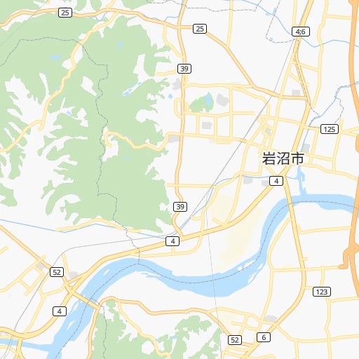
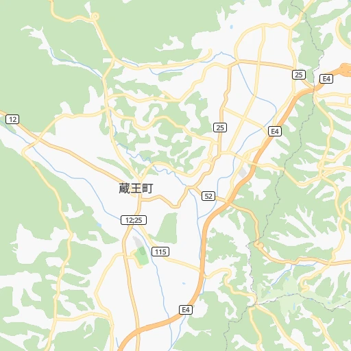
Roadmap (route) to go from Iwanuma-eki to Shiroishi detailed above, you can also see the course layout on the map.
While doing trip Iwanuma-eki - Shiroishi by car, the calculated route ends at a distance , or more straight.
Distance and duration of the route between Iwanuma-eki and Shiroishi
Calculation of distance and route from Shiroishi to Iwanuma-eki :
24.629.3 km1h30mn
Continue 0h0mn 227 mTurn sharp right onto 西大町線 0h3mn 2.6 kmTurn right onto 岩沼バイパス 0h4mn 3.4 kmKeep left 0h2mn 1.5 kmKeep left onto 国道349号 0h1mn 553 mContinue onto 国道349号 0h0mn 78 mContinue onto 白石柴田線 0h5mn 5.2 kmContinue onto 亘理大河原川崎線 0h1mn 1.4 kmContinue onto 白石柴田線 0h0mn 252 mTurn left 0h0mn 235 mTurn right 0h1mn 498 mTurn left onto 白石柴田線 0h0mn 89 mTurn right onto 白石柴田線 0h3mn 3.8 kmTurn left onto 白石柴田線 0h1mn 1.1 kmTurn left onto 白川犬卒都婆向山線 0h3mn 3.4 kmTurn slight right onto 国道113号 0h4mn 3.3 kmTurn left 0h1mn 653 mKeep left 0h0mn 70 mTurn left 0h0mn 240 mTurn right onto 白石停車場線 0h0mn 267 mContinue 0h0mn 134 mContinue 0h0mn 63 mTurn right 0h0mn 248 mTurn left 0h0mn 34 mTurn left 0h0mn 39 mArrive at destination 0h0mn 0 m
Travel from Iwanuma-eki (Miyagi) to a selection of major cities.
Distances from Iwanuma-eki to biggest cities in Miyagi
Other major cities in country :
- Honcho [04], 560,743 inhabitants. 279 km
- Kagoshima [18], 555,352 inhabitants. 1,190 km
- Niigata [29], 505,272 inhabitants. 165 km
- Himeji [13], 481,493 inhabitants. 662 km
- Matsudo [04], 470,277 inhabitants. 273 km
- Nishinomiya-hama [13], 468,925 inhabitants. 623 km
- Kawaguchi [34], 468,565 inhabitants. 276 km
- Kanazawa [15], 458,937 inhabitants. 412 km
- Utsunomiya [38], 449,865 inhabitants. 193 km
- Oita [30], 448,907 inhabitants. 998 km
- Matsuyama [05], 443,322 inhabitants. 870 km
- Amagasaki [13], 442,173 inhabitants. 617 km
- Kurashiki [31], 437,581 inhabitants. 747 km
- Yokosuka [19], 428,992 inhabitants. 332 km
- Nagasaki [27], 410,204 inhabitants. 1,160 km
- Hirakata [32], 406,331 inhabitants. 594 km
- Machida [40], 399,969 inhabitants. 313 km
- Gifu-shi [09], 397,714 inhabitants. 473 km
- Fujisawa [19], 394,624 inhabitants. 331 km
- Toyonaka [32], 384,459 inhabitants. 609 km
Route from Shiroishi to major cities (Japan).
- Distance Shiroishi Tokyo270 km
- Distance Shiroishi Yokohama299 km
- Distance Shiroishi Osaka588 km
- Distance Shiroishi Nagoya457 km
- Distance Shiroishi Sapporo567 km
- Distance Shiroishi Kobe611 km
- Distance Shiroishi Kyoto547 km
- Distance Shiroishi Fukuoka1,042 km
- Distance Shiroishi Kawasaki288 km
- Distance Shiroishi Saitama248 km
- Distance Shiroishi Hiroshima836 km
- Distance Shiroishi Yono252 km
- Distance Shiroishi Kitakyushu994 km
- Distance Shiroishi Chiba271 km
- Distance Shiroishi Sakai599 km
- Distance Shiroishi Shizuoka391 km
- Distance Shiroishi Kumamoto1,070 km
- Distance Shiroishi Okayama706 km
- Distance Shiroishi Hamamatsu450 km
- Distance Shiroishi Hachioji286 km
Nearest cities to Iwanuma-eki :
- Tokyo, 8,336,599 inhabitants. 289 km
- Yokohama, 3,574,443 inhabitants. 317 km
- Kawasaki, 1,306,785 inhabitants. 306 km
- Saitama, 1,193,350 inhabitants. 268 km
- Yono, 1,077,730 inhabitants. 271 km
- Sendai, 1,063,103 inhabitants. 17 km
- Chiba, 919,729 inhabitants. 287 km
- Hachioji, 579,399 inhabitants. 306 km
- Honcho, 560,743 inhabitants. 279 km
- Niigata, 505,272 inhabitants. 165 km
- Matsudo, 470,277 inhabitants. 273 km
- Kawaguchi, 468,565 inhabitants. 276 km
- Utsunomiya, 449,865 inhabitants. 193 km
- Yokosuka, 428,992 inhabitants. 332 km
- Machida, 399,969 inhabitants. 313 km
- Fujisawa, 394,624 inhabitants. 331 km
- Nagano, 360,176 inhabitants. 288 km
- Iwaki, 357,309 inhabitants. 118 km
- Koriyama, 340,560 inhabitants. 90 km
- Kashiwa, 340,221 inhabitants. 263 km
- Tokorozawa, 339,435 inhabitants. 286 km
- Kawagoe, 337,931 inhabitants. 274 km
- Akita, 320,069 inhabitants. 190 km
- Koshigaya, 317,437 inhabitants. 265 km
- Aomori, 298,394 inhabitants. 301 km
- Morioka, 295,172 inhabitants. 179 km
- Fukushima, 294,237 inhabitants. 53 km
- Ichihara, 283,531 inhabitants. 297 km
- Maebashi, 282,711 inhabitants. 247 km
- Hiratsuka, 259,052 inhabitants. 339 km
- Yamagata, 254,538 inhabitants. 46 km
- Mito, 246,538 inhabitants. 200 km
- Takasaki, 240,857 inhabitants. 257 km
- Fuji, 240,014 inhabitants. 381 km
- Hachinohe, 239,046 inhabitants. 271 km
- Chigasaki, 231,657 inhabitants. 335 km
- Soka, 231,445 inhabitants. 270 km
- Atsugi, 229,199 inhabitants. 326 km
- Minamirinkan, 224,015 inhabitants. 318 km
- Ageoshimo, 219,401 inhabitants. 263 km
- Chofu, 212,977 inhabitants. 297 km
- Matsumoto, 210,667 inhabitants. 331 km
- Kasukabe, 206,915 inhabitants. 257 km
- Joetsu, 204,137 inhabitants. 255 km
- Odawara, 203,035 inhabitants. 352 km
- Nagaoka, 195,318 inhabitants. 192 km
- Nishi-Tokyo-shi, 195,164 inhabitants. 291 km
- Kofu, 190,000 inhabitants. 340 km
- Hitachi, 186,307 inhabitants. 169 km
- Sakura, 182,549 inhabitants. 272 km
Location Iwanuma-eki (Miyagi) :
| Country flag |  |
| Location | Iwanuma-eki |
| State | Miyagi |
| County | Iwanuma-shi |
| Country | Japan |
| Country code / ISO 2 | JP |
| Latitude | 38.1118700 |
| Longitude | 140.8636500 |
| Altitude | 0 meters |
| Time zone | Asia/Tokyo |
Location Shiroishi (Miyagi) :
| Country flag | |
| Location | Shiroishi |
| State | Miyagi |
| County | Shiroishi Shi |
| Country | Japan |
| Country code / ISO 2 | JP |
| Latitude | 38.0033300 |
| Longitude | 140.6183300 |
| Altitude | 0 meters |
| Time zone | Asia/Tokyo |


