
How to get from Itsutsubashi-eki (Miyagi) to Shiroishi (Miyagi)
Calculate route from Itsutsubashi-eki (Miyagi, Japan) to Shiroishi (Miyagi, Japan).
The flight distance (as the crow flies) between Itsutsubashi-eki and Shiroishi is 35.9 km.
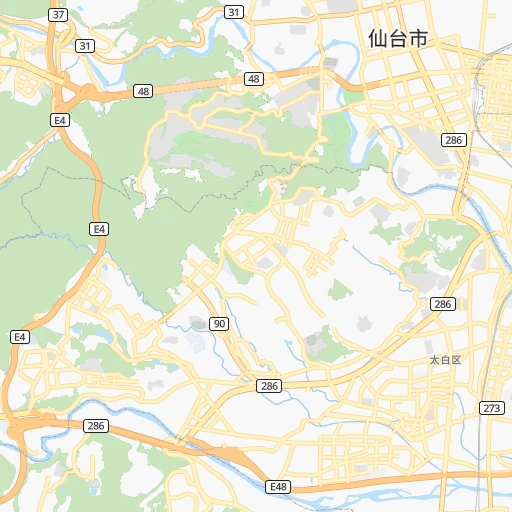
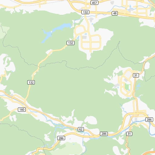
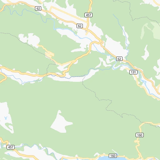
Roadmap (route) to go from Itsutsubashi-eki to Shiroishi detailed above, you can also see the course layout on the map.
While doing trip Itsutsubashi-eki - Shiroishi by car, the calculated route ends at a distance , or more straight.
Distance and duration of the route between Itsutsubashi-eki and Shiroishi
Calculation of distance and route from Shiroishi to Itsutsubashi-eki :
35.942.8 km1h37mn
Continue onto 愛宕上杉通 0h8mn 9.3 kmKeep left 0h0mn 385 mKeep left 0h22mn 27.1 kmKeep left 0h1mn 848 mKeep right 0h2mn 2.3 kmTurn left onto 白石上山線 0h2mn 2.2 kmTurn right onto 国道113号 0h0mn 285 mTurn left 0h1mn 420 mArrive at destination 0h0mn 0 m
Travel from Itsutsubashi-eki (Miyagi) to a selection of major cities.
Distances from Itsutsubashi-eki to biggest cities in Miyagi
Other major cities in country :
- Honcho [04], 560,743 inhabitants. 295 km
- Kagoshima [18], 555,352 inhabitants. 1,200 km
- Niigata [29], 505,272 inhabitants. 169 km
- Himeji [13], 481,493 inhabitants. 672 km
- Matsudo [04], 470,277 inhabitants. 289 km
- Nishinomiya-hama [13], 468,925 inhabitants. 634 km
- Kawaguchi [34], 468,565 inhabitants. 292 km
- Kanazawa [15], 458,937 inhabitants. 419 km
- Utsunomiya [38], 449,865 inhabitants. 207 km
- Oita [30], 448,907 inhabitants. 1,007 km
- Matsuyama [05], 443,322 inhabitants. 880 km
- Amagasaki [13], 442,173 inhabitants. 628 km
- Kurashiki [31], 437,581 inhabitants. 757 km
- Yokosuka [19], 428,992 inhabitants. 348 km
- Nagasaki [27], 410,204 inhabitants. 1,169 km
- Hirakata [32], 406,331 inhabitants. 604 km
- Machida [40], 399,969 inhabitants. 328 km
- Gifu-shi [09], 397,714 inhabitants. 484 km
- Fujisawa [19], 394,624 inhabitants. 347 km
- Toyonaka [32], 384,459 inhabitants. 619 km
Route from Shiroishi to major cities (Japan).
- Distance Shiroishi Tokyo270 km
- Distance Shiroishi Yokohama299 km
- Distance Shiroishi Osaka588 km
- Distance Shiroishi Nagoya457 km
- Distance Shiroishi Sapporo567 km
- Distance Shiroishi Kobe611 km
- Distance Shiroishi Kyoto547 km
- Distance Shiroishi Fukuoka1,042 km
- Distance Shiroishi Kawasaki288 km
- Distance Shiroishi Saitama248 km
- Distance Shiroishi Hiroshima836 km
- Distance Shiroishi Yono252 km
- Distance Shiroishi Kitakyushu994 km
- Distance Shiroishi Chiba271 km
- Distance Shiroishi Sakai599 km
- Distance Shiroishi Shizuoka391 km
- Distance Shiroishi Kumamoto1,070 km
- Distance Shiroishi Okayama706 km
- Distance Shiroishi Hamamatsu450 km
- Distance Shiroishi Hachioji286 km
Nearest cities to Itsutsubashi-eki :
- Tokyo, 8,336,599 inhabitants. 304 km
- Yokohama, 3,574,443 inhabitants. 332 km
- Kawasaki, 1,306,785 inhabitants. 321 km
- Saitama, 1,193,350 inhabitants. 283 km
- Yono, 1,077,730 inhabitants. 286 km
- Sendai, 1,063,103 inhabitants. 2 km
- Chiba, 919,729 inhabitants. 303 km
- Hachioji, 579,399 inhabitants. 320 km
- Honcho, 560,743 inhabitants. 295 km
- Niigata, 505,272 inhabitants. 169 km
- Matsudo, 470,277 inhabitants. 289 km
- Kawaguchi, 468,565 inhabitants. 292 km
- Utsunomiya, 449,865 inhabitants. 207 km
- Yokosuka, 428,992 inhabitants. 348 km
- Machida, 399,969 inhabitants. 328 km
- Fujisawa, 394,624 inhabitants. 347 km
- Nagano, 360,176 inhabitants. 298 km
- Iwaki, 357,309 inhabitants. 134 km
- Koriyama, 340,560 inhabitants. 104 km
- Kashiwa, 340,221 inhabitants. 278 km
- Tokorozawa, 339,435 inhabitants. 300 km
- Kawagoe, 337,931 inhabitants. 289 km
- Akita, 320,069 inhabitants. 176 km
- Koshigaya, 317,437 inhabitants. 280 km
- Aomori, 298,394 inhabitants. 286 km
- Morioka, 295,172 inhabitants. 163 km
- Fukushima, 294,237 inhabitants. 67 km
- Ichihara, 283,531 inhabitants. 313 km
- Maebashi, 282,711 inhabitants. 260 km
- Hiratsuka, 259,052 inhabitants. 353 km
- Yamagata, 254,538 inhabitants. 45 km
- Mito, 246,538 inhabitants. 215 km
- Takasaki, 240,857 inhabitants. 270 km
- Hachinohe, 239,046 inhabitants. 256 km
- Chigasaki, 231,657 inhabitants. 350 km
- Soka, 231,445 inhabitants. 286 km
- Atsugi, 229,199 inhabitants. 340 km
- Minamirinkan, 224,015 inhabitants. 333 km
- Ageoshimo, 219,401 inhabitants. 278 km
- Chofu, 212,977 inhabitants. 312 km
- Matsumoto, 210,667 inhabitants. 342 km
- Kasukabe, 206,915 inhabitants. 272 km
- Joetsu, 204,137 inhabitants. 263 km
- Odawara, 203,035 inhabitants. 367 km
- Nagaoka, 195,318 inhabitants. 200 km
- Nishi-Tokyo-shi, 195,164 inhabitants. 306 km
- Kofu, 190,000 inhabitants. 354 km
- Hitachi, 186,307 inhabitants. 185 km
- Sakura, 182,549 inhabitants. 288 km
- Kamirenjaku, 178,739 inhabitants. 308 km
Location Itsutsubashi-eki (Miyagi) :
| Country flag |  |
| Location | Itsutsubashi-eki |
| State | Miyagi |
| County | Sendai Shi |
| Country | Japan |
| Country code / ISO 2 | JP |
| Latitude | 38.2518800 |
| Longitude | 140.8811100 |
| Altitude | 0 meters |
| Time zone | Asia/Tokyo |
Location Shiroishi (Miyagi) :
| Country flag | |
| Location | Shiroishi |
| State | Miyagi |
| County | Shiroishi Shi |
| Country | Japan |
| Country code / ISO 2 | JP |
| Latitude | 38.0033300 |
| Longitude | 140.6183300 |
| Altitude | 0 meters |
| Time zone | Asia/Tokyo |


