
How to get from Stantsiya Chekhovichi (Kherson) to Podil’s’k (Odessa)
Calculate route from Stantsiya Chekhovichi (Kherson, Ukraine) to Podil’s’k (Odessa, Ukraine).
The flight distance (as the crow flies) between Stantsiya Chekhovichi and Podil’s’k is 243.6 km.
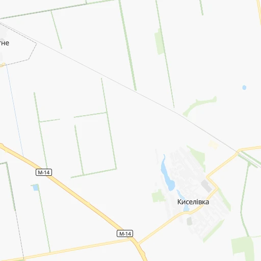
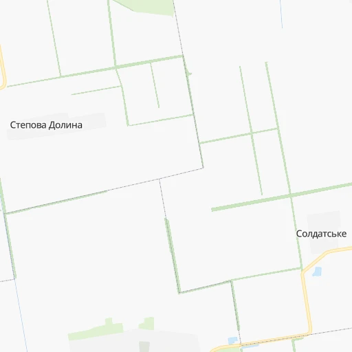
Roadmap (route) to go from Stantsiya Chekhovichi to Podil’s’k detailed above, you can also see the course layout on the map.
While doing trip Stantsiya Chekhovichi - Podil’s’k by car, the calculated route ends at a distance , or more straight.
Distance and duration of the route between Stantsiya Chekhovichi and Podil’s’k
Calculation of distance and route from Podil’s’k to Stantsiya Chekhovichi :
243.6292.0 km5h4mn
Continue 0h0mn 87 mTurn left 0h1mn 397 mTurn right onto О220203 0h1mn 932 mContinue 0h1mn 258 mTurn left onto Освітянська вулиця 0h0mn 21 mTurn right 0h0mn 377 mTurn left 0h0mn 145 mKeep right 0h0mn 132 mKeep right 0h0mn 159 mTurn right onto О220203 0h19mn 23.3 kmKeep right onto М-14 0h0mn 32 mKeep left onto М-14 0h7mn 10.4 kmKeep right and drive toward Миколаїв 0h11mn 10.1 kmAt roundabout, take exit 2 onto Центральний проспект 0h3mn 2.4 kmTurn right onto Садова вулиця 0h1mn 514 mTurn slight left onto Нікольська вулиця 0h3mn 2.3 kmTurn right onto Велика Морська вулиця 0h8mn 7.0 kmKeep right and drive toward Доманівка 0h0mn 510 mContinue onto Т-15-06 1h34mn 43.7 kmTurn slight right onto Центральна вулиця 0h22mn 26.2 kmTurn left onto Р-55 0h26mn 20.1 kmKeep right onto С-160608 0h3mn 2.1 kmContinue onto Т-16-23 0h4mn 4.0 kmTurn left onto вулиця Михайла Грушевського 0h0mn 401 mTurn right onto Т-16-23 1h57mn 57.4 kmTurn right onto Т-16-23 0h19mn 16.6 kmTurn left onto Т-16-23 1h32mn 26.7 kmTurn right onto вулиця Героїв України 0h0mn 322 mTurn left onto Гімназійна вулиця 0h1mn 718 mTurn sharp left onto вулиця Козацької Сотні 0h8mn 6.1 kmTurn left 0h2mn 579 mTurn right onto Кримський провулок 0h1mn 485 mKeep left onto Кримський провулок 0h1mn 337 mKeep right onto Кримський провулок 0h0mn 37 mTurn slight right 0h1mn 268 mTurn left 0h1mn 272 mKeep right 0h0mn 47 mTurn slight right 0h2mn 876 mKeep right 0h3mn 1.5 kmTurn right 0h6mn 3.2 kmTurn right onto С-161402 0h0mn 279 mTurn left onto С-161402 0h16mn 13.5 kmTurn left onto С-161402 0h8mn 6.6 kmTurn left onto вулиця 8 Березня 0h1mn 463 mArrive at destination 0h0mn 0 m
Travel from Stantsiya Chekhovichi (Odessa) to a selection of major cities.
Distances from Stantsiya Chekhovichi to biggest cities in Kherson
Other major cities in country :
- Zhytomyr [27], 282,192 inhabitants. 477 km
- Horlivka [05], 278,550 inhabitants. 458 km
- Rivne [19], 255,106 inhabitants. 625 km
- Kropyvnytskyi [10], 249,454 inhabitants. 195 km
- Kamianske [04], 248,575 inhabitants. 254 km
- Chernivtsi [03], 236,250 inhabitants. 515 km
- Ternopil [22], 235,676 inhabitants. 594 km
- Kremenchuk [18], 227,494 inhabitants. 267 km
- Lutsk [24], 213,661 inhabitants. 683 km
- Ivano-Frankivsk [06], 204,200 inhabitants. 623 km
- Bila Tserkva [13], 199,163 inhabitants. 379 km
- Kramators'k [05], 173,700 inhabitants. 442 km
- Melitopol [26], 158,000 inhabitants. 225 km
- Kerch [11], 148,932 inhabitants. 351 km
- Nikopol [04], 130,500 inhabitants. 174 km
- Syevyerodonets'k [14], 130,000 inhabitants. 514 km
- Sloviansk [05], 124,800 inhabitants. 453 km
- Berdyansk [26], 118,284 inhabitants. 334 km
- Uzhgorod [25], 117,878 inhabitants. 785 km
- Alchevs'k [14], 116,000 inhabitants. 516 km
Route from Podil’s’k to major cities (Ukraine).
- Distance Podil’s’k Kyiv309 km
- Distance Podil’s’k Kharkiv551 km
- Distance Podil’s’k Dnipro417 km
- Distance Podil’s’k Donetsk618 km
- Distance Podil’s’k Zaporizhia423 km
- Distance Podil’s’k Lviv466 km
- Distance Podil’s’k Kryvyi Rih288 km
- Distance Podil’s’k Mykolayiv206 km
- Distance Podil’s’k Mariupol607 km
- Distance Podil’s’k Luhansk732 km
- Distance Podil’s’k Sevastopol468 km
- Distance Podil’s’k Khmelnytskyi263 km
- Distance Podil’s’k Makiyivka627 km
- Distance Podil’s’k Vinnytsia182 km
- Distance Podil’s’k Simferopol470 km
- Distance Podil’s’k Kherson263 km
- Distance Podil’s’k Poltava421 km
- Distance Podil’s’k Chernihiv436 km
- Distance Podil’s’k Cherkasy264 km
- Distance Podil’s’k Sumy520 km
Nearest cities to Stantsiya Chekhovichi :
- Dnipro, 1,032,822 inhabitants. 272 km
- Odessa, 1,001,558 inhabitants. 133 km
- Zaporizhia, 796,217 inhabitants. 240 km
- Kryvyi Rih, 652,380 inhabitants. 146 km
- Mykolayiv, 510,840 inhabitants. 39 km
- Sevastopol, 416,263 inhabitants. 257 km
- Simferopol, 336,460 inhabitants. 240 km
- Kherson, 320,477 inhabitants. 20 km
- Poltava, 317,847 inhabitants. 352 km
- Cherkasy, 297,568 inhabitants. 297 km
- Kropyvnytskyi, 249,454 inhabitants. 195 km
- Kamianske, 248,575 inhabitants. 254 km
- Kremenchuk, 227,494 inhabitants. 267 km
- Melitopol, 158,000 inhabitants. 225 km
- Nikopol, 130,500 inhabitants. 174 km
- Yevpatoriya, 106,202 inhabitants. 189 km
- Oleksandriya, 103,000 inhabitants. 218 km
- Uman, 87,658 inhabitants. 275 km
- Yalta, 77,003 inhabitants. 287 km
- Novomoskovs'k, 73,100 inhabitants. 297 km
- Pervomays'k, 70,746 inhabitants. 185 km
- Feodosiya, 68,562 inhabitants. 299 km
- Smila, 67,530 inhabitants. 276 km
- Energodar, 55,800 inhabitants. 188 km
- Chornomors'k, 54,102 inhabitants. 144 km
- Horishni Plavni, 51,740 inhabitants. 266 km
- Zhovti Vody, 51,559 inhabitants. 194 km
- Nova Kakhovka, 50,672 inhabitants. 71 km
- Marhanets', 50,443 inhabitants. 193 km
- Bilhorod-Dnistrovskyi, 50,201 inhabitants. 171 km
- Svitlovods'k, 47,946 inhabitants. 261 km
- Voznesensk, 42,248 inhabitants. 121 km
- Dzhankoy, 41,731 inhabitants. 192 km
- Podil's'k, 40,664 inhabitants. 244 km
- Yuzhnoukrains'k, 39,430 inhabitants. 150 km
- Kakhovka, 36,816 inhabitants. 82 km
- Dolyns'ka, 34,267 inhabitants. 152 km
- Krasnoperekops'k, 30,700 inhabitants. 139 km
- Alushta, 29,586 inhabitants. 279 km
- Tsyurupyns'k, 28,800 inhabitants. 28 km
- Saki, 28,322 inhabitants. 204 km
- Znomenka, 28,318 inhabitants. 217 km
- Zolotonosha, 27,722 inhabitants. 324 km
- Bakhchisaray, 27,351 inhabitants. 250 km
- Kaniv, 25,666 inhabitants. 340 km
- Yuzhne, 25,000 inhabitants. 102 km
- Armyansk, 24,442 inhabitants. 122 km
- Heniches'k, 21,663 inhabitants. 194 km
- Piatykhatky, 20,459 inhabitants. 207 km
- Dniprorudne, 20,271 inhabitants. 206 km
Location Stantsiya Chekhovichi (Kherson) :
| Country flag |  |
| Location | Stantsiya Chekhovichi |
| State | Kherson |
| County | |
| Country | Ukraine |
| Country code / ISO 2 | UA |
| Latitude | 46.7672400 |
| Longitude | 32.4177700 |
| Altitude | 0 meters |
| Time zone | Europe/Zaporozhye |
Location Podil’s’k (Odessa) :
| Country flag | |
| Location | Podil’s’k |
| State | Odessa |
| County | |
| Country | Ukraine |
| Country code / ISO 2 | UA |
| Latitude | 47.7530500 |
| Longitude | 29.5320500 |
| Altitude | 0 meters |
| Time zone | Europe/Kiev |