
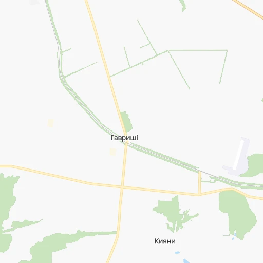
How to get from Havryshi (Kharkiv) to Mykolayiv (Mykolaiv)
Calculate route from Havryshi (Kharkiv, Ukraine) to Mykolayiv (Mykolaiv, Ukraine).
The flight distance (as the crow flies) between Havryshi and Mykolayiv is 435.0 km.
Roadmap (route) to go from Havryshi to Mykolayiv detailed above, you can also see the course layout on the map.
While doing trip Havryshi - Mykolayiv by car, the calculated route ends at a distance , or more straight.
Distance and duration of the route between Havryshi and Mykolayiv
Calculation of distance and route from Mykolayiv to Havryshi :
435.0526.6 km8h35mn
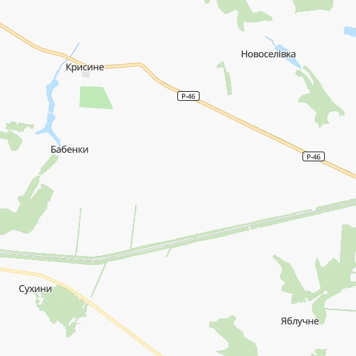
Continue onto С-210407 0h1mn 501 mTurn right onto Т-21-06 0h2mn 1.9 kmTurn left onto О-210412 0h8mn 6.5 kmTurn right onto Слобідська вулиця 0h16mn 13.6 kmTurn right onto Привокзальна вулиця 0h1mn 977 mTurn left onto Центральна вулиця 0h11mn 9.5 kmTurn left onto Ков’язька вулиця 0h0mn 111 mTurn right onto Ков’язька вулиця 0h1mn 789 mTurn left onto Григорія Сковороди проспект 0h1mn 506 mTurn sharp right onto Грабовського вулиця 0h0mn 124 mTurn left onto Благовіщенська вулиця 0h1mn 824 mTurn right onto О-210618 0h1mn 602 mTurn left onto Хліборобська вулиця 0h1mn 1.2 kmTurn left onto Шляхова вулиця 0h27mn 22.3 kmTurn right onto О-211718 0h11mn 8.8 kmKeep right and drive toward Сімферополь, Красноград 1h0mn 99.0 kmKeep right onto М-29 0h2mn 1.8 kmTurn slight right onto М-29 0h15mn 20.7 kmKeep right onto М-29 and take Е-50, M-30 toward Дніпро 0h2mn 2.1 kmKeep right onto Шосейна вулиця 0h9mn 8.7 kmMake a U-turn onto Донецьке шосе 0h0mn 171 mTurn right 0h1mn 447 mTurn slight right 0h1mn 707 mTurn left onto Старочумацька вулиця 0h0mn 57 mAt roundabout, take exit 1 onto Янтарна вулиця 0h3mn 2.2 kmTurn left onto Янтарна вулиця 0h1mn 671 mContinue onto вулиця Каруни 0h2mn 1.3 kmKeep right onto вулиця Каруни 0h3mn 2.5 kmKeep right onto Привокзальна вулиця 0h0mn 286 mTurn right onto проспект Дмитра Яворницького 0h0mn 160 mTurn slight left onto вулиця 128-ї Бригади Тероборони 0h1mn 870 mTurn right onto проспект Сергія Нігояна 0h1mn 921 mTurn left onto проспект Івана Мазепи 1h38mn 49.3 kmKeep left onto Н-11 0h22mn 24.0 kmKeep right onto С040646 1h54mn 65.4 kmAt roundabout, take exit 1 onto площа Героїв Кривбасу 0h3mn 2.2 kmAt roundabout, take exit 2 onto площа 95-й Квартал 0h4mn 2.7 kmKeep left onto Старовокзальна вулиця 0h5mn 3.6 kmTurn right onto Старовокзальна вулиця 0h1mn 533 mTurn slight left onto вулиця Сил Спеціальних Операцій 0h4mn 4.7 kmTurn right onto Н-11, Н-23 0h1mn 986 mKeep left onto Н-11 1h50mn 59.5 kmKeep left onto Н-11 0h0mn 32 mKeep right onto Н-11 0h0mn 45 mTurn slight right onto вулиця Романа Шухевича 0h2mn 1.4 kmTurn slight right onto вулиця Грушевського 1h12mn 82.5 kmAt roundabout, take exit 1 onto Н-11 0h5mn 6.9 kmAt roundabout, take exit 2 onto Н-11 0h8mn 6.9 kmKeep right onto 2-га Набережна вулиця 0h1mn 648 mTurn left onto 2-га Інгульська вулиця 0h1mn 737 mTurn left onto 1-ша Інгульська вулиця 0h0mn 72 mTurn right onto Херсонське шосе 0h0mn 341 mAt roundabout, take exit 2 onto Центральний проспект 0h4mn 3.0 kmTurn left onto Мала Морська вулиця 0h0mn 35 mTurn left onto Центральний проспект 0h0mn 181 mArrive at destination 0h0mn 0 m
Travel from Havryshi (Mykolaiv) to a selection of major cities.
Distances from Havryshi to biggest cities in Kharkiv
Other major cities in country :
- Zhytomyr [27], 282,192 inhabitants. 492 km
- Horlivka [05], 278,550 inhabitants. 265 km
- Rivne [19], 255,106 inhabitants. 666 km
- Kropyvnytskyi [10], 249,454 inhabitants. 297 km
- Kamianske [04], 248,575 inhabitants. 189 km
- Chernivtsi [03], 236,250 inhabitants. 728 km
- Ternopil [22], 235,676 inhabitants. 719 km
- Kremenchuk [18], 227,494 inhabitants. 192 km
- Lutsk [24], 213,661 inhabitants. 729 km
- Ivano-Frankivsk [06], 204,200 inhabitants. 795 km
- Bila Tserkva [13], 199,163 inhabitants. 392 km
- Kramators'k [05], 173,700 inhabitants. 209 km
- Melitopol [26], 158,000 inhabitants. 360 km
- Kerch [11], 148,932 inhabitants. 531 km
- Nikopol [04], 130,500 inhabitants. 293 km
- Syevyerodonets'k [14], 130,000 inhabitants. 246 km
- Sloviansk [05], 124,800 inhabitants. 200 km
- Berdyansk [26], 118,284 inhabitants. 380 km
- Uzhgorod [25], 117,878 inhabitants. 975 km
- Alchevs'k [14], 116,000 inhabitants. 296 km
Route from Mykolayiv to major cities (Ukraine).
- Distance Mykolayiv Kyiv403 km
- Distance Mykolayiv Kharkiv459 km
- Distance Mykolayiv Dnipro282 km
- Distance Mykolayiv Donetsk452 km
- Distance Mykolayiv Odessa111 km
- Distance Mykolayiv Zaporizhia259 km
- Distance Mykolayiv Lviv670 km
- Distance Mykolayiv Kryvyi Rih148 km
- Distance Mykolayiv Mariupol421 km
- Distance Mykolayiv Luhansk576 km
- Distance Mykolayiv Sevastopol290 km
- Distance Mykolayiv Khmelnytskyi461 km
- Distance Mykolayiv Makiyivka462 km
- Distance Mykolayiv Vinnytsia363 km
- Distance Mykolayiv Simferopol277 km
- Distance Mykolayiv Kherson59 km
- Distance Mykolayiv Poltava348 km
- Distance Mykolayiv Chernihiv508 km
- Distance Mykolayiv Cherkasy274 km
- Distance Mykolayiv Sumy486 km
Nearest cities to Havryshi :
- Kharkiv, 1,430,885 inhabitants. 50 km
- Dnipro, 1,032,822 inhabitants. 185 km
- Donetsk, 1,024,700 inhabitants. 281 km
- Zaporizhia, 796,217 inhabitants. 253 km
- Kryvyi Rih, 652,380 inhabitants. 290 km
- Mariupol, 481,626 inhabitants. 363 km
- Makiyivka, 376,610 inhabitants. 284 km
- Poltava, 317,847 inhabitants. 92 km
- Sumy, 294,456 inhabitants. 108 km
- Horlivka, 278,550 inhabitants. 265 km
- Kamianske, 248,575 inhabitants. 189 km
- Kremenchuk, 227,494 inhabitants. 192 km
- Kramators'k, 173,700 inhabitants. 209 km
- Nikopol, 130,500 inhabitants. 293 km
- Syevyerodonets'k, 130,000 inhabitants. 246 km
- Sloviansk, 124,800 inhabitants. 200 km
- Pavlohrad, 115,932 inhabitants. 174 km
- Lysychans'k, 111,600 inhabitants. 245 km
- Yenakiyeve, 104,101 inhabitants. 281 km
- Oleksandriya, 103,000 inhabitants. 238 km
- Konotop, 91,798 inhabitants. 211 km
- Kostyantynivka, 91,259 inhabitants. 232 km
- Shostka, 85,432 inhabitants. 247 km
- Bakhmut, 80,500 inhabitants. 242 km
- Novomoskovs'k, 73,100 inhabitants. 163 km
- Shakhtars'k, 71,700 inhabitants. 307 km
- Pokrovsk, 68,263 inhabitants. 232 km
- Khartsyz'k, 64,000 inhabitants. 295 km
- Rubizhne, 62,993 inhabitants. 235 km
- Druzhkivka, 62,315 inhabitants. 216 km
- Lozova, 62,311 inhabitants. 143 km
- Energodar, 55,800 inhabitants. 295 km
- Izyum, 53,778 inhabitants. 155 km
- Lubny, 52,600 inhabitants. 184 km
- Horishni Plavni, 51,740 inhabitants. 184 km
- Zhovti Vody, 51,559 inhabitants. 245 km
- Marhanets', 50,443 inhabitants. 281 km
- Okhtyrka, 49,818 inhabitants. 54 km
- Myrnohrad, 49,646 inhabitants. 233 km
- Romny, 48,570 inhabitants. 166 km
- Svitlovods'k, 47,946 inhabitants. 204 km
- Toretsk, 41,758 inhabitants. 250 km
- Pervomays'k, 41,480 inhabitants. 270 km
- Myrhorod, 41,377 inhabitants. 141 km
- Yasynuvata, 37,600 inhabitants. 274 km
- Chuhuyiv, 36,519 inhabitants. 84 km
- Dobropillya, 35,977 inhabitants. 211 km
- Avdiyivka, 35,826 inhabitants. 268 km
- Hlukhiv, 35,387 inhabitants. 212 km
- Tokmak, 34,926 inhabitants. 315 km
Location Havryshi (Kharkiv) :
| Country flag |  |
| Location | Havryshi |
| State | Kharkiv |
| County | |
| Country | Ukraine |
| Country code / ISO 2 | UA |
| Latitude | 50.0833500 |
| Longitude | 35.5747900 |
| Altitude | 0 meters |
| Time zone | Europe/Zaporozhye |
Location Mykolayiv (Mykolaiv) :
| Country flag | |
| Location | Mykolayiv |
| State | Mykolaiv |
| County | |
| Country | Ukraine |
| Country code / ISO 2 | UA |
| Latitude | 46.9659100 |
| Longitude | 31.9974000 |
| Altitude | 0 meters |
| Time zone | Europe/Kiev |


