
How to get from Stantsiya Osykovo (Zhytomyr) to Luhansk (Luhansk)
Calculate route from Stantsiya Osykovo (Zhytomyr, Ukraine) to Luhansk (Luhansk, Ukraine).
The flight distance (as the crow flies) between Stantsiya Osykovo and Luhansk is 791.8 km.
Roadmap (route) to go from Stantsiya Osykovo to Luhansk detailed above, you can also see the course layout on the map.
While doing trip Stantsiya Osykovo - Luhansk by car, the calculated route ends at a distance , or more straight.
Distance and duration of the route between Stantsiya Osykovo and Luhansk
Calculation of distance and route from Luhansk to Stantsiya Osykovo :
791.8959.1 km13h21mn
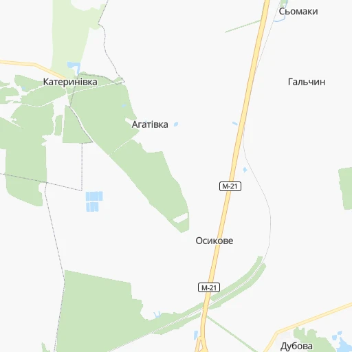
Continue 0h7mn 1.8 kmTurn slight left 0h0mn 11 mTurn right onto С-060319 0h2mn 879 mTurn right onto вулиця Ватутіна 0h4mn 1.8 kmTurn right onto М-21 0h0mn 280 mTurn left 0h0mn 15 mTurn left onto М-21 0h24mn 29.2 kmTurn left onto Велика Бердичівська вулиця 0h0mn 315 mTurn right onto вулиця Юрія Вороного 0h1mn 1.1 kmTurn right onto вулиця Шевченка 0h0mn 294 mTurn left onto Східна вулиця 0h1mn 1.1 kmTurn right onto Київська вулиця 0h14mn 17.7 kmKeep right onto О-060814 and drive toward Коростишів 0h0mn 479 mKeep right onto О-060814 1h12mn 103.8 kmContinue onto Берестейський проспект 0h12mn 8.9 kmKeep left onto Берестейський проспект 0h1mn 962 mContinue onto бульвар Тараса Шевченка 0h2mn 1.9 kmTurn right onto Велика Васильківська вулиця 0h0mn 142 mKeep left onto Бессарабський проїзд 0h0mn 186 mKeep right onto Басейна вулиця 0h2mn 1.9 kmTurn left onto площа Лесі Українки 0h0mn 320 mTurn right onto Старонаводницька вулиця 0h3mn 2.0 kmKeep right and drive toward Одеса, Луганськ, Ковель, Львів, Харків 0h1mn 933 mKeep right 0h7mn 5.0 kmKeep right 0h0mn 65 mAt roundabout, take exit 2 onto Тепловозна вулиця 0h1mn 444 mTurn right onto Харківське шосе 0h6mn 4.2 kmAt roundabout, take exit 3 onto Харківська площа 0h0mn 302 mContinue onto Бориспільське шосе 0h21mn 26.4 kmAt roundabout, take exit 1 onto М-03 3h9mn 289.4 kmKeep left onto М-03 0h0mn 374 mKeep left onto М-03 0h21mn 28.4 kmKeep right and drive toward Красноград 0h0mn 314 mContinue onto Р-11 1h44mn 50.3 kmTurn right 0h1mn 463 mTurn slight left onto Садова вулиця 0h0mn 67 mKeep right onto Центральна вулиця 0h3mn 1.8 kmTurn left onto Козацька вулиця 0h0mn 275 mTurn right onto Полтавська вулиця 0h14mn 13.9 kmKeep right 0h0mn 238 mContinue 0h25mn 33.3 kmTurn right 0h0mn 26 mTurn right onto Заозерна вулиця 0h2mn 2.8 kmTurn sharp right onto Р-79 0h15mn 20.6 kmTurn left onto Р-79 0h30mn 36.1 kmTurn left onto Центральна вулиця 1h56mn 61.4 kmTurn sharp right onto М-03 1h56mn 64.8 kmTurn left 0h11mn 5.6 kmTurn sharp right 0h10mn 8.0 kmTurn left 0h0mn 220 mTurn right 0h0mn 386 mTurn left 0h3mn 673 mTurn left 0h15mn 3.9 kmTurn sharp right onto Т-05-13 0h7mn 6.9 kmTurn left 0h1mn 1.0 kmTurn right 0h0mn 111 mTurn right 0h2mn 1.7 kmTurn left 0h6mn 4.6 kmTurn right onto Залевського вулиця 0h2mn 1.7 kmTurn left onto Т-13-02 0h19mn 19.5 kmTurn right 0h13mn 10.9 kmTurn left 0h9mn 7.8 kmTurn right onto Чернишевського вулиця 0h4mn 3.2 kmTurn left 0h0mn 55 mTurn sharp left onto Центральна вулиця 0h2mn 1.9 kmKeep right onto Т-13-03, Т-13-16 0h0mn 59 mContinue onto Р-66 1h53mn 58.3 kmTurn left onto Р-66 0h1mn 1.4 kmTurn right onto Комінтерну вулиця 0h1mn 1.4 kmTurn slight left onto Тараса Шевченка вулиця 0h2mn 1.3 kmKeep right 0h1mn 882 mContinue onto Оборонна вулиця 0h0mn 262 mMake a U-turn onto Оборонна вулиця 0h0mn 45 mTurn right 0h0mn 110 mArrive at destination 0h0mn 0 m
Travel from Stantsiya Osykovo (Luhansk) to a selection of major cities.
Distances from Stantsiya Osykovo to biggest cities in Zhytomyr
Other major cities in country :
- Sumy [21], 294,456 inhabitants. 452 km
- Horlivka [05], 278,550 inhabitants. 711 km
- Rivne [19], 255,106 inhabitants. 184 km
- Kropyvnytskyi [10], 249,454 inhabitants. 311 km
- Kamianske [04], 248,575 inhabitants. 465 km
- Chernivtsi [03], 236,250 inhabitants. 269 km
- Ternopil [22], 235,676 inhabitants. 221 km
- Kremenchuk [18], 227,494 inhabitants. 362 km
- Lutsk [24], 213,661 inhabitants. 248 km
- Ivano-Frankivsk [06], 204,200 inhabitants. 305 km
- Bila Tserkva [13], 199,163 inhabitants. 110 km
- Kramators'k [05], 173,700 inhabitants. 664 km
- Melitopol [26], 158,000 inhabitants. 608 km
- Kerch [11], 148,932 inhabitants. 782 km
- Nikopol [04], 130,500 inhabitants. 502 km
- Syevyerodonets'k [14], 130,000 inhabitants. 724 km
- Sloviansk [05], 124,800 inhabitants. 664 km
- Berdyansk [26], 118,284 inhabitants. 703 km
- Uzhgorod [25], 117,878 inhabitants. 481 km
- Alchevs'k [14], 116,000 inhabitants. 761 km
Route from Luhansk to major cities (Ukraine).
- Distance Luhansk Kyiv669 km
- Distance Luhansk Kharkiv273 km
- Distance Luhansk Dnipro316 km
- Distance Luhansk Donetsk127 km
- Distance Luhansk Odessa686 km
- Distance Luhansk Zaporizhia317 km
- Distance Luhansk Lviv1,119 km
- Distance Luhansk Kryvyi Rih446 km
- Distance Luhansk Mykolayiv576 km
- Distance Luhansk Mariupol211 km
- Distance Luhansk Sevastopol626 km
- Distance Luhansk Khmelnytskyi904 km
- Distance Luhansk Makiyivka118 km
- Distance Luhansk Vinnytsia796 km
- Distance Luhansk Simferopol565 km
- Distance Luhansk Kherson546 km
- Distance Luhansk Poltava366 km
- Distance Luhansk Chernihiv660 km
- Distance Luhansk Cherkasy538 km
- Distance Luhansk Sumy417 km
Nearest cities to Stantsiya Osykovo :
- Kyiv, 2,797,553 inhabitants. 147 km
- Khmelnytskyi, 398,346 inhabitants. 130 km
- Vinnytsia, 352,115 inhabitants. 82 km
- Chernihiv, 307,684 inhabitants. 255 km
- Zhytomyr, 282,192 inhabitants. 34 km
- Rivne, 255,106 inhabitants. 184 km
- Chernivtsi, 236,250 inhabitants. 269 km
- Bila Tserkva, 199,163 inhabitants. 110 km
- Kamianets-Podilskyi, 100,000 inhabitants. 204 km
- Brovary, 88,506 inhabitants. 169 km
- Uman, 87,658 inhabitants. 179 km
- Berdychiv, 86,250 inhabitants. 8 km
- Pervomays'k, 70,746 inhabitants. 270 km
- Korosten', 65,000 inhabitants. 111 km
- Novohrad-Volynskyi, 55,925 inhabitants. 99 km
- Boryspil', 55,000 inhabitants. 173 km
- Fastiv, 51,143 inhabitants. 95 km
- Shepetivka, 46,419 inhabitants. 112 km
- Bucha, 42,279 inhabitants. 131 km
- Voznesensk, 42,248 inhabitants. 334 km
- Varash, 42,000 inhabitants. 248 km
- Irpin, 40,789 inhabitants. 133 km
- Podil's'k, 40,664 inhabitants. 256 km
- Vasylkiv, 39,700 inhabitants. 125 km
- Yuzhnoukrains'k, 39,430 inhabitants. 305 km
- Dubno, 37,690 inhabitants. 210 km
- Pereyaslav-Khmel'nyts'kyy, 36,527 inhabitants. 204 km
- Zhmerynka, 35,960 inhabitants. 109 km
- Boyarka, 34,631 inhabitants. 127 km
- Starokostiantyniv, 33,897 inhabitants. 103 km
- Vyshneve, 33,183 inhabitants. 135 km
- Slavuta, 33,080 inhabitants. 129 km
- Netishyn, 33,063 inhabitants. 146 km
- Mohyliv-Podilskyi, 32,500 inhabitants. 179 km
- Obukhiv, 31,557 inhabitants. 145 km
- Kostopil', 30,500 inhabitants. 183 km
- Chortkiv, 28,855 inhabitants. 229 km
- Khmilnyk, 28,136 inhabitants. 65 km
- Sarny, 27,097 inhabitants. 208 km
- Malyn, 27,068 inhabitants. 100 km
- Kaniv, 25,666 inhabitants. 207 km
- Kozyatyn, 25,645 inhabitants. 33 km
- Korostyshiv, 25,099 inhabitants. 51 km
- Slavutych, 25,000 inhabitants. 229 km
- Haisyn, 24,687 inhabitants. 141 km
- Zdolbuniv, 23,697 inhabitants. 179 km
- Polonne, 22,348 inhabitants. 80 km
- Vyshhorod, 22,080 inhabitants. 151 km
- Ladyzhyn, 21,393 inhabitants. 150 km
- Kremenets, 21,000 inhabitants. 206 km
Location Stantsiya Osykovo (Zhytomyr) :
| Country flag |  |
| Location | Stantsiya Osykovo |
| State | Zhytomyr |
| County | |
| Country | Ukraine |
| Country code / ISO 2 | UA |
| Latitude | 49.9666700 |
| Longitude | 28.6000000 |
| Altitude | 0 meters |
| Time zone | Europe/Kiev |
Location Luhansk (Luhansk) :
| Country flag | |
| Location | Luhansk |
| State | Luhansk |
| County | |
| Country | Ukraine |
| Country code / ISO 2 | UA |
| Latitude | 48.5670500 |
| Longitude | 39.3170600 |
| Altitude | 0 meters |
| Time zone | Europe/Zaporozhye |