
How to get from Stantsiya Reya (Zhytomyr) to Netishyn (Khmelnytskyi)
Calculate route from Stantsiya Reya (Zhytomyr, Ukraine) to Netishyn (Khmelnytskyi, Ukraine).
The flight distance (as the crow flies) between Stantsiya Reya and Netishyn is 146.5 km.
Roadmap (route) to go from Stantsiya Reya to Netishyn detailed above, you can also see the course layout on the map.
While doing trip Stantsiya Reya - Netishyn by car, the calculated route ends at a distance , or more straight.
Distance and duration of the route between Stantsiya Reya and Netishyn
Calculation of distance and route from Netishyn to Stantsiya Reya :
146.5165.3 km3h13mn
Continue 0h0mn 62 mTurn slight left 0h1mn 183 mTurn right onto Житомирська вулиця 0h1mn 393 mTurn left 0h0mn 12 mTurn right onto М-21 0h0mn 203 mTurn left 0h0mn 10 mTurn left onto М-21 0h3mn 3.2 kmTurn right onto С-060319 0h4mn 1.8 kmTurn left onto С-060319 0h2mn 879 mTurn right onto С-060319 0h3mn 1.6 kmTurn left onto С-060319 0h6mn 4.8 kmTurn left onto С-060303 0h1mn 765 mTurn right 0h1mn 356 mKeep left 0h1mn 696 mKeep left 0h1mn 660 mKeep right 0h12mn 3.1 kmTurn slight right 0h0mn 52 mTurn left onto С-060327 0h2mn 793 mTurn right onto Т-23-09 0h25mn 24.6 kmTurn left onto Соборна вулиця 0h0mn 281 mContinue onto Європейська вулиця 0h1mn 566 mAt roundabout, take exit 2 onto вулиця Героїв Майдану 0h1mn 1.2 kmAt roundabout, take exit 1 onto вулиця Героїв Майдану 0h13mn 10.7 kmAt roundabout, take exit 2 onto Т-23-09 0h26mn 20.9 kmContinue onto Т-23-09 0h0mn 130 mTurn right onto вулиця Перемоги 1h51mn 46.4 kmTurn slight right onto вулиця Героїв Небесної Сотні 0h0mn 215 mTurn left onto вулиця Захисників України 0h1mn 1.1 kmAt roundabout, take exit 2 onto Українська вулиця 0h2mn 1.3 kmContinue onto вулиця Захисників України 0h0mn 243 mContinue onto Н-25 1h34mn 36.5 kmTurn left onto Старонетішинська вулиця 0h1mn 1.1 kmTurn left onto Підгірна вулиця 0h1mn 381 mArrive at destination 0h0mn 0 m
Travel from Stantsiya Reya (Khmelnytskyi) to a selection of major cities.
Distances from Stantsiya Reya to biggest cities in Zhytomyr
Other major cities in country :
- Sumy [21], 294,456 inhabitants. 448 km
- Horlivka [05], 278,550 inhabitants. 710 km
- Rivne [19], 255,106 inhabitants. 184 km
- Kropyvnytskyi [10], 249,454 inhabitants. 312 km
- Kamianske [04], 248,575 inhabitants. 464 km
- Chernivtsi [03], 236,250 inhabitants. 274 km
- Ternopil [22], 235,676 inhabitants. 225 km
- Kremenchuk [18], 227,494 inhabitants. 361 km
- Lutsk [24], 213,661 inhabitants. 248 km
- Ivano-Frankivsk [06], 204,200 inhabitants. 309 km
- Bila Tserkva [13], 199,163 inhabitants. 108 km
- Kramators'k [05], 173,700 inhabitants. 662 km
- Melitopol [26], 158,000 inhabitants. 609 km
- Kerch [11], 148,932 inhabitants. 783 km
- Nikopol [04], 130,500 inhabitants. 502 km
- Syevyerodonets'k [14], 130,000 inhabitants. 722 km
- Sloviansk [05], 124,800 inhabitants. 662 km
- Berdyansk [26], 118,284 inhabitants. 703 km
- Uzhgorod [25], 117,878 inhabitants. 485 km
- Alchevs'k [14], 116,000 inhabitants. 759 km
Route from Netishyn to major cities (Ukraine).
- Distance Netishyn Kyiv276 km
- Distance Netishyn Kharkiv686 km
- Distance Netishyn Dnipro643 km
- Distance Netishyn Donetsk851 km
- Distance Netishyn Odessa525 km
- Distance Netishyn Zaporizhia683 km
- Distance Netishyn Lviv195 km
- Distance Netishyn Kryvyi Rih560 km
- Distance Netishyn Mykolayiv544 km
- Distance Netishyn Mariupol877 km
- Distance Netishyn Luhansk937 km
- Distance Netishyn Sevastopol823 km
- Distance Netishyn Makiyivka859 km
- Distance Netishyn Vinnytsia181 km
- Distance Netishyn Simferopol819 km
- Distance Netishyn Kherson602 km
- Distance Netishyn Poltava571 km
- Distance Netishyn Chernihiv351 km
- Distance Netishyn Cherkasy402 km
- Distance Netishyn Sumy579 km
Nearest cities to Stantsiya Reya :
- Kyiv, 2,797,553 inhabitants. 143 km
- Khmelnytskyi, 398,346 inhabitants. 135 km
- Vinnytsia, 352,115 inhabitants. 88 km
- Chernihiv, 307,684 inhabitants. 250 km
- Zhytomyr, 282,192 inhabitants. 28 km
- Rivne, 255,106 inhabitants. 184 km
- Chernivtsi, 236,250 inhabitants. 274 km
- Bila Tserkva, 199,163 inhabitants. 108 km
- Kamianets-Podilskyi, 100,000 inhabitants. 210 km
- Brovary, 88,506 inhabitants. 164 km
- Uman, 87,658 inhabitants. 182 km
- Berdychiv, 86,250 inhabitants. 13 km
- Pervomays'k, 70,746 inhabitants. 272 km
- Korosten', 65,000 inhabitants. 105 km
- Novohrad-Volynskyi, 55,925 inhabitants. 97 km
- Boryspil', 55,000 inhabitants. 170 km
- Fastiv, 51,143 inhabitants. 92 km
- Shepetivka, 46,419 inhabitants. 114 km
- Bucha, 42,279 inhabitants. 127 km
- Voznesensk, 42,248 inhabitants. 337 km
- Varash, 42,000 inhabitants. 247 km
- Irpin, 40,789 inhabitants. 128 km
- Podil's'k, 40,664 inhabitants. 260 km
- Vasylkiv, 39,700 inhabitants. 121 km
- Yuzhnoukrains'k, 39,430 inhabitants. 307 km
- Dubno, 37,690 inhabitants. 212 km
- Pereyaslav-Khmel'nyts'kyy, 36,527 inhabitants. 201 km
- Zhmerynka, 35,960 inhabitants. 115 km
- Boyarka, 34,631 inhabitants. 123 km
- Starokostiantyniv, 33,897 inhabitants. 107 km
- Vyshneve, 33,183 inhabitants. 130 km
- Slavuta, 33,080 inhabitants. 130 km
- Netishyn, 33,063 inhabitants. 147 km
- Mohyliv-Podilskyi, 32,500 inhabitants. 185 km
- Obukhiv, 31,557 inhabitants. 142 km
- Kostopil', 30,500 inhabitants. 182 km
- Chortkiv, 28,855 inhabitants. 233 km
- Khmilnyk, 28,136 inhabitants. 70 km
- Sarny, 27,097 inhabitants. 206 km
- Malyn, 27,068 inhabitants. 95 km
- Kaniv, 25,666 inhabitants. 205 km
- Kozyatyn, 25,645 inhabitants. 36 km
- Korostyshiv, 25,099 inhabitants. 45 km
- Slavutych, 25,000 inhabitants. 223 km
- Haisyn, 24,687 inhabitants. 144 km
- Zdolbuniv, 23,697 inhabitants. 179 km
- Polonne, 22,348 inhabitants. 81 km
- Vyshhorod, 22,080 inhabitants. 146 km
- Ladyzhyn, 21,393 inhabitants. 154 km
- Kremenets, 21,000 inhabitants. 208 km
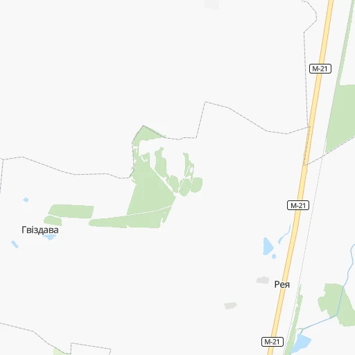
Location Stantsiya Reya (Zhytomyr) :
| Country flag |  |
| Location | Stantsiya Reya |
| State | Zhytomyr |
| County | |
| Country | Ukraine |
| Country code / ISO 2 | UA |
| Latitude | 50.0130500 |
| Longitude | 28.6362100 |
| Altitude | 0 meters |
| Time zone | Europe/Kiev |
Location Netishyn (Khmelnytskyi) :
| Country flag | |
| Location | Netishyn |
| State | Khmelnytskyi |
| County | |
| Country | Ukraine |
| Country code / ISO 2 | UA |
| Latitude | 50.3400400 |
| Longitude | 26.6417100 |
| Altitude | 0 meters |
| Time zone | Europe/Kiev |