

How to get from Stantsiya Zmiyiv (Kharkiv) to Sloviansk (Donetsk)
Calculate route from Stantsiya Zmiyiv (Kharkiv, Ukraine) to Sloviansk (Donetsk, Ukraine).
The flight distance (as the crow flies) between Stantsiya Zmiyiv and Sloviansk is 130.0 km.
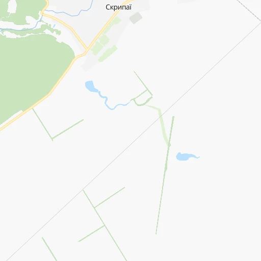
Roadmap (route) to go from Stantsiya Zmiyiv to Sloviansk detailed above, you can also see the course layout on the map.
While doing trip Stantsiya Zmiyiv - Sloviansk by car, the calculated route ends at a distance , or more straight.
Distance and duration of the route between Stantsiya Zmiyiv and Sloviansk
Calculation of distance and route from Sloviansk to Stantsiya Zmiyiv :
130.0158.5 km2h29mn
Continue 0h1mn 255 mTurn left 0h1mn 294 mTurn left onto Харківська вулиця 1h53mn 55.7 kmTurn left onto вулиця Новоселівка 0h2mn 2.1 kmTurn right onto Савинське шосе 0h14mn 14.9 kmTurn left 0h0mn 42 mTurn slight left onto Соборна вулиця 0h0mn 7 mTurn right onto вулиця Незалежності 0h1mn 518 mTurn left onto вулиця 20 Гвардійської Дивізії 0h26mn 29.7 kmTurn left 0h3mn 2.5 kmTurn left onto Європейська вулиця 0h2mn 2.0 kmTurn right onto Р-79 0h3mn 3.6 kmTurn right onto Гайдамацька вулиця 0h0mn 388 mTurn left onto Ростовський Шлях вулиця 0h27mn 31.6 kmTurn right onto О0536 0h0mn 19 mKeep left 0h3mn 1.4 kmContinue 0h10mn 11.0 kmTurn left onto Шнурковська вулиця 0h0mn 393 mContinue onto Шнурковська вулиця 0h2mn 1.6 kmTurn left onto Сільзаводська вулиця 0h0mn 357 mTurn sharp left 0h0mn 18 mKeep right 0h1mn 171 mArrive at destination 0h0mn 0 m
Travel from Stantsiya Zmiyiv (Donetsk) to a selection of major cities.
Distances from Stantsiya Zmiyiv to biggest cities in Kharkiv
Other major cities in country :
- Zhytomyr [27], 282,192 inhabitants. 554 km
- Horlivka [05], 278,550 inhabitants. 196 km
- Rivne [19], 255,106 inhabitants. 730 km
- Kropyvnytskyi [10], 249,454 inhabitants. 328 km
- Kamianske [04], 248,575 inhabitants. 185 km
- Chernivtsi [03], 236,250 inhabitants. 777 km
- Ternopil [22], 235,676 inhabitants. 777 km
- Kremenchuk [18], 227,494 inhabitants. 225 km
- Lutsk [24], 213,661 inhabitants. 793 km
- Ivano-Frankivsk [06], 204,200 inhabitants. 850 km
- Bila Tserkva [13], 199,163 inhabitants. 450 km
- Kramators'k [05], 173,700 inhabitants. 139 km
- Melitopol [26], 158,000 inhabitants. 327 km
- Kerch [11], 148,932 inhabitants. 485 km
- Nikopol [04], 130,500 inhabitants. 279 km
- Syevyerodonets'k [14], 130,000 inhabitants. 176 km
- Sloviansk [05], 124,800 inhabitants. 130 km
- Berdyansk [26], 118,284 inhabitants. 329 km
- Uzhgorod [25], 117,878 inhabitants. 1,030 km
- Alchevs'k [14], 116,000 inhabitants. 225 km
Route from Sloviansk to major cities (Ukraine).
- Distance Sloviansk Kyiv541 km
- Distance Sloviansk Kharkiv159 km
- Distance Sloviansk Dnipro195 km
- Distance Sloviansk Odessa580 km
- Distance Sloviansk Zaporizhia214 km
- Distance Sloviansk Lviv990 km
- Distance Sloviansk Kryvyi Rih331 km
- Distance Sloviansk Mykolayiv469 km
- Distance Sloviansk Luhansk129 km
- Distance Sloviansk Sevastopol569 km
- Distance Sloviansk Khmelnytskyi775 km
- Distance Sloviansk Vinnytsia667 km
- Distance Sloviansk Simferopol510 km
- Distance Sloviansk Kherson448 km
- Distance Sloviansk Poltava238 km
- Distance Sloviansk Chernihiv538 km
- Distance Sloviansk Cherkasy409 km
- Distance Sloviansk Sumy305 km
- Distance Sloviansk Zhytomyr664 km
- Distance Sloviansk Rivne841 km
Nearest cities to Stantsiya Zmiyiv :
- Kharkiv, 1,430,885 inhabitants. 32 km
- Dnipro, 1,032,822 inhabitants. 169 km
- Donetsk, 1,024,700 inhabitants. 215 km
- Zaporizhia, 796,217 inhabitants. 227 km
- Kryvyi Rih, 652,380 inhabitants. 297 km
- Mariupol, 481,626 inhabitants. 303 km
- Luhansk, 452,000 inhabitants. 249 km
- Makiyivka, 376,610 inhabitants. 217 km
- Poltava, 317,847 inhabitants. 132 km
- Sumy, 294,456 inhabitants. 175 km
- Horlivka, 278,550 inhabitants. 196 km
- Kamianske, 248,575 inhabitants. 185 km
- Kremenchuk, 227,494 inhabitants. 225 km
- Kramators'k, 173,700 inhabitants. 139 km
- Melitopol, 158,000 inhabitants. 327 km
- Nikopol, 130,500 inhabitants. 279 km
- Syevyerodonets'k, 130,000 inhabitants. 176 km
- Sloviansk, 124,800 inhabitants. 130 km
- Berdyansk, 118,284 inhabitants. 329 km
- Alchevs'k, 116,000 inhabitants. 225 km
- Pavlohrad, 115,932 inhabitants. 136 km
- Lysychans'k, 111,600 inhabitants. 175 km
- Yenakiyeve, 104,101 inhabitants. 212 km
- Kostyantynivka, 91,259 inhabitants. 163 km
- Krasnyy Luch, 90,005 inhabitants. 256 km
- Shostka, 85,432 inhabitants. 315 km
- Kadiyivka, 84,425 inhabitants. 209 km
- Bakhmut, 80,500 inhabitants. 171 km
- Novomoskovs'k, 73,100 inhabitants. 144 km
- Shakhtars'k, 71,700 inhabitants. 238 km
- Pokrovsk, 68,263 inhabitants. 169 km
- Chystyakove, 68,037 inhabitants. 247 km
- Khartsyz'k, 64,000 inhabitants. 226 km
- Rubizhne, 62,993 inhabitants. 165 km
- Druzhkivka, 62,315 inhabitants. 148 km
- Lozova, 62,311 inhabitants. 91 km
- Antratsyt, 61,600 inhabitants. 267 km
- Energodar, 55,800 inhabitants. 276 km
- Snizhne, 55,587 inhabitants. 257 km
- Izyum, 53,778 inhabitants. 84 km
- Bryanka, 51,921 inhabitants. 214 km
- Horishni Plavni, 51,740 inhabitants. 213 km
- Zhovti Vody, 51,559 inhabitants. 258 km
- Marhanets', 50,443 inhabitants. 264 km
- Okhtyrka, 49,818 inhabitants. 125 km
- Myrnohrad, 49,646 inhabitants. 169 km
- Romny, 48,570 inhabitants. 237 km
- Toretsk, 41,758 inhabitants. 181 km
- Pervomays'k, 41,480 inhabitants. 199 km
- Myrhorod, 41,377 inhabitants. 200 km
Location Stantsiya Zmiyiv (Kharkiv) :
| Country flag |  |
| Location | Stantsiya Zmiyiv |
| State | Kharkiv |
| County | |
| Country | Ukraine |
| Country code / ISO 2 | UA |
| Latitude | 49.7074600 |
| Longitude | 36.3702700 |
| Altitude | 0 meters |
| Time zone | Europe/Zaporozhye |
Location Sloviansk (Donetsk) :
| Country flag | |
| Location | Sloviansk |
| State | Donetsk |
| County | |
| Country | Ukraine |
| Country code / ISO 2 | UA |
| Latitude | 48.8666700 |
| Longitude | 37.6166700 |
| Altitude | 0 meters |
| Time zone | Europe/Kiev |
