

Home
››
Mihail Kogălniceanu International Airport
››
Roadmap from Mihail Kogălniceanu International Airport to Moreni
How to get from Mihail Kogălniceanu International (airport) (Constanța) to Moreni (Dâmboviţa)
Calculate route from Mihail Kogălniceanu International (airport) (Constanța, Romania) to Moreni (Dâmboviţa, Romania).
The flight distance (as the crow flies) between Mihail Kogălniceanu International (airport) and Moreni is 235.1 km.
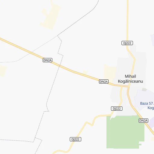
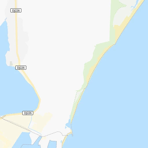
Roadmap (route) to go from Mihail Kogălniceanu International Airport to Moreni detailed above, you can also see the course layout on the map.
While doing trip Mihail Kogălniceanu International (airport) - Moreni by car, the calculated route ends at a distance , or more straight.
Distance and duration of the route between Mihail Kogălniceanu International (airport) and Moreni
Calculation of distance and route from Moreni to Mihail Kogălniceanu International (airport) :
235.1303.5 km3h21mn
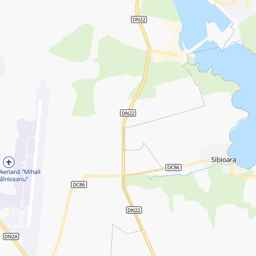
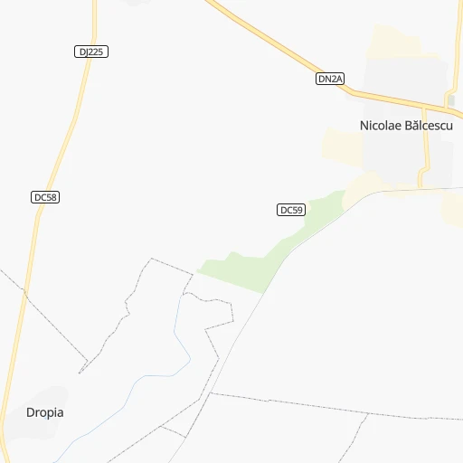
Continue onto DC86 0h3mn 2.6 kmTurn sharp right onto DN2A 0h1mn 2.0 kmAt roundabout, take exit 2 onto DN2A 0h2mn 1.4 kmTurn left 0h0mn 23 mTurn left onto Strada Tomis 0h1mn 546 mTurn right onto Strada Decebal 0h0mn 93 mTurn left onto Strada Stadion 0h0mn 367 mTurn right onto Strada Tomis 0h0mn 188 mTurn left onto DJ222 0h11mn 14.9 kmContinue onto Strada Medgidiei 0h4mn 3.5 kmKeep right onto DN22C 0h2mn 2.3 kmAt roundabout, take exit 1 onto DN22C 0h20mn 22.7 kmAt roundabout, take exit 1 1h12mn 137.6 kmKeep right 0h1mn 516 mAt roundabout, take exit 1 0h1mn 1.0 kmAt roundabout, take exit 1 onto DJ100 0h3mn 2.4 kmKeep left onto Strada Mărășești 0h0mn 286 mTurn left onto Strada Mărășești 0h2mn 800 mTurn left onto DN3 0h7mn 6.9 kmKeep right 0h0mn 274 mKeep right 0h0mn 53 mTurn slight right onto Șoseaua de Centură 0h7mn 8.0 kmAt roundabout, take exit 2 onto Șoseaua de Centură 0h1mn 1.2 kmKeep right and take A3 toward Oradea, Brașov, Ploiești, București 0h1mn 533 mAt roundabout, take exit 2 0h29mn 55.4 kmAt roundabout, take exit 2 onto DN1, DN1A 0h4mn 4.8 kmAt roundabout, take exit 1 onto Centura de Vest 0h1mn 1.8 kmAt roundabout, take exit 2 onto Centura de Vest 0h2mn 2.2 kmKeep right onto DN1 and take DN72 toward Ploiești, Târgoviște 0h0mn 219 mKeep left toward DN1 0h1mn 1.7 kmKeep right 0h3mn 3.0 kmTurn left 0h0mn 341 mContinue onto DJ101I 0h7mn 8.3 kmTurn right 0h1mn 636 mTurn right onto Strada Principală 0h0mn 60 mTurn left onto DJ101I 0h2mn 2.2 kmTurn left onto DJ101I 0h4mn 4.5 kmAt roundabout, take exit 2 0h7mn 7.9 kmAt roundabout, take exit 1 onto Strada Pantea Ion 0h0mn 182 mTurn left 0h0mn 30 mArrive at destination 0h0mn 0 m
Travel from Mihail Kogălniceanu International (airport) (Dâmboviţa) to a selection of major cities.
Distances from Mihail Kogălniceanu International Airport to biggest cities in Constanța
Other major cities in country :
- Targu-Mures [27], 146,863 inhabitants. 391 km
- Baia Mare [25], 136,553 inhabitants. 528 km
- Buzau [11], 130,954 inhabitants. 157 km
- Botosani [07], 114,783 inhabitants. 402 km
- Satu Mare [32], 112,490 inhabitants. 579 km
- Ramnicu Valcea [39], 107,558 inhabitants. 336 km
- Suceava [34], 105,796 inhabitants. 403 km
- Piatra Neamt [28], 102,688 inhabitants. 330 km
- Drobeta-Turnu Severin [26], 102,346 inhabitants. 464 km
- Targu Jiu [19], 97,179 inhabitants. 419 km
- Tulcea [37], 92,475 inhabitants. 93 km
- Targoviste [16], 88,435 inhabitants. 248 km
- Bistrita [06], 81,318 inhabitants. 437 km
- Resita [12], 81,228 inhabitants. 531 km
- Slatina [29], 78,988 inhabitants. 328 km
- Focsani [40], 77,313 inhabitants. 181 km
- Vaslui [38], 69,225 inhabitants. 260 km
- Hunedoara [21], 69,136 inhabitants. 466 km
- Giurgiu [42], 69,067 inhabitants. 208 km
- Roman [28], 67,819 inhabitants. 310 km
Route from Moreni to major cities (Romania).
- Distance Moreni Bucharest71 km
- Distance Moreni Sector 375 km
- Distance Moreni Sector 668 km
- Distance Moreni Sector 271 km
- Distance Moreni Iasi286 km
- Distance Moreni Cluj-Napoca254 km
- Distance Moreni Timisoara356 km
- Distance Moreni Craiova164 km
- Distance Moreni Constanta253 km
- Distance Moreni Galati196 km
- Distance Moreni Sector 477 km
- Distance Moreni Brasov74 km
- Distance Moreni Sector 574 km
- Distance Moreni Ploiesti30 km
- Distance Moreni Sector 163 km
- Distance Moreni Braila186 km
- Distance Moreni Oradea368 km
- Distance Moreni Bacau202 km
- Distance Moreni Arad363 km
- Distance Moreni Pitesti63 km
Nearest cities to Mihail Kogălniceanu International (airport) :
- Bucharest, 1,877,155 inhabitants. 190 km
- Sector 3, 385,439 inhabitants. 185 km
- Sector 6, 367,760 inhabitants. 197 km
- Sector 2, 345,370 inhabitants. 188 km
- Iasi, 318,012 inhabitants. 320 km
- Constanta, 303,399 inhabitants. 23 km
- Galati, 294,087 inhabitants. 126 km
- Sector 4, 287,828 inhabitants. 188 km
- Brasov, 276,088 inhabitants. 268 km
- Sector 5, 271,575 inhabitants. 192 km
- Ploiesti, 228,851 inhabitants. 206 km
- Sector 1, 225,453 inhabitants. 195 km
- Braila, 213,569 inhabitants. 108 km
- Bacau, 171,396 inhabitants. 275 km
- Buzau, 130,954 inhabitants. 157 km
- Piatra Neamt, 102,688 inhabitants. 330 km
- Tulcea, 92,475 inhabitants. 93 km
- Focsani, 77,313 inhabitants. 181 km
- Vaslui, 69,225 inhabitants. 260 km
- Giurgiu, 69,067 inhabitants. 208 km
- Roman, 67,819 inhabitants. 310 km
- Barlad, 67,818 inhabitants. 218 km
- Sfantu Gheorghe, 60,677 inhabitants. 271 km
- Slobozia, 52,710 inhabitants. 92 km
- Pascani, 45,000 inhabitants. 349 km
- Medgidia, 43,315 inhabitants. 21 km
- Campina, 41,554 inhabitants. 234 km
- Miercurea-Ciuc, 41,282 inhabitants. 305 km
- Tecuci, 41,154 inhabitants. 185 km
- Mangalia, 39,619 inhabitants. 63 km
- Ramnicu Sarat, 38,526 inhabitants. 161 km
- Navodari, 33,106 inhabitants. 10 km
- Fetesti, 32,866 inhabitants. 52 km
- Voluntari, 30,323 inhabitants. 185 km
- Sacele, 29,918 inhabitants. 259 km
- Husi, 29,129 inhabitants. 259 km
- Oltenita, 26,356 inhabitants. 151 km
- Moinesti, 23,981 inhabitants. 282 km
- Fetesti-Gara, 23,789 inhabitants. 53 km
- Comanesti, 23,729 inhabitants. 280 km
- Buftea, 20,691 inhabitants. 203 km
- Moreni, 20,596 inhabitants. 236 km
- Targu Neamt, 20,473 inhabitants. 356 km
- Targu Secuiesc, 20,067 inhabitants. 260 km
- Baicoi, 19,869 inhabitants. 222 km
- Gheorgheni, 19,777 inhabitants. 346 km
- Cernavoda, 18,502 inhabitants. 36 km
- Buhusi, 18,395 inhabitants. 297 km
- Breaza, 17,949 inhabitants. 241 km
- Adjud, 17,298 inhabitants. 219 km
Location Mihail Kogălniceanu International (airport) (Constanța) :
| Country flag |  |
| Location | Mihail Kogălniceanu International (airport) |
| State | Constanța |
| County | Comuna Mihail Kogălniceanu |
| Country | Romania |
| Country code / ISO 2 | RO |
| Latitude | 44.3622200 |
| Longitude | 28.4883300 |
| Altitude | 107 meters |
| Time zone | Europe/Bucharest |
Location Moreni (Dâmboviţa) :
| Country flag | |
| Location | Moreni |
| State | Dâmboviţa |
| County | Municipiul Moreni |
| Country | Romania |
| Country code / ISO 2 | RO |
| Latitude | 44.9830100 |
| Longitude | 25.6441500 |
| Altitude | 0 meters |
| Time zone | Europe/Bucharest |