


Home
››
Mohammed V International Airport
››
Roadmap from Mohammed V International Airport to Ouezzane
How to get from Mohammed V International (airport) (Casablanca-Settat) to Ouezzane (Tanger-Tetouan-Al Hoceima)
Calculate route from Mohammed V International (airport) (Casablanca-Settat, Morocco) to Ouezzane (Tanger-Tetouan-Al Hoceima, Morocco).
The flight distance (as the crow flies) between Mohammed V International (airport) and Ouezzane is 243.8 km.
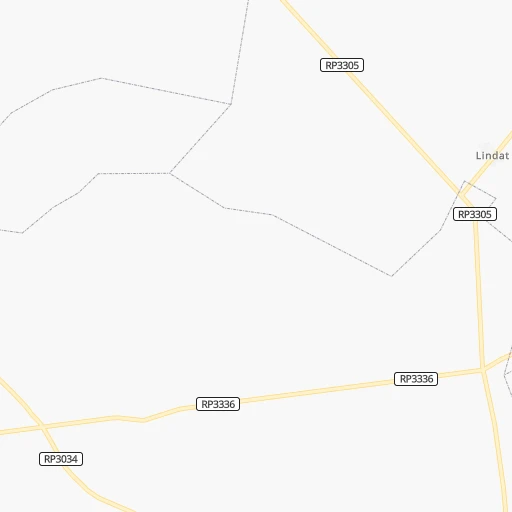
Roadmap (route) to go from Mohammed V International Airport to Ouezzane detailed above, you can also see the course layout on the map.
While doing trip Mohammed V International (airport) - Ouezzane by car, the calculated route ends at a distance , or more straight.
Distance and duration of the route between Mohammed V International (airport) and Ouezzane
Calculation of distance and route from Ouezzane to Mohammed V International (airport) :
243.8282.5 km4h44mn
Continue 0h0mn 247 mKeep left 0h0mn 229 mKeep right 0h4mn 3.7 kmKeep right toward P3038 0h1mn 1.3 kmAt roundabout, take exit 2 onto RP3038 0h1mn 1.7 kmAt roundabout, take exit 2 onto RP3038 0h0mn 556 mAt roundabout, take exit 2 onto Route de Mediouna طريق مديونة 0h3mn 4.0 kmAt roundabout, take exit 2 onto Route de Mediouna طريق مديونة 0h1mn 1.2 kmAt roundabout, take exit 2 onto Route de Mediouna طريق مديونة 0h0mn 323 mAt roundabout, take exit 2 onto RN9 0h1mn 909 mAt roundabout, take exit 2 onto RN9 0h4mn 4.1 kmAt roundabout, take exit 2 onto RN9 0h2mn 1.7 kmAt roundabout, take exit 2 onto RN9 0h2mn 1.9 kmAt roundabout, take exit 2 onto RN9 0h1mn 1.5 kmAt roundabout, take exit 2 onto RN9 0h1mn 1.2 kmAt roundabout, take exit 2 onto RN9 0h1mn 788 mAt roundabout, take exit 2 onto RN9 0h1mn 630 mAt roundabout, take exit 2 0h1mn 1.1 kmAt roundabout, take exit 2 onto RN9 0h1mn 1.2 kmAt roundabout, take exit 1 onto RN9 0h2mn 2.0 kmAt roundabout, take exit 2 onto RN9, RP3006 0h0mn 288 mAt roundabout, take exit 3 onto RN9 0h2mn 2.5 kmAt roundabout, take exit 2 onto RN9 0h1mn 856 mAt roundabout, take exit 2 1h35mn 61.9 kmKeep right and take Rocade 1 de Rabat-Salé toward Hay Riyad, Tanger, Fès, حي الرباض, طنجة, فاس 0h16mn 18.9 kmContinue onto Rocade de Rabat الطريق السيار المداري الرباط and take A5 toward Fès, Tanger, فاس طنجة 0h26mn 46.5 kmKeep right and take N1, N4 toward Kénitra Nord, Fès, Sidi Kacem, via la RN n°4, شمل القنيطرة, فاس, سيدي قاسم, عبر ط.و. رقم 4 0h1mn 745 mKeep right toward N1 0h1mn 709 mAt roundabout, take exit 2 onto RN1 0h2mn 1.3 kmAt roundabout, take exit 1 onto RN1 1h56mn 66.6 kmAt roundabout, take exit 2 onto RN1 0h0mn 174 mTurn slight right onto RN1 0h8mn 9.3 kmTurn right onto RR408 1h31mn 28.2 kmAt roundabout, take exit 2 onto RR408 0h10mn 9.1 kmAt roundabout, take exit 1 onto RR408 0h5mn 4.5 kmAt roundabout, take exit 1 onto Avenue Mohamed V شارع الحسن الثاني 0h0mn 298 mAt roundabout, take exit 1 0h0mn 215 mTurn right 0h0mn 5 mTurn left 0h0mn 233 mKeep left 0h0mn 122 mArrive at destination 0h0mn 0 m
Travel from Mohammed V International (airport) (Tanger-Tetouan-Al Hoceima) to a selection of major cities.
Distances from Mohammed V International Airport to biggest cities in Casablanca-Settat
Other major cities in country :
- Khemisset [04], 106,991 inhabitants. 150 km
- Guelmim [10], 98,229 inhabitants. 541 km
- Errachidia [08], 92,374 inhabitants. 337 km
- Oued Zem [05], 84,910 inhabitants. 110 km
- Al Fqih Ben Calah [05], 84,072 inhabitants. 128 km
- Taourirt [02], 82,518 inhabitants. 449 km
- Berkane [02], 80,721 inhabitants. 515 km
- Sidi Slimane [04], 79,437 inhabitants. 183 km
- Sidi Qacem [04], 74,755 inhabitants. 198 km
- Khenifra [05], 73,906 inhabitants. 186 km
- Ifrane [03], 73,782 inhabitants. 231 km
- Taroudant [09], 71,133 inhabitants. 345 km
- Essaouira [07], 70,634 inhabitants. 291 km
- Tiflet [04], 70,010 inhabitants. 133 km
- Oulad Teima [09], 66,832 inhabitants. 365 km
- Sefrou [03], 65,150 inhabitants. 261 km
- Youssoufia [07], 64,910 inhabitants. 153 km
- Tan-Tan [10], 61,924 inhabitants. 643 km
- Ouezzane [01], 58,684 inhabitants. 244 km
- Guercif [03], 57,544 inhabitants. 403 km
Route from Ouezzane to major cities (Morocco).
- Distance Ouezzane Casablanca230 km
- Distance Ouezzane Rabat144 km
- Distance Ouezzane Fes100 km
- Distance Ouezzane Sale139 km
- Distance Ouezzane Marrakesh418 km
- Distance Ouezzane Agadir616 km
- Distance Ouezzane Meknes100 km
- Distance Ouezzane Oujda-Angad336 km
- Distance Ouezzane Kenitra109 km
- Distance Ouezzane Temara156 km
- Distance Ouezzane Safi439 km
- Distance Ouezzane Mohammedia207 km
- Distance Ouezzane Khouribga246 km
- Distance Ouezzane Beni Mellal283 km
- Distance Ouezzane Fes al Bali99 km
- Distance Ouezzane El Jadid320 km
- Distance Ouezzane Taza158 km
- Distance Ouezzane Nador245 km
- Distance Ouezzane Settat275 km
- Distance Ouezzane Khemisset117 km
Nearest cities to Mohammed V International (airport) :
- Casablanca, 3,144,909 inhabitants. 25 km
- Rabat, 1,655,753 inhabitants. 100 km
- Fes, 964,891 inhabitants. 251 km
- Sale, 903,485 inhabitants. 106 km
- Marrakesh, 839,296 inhabitants. 197 km
- Agadir, 698,310 inhabitants. 379 km
- Tangier, 688,356 inhabitants. 314 km
- Meknes, 545,705 inhabitants. 198 km
- Kenitra, 366,570 inhabitants. 136 km
- Tetouan, 326,261 inhabitants. 320 km
- Temara, 313,510 inhabitants. 89 km
- Safi, 288,163 inhabitants. 195 km
- Mohammedia, 187,708 inhabitants. 40 km
- Khouribga, 167,673 inhabitants. 84 km
- Beni Mellal, 166,399 inhabitants. 163 km
- Fes al Bali, 156,000 inhabitants. 256 km
- El Jadid, 147,549 inhabitants. 86 km
- Settat, 119,082 inhabitants. 41 km
- Larache, 109,294 inhabitants. 242 km
- Ksar El Kebir, 108,753 inhabitants. 239 km
- Khemisset, 106,991 inhabitants. 150 km
- Berrechid, 93,954 inhabitants. 11 km
- Oued Zem, 84,910 inhabitants. 110 km
- Al Fqih Ben Calah, 84,072 inhabitants. 128 km
- Sidi Slimane, 79,437 inhabitants. 183 km
- Sidi Qacem, 74,755 inhabitants. 198 km
- Khenifra, 73,906 inhabitants. 186 km
- Ifrane, 73,782 inhabitants. 231 km
- Taroudant, 71,133 inhabitants. 345 km
- Essaouira, 70,634 inhabitants. 291 km
- Tiflet, 70,010 inhabitants. 133 km
- Oulad Teima, 66,832 inhabitants. 365 km
- Sefrou, 65,150 inhabitants. 261 km
- Youssoufia, 64,910 inhabitants. 153 km
- Ouezzane, 58,684 inhabitants. 244 km
- Ouarzazat, 57,245 inhabitants. 280 km
- Dakhla, 55,618 inhabitants. 378 km
- Fnidek, 53,559 inhabitants. 344 km
- Azrou, 48,249 inhabitants. 220 km
- Midelt, 45,159 inhabitants. 276 km
- Skhirate, 44,850 inhabitants. 75 km
- Souq Larb'a al Gharb, 44,059 inhabitants. 207 km
- Kasba Tadla, 41,199 inhabitants. 150 km
- Sidi Bennour, 40,044 inhabitants. 112 km
- Martil, 39,738 inhabitants. 328 km
- Azemmour, 37,140 inhabitants. 71 km
- Tinghir, 36,795 inhabitants. 283 km
- Chefchaouene, 36,280 inhabitants. 293 km
- Taounate, 32,802 inhabitants. 302 km
- Sidi Yahia El Gharb, 32,202 inhabitants. 158 km
Location Mohammed V International (airport) (Casablanca-Settat) :
| Country flag |  |
| Location | Mohammed V International (airport) |
| State | Casablanca-Settat |
| County | Nouaceur |
| Country | Morocco |
| Country code / ISO 2 | MA |
| Latitude | 33.3674700 |
| Longitude | -7.5899700 |
| Altitude | 199 meters |
| Time zone | Africa/Casablanca |
Location Ouezzane (Tanger-Tetouan-Al Hoceima) :
| Country flag | |
| Location | Ouezzane |
| State | Tanger-Tetouan-Al Hoceima |
| County | Ouezzane Province |
| Country | Morocco |
| Country code / ISO 2 | MA |
| Latitude | 34.7958400 |
| Longitude | -5.5784900 |
| Altitude | 0 meters |
| Time zone | Africa/Casablanca |