
How to get from Yongyŏn-yŏk (Hwanghae-namdo) to Sakchu-ŭp (P'yŏngan-bukto)
Calculate route from Yongyŏn-yŏk (Hwanghae-namdo, North Korea) to Sakchu-ŭp (P'yŏngan-bukto, North Korea).
The flight distance (as the crow flies) between Yongyŏn-yŏk and Sakchu-ŭp is 283.0 km.
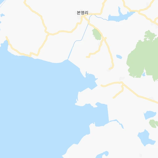
Roadmap (route) to go from Yongyŏn-yŏk to Sakchu-ŭp detailed above, you can also see the course layout on the map.
While doing trip Yongyŏn-yŏk - Sakchu-ŭp by car, the calculated route ends at a distance , or more straight.
Distance and duration of the route between Yongyŏn-yŏk and Sakchu-ŭp
Calculation of distance and route from Sakchu-ŭp to Yongyŏn-yŏk :
283.0355.1 km5h56mn
Continue 0h4mn 3.8 kmTurn right 0h2mn 1.5 kmTurn slight right 0h16mn 17.5 kmTurn left 0h1mn 1.4 kmTurn right 0h1mn 800 mKeep left 0h11mn 11.1 kmTurn right 0h11mn 11.2 kmTurn left 0h15mn 16.1 kmTurn left 0h15mn 16.9 kmKeep right 0h6mn 5.2 kmTurn slight left 0h1mn 295 mTurn left 0h2mn 874 mTurn left 0h6mn 5.9 kmKeep right 1h42mn 59.1 kmTurn sharp left 0h0mn 135 mTurn right onto 서성거리 0h9mn 10.0 kmContinue 0h0mn 256 mTurn slight left 0h1mn 1.3 kmTurn right 0h0mn 4 mTurn left 0h5mn 8.5 kmKeep right onto 평양희천고속도로 0h29mn 48.8 kmKeep right onto AH1 0h0mn 377 mKeep left onto AH1 0h0mn 54 mTurn left onto AH1 0h1mn 1.6 kmAt roundabout, take exit 1 onto AH1 0h12mn 13.7 kmKeep right 0h2mn 2.2 kmKeep right 0h6mn 5.5 kmKeep left 1h7mn 78.7 kmTurn left 0h0mn 69 mTurn left 0h9mn 9.4 kmTurn left 0h1mn 576 mTurn right 0h20mn 21.8 kmTurn left 0h0mn 363 mTurn right 0h0mn 193 mArrive at destination 0h0mn 0 m
Travel from Yongyŏn-yŏk (P'yŏngan-bukto) to a selection of major cities.
Distances from Yongyŏn-yŏk to biggest cities in Hwanghae-namdo
Other major cities in country :
Route from Sakchu-ŭp to major cities (North Korea).
- Distance Sakchu-ŭp Pyongyang163 km
- Distance Sakchu-ŭp Hamhung218 km
- Distance Sakchu-ŭp Namp'o186 km
- Distance Sakchu-ŭp Sunch'on131 km
- Distance Sakchu-ŭp Hungnam228 km
- Distance Sakchu-ŭp Kaesong299 km
- Distance Sakchu-ŭp Wonsan247 km
- Distance Sakchu-ŭp Chongjin426 km
- Distance Sakchu-ŭp Sariwon218 km
- Distance Sakchu-ŭp Haeju268 km
- Distance Sakchu-ŭp Kanggye145 km
- Distance Sakchu-ŭp Hyesan287 km
- Distance Sakchu-ŭp Songnim189 km
- Distance Sakchu-ŭp Manp'o135 km
- Distance Sakchu-ŭp P'yongsong145 km
- Distance Sakchu-ŭp Hyesan-dong286 km
- Distance Sakchu-ŭp Yuktae-dong268 km
- Distance Sakchu-ŭp Hongwon251 km
- Distance Sakchu-ŭp Rajin485 km
- Distance Sakchu-ŭp Ongjin275 km
Nearest cities to Yongyŏn-yŏk :
- Pyongyang, 3,222,000 inhabitants. 131 km
- Hamhung, 559,056 inhabitants. 286 km
- Namp'o, 455,000 inhabitants. 97 km
- Sunch'on, 437,000 inhabitants. 177 km
- Hungnam, 346,082 inhabitants. 283 km
- Kaesong, 338,155 inhabitants. 90 km
- Wonsan, 329,207 inhabitants. 219 km
- Sariwon, 310,100 inhabitants. 73 km
- Sinuiju, 288,112 inhabitants. 267 km
- Haeju, 222,396 inhabitants. 24 km
- Songnim, 152,425 inhabitants. 99 km
- P'yongsong, 100,000 inhabitants. 156 km
- Yuktae-dong, 76,427 inhabitants. 330 km
- Hongwon, 70,923 inhabitants. 318 km
- Ongjin, 64,247 inhabitants. 17 km
- Chaeryong-up, 53,330 inhabitants. 59 km
- Anju, 50,196 inhabitants. 195 km
- Uiju, 50,081 inhabitants. 273 km
- Sungho 1-tong, 39,841 inhabitants. 130 km
- Changyon, 39,368 inhabitants. 57 km
- Sunan, 36,671 inhabitants. 148 km
- Hwangju-up, 35,641 inhabitants. 91 km
- Anbyon-up, 31,845 inhabitants. 216 km
- Kusong, 30,902 inhabitants. 236 km
- Chongju, 29,065 inhabitants. 205 km
- Kangdong-up, 28,922 inhabitants. 149 km
- Hukkyo-ri, 25,437 inhabitants. 105 km
- Kosan, 24,822 inhabitants. 197 km
- Yonan-up, 22,665 inhabitants. 55 km
- Yonggwang-up, 21,882 inhabitants. 291 km
- Kowon-up, 21,490 inhabitants. 229 km
- Hoeyang, 21,111 inhabitants. 202 km
- T'ongch'on-up, 20,575 inhabitants. 238 km
- Anak, 19,995 inhabitants. 71 km
- Kujang-up, 19,522 inhabitants. 226 km
- Sil-li, 19,463 inhabitants. 181 km
- Chunghwa, 19,346 inhabitants. 113 km
- Samho-rodongjagu, 19,025 inhabitants. 307 km
- Sinmak, 18,669 inhabitants. 86 km
- Sakchu-up, 18,001 inhabitants. 283 km
- Ayang-ni, 16,104 inhabitants. 46 km
- Sinanju, 15,693 inhabitants. 192 km
- Sinsang-ni, 14,960 inhabitants. 256 km
- Pukchil-lodongjagu, 14,129 inhabitants. 260 km
- Yonggang-up, 13,440 inhabitants. 110 km
- Pyoksong-up, 12,937 inhabitants. 20 km
- Koksan, 12,923 inhabitants. 141 km
- Panghyon-dong, 11,026 inhabitants. 226 km
- Kwaksan, 10,478 inhabitants. 206 km
- Sangsong-ni, 9,888 inhabitants. 186 km
Location Yongyŏn-yŏk (Hwanghae-namdo) :
| Country flag |  |
| Location | Yongyŏn-yŏk |
| State | Hwanghae-namdo |
| County | |
| Country | North Korea |
| Country code / ISO 2 | KP |
| Latitude | 37.8722200 |
| Longitude | 125.5419400 |
| Altitude | 0 meters |
| Time zone | Asia/Pyongyang |
Location Sakchu-ŭp (P'yŏngan-bukto) :
| Country flag | |
| Location | Sakchu-ŭp |
| State | P'yŏngan-bukto |
| County | |
| Country | North Korea |
| Country code / ISO 2 | KP |
| Latitude | 40.3894400 |
| Longitude | 125.0466700 |
| Altitude | 0 meters |
| Time zone | Asia/Pyongyang |