
How to get from Jackson Hole (airport) (Wyoming) to Rock Springs (Wyoming)
Calculate route from Jackson Hole (airport) (Wyoming, United States) to Rock Springs (Wyoming, United States).
The flight distance (as the crow flies) between Jackson Hole (airport) and Rock Springs is 257.1 km.
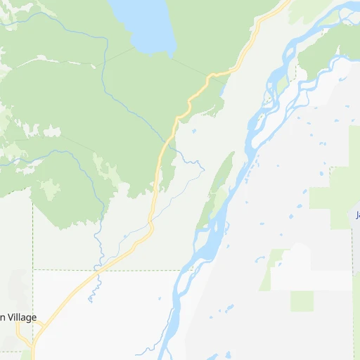
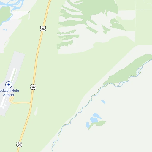
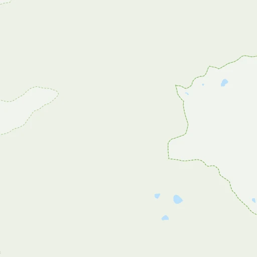
Roadmap (route) to go from Jackson Hole Airport to Rock Springs detailed above, you can also see the course layout on the map.
While doing trip Jackson Hole (airport) - Rock Springs by car, the calculated route ends at a distance , or more straight.
Distance and duration of the route between Jackson Hole (airport) and Rock Springs
Calculation of distance and route from Rock Springs to Jackson Hole (airport) :
257.1301.0 km3h25mn
Continue 0h0mn 227 mTurn left 0h0mn 70 mAt roundabout, take exit 2 onto East Airport Road 0h1mn 980 mTurn right onto North Highway 89 0h2mn 3.0 kmAt roundabout, take exit 2 onto North Highway 89 0h10mn 11.1 kmTurn right onto West Broadway Avenue 0h18mn 21.3 kmAt roundabout, take exit 2 onto US 26, US 89, US 189, US 191 3h34mn 243.4 kmKeep right 0h0mn 76 mContinue onto Yellowstone Road 0h12mn 14.7 kmTurn right onto Elk Street 0h4mn 3.6 kmTurn left onto Bridger Avenue 0h0mn 420 mTurn sharp right onto M Street 0h1mn 493 mTurn left onto F Street 0h0mn 70 mTurn left onto 2nd Street 0h0mn 339 mTurn right onto Edgar Street 0h1mn 939 mTurn right onto Agate Street 0h0mn 129 mTurn left onto Collins Street 0h0mn 25 mArrive at destination 0h0mn 0 m
Travel from Jackson Hole (airport) (Wyoming) to a selection of major cities.
Distances from Jackson Hole Airport to biggest cities in Wyoming
Other major cities in country :
- Charlotte [NC], 827,097 inhabitants. 2,717 km
- Seattle [WA], 684,451 inhabitants. 1,005 km
- Denver [CO], 682,545 inhabitants. 643 km
- El Paso [TX], 681,124 inhabitants. 1,371 km
- Detroit [MI], 677,116 inhabitants. 2,250 km
- Boston [MA], 667,137 inhabitants. 3,203 km
- Memphis [TN], 655,770 inhabitants. 2,006 km
- New South Memphis [TN], 641,608 inhabitants. 2,009 km
- Portland [OR], 632,309 inhabitants. 970 km
- Oklahoma City [OK], 631,346 inhabitants. 1,449 km
- Las Vegas [NV], 623,747 inhabitants. 908 km
- Baltimore [MD], 621,849 inhabitants. 2,867 km
- Washington, D.C. [DC], 601,723 inhabitants. 2,849 km
- Milwaukee [WI], 600,155 inhabitants. 1,844 km
- South Boston [MA], 571,281 inhabitants. 3,205 km
- Albuquerque [NM], 559,121 inhabitants. 1,011 km
- Tucson [AZ], 531,641 inhabitants. 1,267 km
- Nashville [TN], 530,852 inhabitants. 2,198 km
- Fresno [CA], 520,052 inhabitants. 1,082 km
- Sacramento [CA], 490,712 inhabitants. 1,060 km
Route from Rock Springs to major cities (United States).
- Distance Rock Springs New York City2,931 km
- Distance Rock Springs Los Angeles1,154 km
- Distance Rock Springs Chicago1,786 km
- Distance Rock Springs Brooklyn2,938 km
- Distance Rock Springs Houston1,812 km
- Distance Rock Springs Queens2,946 km
- Distance Rock Springs Philadelphia2,857 km
- Distance Rock Springs Phoenix941 km
- Distance Rock Springs Manhattan2,933 km
- Distance Rock Springs San Antonio1,663 km
- Distance Rock Springs San Diego1,213 km
- Distance Rock Springs The Bronx2,939 km
- Distance Rock Springs Dallas1,470 km
- Distance Rock Springs San Jose1,187 km
- Distance Rock Springs Austin1,626 km
- Distance Rock Springs Jacksonville2,764 km
- Distance Rock Springs San Francisco1,208 km
- Distance Rock Springs Columbus2,208 km
- Distance Rock Springs Fort Worth1,441 km
- Distance Rock Springs Indianapolis1,950 km
Nearest cities to Jackson Hole (airport) :
- Salt Lake City, 192,672 inhabitants. 331 km
- West Valley City, 136,208 inhabitants. 341 km
- West Jordan, 111,946 inhabitants. 348 km
- Billings, 110,263 inhabitants. 300 km
- Ogden, 85,444 inhabitants. 284 km
- Layton, 74,143 inhabitants. 301 km
- Millcreek, 62,139 inhabitants. 338 km
- Taylorsville, 60,514 inhabitants. 342 km
- Idaho Falls, 59,184 inhabitants. 106 km
- Pocatello, 54,441 inhabitants. 161 km
- Logan, 50,371 inhabitants. 227 km
- Murray, 49,250 inhabitants. 341 km
- Bountiful, 43,784 inhabitants. 317 km
- Bozeman, 43,405 inhabitants. 232 km
- Roy, 37,964 inhabitants. 292 km
- Kearns, 35,731 inhabitants. 344 km
- Cottonwood Heights, 34,343 inhabitants. 344 km
- Butte, 34,190 inhabitants. 302 km
- Butte-Silver Bow (Balance), 33,525 inhabitants. 297 km
- Midvale, 32,613 inhabitants. 347 km
- Holladay, 30,864 inhabitants. 339 km
- Clearfield, 30,653 inhabitants. 297 km
- Helena, 30,581 inhabitants. 348 km
- Kaysville, 30,472 inhabitants. 303 km
- Rexburg, 27,663 inhabitants. 88 km
- Syracuse, 27,395 inhabitants. 301 km
- Magna, 26,505 inhabitants. 342 km
- South Salt Lake, 24,788 inhabitants. 335 km
- Rock Springs, 23,962 inhabitants. 258 km
- Farmington, 22,566 inhabitants. 307 km
- Clinton, 21,399 inhabitants. 295 km
- East Millcreek, 20,816 inhabitants. 335 km
- North Salt Lake, 19,796 inhabitants. 322 km
- Brigham City, 18,752 inhabitants. 256 km
- North Ogden, 18,446 inhabitants. 275 km
- South Ogden, 16,955 inhabitants. 287 km
- Centerville, 16,877 inhabitants. 314 km
- Ammon, 14,960 inhabitants. 100 km
- Chubbuck, 14,428 inhabitants. 159 km
- Green River, 12,465 inhabitants. 254 km
- Evanston, 12,133 inhabitants. 261 km
- West Haven, 11,921 inhabitants. 288 km
- Blackfoot, 11,740 inhabitants. 138 km
- Oquirrh, 11,668 inhabitants. 348 km
- Woods Cross, 11,284 inhabitants. 319 km
- Riverton, 10,873 inhabitants. 202 km
- Smithfield, 10,782 inhabitants. 216 km
- Jackson, 10,523 inhabitants. 14 km
- West Point, 10,345 inhabitants. 298 km
- North Logan, 10,181 inhabitants. 222 km
Location Jackson Hole (airport) (Wyoming) :
| Country flag |  |
| Location | Jackson Hole (airport) |
| State | Wyoming |
| County | Teton County |
| Country | United States |
| Country code / ISO 2 | US |
| Latitude | 43.6066000 |
| Longitude | -110.7385400 |
| Altitude | 1959 meters |
| Time zone | America/Denver |
Location Rock Springs (Wyoming) :
| Country flag | |
| Location | Rock Springs |
| State | Wyoming |
| County | Sweetwater County |
| Country | United States |
| Country code / ISO 2 | US |
| Latitude | 41.5874600 |
| Longitude | -109.2029000 |
| Altitude | 1947 meters |
| Time zone | America/Denver |


