
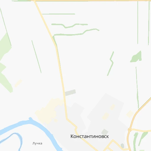
How to get from Konstantinovsk (Rostov) to Millerovo (Rostov)
Calculate route from Konstantinovsk (Rostov, Russia) to Millerovo (Rostov, Russia).
The flight distance (as the crow flies) between Konstantinovsk and Millerovo is 157.5 km.
Roadmap (route) to go from Konstantinovsk to Millerovo detailed above, you can also see the course layout on the map.
While doing trip Konstantinovsk - Millerovo by car, the calculated route ends at a distance , or more straight.
Distance and duration of the route between Konstantinovsk and Millerovo
Calculation of distance and route from Millerovo to Konstantinovsk :
157.5206.1 km3h7mn
Continue onto улица Баумана 0h0mn 19 mTurn left onto улица Маренова 0h0mn 88 mTurn right onto улица Комарова 0h8mn 6.5 kmTurn sharp left onto Шахты - Цимлянск 0h10mn 13.9 kmTurn right onto Усть-Донецкий – Евсеевский – Голубинка – 60К-20 0h6mn 4.8 kmTurn left onto Усть-Донецкий – Евсеевский – Голубинка – 60К-20 0h5mn 4.1 kmTurn left onto Усть-Донецкий – Евсеевский – Голубинка – 60К-20 0h13mn 10.8 kmTurn right onto 60К-20 0h2mn 1.6 kmTurn left onto Усть-Донецкий – Евсеевский – Голубинка – 60К-20 0h19mn 15.7 kmTurn right onto Шахты — Белая Калитва 0h30mn 34.1 kmTurn left onto А-260 0h12mn 16.3 kmTurn right 0h2mn 1.4 kmTurn sharp left onto Каменск-Шахтинский — Репная — Верхнеясиновский — А260 0h10mn 8.5 kmTurn slight left onto Каменск-Шахтинский — Репная — Верхнеясиновский — А260 0h10mn 11.6 kmKeep right onto «Дон» 0h30mn 39.8 kmKeep right and drive toward Тарасовский 0h10mn 11.8 kmKeep left 0h14mn 18.6 kmKeep right and drive toward Миллерово, Луганск, Ростов-На-Дону 0h0mn 553 mContinue onto Миллерово — Луганск 0h1mn 1.7 kmKeep right onto Артиллерийская улица 0h3mn 2.8 kmKeep right onto Артиллерийская улица 0h0mn 24 mTurn slight right onto Российская улица 0h0mn 52 mTurn slight right onto Российская улица 0h2mn 1.1 kmTurn left onto улица 3 Интернационала 0h0mn 335 mArrive at destination 0h0mn 0 m
Travel from Konstantinovsk (Rostov) to a selection of major cities.
Distances from Konstantinovsk to biggest cities in Rostov
Other major cities in country :
- Barnaul [04], 599,579 inhabitants. 3,043 km
- Vladivostok [59], 587,022 inhabitants. 6,696 km
- Irkutsk [20], 586,695 inhabitants. 4,413 km
- Khabarovsk [30], 579,000 inhabitants. 6,519 km
- Khabarovsk Vtoroy [30], 578,303 inhabitants. 6,525 km
- Orenburg [55], 550,204 inhabitants. 1,109 km
- Novokuznetsk [29], 539,616 inhabitants. 3,258 km
- Ryazan' [62], 520,173 inhabitants. 790 km
- Tyumen [78], 519,119 inhabitants. 1,957 km
- Lipetsk [43], 515,655 inhabitants. 569 km
- Penza [57], 512,602 inhabitants. 684 km
- Naberezhnyye Chelny [73], 509,870 inhabitants. 1,194 km
- Kalininskiy [42], 504,641 inhabitants. 1,546 km
- Astrakhan [07], 502,533 inhabitants. 545 km
- Makhachkala [17], 497,959 inhabitants. 717 km
- Tomsk [75], 485,519 inhabitants. 3,103 km
- Kemerovo [29], 477,090 inhabitants. 3,176 km
- Tula [76], 468,825 inhabitants. 775 km
- Kirov [33], 457,383 inhabitants. 1,351 km
- Cheboksary [16], 446,781 inhabitants. 1,041 km
Route from Millerovo to major cities (Russia).
- Distance Millerovo Moscow783 km
- Distance Millerovo Saint Petersburg1,386 km
- Distance Millerovo Novosibirsk2,946 km
- Distance Millerovo Yekaterinburg1,610 km
- Distance Millerovo Nizhniy Novgorod859 km
- Distance Millerovo Samara831 km
- Distance Millerovo Omsk2,336 km
- Distance Millerovo Kazan966 km
- Distance Millerovo Chelyabinsk1,590 km
- Distance Millerovo Ufa1,248 km
- Distance Millerovo Volgograd302 km
- Distance Millerovo Perm1,452 km
- Distance Millerovo Krasnoyarsk3,553 km
- Distance Millerovo Saratov494 km
- Distance Millerovo Voronezh318 km
- Distance Millerovo Tol'yatti807 km
- Distance Millerovo Krasnodar445 km
- Distance Millerovo Ulyanovsk816 km
- Distance Millerovo Izhevsk1,229 km
- Distance Millerovo Yaroslavl970 km
Nearest cities to Konstantinovsk :
- Rostov-na-Donu, 1,074,482 inhabitants. 110 km
- Krasnodar, 649,851 inhabitants. 326 km
- Stavropol', 363,064 inhabitants. 291 km
- Taganrog, 279,056 inhabitants. 170 km
- Shakhty, 221,312 inhabitants. 67 km
- Armavir, 199,548 inhabitants. 289 km
- Volgodonsk, 167,731 inhabitants. 80 km
- Novocherkassk, 166,974 inhabitants. 77 km
- Maykop, 144,055 inhabitants. 340 km
- Nevinnomyssk, 134,345 inhabitants. 335 km
- Bataysk, 109,962 inhabitants. 112 km
- Novoshakhtinsk, 99,478 inhabitants. 89 km
- Yeysk, 87,814 inhabitants. 235 km
- Azov, 82,133 inhabitants. 137 km
- Kropotkin, 79,599 inhabitants. 242 km
- Kamensk-Shakhtinskiy, 75,814 inhabitants. 103 km
- Gukovo, 66,079 inhabitants. 102 km
- Slavyansk-na-Kubani, 65,196 inhabitants. 345 km
- Tikhoretsk, 64,387 inhabitants. 206 km
- Rossosh', 62,000 inhabitants. 312 km
- Labinsk, 61,945 inhabitants. 329 km
- Sal'sk, 61,000 inhabitants. 128 km
- Mikhaylovsk, 59,198 inhabitants. 282 km
- Mikhaylovka, 58,898 inhabitants. 317 km
- Belorechensk, 54,526 inhabitants. 327 km
- Timashevsk, 53,940 inhabitants. 274 km
- Donetsk, 50,850 inhabitants. 119 km
- Kurganinsk, 47,681 inhabitants. 303 km
- Belaya Kalitva, 47,521 inhabitants. 71 km
- Kanevskaya, 45,334 inhabitants. 233 km
- Krasnyy Sulin, 44,133 inhabitants. 84 km
- Ust'-Labinsk, 44,088 inhabitants. 285 km
- Pashkovskiy, 43,634 inhabitants. 323 km
- Korenovsk, 41,665 inhabitants. 267 km
- Frolovo, 40,882 inhabitants. 308 km
- Svetlograd, 39,727 inhabitants. 284 km
- Izobil'nyy, 39,022 inhabitants. 251 km
- Aksay, 38,871 inhabitants. 99 km
- Leningradskaya, 38,712 inhabitants. 191 km
- Millerovo, 38,527 inhabitants. 158 km
- Novokubansk, 36,401 inhabitants. 275 km
- Blagodarnyy, 35,995 inhabitants. 330 km
- Valuyki, 35,887 inhabitants. 364 km
- Gul'kevichi, 34,953 inhabitants. 250 km
- Abinsk, 34,668 inhabitants. 377 km
- Dinskaya, 34,573 inhabitants. 300 km
- Primorsko-Akhtarsk, 33,102 inhabitants. 280 km
- Pavlovskaya, 31,133 inhabitants. 189 km
- Starominskaya, 30,461 inhabitants. 194 km
- Kushchevskaya, 29,915 inhabitants. 159 km
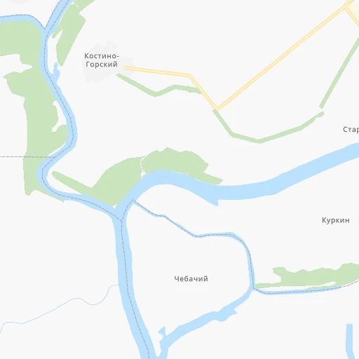
Location Konstantinovsk (Rostov) :
| Country flag |  |
| Location | Konstantinovsk |
| State | Rostov |
| County | |
| Country | Russia |
| Country code / ISO 2 | RU |
| Latitude | 47.5827800 |
| Longitude | 41.0922200 |
| Altitude | 0 meters |
| Time zone | Europe/Moscow |
Location Millerovo (Rostov) :
| Country flag | |
| Location | Millerovo |
| State | Rostov |
| County | |
| Country | Russia |
| Country code / ISO 2 | RU |
| Latitude | 48.9226500 |
| Longitude | 40.3967300 |
| Altitude | 0 meters |
| Time zone | Europe/Moscow |