
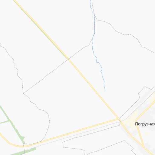
How to get from Stantsiya Pogruznaya (Samara Oblast) to Novocheboksarsk (Chuvashia)
Calculate route from Stantsiya Pogruznaya (Samara Oblast, Russia) to Novocheboksarsk (Chuvashia, Russia).
The flight distance (as the crow flies) between Stantsiya Pogruznaya and Novocheboksarsk is 281.0 km.
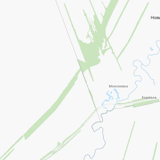
Roadmap (route) to go from Stantsiya Pogruznaya to Novocheboksarsk detailed above, you can also see the course layout on the map.
While doing trip Stantsiya Pogruznaya - Novocheboksarsk by car, the calculated route ends at a distance , or more straight.
Distance and duration of the route between Stantsiya Pogruznaya and Novocheboksarsk
Calculation of distance and route from Novocheboksarsk to Stantsiya Pogruznaya :
281.0400.2 km6h10mn
Continue onto Железнодорожная улица 0h1mn 700 mTurn right onto Кошки — Степная Шентала — Старое Максимкино — граница Татарстана 0h15mn 15.3 kmTurn left 0h2mn 979 mTurn right onto Старое Фейзуллово-Вороний Куст 0h13mn 6.4 kmTurn slight right 0h2mn 506 mTurn slight right 0h0mn 115 mTurn sharp left 0h5mn 2.6 kmTurn left onto 73-227Н-010 0h28mn 27.6 kmTurn right onto Р-241 0h16mn 17.6 kmTurn right onto Западная улица 0h1mn 780 mTurn left onto Октябрьская улица 0h1mn 545 mTurn right onto Р-241 0h2mn 2.2 kmTurn left onto Мулловское шоссе 1h46mn 52.9 kmAt roundabout, take exit 2 onto Р-241 1h36mn 38.7 kmAt roundabout, take exit 2 onto Р-241 0h7mn 8.5 kmTurn left onto 73-252Н-002 0h2mn 2.7 kmTurn right onto А-151 3h36mn 182.9 kmAt roundabout, take exit 2 onto улица Терешковой 0h18mn 20.8 kmKeep right onto «Вятка» 0h12mn 14.0 kmKeep right 0h2mn 1.7 kmAt roundabout, take exit 2 onto Советская улица 0h2mn 1.7 kmTurn right onto Солнечная улица 0h1mn 384 mTurn left onto Солнечная улица 0h1mn 317 mTurn right 0h0mn 157 mKeep right 0h0mn 20 mTurn right 0h0mn 49 mTurn left 0h1mn 184 mArrive at destination 0h0mn 0 m
Travel from Stantsiya Pogruznaya (Chuvashia) to a selection of major cities.
Distances from Stantsiya Pogruznaya to biggest cities in Samara Oblast
Other major cities in country :
- Vladivostok [59], 587,022 inhabitants. 5,770 km
- Irkutsk [20], 586,695 inhabitants. 3,505 km
- Khabarovsk [30], 579,000 inhabitants. 5,559 km
- Khabarovsk Vtoroy [30], 578,303 inhabitants. 5,565 km
- Orenburg [55], 550,204 inhabitants. 415 km
- Novokuznetsk [29], 539,616 inhabitants. 2,373 km
- Ryazan' [62], 520,173 inhabitants. 697 km
- Tyumen [78], 519,119 inhabitants. 999 km
- Lipetsk [43], 515,655 inhabitants. 742 km
- Penza [57], 512,602 inhabitants. 376 km
- Naberezhnyye Chelny [73], 509,870 inhabitants. 209 km
- Kalininskiy [42], 504,641 inhabitants. 1,364 km
- Astrakhan [07], 502,533 inhabitants. 893 km
- Makhachkala [17], 497,959 inhabitants. 1,271 km
- Tomsk [75], 485,519 inhabitants. 2,176 km
- Kemerovo [29], 477,090 inhabitants. 2,267 km
- Tula [76], 468,825 inhabitants. 833 km
- Kirov [33], 457,383 inhabitants. 488 km
- Cheboksary [16], 446,781 inhabitants. 293 km
- Kaliningrad [23], 434,954 inhabitants. 1,922 km
Route from Novocheboksarsk to major cities (Russia).
- Distance Novocheboksarsk Moscow616 km
- Distance Novocheboksarsk Saint Petersburg1,094 km
- Distance Novocheboksarsk Novosibirsk2,210 km
- Distance Novocheboksarsk Yekaterinburg810 km
- Distance Novocheboksarsk Nizhniy Novgorod216 km
- Distance Novocheboksarsk Samara367 km
- Distance Novocheboksarsk Omsk1,625 km
- Distance Novocheboksarsk Kazan109 km
- Distance Novocheboksarsk Rostov-na-Donu1,123 km
- Distance Novocheboksarsk Chelyabinsk882 km
- Distance Novocheboksarsk Ufa557 km
- Distance Novocheboksarsk Volgograd847 km
- Distance Novocheboksarsk Perm571 km
- Distance Novocheboksarsk Krasnoyarsk2,769 km
- Distance Novocheboksarsk Saratov518 km
- Distance Novocheboksarsk Voronezh734 km
- Distance Novocheboksarsk Tol'yatti311 km
- Distance Novocheboksarsk Krasnodar1,368 km
- Distance Novocheboksarsk Ulyanovsk207 km
- Distance Novocheboksarsk Izhevsk361 km
Nearest cities to Stantsiya Pogruznaya :
- Samara, 1,134,730 inhabitants. 116 km
- Kazan, 1,104,738 inhabitants. 193 km
- Tol'yatti, 702,879 inhabitants. 106 km
- Ulyanovsk, 640,680 inhabitants. 134 km
- Izhevsk, 631,038 inhabitants. 340 km
- Naberezhnyye Chelny, 509,870 inhabitants. 209 km
- Yoshkar-Ola, 279,100 inhabitants. 313 km
- Nizhnekamsk, 234,297 inhabitants. 180 km
- Balakovo, 199,572 inhabitants. 302 km
- Syzran', 189,338 inhabitants. 176 km
- Al'met'yevsk, 140,437 inhabitants. 143 km
- Dimitrovgrad, 132,226 inhabitants. 53 km
- Novocheboksarsk, 128,468 inhabitants. 281 km
- Novokuybyshevsk, 111,800 inhabitants. 130 km
- Zelenodolsk, 99,600 inhabitants. 217 km
- Bugul'ma, 91,900 inhabitants. 157 km
- Buzuluk, 87,714 inhabitants. 202 km
- Yelabuga, 72,643 inhabitants. 200 km
- Chapayevsk, 70,147 inhabitants. 147 km
- Leninogorsk, 66,263 inhabitants. 138 km
- Chistopol', 62,200 inhabitants. 127 km
- Volzhsk, 58,000 inhabitants. 225 km
- Zhigulevsk, 57,094 inhabitants. 111 km
- Buguruslan, 53,511 inhabitants. 146 km
- Otradnyy, 50,127 inhabitants. 112 km
- Kanash, 49,886 inhabitants. 236 km
- Mozhga, 47,270 inhabitants. 271 km
- Zainsk, 42,044 inhabitants. 160 km
- Pugachev, 41,375 inhabitants. 270 km
- Vyatskiye Polyany, 39,534 inhabitants. 226 km
- Nurlat, 34,451 inhabitants. 33 km
- Kinel', 34,336 inhabitants. 112 km
- Sorochinsk, 30,731 inhabitants. 270 km
- Pokhvistnevo, 28,300 inhabitants. 128 km
- Bezenchuk, 23,736 inhabitants. 154 km
- Yershov, 23,681 inhabitants. 352 km
- Bavly, 22,982 inhabitants. 184 km
- Mendeleyevsk, 22,969 inhabitants. 221 km
- Buinsk, 20,266 inhabitants. 161 km
- Neftegorsk, 19,542 inhabitants. 166 km
- Uva, 19,143 inhabitants. 326 km
- Agryz, 18,601 inhabitants. 302 km
- Kinel'-Cherkassy, 18,393 inhabitants. 109 km
- Arsk, 17,243 inhabitants. 210 km
- Novoul'yanovsk, 17,139 inhabitants. 134 km
- Menzelinsk, 16,858 inhabitants. 238 km
- Vasil'yevo, 16,800 inhabitants. 212 km
- Kukmor, 16,795 inhabitants. 220 km
- Medvedevo, 16,407 inhabitants. 315 km
- Dzhalil', 14,797 inhabitants. 173 km
Location Stantsiya Pogruznaya (Samara Oblast) :
| Country flag |  |
| Location | Stantsiya Pogruznaya |
| State | Samara Oblast |
| County | |
| Country | Russia |
| Country code / ISO 2 | RU |
| Latitude | 54.2296700 |
| Longitude | 50.4368600 |
| Altitude | 0 meters |
| Time zone | Europe/Samara |
Location Novocheboksarsk (Chuvashia) :
| Country flag | |
| Location | Novocheboksarsk |
| State | Chuvashia |
| County | |
| Country | Russia |
| Country code / ISO 2 | RU |
| Latitude | 56.1109500 |
| Longitude | 47.4775500 |
| Altitude | 0 meters |
| Time zone | Europe/Moscow |