

How to get from Franklins Plainview (airport) (Nebraska) to Pratt (Kansas)
Calculate route from Franklins Plainview (airport) (Nebraska, United States) to Pratt (Kansas, United States).
The flight distance (as the crow flies) between Franklins Plainview (airport) and Pratt is 275.7 km.
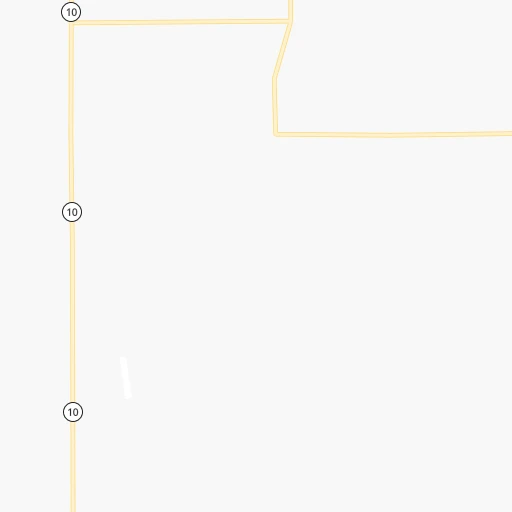
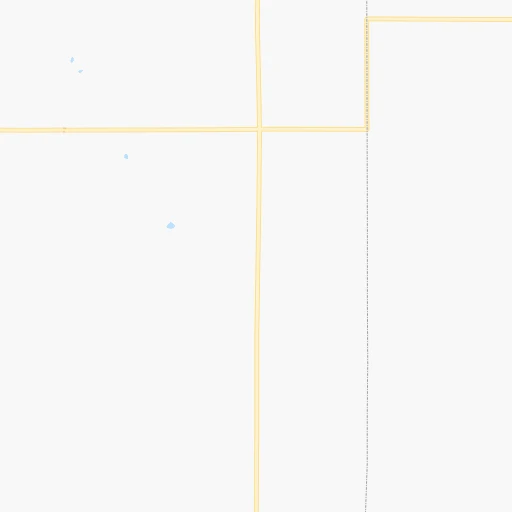
Roadmap (route) to go from Franklins Plainview Airport to Pratt detailed above, you can also see the course layout on the map.
While doing trip Franklins Plainview (airport) - Pratt by car, the calculated route ends at a distance , or more straight.
Distance and duration of the route between Franklins Plainview (airport) and Pratt
Calculation of distance and route from Pratt to Franklins Plainview (airport) :
275.7316.7 km4h17mn
Continue onto I Road 0h3mn 2.5 kmTurn right onto H Road 0h2mn 1.3 kmTurn left onto 16th Avenue 1h35mn 37.5 kmTurn left onto US 36 0h6mn 9.8 kmTurn right onto KS 204 0h3mn 3.3 kmTurn right onto South Main Street 1h59mn 77.7 kmTurn right onto Waldo Road 0h9mn 13.7 kmTurn left onto US 281 1h55mn 64.9 kmTurn left onto Northwest 120 Road 0h5mn 7.4 kmTurn right onto North Main Street 1h48mn 63.6 kmAt roundabout, take exit 2 onto US 281 1h32mn 34.7 kmTurn left onto East 1st Street 0h0mn 117 mTurn right onto South Ninnescah Street 0h0mn 232 mTurn left onto East 3rd Street 0h0mn 50 mArrive at destination 0h0mn 0 m
Travel from Franklins Plainview (airport) (Kansas) to a selection of major cities.
Distances from Franklins Plainview Airport to biggest cities in Nebraska
Other major cities in country :
- Charlotte [NC], 827,097 inhabitants. 1,680 km
- Seattle [WA], 684,451 inhabitants. 2,045 km
- Denver [CO], 682,545 inhabitants. 519 km
- El Paso [TX], 681,124 inhabitants. 1,153 km
- Detroit [MI], 677,116 inhabitants. 1,350 km
- Boston [MA], 667,137 inhabitants. 2,335 km
- Memphis [TN], 655,770 inhabitants. 958 km
- New South Memphis [TN], 641,608 inhabitants. 961 km
- Portland [OR], 632,309 inhabitants. 2,022 km
- Oklahoma City [OK], 631,346 inhabitants. 533 km
- Las Vegas [NV], 623,747 inhabitants. 1,483 km
- Baltimore [MD], 621,849 inhabitants. 1,908 km
- Washington, D.C. [DC], 601,723 inhabitants. 1,880 km
- Milwaukee [WI], 600,155 inhabitants. 972 km
- South Boston [MA], 571,281 inhabitants. 2,336 km
- Albuquerque [NM], 559,121 inhabitants. 882 km
- Tucson [AZ], 531,641 inhabitants. 1,389 km
- Nashville [TN], 530,852 inhabitants. 1,149 km
- Fresno [CA], 520,052 inhabitants. 1,852 km
- Sacramento [CA], 490,712 inhabitants. 1,945 km
Route from Pratt to major cities (United States).
- Distance Pratt New York City2,154 km
- Distance Pratt Los Angeles1,801 km
- Distance Pratt Chicago1,057 km
- Distance Pratt Brooklyn2,159 km
- Distance Pratt Houston931 km
- Distance Pratt Queens2,168 km
- Distance Pratt Philadelphia2,055 km
- Distance Pratt Phoenix1,294 km
- Distance Pratt Manhattan2,157 km
- Distance Pratt San Antonio915 km
- Distance Pratt San Diego1,761 km
- Distance Pratt The Bronx2,166 km
- Distance Pratt Dallas569 km
- Distance Pratt San Jose2,040 km
- Distance Pratt Austin826 km
- Distance Pratt Jacksonville1,770 km
- Distance Pratt San Francisco2,080 km
- Distance Pratt Columbus1,388 km
- Distance Pratt Fort Worth562 km
- Distance Pratt Indianapolis1,117 km
Nearest cities to Franklins Plainview (airport) :
- Omaha, 443,885 inhabitants. 282 km
- Wichita, 389,965 inhabitants. 303 km
- Lincoln, 277,348 inhabitants. 206 km
- Sioux City, 82,821 inhabitants. 339 km
- Manhattan, 56,308 inhabitants. 227 km
- Grand Island, 51,440 inhabitants. 102 km
- Salina, 47,813 inhabitants. 182 km
- Hutchinson, 41,569 inhabitants. 245 km
- Kearney, 33,021 inhabitants. 66 km
- Dodge City, 27,912 inhabitants. 280 km
- Garden City, 27,005 inhabitants. 293 km
- Fremont, 26,474 inhabitants. 251 km
- Hastings, 24,924 inhabitants. 69 km
- Emporia, 24,649 inhabitants. 304 km
- Junction City, 24,621 inhabitants. 217 km
- Norfolk, 24,366 inhabitants. 247 km
- North Platte, 24,194 inhabitants. 191 km
- Derby, 23,509 inhabitants. 321 km
- Columbus, 22,797 inhabitants. 196 km
- Hays, 21,092 inhabitants. 142 km
- Papillion, 19,510 inhabitants. 269 km
- Newton, 19,216 inhabitants. 268 km
- La Vista, 16,921 inhabitants. 272 km
- Great Bend, 15,717 inhabitants. 196 km
- Yankton, 14,557 inhabitants. 332 km
- South Sioux City, 13,319 inhabitants. 336 km
- McPherson, 13,144 inhabitants. 223 km
- El Dorado, 12,931 inhabitants. 312 km
- Andover, 12,745 inhabitants. 310 km
- Beatrice, 12,388 inhabitants. 186 km
- Winfield, 12,204 inhabitants. 362 km
- Haysville, 11,212 inhabitants. 316 km
- Chalco, 10,994 inhabitants. 263 km
- Vermillion, 10,738 inhabitants. 340 km
- Lexington, 10,075 inhabitants. 101 km
- Le Mars, 9,761 inhabitants. 376 km
- Augusta, 9,299 inhabitants. 319 km
- Elkhorn, 8,251 inhabitants. 262 km
- Wellington, 7,987 inhabitants. 345 km
- Blair, 7,975 inhabitants. 284 km
- York, 7,864 inhabitants. 140 km
- Fort Riley North, 7,761 inhabitants. 213 km
- Park City, 7,618 inhabitants. 293 km
- McCook, 7,580 inhabitants. 145 km
- Sioux Center, 7,461 inhabitants. 401 km
- Valley Center, 7,222 inhabitants. 288 km
- Seward, 7,167 inhabitants. 178 km
- Crete, 7,037 inhabitants. 176 km
- Pratt, 6,849 inhabitants. 276 km
- Abilene, 6,558 inhabitants. 199 km
Location Franklins Plainview (airport) (Nebraska) :
| Country flag |  |
| Location | Franklins Plainview (airport) |
| State | Nebraska |
| County | Franklin County |
| Country | United States |
| Country code / ISO 2 | US |
| Latitude | 40.1208500 |
| Longitude | -98.9256400 |
| Altitude | 591 meters |
| Time zone | America/Chicago |
Location Pratt (Kansas) :
| Country flag | |
| Location | Pratt |
| State | Kansas |
| County | Pratt County |
| Country | United States |
| Country code / ISO 2 | US |
| Latitude | 37.6439100 |
| Longitude | -98.7375900 |
| Altitude | 575 meters |
| Time zone | America/Chicago |


