
How to get from Wallingford Landing Strip (Iowa) to Burlington (Iowa)
Calculate route from Wallingford Landing Strip (Iowa, United States) to Burlington (Iowa, United States).
The flight distance (as the crow flies) between Wallingford Landing Strip and Burlington is 411.8 km.
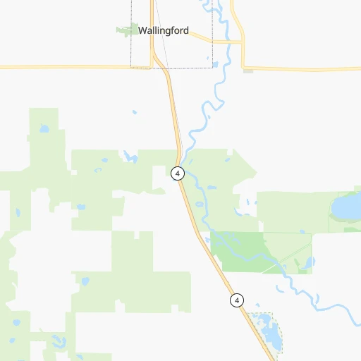
Roadmap (route) to go from Wallingford Landing Strip to Burlington detailed above, you can also see the course layout on the map.
While doing trip Wallingford Landing Strip - Burlington by car, the calculated route ends at a distance , or more straight.
Distance and duration of the route between Wallingford Landing Strip and Burlington
Calculation of distance and route from Burlington to Wallingford Landing Strip :
411.8536.4 km6h20mn
Continue 0h0mn 88 mTurn slight left 0h0mn 41 mTurn right 0h0mn 24 mTurn left onto Saint James Avenue 0h1mn 817 mTurn left onto State Highway 4 0h17mn 22.3 kmTurn left onto 360th Street 2h40mn 114.7 kmTurn right onto 16th Street Southwest 0h0mn 70 mTurn left onto West 7th Avenue North 0h1mn 404 mTurn left onto North Shore Drive 0h2mn 1.8 kmTurn right onto 1st Avenue North 0h0mn 205 mTurn right onto South Shore Drive 0h0mn 225 mTurn left onto 4th Avenue South 0h2mn 2.0 kmTurn right onto I 35 Business and take I 35 south, US 18 east, IA 27 south toward Des Moines 0h2mn 3.0 kmKeep right onto US 18, IA 27 0h1mn 926 mKeep right onto US 18, IA 27 1h23mn 130.7 kmKeep right and take US 218 south toward Waterloo 0h1mn 591 mKeep left onto Leo P Rooff Expressway 0h1mn 1.7 kmKeep right and take Broadway Street toward Airport 0h15mn 18.3 kmKeep right 0h0mn 60 mTurn slight right onto South 3rd Street 0h1mn 1.8 kmTurn sharp left 0h1mn 1.6 kmKeep right onto Avenue of the Saints and take I 380 South, IA 27 South toward Cedar Rapids 2h60mn 192.1 kmKeep right onto US 34, IA 163 and take US 34 East, 163 East toward Mount Pleasant, Burlington 0h0mn 409 mKeep right onto US 34, IA 163 and take US 34 East, IA 163 East toward Burlington 0h13mn 19.3 kmTurn left onto Old Highway 34 0h2mn 1.8 kmKeep left onto Old Highway 34 0h6mn 5.7 kmTurn right 0h10mn 14.4 kmKeep right and drive toward Central Ave 0h0mn 430 mTurn right onto North Central Avenue 0h1mn 885 mArrive at destination 0h0mn 0 m
Travel from Wallingford Landing Strip (Iowa) to a selection of major cities.
Distances from Wallingford Landing Strip to biggest cities in Iowa
- Ottumwa,24,624 inhabitants.322 km
- Muscatine,23,968 inhabitants.373 km
- Johnston,20,871 inhabitants.204 km
- Coralville,20,608 inhabitants.320 km
Other major cities in country :
- Charlotte [NC], 827,097 inhabitants. 1,498 km
- Seattle [WA], 684,451 inhabitants. 2,191 km
- Denver [CO], 682,545 inhabitants. 938 km
- El Paso [TX], 681,124 inhabitants. 1,647 km
- Detroit [MI], 677,116 inhabitants. 964 km
- Boston [MA], 667,137 inhabitants. 1,933 km
- Memphis [TN], 655,770 inhabitants. 996 km
- New South Memphis [TN], 641,608 inhabitants. 1,003 km
- Portland [OR], 632,309 inhabitants. 2,220 km
- Oklahoma City [OK], 631,346 inhabitants. 905 km
- Las Vegas [NV], 623,747 inhabitants. 1,908 km
- Baltimore [MD], 621,849 inhabitants. 1,581 km
- Washington, D.C. [DC], 601,723 inhabitants. 1,565 km
- Milwaukee [WI], 600,155 inhabitants. 559 km
- South Boston [MA], 571,281 inhabitants. 1,935 km
- Albuquerque [NM], 559,121 inhabitants. 1,371 km
- Tucson [AZ], 531,641 inhabitants. 1,876 km
- Nashville [TN], 530,852 inhabitants. 1,049 km
- Fresno [CA], 520,052 inhabitants. 2,242 km
- Sacramento [CA], 490,712 inhabitants. 2,296 km
Route from Burlington to major cities (United States).
- Distance Burlington New York City1,440 km
- Distance Burlington Los Angeles2,502 km
- Distance Burlington Chicago312 km
- Distance Burlington Brooklyn1,446 km
- Distance Burlington Houston1,288 km
- Distance Burlington Queens1,455 km
- Distance Burlington Philadelphia1,354 km
- Distance Burlington Phoenix2,026 km
- Distance Burlington Manhattan1,443 km
- Distance Burlington San Antonio1,433 km
- Distance Burlington San Diego2,480 km
- Distance Burlington The Bronx1,450 km
- Distance Burlington Dallas1,027 km
- Distance Burlington San Jose2,674 km
- Distance Burlington Austin1,317 km
- Distance Burlington Jacksonville1,445 km
- Distance Burlington San Francisco2,704 km
- Distance Burlington Columbus694 km
- Distance Burlington Fort Worth1,056 km
- Distance Burlington Indianapolis436 km
Nearest cities to Wallingford Landing Strip :
- Omaha, 443,885 inhabitants. 248 km
- Minneapolis, 410,939 inhabitants. 221 km
- Saint Paul, 285,068 inhabitants. 226 km
- Lincoln, 277,348 inhabitants. 320 km
- Des Moines, 210,330 inhabitants. 214 km
- Sioux Falls, 171,544 inhabitants. 157 km
- Rochester, 112,225 inhabitants. 202 km
- Bloomington, 86,435 inhabitants. 207 km
- Sioux City, 82,821 inhabitants. 160 km
- Brooklyn Park, 79,149 inhabitants. 228 km
- Plymouth, 75,907 inhabitants. 216 km
- Waterloo, 68,460 inhabitants. 219 km
- Maple Grove, 68,385 inhabitants. 222 km
- Woodbury, 67,855 inhabitants. 231 km
- Eagan, 66,286 inhabitants. 210 km
- Saint Cloud, 65,842 inhabitants. 255 km
- Ames, 65,060 inhabitants. 172 km
- West Des Moines, 64,113 inhabitants. 213 km
- Eden Prairie, 63,496 inhabitants. 201 km
- Council Bluffs, 62,597 inhabitants. 245 km
- West Coon Rapids, 62,528 inhabitants. 235 km
- Coon Rapids, 62,240 inhabitants. 234 km
- Blaine, 62,124 inhabitants. 240 km
- Burnsville, 61,481 inhabitants. 202 km
- Lakeville, 60,633 inhabitants. 193 km
- Ankeny, 56,764 inhabitants. 202 km
- Bellevue, 55,510 inhabitants. 259 km
- Minnetonka, 51,669 inhabitants. 205 km
- Apple Valley, 51,221 inhabitants. 201 km
- Edina, 50,138 inhabitants. 209 km
- Minnetonka Mills, 50,117 inhabitants. 210 km
- Saint Louis Park, 45,250 inhabitants. 215 km
- Urbandale, 44,062 inhabitants. 208 km
- Cedar Falls, 41,255 inhabitants. 210 km
- Mankato, 41,044 inhabitants. 113 km
- Maplewood, 40,567 inhabitants. 232 km
- Shakopee, 39,981 inhabitants. 193 km
- Richfield, 36,216 inhabitants. 212 km
- Cottage Grove, 35,918 inhabitants. 224 km
- Roseville, 35,580 inhabitants. 229 km
- Inver Grove Heights, 34,857 inhabitants. 220 km
- Andover, 32,213 inhabitants. 244 km
- Brooklyn Center, 30,770 inhabitants. 228 km
- Savage, 30,391 inhabitants. 200 km
- Oakdale, 28,080 inhabitants. 234 km
- Fridley, 27,713 inhabitants. 231 km
- Marshalltown, 27,620 inhabitants. 209 km
- Mason City, 27,366 inhabitants. 130 km
- Shoreview, 26,477 inhabitants. 236 km
- Fremont, 26,474 inhabitants. 253 km
Location Wallingford Landing Strip (Iowa) :
| Country flag |  |
| Location | Wallingford Landing Strip |
| State | Iowa |
| County | Emmet County |
| Country | United States |
| Country code / ISO 2 | US |
| Latitude | 43.3180200 |
| Longitude | -94.7866500 |
| Altitude | 381 meters |
| Time zone | America/Chicago |
Location Burlington (Iowa) :
| Country flag | |
| Location | Burlington |
| State | Iowa |
| County | Des Moines County |
| Country | United States |
| Country code / ISO 2 | US |
| Latitude | 40.8075400 |
| Longitude | -91.1129200 |
| Altitude | 185 meters |
| Time zone | America/Chicago |


