


How to get from Durham Landing Strip (Iowa) to Clinton (Iowa)
Calculate route from Durham Landing Strip (Iowa, United States) to Clinton (Iowa, United States).
The flight distance (as the crow flies) between Durham Landing Strip and Clinton is 283.1 km.
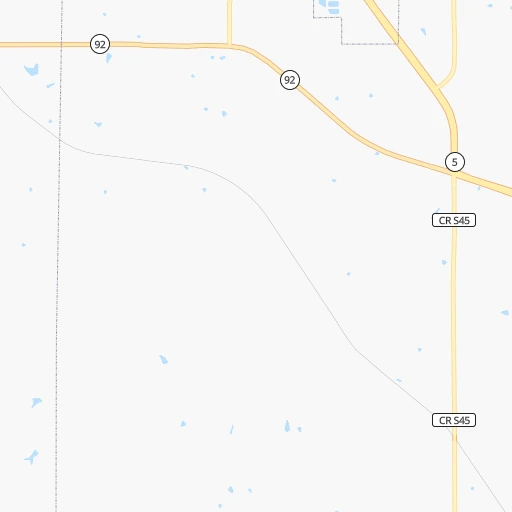
Roadmap (route) to go from Durham Landing Strip to Clinton detailed above, you can also see the course layout on the map.
While doing trip Durham Landing Strip - Clinton by car, the calculated route ends at a distance , or more straight.
Distance and duration of the route between Durham Landing Strip and Clinton
Calculation of distance and route from Clinton to Durham Landing Strip :
283.1345.4 km4h42mn
Continue 0h1mn 171 mTurn left onto Kennedy Street 0h1mn 686 mTurn right onto South 15th Street 0h2mn 808 mTurn left onto East 2nd Avenue 0h1mn 1.6 kmTurn right onto South Jefferson Way 0h15mn 16.2 kmKeep right onto US 65 0h13mn 19.5 kmKeep right and take US 6 toward Hubbell Avenue, Altoona 0h1mn 1.0 kmTurn right onto Hubbell Avenue 0h1mn 1.8 kmKeep right onto US 6 and take I 80 east, US 6 east toward Davenport 2h27mn 246.6 kmKeep right onto US 61 and take US 61 North toward Eldridge, DeWitt 0h15mn 23.9 kmKeep right 0h18mn 26.8 kmContinue onto Lincoln Way 0h0mn 203 mTurn left onto Manufacturing Drive 0h5mn 4.8 kmKeep right onto 2nd Avenue South 0h2mn 1.4 kmArrive at destination 0h0mn 0 m
Travel from Durham Landing Strip (Iowa) to a selection of major cities.
Distances from Durham Landing Strip to biggest cities in Iowa
- Ottumwa,24,624 inhabitants.101 km
- Muscatine,23,968 inhabitants.208 km
- Johnston,20,871 inhabitants.39 km
- Coralville,20,608 inhabitants.167 km
Other major cities in country :
- Charlotte [NC], 827,097 inhabitants. 1,299 km
- Seattle [WA], 684,451 inhabitants. 2,376 km
- Denver [CO], 682,545 inhabitants. 985 km
- El Paso [TX], 681,124 inhabitants. 1,572 km
- Detroit [MI], 677,116 inhabitants. 876 km
- Boston [MA], 667,137 inhabitants. 1,861 km
- Memphis [TN], 655,770 inhabitants. 754 km
- New South Memphis [TN], 641,608 inhabitants. 760 km
- Portland [OR], 632,309 inhabitants. 2,388 km
- Oklahoma City [OK], 631,346 inhabitants. 741 km
- Las Vegas [NV], 623,747 inhabitants. 1,956 km
- Baltimore [MD], 621,849 inhabitants. 1,452 km
- Washington, D.C. [DC], 601,723 inhabitants. 1,428 km
- Milwaukee [WI], 600,155 inhabitants. 500 km
- South Boston [MA], 571,281 inhabitants. 1,862 km
- Albuquerque [NM], 559,121 inhabitants. 1,341 km
- Tucson [AZ], 531,641 inhabitants. 1,849 km
- Nashville [TN], 530,852 inhabitants. 822 km
- Fresno [CA], 520,052 inhabitants. 2,316 km
- Sacramento [CA], 490,712 inhabitants. 2,395 km
Route from Clinton to major cities (United States).
- Distance Clinton New York City1,358 km
- Distance Clinton Los Angeles2,597 km
- Distance Clinton Chicago211 km
- Distance Clinton Brooklyn1,364 km
- Distance Clinton Houston1,423 km
- Distance Clinton Queens1,372 km
- Distance Clinton Philadelphia1,280 km
- Distance Clinton Phoenix2,135 km
- Distance Clinton Manhattan1,359 km
- Distance Clinton San Antonio1,572 km
- Distance Clinton San Diego2,583 km
- Distance Clinton The Bronx1,366 km
- Distance Clinton Dallas1,166 km
- Distance Clinton San Jose2,749 km
- Distance Clinton Austin1,456 km
- Distance Clinton Jacksonville1,492 km
- Distance Clinton San Francisco2,776 km
- Distance Clinton Columbus640 km
- Distance Clinton Fort Worth1,195 km
- Distance Clinton Indianapolis411 km
Nearest cities to Durham Landing Strip :
- Kansas City, 475,378 inhabitants. 266 km
- Omaha, 443,885 inhabitants. 202 km
- Des Moines, 210,330 inhabitants. 29 km
- Overland Park, 186,515 inhabitants. 281 km
- Kansas City, 151,306 inhabitants. 266 km
- Olathe, 134,305 inhabitants. 296 km
- Cedar Rapids, 130,405 inhabitants. 173 km
- Topeka, 127,265 inhabitants. 315 km
- Columbia, 119,108 inhabitants. 286 km
- Independence, 117,255 inhabitants. 262 km
- Rochester, 112,225 inhabitants. 310 km
- East Independence, 110,675 inhabitants. 260 km
- Davenport, 102,582 inhabitants. 247 km
- Lee's Summit, 95,094 inhabitants. 281 km
- Lawrence, 93,917 inhabitants. 302 km
- O'Fallon, 85,040 inhabitants. 371 km
- Sioux City, 82,821 inhabitants. 270 km
- Saint Joseph, 76,780 inhabitants. 208 km
- Iowa City, 74,220 inhabitants. 170 km
- Waterloo, 68,460 inhabitants. 161 km
- Ames, 65,060 inhabitants. 77 km
- Shawnee, 65,046 inhabitants. 276 km
- West Des Moines, 64,113 inhabitants. 30 km
- Council Bluffs, 62,597 inhabitants. 195 km
- Dubuque, 58,799 inhabitants. 270 km
- Ankeny, 56,764 inhabitants. 43 km
- Bellevue, 55,510 inhabitants. 199 km
- Blue Springs, 54,148 inhabitants. 267 km
- Saint Peters, 52,575 inhabitants. 376 km
- Lenexa, 52,490 inhabitants. 286 km
- La Crosse, 52,306 inhabitants. 331 km
- North La Crosse, 50,470 inhabitants. 335 km
- Chesterfield, 47,864 inhabitants. 391 km
- Urbandale, 44,062 inhabitants. 34 km
- Jefferson City, 43,169 inhabitants. 330 km
- Cedar Falls, 41,255 inhabitants. 159 km
- Mankato, 41,044 inhabitants. 315 km
- Quincy, 40,780 inhabitants. 238 km
- Rock Island, 38,620 inhabitants. 247 km
- Marion, 37,330 inhabitants. 178 km
- Leavenworth, 35,980 inhabitants. 256 km
- Wildwood, 35,899 inhabitants. 393 km
- Wentzville, 35,603 inhabitants. 363 km
- Leawood, 34,579 inhabitants. 281 km
- Ballwin, 30,577 inhabitants. 398 km
- Liberty, 30,450 inhabitants. 246 km
- Raytown, 29,401 inhabitants. 272 km
- Marshalltown, 27,620 inhabitants. 94 km
- Mason City, 27,366 inhabitants. 203 km
- Winona, 27,094 inhabitants. 338 km
Location Durham Landing Strip (Iowa) :
| Country flag |  |
| Location | Durham Landing Strip |
| State | Iowa |
| County | Warren County |
| Country | United States |
| Country code / ISO 2 | US |
| Latitude | 41.3488800 |
| Longitude | -93.5302100 |
| Altitude | 288 meters |
| Time zone | America/Chicago |
Location Clinton (Iowa) :
| Country flag | |
| Location | Clinton |
| State | Iowa |
| County | Clinton County |
| Country | United States |
| Country code / ISO 2 | US |
| Latitude | 41.8444700 |
| Longitude | -90.1887400 |
| Altitude | 179 meters |
| Time zone | America/Chicago |

