
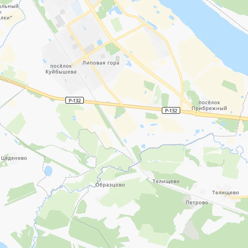

How to get from Stantsiya Telishchevo (Jaroslavl) to Pereslavl’-Zalesskiy (Jaroslavl)
Calculate route from Stantsiya Telishchevo (Jaroslavl, Russia) to Pereslavl’-Zalesskiy (Jaroslavl, Russia).
The flight distance (as the crow flies) between Stantsiya Telishchevo and Pereslavl’-Zalesskiy is 110.1 km.
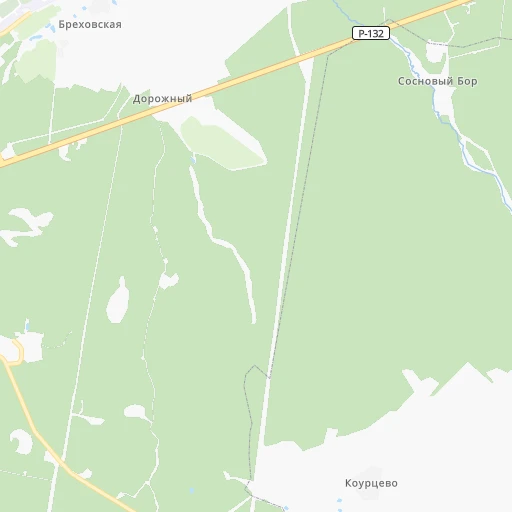
Roadmap (route) to go from Stantsiya Telishchevo to Pereslavl’-Zalesskiy detailed above, you can also see the course layout on the map.
While doing trip Stantsiya Telishchevo - Pereslavl’-Zalesskiy by car, the calculated route ends at a distance , or more straight.
Distance and duration of the route between Stantsiya Telishchevo and Pereslavl’-Zalesskiy
Calculation of distance and route from Pereslavl’-Zalesskiy to Stantsiya Telishchevo :
110.1125.4 km2h53mn
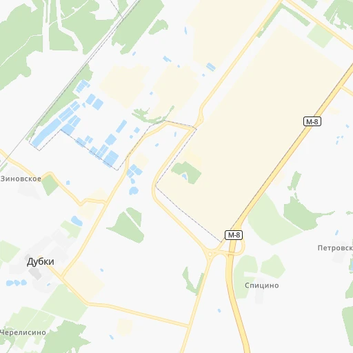
Continue 0h2mn 940 mTurn right 0h3mn 1.7 kmTurn left onto Костромское шоссе 0h6mn 7.6 kmKeep left and take М-8 toward Москва 1h3mn 72.1 kmContinue onto Советская улица 1h33mn 38.0 kmContinue onto 78К-0043 0h6mn 5.0 kmArrive at destination 0h0mn 0 m
Travel from Stantsiya Telishchevo (Jaroslavl) to a selection of major cities.
Distances from Stantsiya Telishchevo to biggest cities in Jaroslavl
Other major cities in country :
- Barnaul [04], 599,579 inhabitants. 2,754 km
- Vladivostok [59], 587,022 inhabitants. 6,201 km
- Irkutsk [20], 586,695 inhabitants. 4,000 km
- Khabarovsk [30], 579,000 inhabitants. 5,915 km
- Khabarovsk Vtoroy [30], 578,303 inhabitants. 5,921 km
- Orenburg [55], 550,204 inhabitants. 1,163 km
- Novokuznetsk [29], 539,616 inhabitants. 2,931 km
- Ryazan' [62], 520,173 inhabitants. 323 km
- Tyumen [78], 519,119 inhabitants. 1,527 km
- Lipetsk [43], 515,655 inhabitants. 549 km
- Penza [57], 512,602 inhabitants. 577 km
- Naberezhnyye Chelny [73], 509,870 inhabitants. 787 km
- Kalininskiy [42], 504,641 inhabitants. 616 km
- Astrakhan [07], 502,533 inhabitants. 1,360 km
- Makhachkala [17], 497,959 inhabitants. 1,704 km
- Tomsk [75], 485,519 inhabitants. 2,680 km
- Kemerovo [29], 477,090 inhabitants. 2,794 km
- Tula [76], 468,825 inhabitants. 399 km
- Kirov [33], 457,383 inhabitants. 583 km
- Cheboksary [16], 446,781 inhabitants. 470 km
Route from Pereslavl’-Zalesskiy to major cities (Russia).
- Distance Pereslavl’-Zalesskiy Moscow134 km
- Distance Pereslavl’-Zalesskiy Saint Petersburg612 km
- Distance Pereslavl’-Zalesskiy Novosibirsk2,710 km
- Distance Pereslavl’-Zalesskiy Yekaterinburg1,321 km
- Distance Pereslavl’-Zalesskiy Nizhniy Novgorod319 km
- Distance Pereslavl’-Zalesskiy Samara821 km
- Distance Pereslavl’-Zalesskiy Omsk2,142 km
- Distance Pereslavl’-Zalesskiy Kazan643 km
- Distance Pereslavl’-Zalesskiy Rostov-na-Donu1,060 km
- Distance Pereslavl’-Zalesskiy Chelyabinsk1,412 km
- Distance Pereslavl’-Zalesskiy Ufa1,092 km
- Distance Pereslavl’-Zalesskiy Volgograd970 km
- Distance Pereslavl’-Zalesskiy Perm1,050 km
- Distance Pereslavl’-Zalesskiy Krasnoyarsk3,243 km
- Distance Pereslavl’-Zalesskiy Saratov742 km
- Distance Pereslavl’-Zalesskiy Voronezh564 km
- Distance Pereslavl’-Zalesskiy Tol'yatti756 km
- Distance Pereslavl’-Zalesskiy Krasnodar1,302 km
- Distance Pereslavl’-Zalesskiy Ulyanovsk657 km
- Distance Pereslavl’-Zalesskiy Izhevsk873 km
Nearest cities to Stantsiya Telishchevo :
- Moscow, 10,381,222 inhabitants. 244 km
- Yaroslavl, 606,730 inhabitants. 12 km
- Ryazan', 520,173 inhabitants. 323 km
- Ivanovo, 420,839 inhabitants. 85 km
- Cherepovets, 315,738 inhabitants. 215 km
- Vologda, 314,900 inhabitants. 189 km
- Vladimir, 310,024 inhabitants. 157 km
- Kostroma, 277,656 inhabitants. 63 km
- Mar'ino, 243,000 inhabitants. 250 km
- Khimki, 239,967 inhabitants. 238 km
- Rybinsk, 216,724 inhabitants. 88 km
- Vykhino-Zhulebino, 216,000 inhabitants. 242 km
- Zelenograd, 215,727 inhabitants. 242 km
- Severnyy, 200,000 inhabitants. 230 km
- Korolyov, 183,402 inhabitants. 222 km
- Yasenevo, 180,000 inhabitants. 261 km
- Podolsk, 179,400 inhabitants. 277 km
- Lyublino, 172,000 inhabitants. 246 km
- Mytishchi, 160,542 inhabitants. 226 km
- Bibirevo, 159,000 inhabitants. 233 km
- Khoroshevo-Mnevniki, 159,000 inhabitants. 247 km
- Gol'yanovo, 158,000 inhabitants. 231 km
- Lyubertsy, 154,650 inhabitants. 242 km
- Kovrov, 154,224 inhabitants. 154 km
- Strogino, 152,000 inhabitants. 246 km
- Balashikha, 150,103 inhabitants. 227 km
- Zhulebino, 150,000 inhabitants. 241 km
- Kolomna, 147,690 inhabitants. 282 km
- Elektrostal', 144,387 inhabitants. 215 km
- Orekhovo-Borisovo, 144,000 inhabitants. 253 km
- Biryulevo, 144,000 inhabitants. 258 km
- Kuz'minki, 143,000 inhabitants. 243 km
- Novyye Kuz'minki, 143,000 inhabitants. 244 km
- Chertanovo Yuzhnoye, 142,000 inhabitants. 260 km
- Zheleznodorozhnyy, 141,648 inhabitants. 232 km
- Korolev, 139,798 inhabitants. 222 km
- Odintsovo, 137,041 inhabitants. 263 km
- Ramenki, 130,000 inhabitants. 253 km
- Zyablikovo, 129,000 inhabitants. 252 km
- Serpukhov, 128,158 inhabitants. 331 km
- Ivanovskoye, 128,000 inhabitants. 235 km
- Orekhovo-Borisovo Severnoye, 128,000 inhabitants. 255 km
- Murom, 126,931 inhabitants. 252 km
- Tyoply Stan, 125,000 inhabitants. 261 km
- Tsaritsyno, 123,000 inhabitants. 255 km
- Presnenskiy, 122,000 inhabitants. 247 km
- Veshnyaki, 122,000 inhabitants. 240 km
- Zyuzino, 121,000 inhabitants. 255 km
- Orekhovo-Zuyevo, 120,000 inhabitants. 201 km
- Solntsevo, 120,000 inhabitants. 263 km
Location Stantsiya Telishchevo (Jaroslavl) :
| Country flag |  |
| Location | Stantsiya Telishchevo |
| State | Jaroslavl |
| County | |
| Country | Russia |
| Country code / ISO 2 | RU |
| Latitude | 57.5280600 |
| Longitude | 39.9612300 |
| Altitude | 0 meters |
| Time zone | Europe/Moscow |
Location Pereslavl’-Zalesskiy (Jaroslavl) :
| Country flag | |
| Location | Pereslavl’-Zalesskiy |
| State | Jaroslavl |
| County | |
| Country | Russia |
| Country code / ISO 2 | RU |
| Latitude | 56.7393400 |
| Longitude | 38.8562600 |
| Altitude | 0 meters |
| Time zone | Europe/Moscow |
