
Home
››
Edinburg Rio Grande Valley Regional Freight Terminal Airport
››
Roadmap from Edinburg Rio Grande Valley Regional Freight Terminal Airport to Rockport
How to get from Edinburg Rio Grande Valley Regional Freight Terminal (airport) (Texas) to Rockport (Texas)
Calculate route from Edinburg Rio Grande Valley Regional Freight Terminal (airport) (Texas, United States) to Rockport (Texas, United States).
The flight distance (as the crow flies) between Edinburg Rio Grande Valley Regional Freight Terminal (airport) and Rockport is 205.0 km.
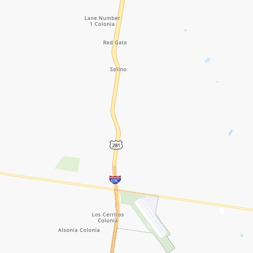
Roadmap (route) to go from Edinburg Rio Grande Valley Regional Freight Terminal Airport to Rockport detailed above, you can also see the course layout on the map.
While doing trip Edinburg Rio Grande Valley Regional Freight Terminal (airport) - Rockport by car, the calculated route ends at a distance , or more straight.
Distance and duration of the route between Edinburg Rio Grande Valley Regional Freight Terminal (airport) and Rockport
Calculation of distance and route from Rockport to Edinburg Rio Grande Valley Regional Freight Terminal (airport) :
205.0261.6 km3h58mn
Continue 0h0mn 71 mTurn left onto return road 0h0mn 151 mTurn right 0h0mn 15 mTurn sharp left 0h1mn 251 mTurn right onto North Expressway 281 1h54mn 91.6 kmContinue onto US 281 0h7mn 8.5 kmKeep right onto US 281 0h19mn 24.2 kmKeep right 0h1mn 665 mTurn right onto TX 141 0h13mn 20.3 kmKeep left onto West Santa Gertrudis Street 0h2mn 1.3 kmAt roundabout, take exit 2 onto West Santa Gertrudis Street 0h2mn 1.5 kmTurn left onto North 6th Street 0h1mn 1.0 kmKeep right onto East Corral Avenue 0h2mn 2.3 kmTurn left onto North US Highway 77 Bypass 0h20mn 33.5 kmKeep right and take TX 44 East toward Robstown, Corpus Christi 0h2mn 1.6 kmKeep right 0h0mn 62 mTurn slight right onto East State Highway 44 0h10mn 16.3 kmKeep right and drive toward Agnes Street 0h1mn 1.0 kmKeep right 0h4mn 4.2 kmTurn left onto Old Robstown Road 0h2mn 1.5 kmTurn right onto Leopard Street 0h0mn 117 mKeep left onto Nueces Bay Boulevard 0h1mn 486 mTurn right 0h0mn 115 mKeep left 0h2mn 2.4 kmKeep right and take US 181, TX 35 toward Portland 0h10mn 16.4 kmKeep left onto TX 35 0h9mn 12.0 kmKeep right and take TX 35 Business, FM 1069 toward Aransas Pass 0h1mn 642 mContinue onto West Wheeler Avenue 0h0mn 472 mTurn left onto FM 1069 North 0h14mn 18.9 kmArrive at destination 0h0mn 0 m
Travel from Edinburg Rio Grande Valley Regional Freight Terminal (airport) (Texas) to a selection of major cities.
Distances from Edinburg Rio Grande Valley Regional Freight Terminal Airport to biggest cities in Texas
- Killeen,140,806 inhabitants.522 km
- McAllen,140,269 inhabitants.28 km
- Carrollton,133,168 inhabitants.735 km
- Midland,132,950 inhabitants.728 km
- Waco,132,356 inhabitants.577 km
- Denton,131,044 inhabitants.760 km
- Abilene,121,721 inhabitants.686 km
- Odessa,118,968 inhabitants.729 km
- Beaumont,118,129 inhabitants.566 km
- Round Rock,115,997 inhabitants.455 km
- Richardson,110,815 inhabitants.737 km
- Pearland,108,821 inhabitants.446 km
- College Station,107,889 inhabitants.498 km
- Wichita Falls,104,710 inhabitants.832 km
- Lewisville,104,039 inhabitants.743 km
- Tyler,103,700 inhabitants.713 km
- San Angelo,100,450 inhabitants.602 km
- Alief,98,725 inhabitants.441 km
- League City,98,312 inhabitants.453 km
- Allen,98,143 inhabitants.755 km
Other major cities in country :
- Memphis [TN], 655,770 inhabitants. 1,239 km
- New South Memphis [TN], 641,608 inhabitants. 1,233 km
- Portland [OR], 632,309 inhabitants. 3,043 km
- Oklahoma City [OK], 631,346 inhabitants. 1,006 km
- Las Vegas [NV], 623,747 inhabitants. 1,942 km
- Baltimore [MD], 621,849 inhabitants. 2,458 km
- Washington, D.C. [DC], 601,723 inhabitants. 2,404 km
- Milwaukee [WI], 600,155 inhabitants. 2,067 km
- South Boston [MA], 571,281 inhabitants. 3,031 km
- Albuquerque [NM], 559,121 inhabitants. 1,260 km
- Tucson [AZ], 531,641 inhabitants. 1,397 km
- Nashville [TN], 530,852 inhabitants. 1,526 km
- Fresno [CA], 520,052 inhabitants. 2,343 km
- Sacramento [CA], 490,712 inhabitants. 2,565 km
- Kansas City [MO], 475,378 inhabitants. 1,447 km
- Long Beach [CA], 474,140 inhabitants. 2,092 km
- Mesa [AZ], 471,825 inhabitants. 1,530 km
- Staten Island [NY], 468,730 inhabitants. 2,711 km
- Atlanta [GA], 463,878 inhabitants. 1,551 km
- Colorado Springs [CO], 456,568 inhabitants. 1,514 km
Route from Rockport to major cities (United States).
- Distance Rockport New York City2,534 km
- Distance Rockport Los Angeles2,125 km
- Distance Rockport Chicago1,760 km
- Distance Rockport Brooklyn2,535 km
- Distance Rockport Queens2,545 km
- Distance Rockport Philadelphia2,408 km
- Distance Rockport Phoenix1,557 km
- Distance Rockport Manhattan2,540 km
- Distance Rockport San Diego1,997 km
- Distance Rockport The Bronx2,551 km
- Distance Rockport San Jose2,538 km
- Distance Rockport Jacksonville1,518 km
- Distance Rockport San Francisco2,596 km
- Distance Rockport Columbus1,853 km
- Distance Rockport Indianapolis1,648 km
- Distance Rockport Charlotte1,730 km
- Distance Rockport Seattle3,087 km
- Distance Rockport Denver1,495 km
- Distance Rockport Detroit2,034 km
- Distance Rockport Boston2,835 km
Nearest cities to Edinburg Rio Grande Valley Regional Freight Terminal (airport) :
- San Antonio, 1,469,845 inhabitants. 334 km
- Corpus Christi, 324,074 inhabitants. 168 km
- Laredo, 255,473 inhabitants. 181 km
- Brownsville, 183,887 inhabitants. 87 km
- McAllen, 140,269 inhabitants. 28 km
- Edinburg, 84,497 inhabitants. 16 km
- Mission, 83,298 inhabitants. 32 km
- Pharr, 76,538 inhabitants. 28 km
- Victoria, 67,574 inhabitants. 286 km
- Harlingen, 65,774 inhabitants. 52 km
- Weslaco, 39,474 inhabitants. 34 km
- San Juan, 36,556 inhabitants. 28 km
- Del Rio, 36,153 inhabitants. 424 km
- Eagle Pass, 28,765 inhabitants. 344 km
- Lake Jackson, 27,533 inhabitants. 392 km
- Kingsville, 26,225 inhabitants. 123 km
- Alvin, 25,791 inhabitants. 437 km
- San Benito, 24,496 inhabitants. 61 km
- Angleton, 19,429 inhabitants. 403 km
- Alice, 19,408 inhabitants. 146 km
- Alamo, 19,246 inhabitants. 29 km
- Bay City, 17,598 inhabitants. 354 km
- Mercedes, 16,657 inhabitants. 39 km
- Donna, 16,523 inhabitants. 31 km
- Uvalde, 16,476 inhabitants. 349 km
- Portland, 16,116 inhabitants. 179 km
- Alton, 15,760 inhabitants. 25 km
- Rio Grande City, 14,404 inhabitants. 69 km
- Hidalgo, 13,709 inhabitants. 40 km
- Beeville, 13,277 inhabitants. 221 km
- Port Lavaca, 12,416 inhabitants. 284 km
- Freeport, 12,154 inhabitants. 391 km
- La Homa, 11,985 inhabitants. 32 km
- El Campo, 11,604 inhabitants. 357 km
- Robstown, 11,576 inhabitants. 157 km
- Clute, 11,444 inhabitants. 394 km
- Raymondville, 11,139 inhabitants. 35 km
- Rockport, 10,490 inhabitants. 205 km
- Roma, 10,223 inhabitants. 88 km
- Pearsall, 9,980 inhabitants. 289 km
- Lackland Air Force Base, 9,918 inhabitants. 331 km
- Pleasanton, 9,829 inhabitants. 283 km
- Roma-Los Saenz, 9,765 inhabitants. 88 km
- Ingleside, 9,695 inhabitants. 184 km
- Hondo, 9,119 inhabitants. 338 km
- Eidson Road, 8,960 inhabitants. 341 km
- Wharton, 8,726 inhabitants. 377 km
- Aransas Pass, 8,530 inhabitants. 190 km
- Crystal City, 7,496 inhabitants. 300 km
- Murillo Colonia, 7,344 inhabitants. 21 km
Location Edinburg Rio Grande Valley Regional Freight Terminal (airport) (Texas) :
| Country flag |  |
| Location | Edinburg Rio Grande Valley Regional Freight Terminal (airport) |
| State | Texas |
| County | Hidalgo County |
| Country | United States |
| Country code / ISO 2 | US |
| Latitude | 26.4422900 |
| Longitude | -98.1297300 |
| Altitude | 25 meters |
| Time zone | America/Chicago |
Location Rockport (Texas) :
| Country flag | |
| Location | Rockport |
| State | Texas |
| County | Aransas County |
| Country | United States |
| Country code / ISO 2 | US |
| Latitude | 28.0207700 |
| Longitude | -97.0560100 |
| Altitude | 2 meters |
| Time zone | America/Chicago |


