


How to get from Tipton Municipal (airport) (Oklahoma) to Claremore (Oklahoma)
Calculate route from Tipton Municipal (airport) (Oklahoma, United States) to Claremore (Oklahoma, United States).
The flight distance (as the crow flies) between Tipton Municipal (airport) and Claremore is 382.2 km.
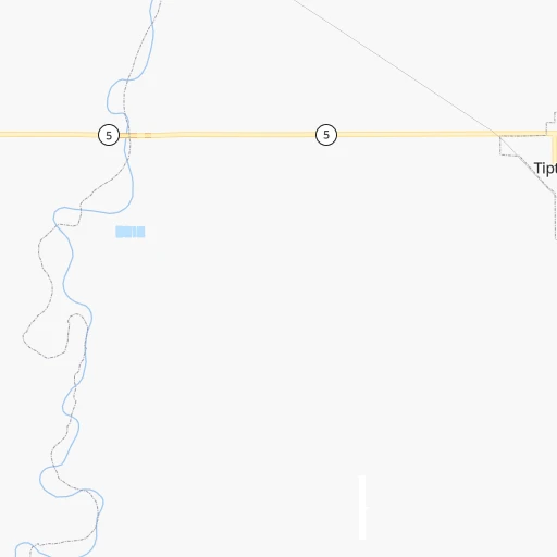
Roadmap (route) to go from Tipton Municipal Airport to Claremore detailed above, you can also see the course layout on the map.
While doing trip Tipton Municipal (airport) - Claremore by car, the calculated route ends at a distance , or more straight.
Distance and duration of the route between Tipton Municipal (airport) and Claremore
Calculation of distance and route from Claremore to Tipton Municipal (airport) :
382.2434.7 km5h48mn
Continue onto N2130 Road 0h11mn 5.3 kmTurn right onto OK 5 0h17mn 16.9 kmTurn left onto Mather Avenue 0h13mn 14.7 kmTurn right 1h32mn 42.1 kmKeep right onto US 62 0h1mn 1.5 kmContinue onto Northwest Rogers Lane 0h9mn 10.0 kmContinue onto Northeast Rogers Lane 0h0mn 144 mTurn sharp left onto Northeast Rogers Lane 0h0mn 52 mKeep right 1h18mn 133.6 kmKeep right onto Will Rogers Expressway and take I 44 East, OK 66 East toward Tulsa 0h13mn 19.2 kmKeep right onto I 44 and take I 44 Toll East toward Tulsa 2h38mn 169.6 kmKeep left onto OK 66 and take OK 66 East toward Catoosa, Claremore 0h17mn 21.5 kmTurn left onto West Will Rogers Boulevard 0h0mn 7 mArrive at destination 0h0mn 0 m
Travel from Tipton Municipal (airport) (Oklahoma) to a selection of major cities.
Distances from Tipton Municipal Airport to biggest cities in Oklahoma
Other major cities in country :
- Charlotte [NC], 827,097 inhabitants. 1,674 km
- Seattle [WA], 684,451 inhabitants. 2,418 km
- Denver [CO], 682,545 inhabitants. 782 km
- El Paso [TX], 681,124 inhabitants. 745 km
- Detroit [MI], 677,116 inhabitants. 1,653 km
- Boston [MA], 667,137 inhabitants. 2,591 km
- Memphis [TN], 655,770 inhabitants. 837 km
- New South Memphis [TN], 641,608 inhabitants. 836 km
- Portland [OR], 632,309 inhabitants. 2,340 km
- Las Vegas [NV], 623,747 inhabitants. 1,461 km
- Baltimore [MD], 621,849 inhabitants. 2,073 km
- Washington, D.C. [DC], 601,723 inhabitants. 2,031 km
- Milwaukee [WI], 600,155 inhabitants. 1,365 km
- South Boston [MA], 571,281 inhabitants. 2,591 km
- Albuquerque [NM], 559,121 inhabitants. 687 km
- Tucson [AZ], 531,641 inhabitants. 1,121 km
- Nashville [TN], 530,852 inhabitants. 1,140 km
- Fresno [CA], 520,052 inhabitants. 1,878 km
- Sacramento [CA], 490,712 inhabitants. 2,044 km
- Kansas City [MO], 475,378 inhabitants. 659 km
Route from Claremore to major cities (United States).
- Distance Claremore New York City1,940 km
- Distance Claremore Los Angeles2,069 km
- Distance Claremore Chicago923 km
- Distance Claremore Brooklyn1,943 km
- Distance Claremore Houston729 km
- Distance Claremore Queens1,953 km
- Distance Claremore Philadelphia1,832 km
- Distance Claremore Phoenix1,534 km
- Distance Claremore Manhattan1,944 km
- Distance Claremore San Antonio813 km
- Distance Claremore San Diego2,012 km
- Distance Claremore The Bronx1,953 km
- Distance Claremore Dallas408 km
- Distance Claremore San Jose2,337 km
- Distance Claremore Austin701 km
- Distance Claremore Jacksonville1,457 km
- Distance Claremore San Francisco2,379 km
- Distance Claremore Columbus1,176 km
- Distance Claremore Fort Worth429 km
- Distance Claremore Indianapolis913 km
Nearest cities to Tipton Municipal (airport) :
- Dallas, 1,300,092 inhabitants. 288 km
- Fort Worth, 833,319 inhabitants. 258 km
- Oklahoma City, 631,346 inhabitants. 188 km
- Arlington, 388,125 inhabitants. 271 km
- Plano, 283,558 inhabitants. 279 km
- Lubbock, 249,042 inhabitants. 266 km
- Garland, 236,897 inhabitants. 291 km
- Irving, 236,607 inhabitants. 276 km
- Amarillo, 198,645 inhabitants. 258 km
- Grand Prairie, 187,809 inhabitants. 277 km
- McKinney, 162,898 inhabitants. 275 km
- Frisco, 154,407 inhabitants. 261 km
- Mesquite, 144,788 inhabitants. 304 km
- Carrollton, 133,168 inhabitants. 270 km
- Midland, 132,950 inhabitants. 385 km
- Waco, 132,356 inhabitants. 375 km
- Denton, 131,044 inhabitants. 234 km
- Abilene, 121,721 inhabitants. 230 km
- Norman, 120,284 inhabitants. 180 km
- Richardson, 110,815 inhabitants. 282 km
- Wichita Falls, 104,710 inhabitants. 87 km
- Lewisville, 104,039 inhabitants. 256 km
- San Angelo, 100,450 inhabitants. 354 km
- Allen, 98,143 inhabitants. 276 km
- Lawton, 96,655 inhabitants. 73 km
- Edmond, 90,092 inhabitants. 204 km
- Flower Mound, 71,253 inhabitants. 250 km
- North Richland Hills, 69,204 inhabitants. 255 km
- Mansfield, 64,274 inhabitants. 283 km
- Moore, 60,451 inhabitants. 182 km
- Rowlett, 60,236 inhabitants. 297 km
- Midwest City, 57,249 inhabitants. 196 km
- Euless, 54,219 inhabitants. 265 km
- DeSoto, 52,486 inhabitants. 299 km
- Enid, 51,776 inhabitants. 245 km
- Grapevine, 51,404 inhabitants. 258 km
- Bedford, 49,337 inhabitants. 260 km
- Stillwater, 48,967 inhabitants. 266 km
- Cedar Hill, 48,507 inhabitants. 293 km
- Wylie, 46,708 inhabitants. 292 km
- Keller, 45,758 inhabitants. 246 km
- Haltom City, 44,206 inhabitants. 255 km
- Burleson, 43,625 inhabitants. 274 km
- Rockwall, 42,566 inhabitants. 303 km
- The Colony, 41,779 inhabitants. 261 km
- Coppell, 41,159 inhabitants. 261 km
- Sherman, 40,667 inhabitants. 253 km
- Duncanville, 39,826 inhabitants. 291 km
- Hurst, 39,016 inhabitants. 260 km
- Lancaster, 38,801 inhabitants. 306 km
Location Tipton Municipal (airport) (Oklahoma) :
| Country flag |  |
| Location | Tipton Municipal (airport) |
| State | Oklahoma |
| County | Tillman County |
| Country | United States |
| Country code / ISO 2 | US |
| Latitude | 34.4591700 |
| Longitude | -99.1701200 |
| Altitude | 380 meters |
| Time zone | America/Chicago |
Location Claremore (Oklahoma) :
| Country flag | |
| Location | Claremore |
| State | Oklahoma |
| County | Rogers County |
| Country | United States |
| Country code / ISO 2 | US |
| Latitude | 36.3126000 |
| Longitude | -95.6160900 |
| Altitude | 182 meters |
| Time zone | America/Chicago |
