

Home
››
Henderson Mounds E B G Airport
››
Roadmap from Henderson Mounds E B G Airport to Philadelphia
How to get from Henderson Mounds E B G (airport) (Missouri) to Philadelphia (Pennsylvania)
Calculate route from Henderson Mounds E B G (airport) (Missouri, United States) to Philadelphia (Pennsylvania, United States).
The flight distance (as the crow flies) between Henderson Mounds E B G (airport) and Philadelphia is 1,295.9 km.
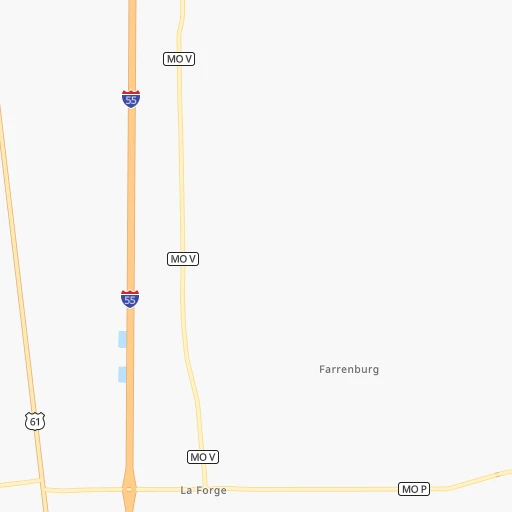
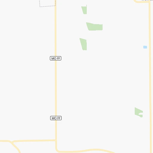
Roadmap (route) to go from Henderson Mounds E B G Airport to Philadelphia detailed above, you can also see the course layout on the map.
While doing trip Henderson Mounds E B G (airport) - Philadelphia by car, the calculated route ends at a distance , or more straight.
Distance and duration of the route between Henderson Mounds E B G (airport) and Philadelphia
Calculation of distance and route from Philadelphia to Henderson Mounds E B G (airport) :
1,295.91,520.9 km17h30mn
Continue 0h4mn 707 mTurn left onto County Road 716 0h3mn 1.6 kmTurn left onto County Road 713 0h7mn 3.3 kmTurn left onto County Road 714 0h0mn 134 mTurn right onto County Road 713 0h6mn 3.2 kmTurn right onto County Road 706 0h3mn 1.6 kmTurn left onto County Road 535 0h5mn 2.4 kmTurn right onto MO 80 0h15mn 18.6 kmTurn right 0h2mn 3.1 kmKeep right onto US 60 and take I 57 Business South, US 60 East , US 62, MO 77 toward Charleston, Wyatt 0h1mn 695 mTurn right onto US 60, US 62, MO 77 0h16mn 19.7 kmTurn right onto US 51, US 60, US 62 0h7mn 7.8 kmTurn right onto 4th Street 0h1mn 436 mTurn left onto Court Street 0h0mn 528 mKeep left onto Phillips Drive 0h21mn 26.7 kmContinue onto Blandville Road 0h10mn 13.6 kmKeep right and take I-24 East toward Nashville 0h1mn 790 mKeep left and drive toward Mayfield, Nashville 1h32mn 55.0 kmKeep right onto I 69 and take I 69 North toward Elizabethtown, Princeton 1h37mn 61.5 kmKeep right onto Western Kentucky Parkway and take I 169 South toward Hopkinsville 2h35mn 159.4 kmKeep right and take I 65 North toward Lexington, Louisville 0h1mn 596 mKeep left and take I 65 North toward Lexington, Louisville 1h32mn 54.2 kmKeep right and take I 265 East, KY 841 East toward Gene Snyder Freeway 0h21mn 32.2 kmKeep right and take KY 146 toward Anchorage, Pewee Valley 0h1mn 606 mKeep right 0h5mn 5.9 kmTurn left onto Dogwood Lane 0h0mn 60 mTurn right onto Lagrange Road 0h5mn 5.6 kmTurn left 0h0mn 7 mTurn right 1h56mn 95.2 kmKeep left onto I 71 and take I 75 North, I 71 North toward Cincinnati 0h21mn 31.7 kmKeep right onto I 71 and take I 71 North, US 50 East toward Columbus 2h40mn 160.8 kmKeep right onto South Freeway and take I 270 toward Stringtown Road, Grove City 0h0mn 165 mKeep left onto South Freeway toward I 270 0h1mn 1.4 kmKeep right toward I 270 East 0h13mn 19.4 kmKeep right and take I 70 West, US 40, I 70 East toward Columbus, Main Street, Wheeling 0h0mn 332 mKeep right and take I 70 East toward Wheeling 2h46mn 177.9 kmKeep right onto I 470 1h36mn 55.9 kmKeep right and take US 40 toward Chestnut Street 0h0mn 261 mKeep right toward US 40 0h3mn 2.4 kmKeep right 0h0mn 215 mTurn left onto West Beau Street 0h3mn 2.5 kmKeep right 0h0mn 51 mTurn slight right onto Clare Drive 0h0mn 66 mTurn left 0h2mn 3.1 kmContinue onto Dwight D Eisenhower Highway 0h23mn 30.2 kmKeep right and drive toward Speers 0h14mn 18.1 kmKeep right and take PA 31 toward Mount Pleasant, West Newton 0h0mn 424 mKeep right 0h0mn 78 mTurn slight right onto Mount Pleasant Road 0h27mn 29.7 kmKeep left 0h0mn 248 mTurn left 0h0mn 159 mKeep right 4h47mn 380.1 kmKeep right onto I 76 and take I 76 East toward Philadelphia, Valley Forge 0h14mn 18.7 kmKeep right and drive toward Green Lane, Belmont Avenue 0h0mn 305 mTurn right onto Belmont Avenue 0h5mn 4.7 kmTurn left onto Montgomery Drive 0h1mn 633 mKeep right toward I 76 East 0h3mn 3.9 kmKeep left onto Vine Street Expressway and take I 676 East, US 30 East toward Central Philadelphia 0h1mn 1.3 kmKeep right and drive toward Central Philadelphia 0h0mn 222 mKeep right and drive toward 15th Street, Central Philadelphia 0h0mn 95 mTurn right onto North 15th Street 0h1mn 722 mKeep left onto South Penn Square 0h0mn 49 mArrive at destination 0h0mn 0 m
Travel from Henderson Mounds E B G (airport) (Pennsylvania) to a selection of major cities.
Distances from Henderson Mounds E B G Airport to biggest cities in Missouri
- University City,35,058 inhabitants.229 km
- Ballwin,30,577 inhabitants.231 km
- Liberty,30,450 inhabitants.518 km
- Raytown,29,401 inhabitants.508 km
- Mehlville,28,380 inhabitants.214 km
- Kirkwood,27,750 inhabitants.225 km
- Maryland Heights,27,389 inhabitants.239 km
- Gladstone,26,861 inhabitants.526 km
- Hazelwood,25,661 inhabitants.243 km
- Grandview,25,256 inhabitants.507 km
- Webster Groves,23,177 inhabitants.224 km
- Belton,23,168 inhabitants.504 km
- Sedalia,21,516 inhabitants.399 km
- Arnold,21,357 inhabitants.208 km
- Ferguson,21,059 inhabitants.238 km
- Nixa,20,984 inhabitants.343 km
- Raymore,20,374 inhabitants.497 km
- Affton,20,307 inhabitants.219 km
- Rolla,20,019 inhabitants.247 km
Other major cities in country :
- Charlotte [NC], 827,097 inhabitants. 794 km
- Seattle [WA], 684,451 inhabitants. 2,943 km
- Denver [CO], 682,545 inhabitants. 1,397 km
- El Paso [TX], 681,124 inhabitants. 1,658 km
- Detroit [MI], 677,116 inhabitants. 833 km
- Boston [MA], 667,137 inhabitants. 1,696 km
- Memphis [TN], 655,770 inhabitants. 182 km
- New South Memphis [TN], 641,608 inhabitants. 188 km
- Portland [OR], 632,309 inhabitants. 2,928 km
- Oklahoma City [OK], 631,346 inhabitants. 737 km
- Las Vegas [NV], 623,747 inhabitants. 2,293 km
- Baltimore [MD], 621,849 inhabitants. 1,162 km
- Washington, D.C. [DC], 601,723 inhabitants. 1,119 km
- Milwaukee [WI], 600,155 inhabitants. 717 km
- South Boston [MA], 571,281 inhabitants. 1,696 km
- Albuquerque [NM], 559,121 inhabitants. 1,558 km
- Tucson [AZ], 531,641 inhabitants. 2,027 km
- Nashville [TN], 530,852 inhabitants. 247 km
- Fresno [CA], 520,052 inhabitants. 2,693 km
- Sacramento [CA], 490,712 inhabitants. 2,817 km
Route from Philadelphia to major cities (United States).
- Distance Philadelphia New York City130 km
- Distance Philadelphia Los Angeles3,848 km
- Distance Philadelphia Chicago1,071 km
- Distance Philadelphia Brooklyn129 km
- Distance Philadelphia Houston2,158 km
- Distance Philadelphia Queens139 km
- Distance Philadelphia Phoenix3,348 km
- Distance Philadelphia Manhattan137 km
- Distance Philadelphia San Antonio2,425 km
- Distance Philadelphia San Diego3,815 km
- Distance Philadelphia The Bronx149 km
- Distance Philadelphia Dallas2,091 km
- Distance Philadelphia San Jose4,027 km
- Distance Philadelphia Austin2,312 km
- Distance Philadelphia Jacksonville1,222 km
- Distance Philadelphia San Francisco4,055 km
- Distance Philadelphia Columbus668 km
- Distance Philadelphia Fort Worth2,136 km
- Distance Philadelphia Indianapolis939 km
- Distance Philadelphia Charlotte726 km
Nearest cities to Henderson Mounds E B G (airport) :
- Memphis, 655,770 inhabitants. 182 km
- New South Memphis, 641,608 inhabitants. 188 km
- Nashville, 530,852 inhabitants. 247 km
- St. Louis, 315,685 inhabitants. 223 km
- Little Rock, 197,992 inhabitants. 336 km
- Huntsville, 190,582 inhabitants. 341 km
- Clarksville, 149,176 inhabitants. 189 km
- Evansville, 119,943 inhabitants. 220 km
- Columbia, 119,108 inhabitants. 355 km
- O'Fallon, 85,040 inhabitants. 258 km
- Bloomington, 84,067 inhabitants. 376 km
- Jonesboro, 73,907 inhabitants. 147 km
- Franklin, 72,639 inhabitants. 249 km
- Jackson, 66,975 inhabitants. 135 km
- North Little Rock, 66,504 inhabitants. 333 km
- Saint Charles, 65,794 inhabitants. 248 km
- Conway, 64,980 inhabitants. 324 km
- Terre Haute, 60,825 inhabitants. 356 km
- Owensboro, 59,042 inhabitants. 240 km
- Bartlett, 58,579 inhabitants. 172 km
- Hendersonville, 56,018 inhabitants. 258 km
- Decatur, 55,437 inhabitants. 324 km
- Southaven, 52,589 inhabitants. 198 km
- Saint Peters, 52,575 inhabitants. 254 km
- Florissant, 52,268 inhabitants. 244 km
- Collierville, 48,863 inhabitants. 187 km
- Chesterfield, 47,864 inhabitants. 239 km
- Madison, 46,962 inhabitants. 332 km
- Smyrna, 46,607 inhabitants. 276 km
- Pine Bluff, 44,772 inhabitants. 360 km
- Jefferson City, 43,169 inhabitants. 317 km
- Belleville, 42,034 inhabitants. 207 km
- Brentwood, 41,763 inhabitants. 252 km
- Florence, 40,026 inhabitants. 267 km
- Cape Girardeau, 39,462 inhabitants. 67 km
- Germantown, 39,240 inhabitants. 183 km
- Columbia, 36,800 inhabitants. 250 km
- Oakville, 36,143 inhabitants. 210 km
- Spring Hill, 36,055 inhabitants. 251 km
- Olive Branch, 36,010 inhabitants. 197 km
- Wildwood, 35,899 inhabitants. 234 km
- East Florence, 35,733 inhabitants. 268 km
- Tupelo, 35,680 inhabitants. 281 km
- Wentzville, 35,603 inhabitants. 264 km
- University City, 35,058 inhabitants. 229 km
- La Vergne, 34,794 inhabitants. 270 km
- Hopkinsville, 32,205 inhabitants. 177 km
- Mount Juliet, 31,540 inhabitants. 270 km
- Brentwood Estates, 31,279 inhabitants. 252 km
- Ballwin, 30,577 inhabitants. 231 km
Location Henderson Mounds E B G (airport) (Missouri) :
| Country flag |  |
| Location | Henderson Mounds E B G (airport) |
| State | Missouri |
| County | New Madrid County |
| Country | United States |
| Country code / ISO 2 | US |
| Latitude | 36.7096900 |
| Longitude | -89.4637100 |
| Altitude | 89 meters |
| Time zone | America/Chicago |
Location Philadelphia (Pennsylvania) :
| Country flag | |
| Location | Philadelphia |
| State | Pennsylvania |
| County | Philadelphia County |
| Country | United States |
| Country code / ISO 2 | US |
| Latitude | 39.9523300 |
| Longitude | -75.1637900 |
| Altitude | 12 meters |
| Time zone | America/New_York |


