

How to get from Ragged Island (airport) (Maryland) to Astoria (New York)
Calculate route from Ragged Island (airport) (Maryland, United States) to Astoria (New York, United States).
The flight distance (as the crow flies) between Ragged Island (airport) and Astoria is 319.0 km.
Roadmap (route) to go from Ragged Island Airport to Astoria detailed above, you can also see the course layout on the map.
While doing trip Ragged Island (airport) - Astoria by car, the calculated route ends at a distance , or more straight.
Distance and duration of the route between Ragged Island (airport) and Astoria
Calculation of distance and route from Astoria to Ragged Island (airport) :
319.0375.3 km5h40mn
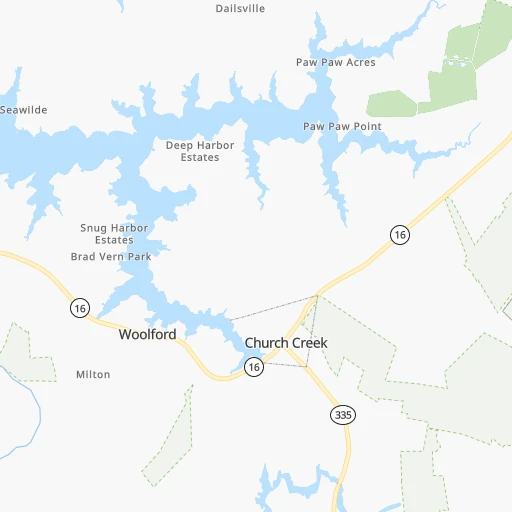
Continue 0h1mn 437 mTurn right onto Ragged Point Road 0h6mn 2.9 kmTurn right onto Hills Point Road 0h6mn 3.1 kmTurn slight left onto Hudson Road 0h18mn 17.5 kmTurn left onto High Street 0h1mn 846 mTurn right onto Gay Street 0h0mn 154 mTurn left onto Race Street 0h0mn 6 mTurn right onto Gay Street 0h0mn 112 mTurn right onto Muse Street 0h1mn 1.1 kmTurn left onto Sunburst Highway 1h35mn 44.8 kmKeep right toward MD 213 North 0h0mn 83 mTurn slight right onto Centreville Road 0h6mn 6.6 kmKeep right toward US 301 North 1h58mn 81.8 kmKeep left onto US 13 and take US 13 North toward New Castle, New Jersey, New York 0h9mn 11.3 kmKeep right onto US 40 and take I 295 North, US 40 East toward Delaware Memorial Bridge, New Jersey, New York 0h6mn 7.3 kmKeep left onto New Jersey Turnpike and drive toward NJ Turnpike, Atlantic City 0h3mn 4.0 kmKeep left 1h48mn 75.7 kmKeep right onto New Jersey Turnpike 1h57mn 90.7 kmKeep right onto New Jersey Turnpike Eastern Spur 0h6mn 10.1 kmKeep right and take NJ 495 East toward Lincoln Tunnel 0h4mn 5.1 kmKeep right onto Lincoln Tunnel 0h3mn 2.6 kmKeep right and drive toward Dyer Avenue 0h0mn 81 mKeep right and drive toward 36th Street, Downtown, Madison Square Garden 0h0mn 208 mTurn left onto West 36th Street 0h3mn 2.1 kmKeep left and take I 495 toward Queens-Midtown Tunnel 0h2mn 2.3 kmKeep right and take NY 25A East toward 21st Street, Long Island City 0h0mn 85 mKeep right and take NY 25A East toward 21st Street, Long Island City 0h0mn 170 mKeep right onto 21st Street and take NY 25A East toward 21st Street 0h0mn 353 mContinue onto 21st Street 0h3mn 3.3 kmTurn left onto 30th Avenue 0h0mn 344 mTurn sharp right onto 12th Street 0h0mn 118 mArrive at destination 0h0mn 0 m
Travel from Ragged Island (airport) (New York) to a selection of major cities.
Distances from Ragged Island Airport to biggest cities in Maryland
- North Bethesda,43,828 inhabitants.92 km
- Catonsville,41,567 inhabitants.91 km
- Hagerstown,40,432 inhabitants.175 km
- Annapolis,39,474 inhabitants.52 km
- Essex,39,262 inhabitants.87 km
- Hanover,38,088 inhabitants.82 km
- Woodlawn,37,879 inhabitants.96 km
- Severna Park,37,634 inhabitants.64 km
- Odenton,37,132 inhabitants.71 km
- Saint Charles,36,376 inhabitants.58 km
- Clinton,35,970 inhabitants.60 km
- Oxon Hill-Glassmanor,35,355 inhabitants.67 km
- North Bel Air,33,925 inhabitants.112 km
- Olney,33,844 inhabitants.97 km
- Suitland-Silver Hill,33,515 inhabitants.66 km
- Chillum,33,513 inhabitants.78 km
- St. Charles,33,379 inhabitants.57 km
- Salisbury,32,899 inhabitants.62 km
- Randallstown,32,430 inhabitants.103 km
- College Park,32,301 inhabitants.76 km
Other major cities in country :
- Charlotte [NC], 827,097 inhabitants. 549 km
- Seattle [WA], 684,451 inhabitants. 3,818 km
- Denver [CO], 682,545 inhabitants. 2,472 km
- El Paso [TX], 681,124 inhabitants. 2,837 km
- Detroit [MI], 677,116 inhabitants. 712 km
- Boston [MA], 667,137 inhabitants. 613 km
- Memphis [TN], 655,770 inhabitants. 1,282 km
- New South Memphis [TN], 641,608 inhabitants. 1,285 km
- Portland [OR], 632,309 inhabitants. 3,859 km
- Oklahoma City [OK], 631,346 inhabitants. 1,915 km
- Las Vegas [NV], 623,747 inhabitants. 3,423 km
- Washington, D.C. [DC], 601,723 inhabitants. 77 km
- Milwaukee [WI], 600,155 inhabitants. 1,099 km
- South Boston [MA], 571,281 inhabitants. 612 km
- Albuquerque [NM], 559,121 inhabitants. 2,722 km
- Tucson [AZ], 531,641 inhabitants. 3,203 km
- Nashville [TN], 530,852 inhabitants. 966 km
- Fresno [CA], 520,052 inhabitants. 3,803 km
- Sacramento [CA], 490,712 inhabitants. 3,895 km
- Kansas City [MO], 475,378 inhabitants. 1,586 km
Route from Astoria to major cities (United States).
- Distance Astoria Los Angeles3,946 km
- Distance Astoria Chicago1,152 km
- Distance Astoria Houston2,292 km
- Distance Astoria Philadelphia139 km
- Distance Astoria Phoenix3,454 km
- Distance Astoria San Antonio2,556 km
- Distance Astoria San Diego3,918 km
- Distance Astoria Dallas2,217 km
- Distance Astoria San Jose4,112 km
- Distance Astoria Austin2,443 km
- Distance Astoria Jacksonville1,355 km
- Distance Astoria San Francisco4,139 km
- Distance Astoria Columbus774 km
- Distance Astoria Fort Worth2,261 km
- Distance Astoria Indianapolis1,044 km
- Distance Astoria Charlotte865 km
- Distance Astoria Seattle3,872 km
- Distance Astoria Denver2,627 km
- Distance Astoria El Paso3,069 km
- Distance Astoria Detroit779 km
Nearest cities to Ragged Island (airport) :
- New York City, 8,175,133 inhabitants. 311 km
- Brooklyn, 2,300,664 inhabitants. 308 km
- Queens, 2,272,771 inhabitants. 317 km
- Philadelphia, 1,567,442 inhabitants. 184 km
- Manhattan, 1,487,536 inhabitants. 319 km
- The Bronx, 1,385,108 inhabitants. 330 km
- Baltimore, 621,849 inhabitants. 89 km
- Washington, D.C., 601,723 inhabitants. 77 km
- Staten Island, 468,730 inhabitants. 290 km
- Virginia Beach, 452,745 inhabitants. 190 km
- Raleigh, 451,066 inhabitants. 373 km
- West Raleigh, 338,759 inhabitants. 373 km
- Newark, 281,944 inhabitants. 304 km
- Jersey City, 264,290 inhabitants. 308 km
- Durham, 257,636 inhabitants. 366 km
- Norfolk, 246,393 inhabitants. 188 km
- Chesapeake, 235,429 inhabitants. 192 km
- Richmond, 220,289 inhabitants. 151 km
- Jamaica, 216,866 inhabitants. 320 km
- Arlington, 207,627 inhabitants. 81 km
- Yonkers, 201,116 inhabitants. 335 km
- Newport News, 182,385 inhabitants. 163 km
- Harlem, 181,259 inhabitants. 322 km
- East Flatbush, 178,464 inhabitants. 310 km
- East New York, 173,198 inhabitants. 313 km
- Cary, 159,769 inhabitants. 378 km
- Alexandria, 153,511 inhabitants. 73 km
- Washington Heights, 152,613 inhabitants. 326 km
- Astoria, 150,165 inhabitants. 320 km
- Borough Park, 149,248 inhabitants. 304 km
- East Hampton, 147,993 inhabitants. 167 km
- Paterson, 147,754 inhabitants. 320 km
- Hampton, 136,454 inhabitants. 168 km
- Elizabeth, 129,007 inhabitants. 295 km
- Stamford, 128,874 inhabitants. 365 km
- Sunset Park, 126,000 inhabitants. 304 km
- Sheepshead Bay, 122,534 inhabitants. 304 km
- North Stamford, 121,230 inhabitants. 372 km
- Allentown, 120,207 inhabitants. 240 km
- East Harlem, 115,921 inhabitants. 321 km
- Elmhurst, 113,364 inhabitants. 319 km
- Bushwick, 112,620 inhabitants. 314 km
- Gravesend, 112,229 inhabitants. 303 km
- Corona, 109,698 inhabitants. 321 km
- Edison, 102,548 inhabitants. 272 km
- Columbia, 99,615 inhabitants. 92 km
- Portsmouth Heights, 99,049 inhabitants. 191 km
- Richmond Hill, 98,984 inhabitants. 319 km
- Portsmouth, 96,201 inhabitants. 190 km
- Fordham, 94,678 inhabitants. 329 km
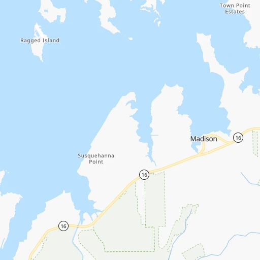
Location Ragged Island (airport) (Maryland) :
| Country flag |  |
| Location | Ragged Island (airport) |
| State | Maryland |
| County | Dorchester County |
| Country | United States |
| Country code / ISO 2 | US |
| Latitude | 38.5396600 |
| Longitude | -76.2756000 |
| Altitude | 1 meters |
| Time zone | America/New_York |
Location Astoria (New York) :
| Country flag | |
| Location | Astoria |
| State | New York |
| County | Queens County |
| Country | United States |
| Country code / ISO 2 | US |
| Latitude | 40.7720500 |
| Longitude | -73.9301400 |
| Altitude | 7 meters |
| Time zone | America/New_York |


