
Home
››
Alexandria Esler Regional Airport
››
Roadmap from Alexandria Esler Regional Airport to Opelousas
How to get from Alexandria Esler Regional (airport) (Louisiana) to Opelousas (Louisiana)
Calculate route from Alexandria Esler Regional (airport) (Louisiana, United States) to Opelousas (Louisiana, United States).
The flight distance (as the crow flies) between Alexandria Esler Regional (airport) and Opelousas is 97.9 km.
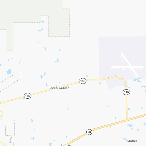
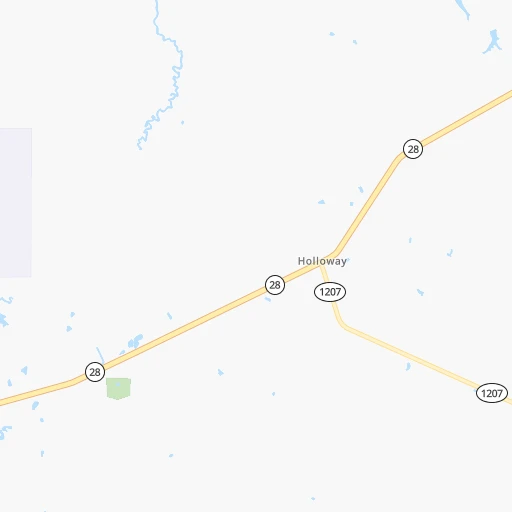
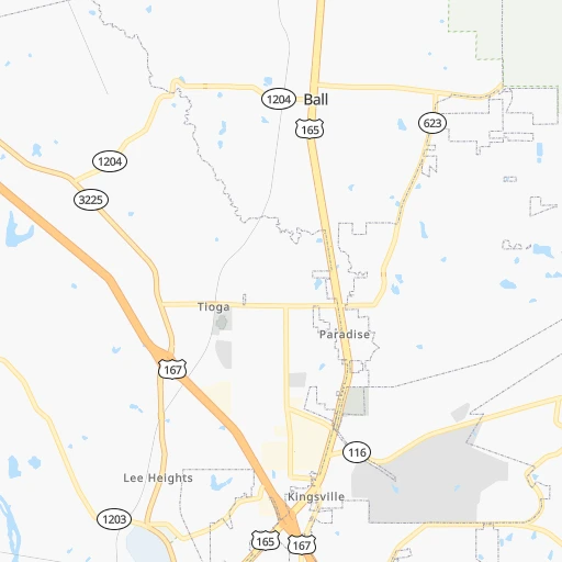
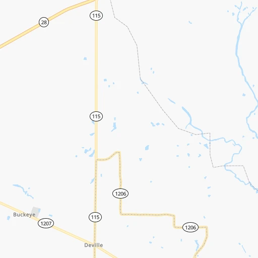
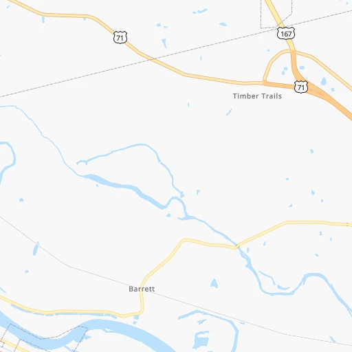
Roadmap (route) to go from Alexandria Esler Regional Airport to Opelousas detailed above, you can also see the course layout on the map.
While doing trip Alexandria Esler Regional (airport) - Opelousas by car, the calculated route ends at a distance , or more straight.
Distance and duration of the route between Alexandria Esler Regional (airport) and Opelousas
Calculation of distance and route from Opelousas to Alexandria Esler Regional (airport) :
97.9122.9 km1h26mn
Continue 0h1mn 252 mTurn left 0h0mn 143 mTurn right 0h1mn 191 mTurn right onto Lee Bridge Road 0h0mn 173 mTurn sharp left onto Esler Field Road 0h2mn 2.4 kmTurn right onto LA 28 0h11mn 12.3 kmTurn left onto LA 28 0h3mn 4.2 kmKeep left onto US 167 0h4mn 6.8 kmKeep right onto US 167, US 71 BYP toward US 71 South, US 167 South 0h19mn 22.9 kmTurn right onto US 167 0h4mn 4.5 kmTurn sharp left 1h37mn 66.6 kmKeep right 0h1mn 818 mKeep right 0h1mn 1.4 kmTurn right onto South Union Street 0h0mn 118 mTurn left onto East Bellevue Street 0h0mn 71 mTurn left onto South Main Street 0h0mn 48 mArrive at destination 0h0mn 0 m
Travel from Alexandria Esler Regional (airport) (Louisiana) to a selection of major cities.
Distances from Alexandria Esler Regional Airport to biggest cities in Louisiana
Other major cities in country :
- Charlotte [NC], 827,097 inhabitants. 1,147 km
- Seattle [WA], 684,451 inhabitants. 3,117 km
- Denver [CO], 682,545 inhabitants. 1,475 km
- El Paso [TX], 681,124 inhabitants. 1,346 km
- Detroit [MI], 677,116 inhabitants. 1,468 km
- Boston [MA], 667,137 inhabitants. 2,241 km
- Memphis [TN], 655,770 inhabitants. 467 km
- New South Memphis [TN], 641,608 inhabitants. 461 km
- Portland [OR], 632,309 inhabitants. 3,053 km
- Oklahoma City [OK], 631,346 inhabitants. 664 km
- Las Vegas [NV], 623,747 inhabitants. 2,174 km
- Baltimore [MD], 621,849 inhabitants. 1,670 km
- Washington, D.C. [DC], 601,723 inhabitants. 1,617 km
- Milwaukee [WI], 600,155 inhabitants. 1,353 km
- South Boston [MA], 571,281 inhabitants. 2,240 km
- Albuquerque [NM], 559,121 inhabitants. 1,397 km
- Tucson [AZ], 531,641 inhabitants. 1,763 km
- Nashville [TN], 530,852 inhabitants. 736 km
- Fresno [CA], 520,052 inhabitants. 2,593 km
- Sacramento [CA], 490,712 inhabitants. 2,767 km
Route from Opelousas to major cities (United States).
- Distance Opelousas New York City1,983 km
- Distance Opelousas Los Angeles2,486 km
- Distance Opelousas Chicago1,321 km
- Distance Opelousas Brooklyn1,984 km
- Distance Opelousas Houston327 km
- Distance Opelousas Queens1,994 km
- Distance Opelousas Philadelphia1,856 km
- Distance Opelousas Phoenix1,912 km
- Distance Opelousas Manhattan1,990 km
- Distance Opelousas San Antonio630 km
- Distance Opelousas San Diego2,384 km
- Distance Opelousas The Bronx2,001 km
- Distance Opelousas Dallas513 km
- Distance Opelousas San Jose2,843 km
- Distance Opelousas Austin544 km
- Distance Opelousas Jacksonville1,001 km
- Distance Opelousas San Francisco2,894 km
- Distance Opelousas Columbus1,334 km
- Distance Opelousas Fort Worth553 km
- Distance Opelousas Indianapolis1,160 km
Nearest cities to Alexandria Esler Regional (airport) :
- New Orleans, 389,617 inhabitants. 266 km
- Baton Rouge, 228,590 inhabitants. 151 km
- Shreveport, 197,204 inhabitants. 186 km
- Jackson, 170,674 inhabitants. 224 km
- Pasadena, 153,784 inhabitants. 338 km
- Metairie Terrace, 142,489 inhabitants. 258 km
- Metairie, 138,481 inhabitants. 258 km
- Lafayette, 127,657 inhabitants. 133 km
- Beaumont, 118,129 inhabitants. 226 km
- Pearland, 108,821 inhabitants. 352 km
- League City, 98,312 inhabitants. 341 km
- Longview, 82,287 inhabitants. 262 km
- Kingwood Area, 81,692 inhabitants. 322 km
- Baytown, 76,335 inhabitants. 317 km
- Lake Charles, 76,070 inhabitants. 158 km
- Bossier City, 68,094 inhabitants. 184 km
- Kenner, 67,091 inhabitants. 251 km
- Atascocita, 65,844 inhabitants. 317 km
- Port Arthur, 55,340 inhabitants. 230 km
- Galveston, 50,180 inhabitants. 335 km
- Monroe, 49,598 inhabitants. 125 km
- Alexandria, 47,889 inhabitants. 17 km
- Texas City, 47,618 inhabitants. 336 km
- Pine Bluff, 44,772 inhabitants. 317 km
- Friendswood, 38,800 inhabitants. 348 km
- Channelview, 38,289 inhabitants. 325 km
- Texarkana, 37,280 inhabitants. 280 km
- Lufkin, 36,333 inhabitants. 231 km
- La Porte, 35,148 inhabitants. 324 km
- Houma, 34,287 inhabitants. 251 km
- Nacogdoches, 33,894 inhabitants. 225 km
- Deer Park, 33,806 inhabitants. 330 km
- Marrero, 33,141 inhabitants. 268 km
- Greenville, 32,156 inhabitants. 253 km
- New Iberia, 30,754 inhabitants. 161 km
- Texarkana, 30,353 inhabitants. 281 km
- Laplace, 29,872 inhabitants. 228 km
- Central, 28,295 inhabitants. 152 km
- Slidell, 27,942 inhabitants. 271 km
- Prairieville, 26,895 inhabitants. 175 km
- Pearl, 26,462 inhabitants. 227 km
- Madison, 25,799 inhabitants. 238 km
- Alvin, 25,791 inhabitants. 358 km
- Clinton, 25,254 inhabitants. 214 km
- Ridgeland, 24,351 inhabitants. 235 km
- Marshall, 23,820 inhabitants. 234 km
- Brandon, 23,529 inhabitants. 239 km
- Terrytown, 23,319 inhabitants. 273 km
- Vicksburg, 23,131 inhabitants. 171 km
- Cloverleaf, 22,942 inhabitants. 329 km
Location Alexandria Esler Regional (airport) (Louisiana) :
| Country flag |  |
| Location | Alexandria Esler Regional (airport) |
| State | Louisiana |
| County | Rapides Parish |
| Country | United States |
| Country code / ISO 2 | US |
| Latitude | 31.3949000 |
| Longitude | -92.2956900 |
| Altitude | 27 meters |
| Time zone | America/Chicago |
Location Opelousas (Louisiana) :
| Country flag | |
| Location | Opelousas |
| State | Louisiana |
| County | Saint Landry Parish |
| Country | United States |
| Country code / ISO 2 | US |
| Latitude | 30.5335300 |
| Longitude | -92.0815100 |
| Altitude | 20 meters |
| Time zone | America/Chicago |


