

How to get from Barnes Farm (airport) (Kentucky) to Elizabethtown (Kentucky)
Calculate route from Barnes Farm (airport) (Kentucky, United States) to Elizabethtown (Kentucky, United States).
The flight distance (as the crow flies) between Barnes Farm (airport) and Elizabethtown is 222.9 km.
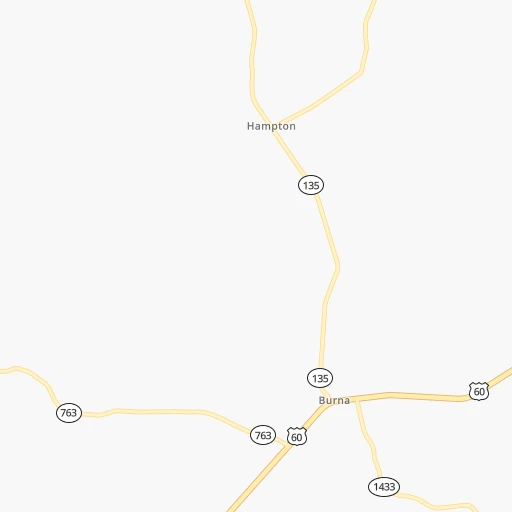
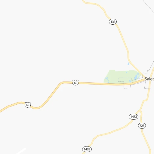
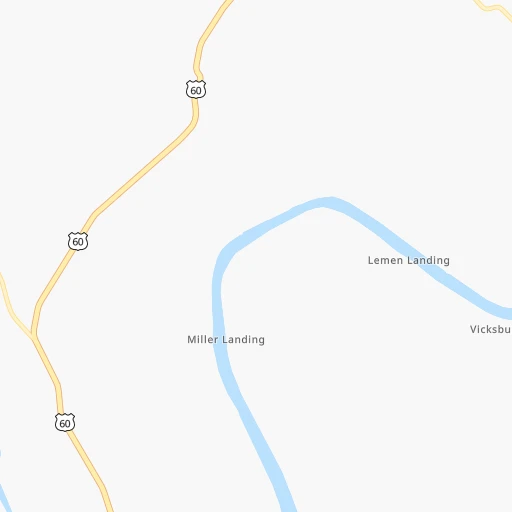
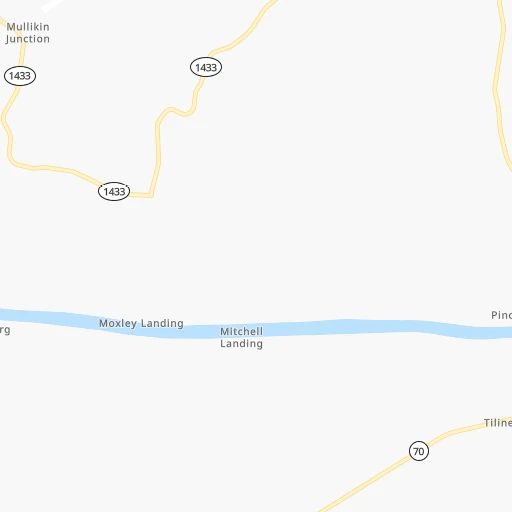
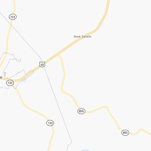
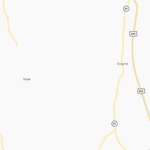
Roadmap (route) to go from Barnes Farm Airport to Elizabethtown detailed above, you can also see the course layout on the map.
While doing trip Barnes Farm (airport) - Elizabethtown by car, the calculated route ends at a distance , or more straight.
Distance and duration of the route between Barnes Farm (airport) and Elizabethtown
Calculation of distance and route from Elizabethtown to Barnes Farm (airport) :
222.9256.2 km3h56mn
Continue onto Klondike Mine Road 0h5mn 2.4 kmTurn right onto Klondike Mine Road Y 0h0mn 30 mTurn right onto US 60 0h9mn 10.2 kmTurn right onto Tyners Chapel Road 0h11mn 11.5 kmContinue onto KY 70 0h7mn 5.8 kmKeep right onto KY 70 0h0mn 75 mTurn slight right onto KY 70, KY 91 0h3mn 2.7 kmTurn right onto US 641 0h19mn 20.7 kmKeep left 0h25mn 41.9 kmKeep right onto Western Kentucky Parkway and take I 169 South toward Hopkinsville 2h34mn 157.3 kmKeep right and take US 31W Bypass toward Elizabethtown 0h1mn 784 mTurn right onto Elizabethtown Bypass 0h0mn 145 mTurn left onto New Glendale Road 0h1mn 1.2 kmTurn left onto East Dixie Avenue 0h1mn 1.4 kmKeep right onto US 31W, KY 61 0h0mn 136 mTurn right onto North Mulberry Street 0h0mn 24 mArrive at destination 0h0mn 0 m
Travel from Barnes Farm (airport) (Kentucky) to a selection of major cities.
Distances from Barnes Farm Airport to biggest cities in Kentucky
- Valley Station,22,756 inhabitants.237 km
- Radcliff,22,387 inhabitants.220 km
- Ashland,21,108 inhabitants.518 km
Other major cities in country :
- Charlotte [NC], 827,097 inhabitants. 707 km
- Seattle [WA], 684,451 inhabitants. 2,994 km
- Denver [CO], 682,545 inhabitants. 1,477 km
- El Paso [TX], 681,124 inhabitants. 1,771 km
- Detroit [MI], 677,116 inhabitants. 725 km
- Boston [MA], 667,137 inhabitants. 1,579 km
- Memphis [TN], 655,770 inhabitants. 279 km
- New South Memphis [TN], 641,608 inhabitants. 285 km
- Portland [OR], 632,309 inhabitants. 2,989 km
- Oklahoma City [OK], 631,346 inhabitants. 847 km
- Las Vegas [NV], 623,747 inhabitants. 2,389 km
- Baltimore [MD], 621,849 inhabitants. 1,048 km
- Washington, D.C. [DC], 601,723 inhabitants. 1,005 km
- Milwaukee [WI], 600,155 inhabitants. 647 km
- South Boston [MA], 571,281 inhabitants. 1,579 km
- Albuquerque [NM], 559,121 inhabitants. 1,662 km
- Tucson [AZ], 531,641 inhabitants. 2,137 km
- Nashville [TN], 530,852 inhabitants. 181 km
- Fresno [CA], 520,052 inhabitants. 2,784 km
- Sacramento [CA], 490,712 inhabitants. 2,902 km
Route from Elizabethtown to major cities (United States).
- Distance Elizabethtown New York City1,075 km
- Distance Elizabethtown Los Angeles2,934 km
- Distance Elizabethtown Chicago487 km
- Distance Elizabethtown Brooklyn1,078 km
- Distance Elizabethtown Houston1,245 km
- Distance Elizabethtown Queens1,088 km
- Distance Elizabethtown Philadelphia960 km
- Distance Elizabethtown Phoenix2,412 km
- Distance Elizabethtown Manhattan1,080 km
- Distance Elizabethtown San Antonio1,488 km
- Distance Elizabethtown San Diego2,887 km
- Distance Elizabethtown The Bronx1,090 km
- Distance Elizabethtown Dallas1,134 km
- Distance Elizabethtown San Jose3,162 km
- Distance Elizabethtown Austin1,372 km
- Distance Elizabethtown Jacksonville906 km
- Distance Elizabethtown San Francisco3,198 km
- Distance Elizabethtown Columbus354 km
- Distance Elizabethtown Fort Worth1,179 km
- Distance Elizabethtown Indianapolis232 km
Nearest cities to Barnes Farm (airport) :
- Indianapolis, 829,718 inhabitants. 339 km
- Memphis, 655,770 inhabitants. 279 km
- New South Memphis, 641,608 inhabitants. 285 km
- Nashville, 530,852 inhabitants. 181 km
- St. Louis, 315,685 inhabitants. 227 km
- Louisville, 243,639 inhabitants. 252 km
- Huntsville, 190,582 inhabitants. 319 km
- Clarksville, 149,176 inhabitants. 116 km
- Murfreesboro, 126,118 inhabitants. 231 km
- Evansville, 119,943 inhabitants. 107 km
- Springfield, 116,565 inhabitants. 309 km
- Carmel, 88,713 inhabitants. 361 km
- Champaign, 86,096 inhabitants. 321 km
- O'Fallon, 85,040 inhabitants. 273 km
- Bloomington, 84,067 inhabitants. 266 km
- Fishers, 76,794 inhabitants. 363 km
- Jonesboro, 73,907 inhabitants. 264 km
- Decatur, 73,254 inhabitants. 296 km
- Franklin, 72,639 inhabitants. 195 km
- Muncie, 70,087 inhabitants. 417 km
- Jackson, 66,975 inhabitants. 185 km
- Saint Charles, 65,794 inhabitants. 257 km
- Bowling Green, 63,616 inhabitants. 169 km
- Terre Haute, 60,825 inhabitants. 261 km
- Noblesville, 59,093 inhabitants. 372 km
- Owensboro, 59,042 inhabitants. 122 km
- Bartlett, 58,579 inhabitants. 265 km
- Hendersonville, 56,018 inhabitants. 183 km
- Greenwood, 55,586 inhabitants. 328 km
- Decatur, 55,437 inhabitants. 316 km
- Anderson, 55,305 inhabitants. 394 km
- Southaven, 52,589 inhabitants. 292 km
- Saint Peters, 52,575 inhabitants. 267 km
- Florissant, 52,268 inhabitants. 247 km
- Collierville, 48,863 inhabitants. 272 km
- Chesterfield, 47,864 inhabitants. 254 km
- Lawrence, 47,809 inhabitants. 352 km
- Madison, 46,962 inhabitants. 315 km
- Jeffersonville, 46,960 inhabitants. 255 km
- Columbus, 46,690 inhabitants. 303 km
- Smyrna, 46,607 inhabitants. 213 km
- Urbana, 42,311 inhabitants. 321 km
- Belleville, 42,034 inhabitants. 205 km
- Brentwood, 41,763 inhabitants. 191 km
- Florence, 40,026 inhabitants. 277 km
- Cape Girardeau, 39,462 inhabitants. 107 km
- Germantown, 39,240 inhabitants. 274 km
- Columbia, 36,800 inhabitants. 213 km
- Westfield, 36,738 inhabitants. 366 km
- New Albany, 36,732 inhabitants. 249 km
Location Barnes Farm (airport) (Kentucky) :
| Country flag |  |
| Location | Barnes Farm (airport) |
| State | Kentucky |
| County | Livingston County |
| Country | United States |
| Country code / ISO 2 | US |
| Latitude | 37.2315900 |
| Longitude | -88.3177300 |
| Altitude | 157 meters |
| Time zone | America/Chicago |
Location Elizabethtown (Kentucky) :
| Country flag | |
| Location | Elizabethtown |
| State | Kentucky |
| County | Hardin County |
| Country | United States |
| Country code / ISO 2 | US |
| Latitude | 37.6939500 |
| Longitude | -85.8591300 |
| Altitude | 221 meters |
| Time zone | America/New_York |


