
How to get from Gill Strip (Georgia) to St. Johns (Florida)
Calculate route from Gill Strip (Georgia, United States) to St. Johns (Florida, United States).
The flight distance (as the crow flies) between Gill Strip and St. Johns is 354.5 km.
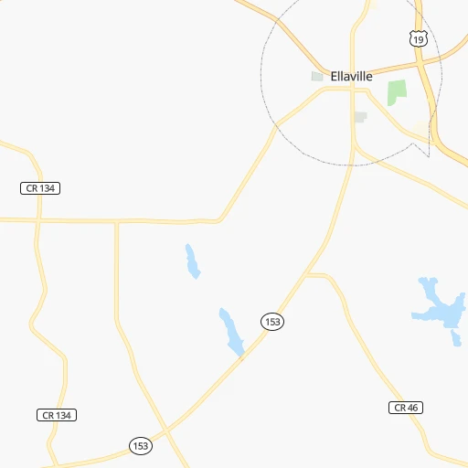
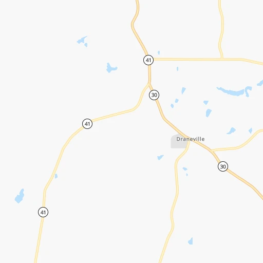
Roadmap (route) to go from Gill Strip to St. Johns detailed above, you can also see the course layout on the map.
While doing trip Gill Strip - St. Johns by car, the calculated route ends at a distance , or more straight.
Distance and duration of the route between Gill Strip and St. Johns
Calculation of distance and route from St. Johns to Gill Strip :
354.5409.6 km5h59mn
Continue onto Gill Street 0h2mn 525 mTurn right onto US 19, GA 3 0h14mn 19.6 kmTurn sharp left onto Parkview Place 0h0mn 66 mTurn right onto McGarrah Street 0h0mn 404 mContinue onto Cotton Avenue 0h0mn 171 mTurn left onto Wheeler Street 0h1mn 684 mTurn left onto East Lamar Street 0h7mn 7.5 kmTurn left onto District Line Road 0h0mn 327 mKeep right 0h0mn 27 mTurn slight right onto Lamar Road 0h19mn 24.6 kmTurn sharp left onto US 280, GA 30 0h11mn 14.0 kmKeep right 0h0mn 160 mContinue onto 24th Avenue West 0h2mn 2.1 kmTurn right onto Joe Wright Road 0h3mn 3.0 kmTurn slight right onto US 41, GA 7 0h3mn 3.3 kmTurn left onto Rockhouse Road East 0h2mn 2.4 kmTurn right 1h31mn 52.5 kmKeep right onto I 75 Business and take I 75 Business, US 41 toward Tifton, A B A C 0h0mn 338 mKeep left onto I 75 Business and take US 41 toward Tifton, Tift Regional Medical Center, Tift Regional Health System West Campus 0h0mn 59 mTurn left onto US Highway 41 North 0h2mn 1.5 kmTurn right onto Forrest Avenue 0h2mn 1.4 kmTurn slight left onto West 2nd Street 0h2mn 1.6 kmTurn left onto US 82, US 319, GA 35, GA 520 1h8mn 100.6 kmTurn right onto Pineview Church Road 0h14mn 13.8 kmTurn sharp right onto Harrison Street 0h0mn 45 mTurn left onto Memorial Drive 1h24mn 115.5 kmContinue onto New Kings Road 0h3mn 3.2 kmTurn right onto Fairfax Street 0h2mn 2.0 kmTurn sharp right onto Myrtle Avenue 0h0mn 366 mTurn left onto West Forsyth Street 0h1mn 987 mTurn right onto Jefferson Street 0h0mn 80 mKeep left onto Jefferson Street 0h2mn 1.8 kmKeep left and take I 95 South, US 90 East, US 1 South toward Jacksonville Beaches, Daytona Beach 0h1mn 759 mKeep right and take I 95, US 1 South, FL 5 South toward Daytona Beach, Philips Highway 0h0mn 344 mKeep left and take I 95 South toward Daytona Beach 0h16mn 25.3 kmKeep right toward FL 9B 0h0mn 508 mKeep right toward FL 9B South 0h3mn 4.5 kmKeep right toward CR 2209 North 0h1mn 694 mTurn left onto Longleaf Pine Parkway 0h2mn 2.2 kmMake a U-turn onto Longleaf Pine Parkway 0h1mn 693 mArrive at destination 0h0mn 0 m
Travel from Gill Strip (Florida) to a selection of major cities.
Distances from Gill Strip to biggest cities in Georgia
- Gainesville,38,712 inhabitants.234 km
- Milton,37,547 inhabitants.211 km
- Newnan,37,291 inhabitants.136 km
- Mableton,37,115 inhabitants.178 km
- Rome,36,323 inhabitants.239 km
- Martinez,35,795 inhabitants.252 km
- East Point,35,467 inhabitants.161 km
- Peachtree City,35,240 inhabitants.132 km
- Dalton,33,853 inhabitants.289 km
- Kennesaw,33,584 inhabitants.201 km
- Hinesville,33,398 inhabitants.259 km
- Redan,33,015 inhabitants.169 km
- Douglasville,32,897 inhabitants.174 km
- Statesboro,30,721 inhabitants.238 km
- Lawrenceville,30,493 inhabitants.194 km
- Woodstock,29,898 inhabitants.209 km
- LaGrange,29,588 inhabitants.113 km
- Duluth,29,193 inhabitants.197 km
- Evans,29,011 inhabitants.249 km
- Chamblee,28,244 inhabitants.185 km
Other major cities in country :
- Charlotte [NC], 827,097 inhabitants. 462 km
- Seattle [WA], 684,451 inhabitants. 3,621 km
- Denver [CO], 682,545 inhabitants. 2,036 km
- El Paso [TX], 681,124 inhabitants. 2,092 km
- Detroit [MI], 677,116 inhabitants. 1,129 km
- Boston [MA], 667,137 inhabitants. 1,623 km
- Memphis [TN], 655,770 inhabitants. 623 km
- New South Memphis [TN], 641,608 inhabitants. 621 km
- Portland [OR], 632,309 inhabitants. 3,597 km
- Oklahoma City [OK], 631,346 inhabitants. 1,273 km
- Las Vegas [NV], 623,747 inhabitants. 2,861 km
- Baltimore [MD], 621,849 inhabitants. 1,048 km
- Washington, D.C. [DC], 601,723 inhabitants. 990 km
- Milwaukee [WI], 600,155 inhabitants. 1,244 km
- South Boston [MA], 571,281 inhabitants. 1,621 km
- Albuquerque [NM], 559,121 inhabitants. 2,091 km
- Tucson [AZ], 531,641 inhabitants. 2,501 km
- Nashville [TN], 530,852 inhabitants. 494 km
- Fresno [CA], 520,052 inhabitants. 3,274 km
- Sacramento [CA], 490,712 inhabitants. 3,424 km
Route from St. Johns to major cities (United States).
- Distance St. Johns New York City1,366 km
- Distance St. Johns Los Angeles3,471 km
- Distance St. Johns Chicago1,420 km
- Distance St. Johns Brooklyn1,362 km
- Distance St. Johns Houston1,333 km
- Distance St. Johns Queens1,371 km
- Distance St. Johns Philadelphia1,243 km
- Distance St. Johns Phoenix2,903 km
- Distance St. Johns Manhattan1,374 km
- Distance St. Johns San Antonio1,638 km
- Distance St. Johns San Diego3,381 km
- Distance St. Johns The Bronx1,385 km
- Distance St. Johns Dallas1,479 km
- Distance St. Johns San Jose3,793 km
- Distance St. Johns Austin1,557 km
- Distance St. Johns San Francisco3,839 km
- Distance St. Johns Columbus1,108 km
- Distance St. Johns Fort Worth1,526 km
- Distance St. Johns Indianapolis1,157 km
- Distance St. Johns Charlotte577 km
Nearest cities to Gill Strip :
- Jacksonville, 868,031 inhabitants. 329 km
- Atlanta, 463,878 inhabitants. 169 km
- Birmingham, 212,461 inhabitants. 274 km
- Montgomery, 200,602 inhabitants. 189 km
- Columbus, 200,579 inhabitants. 69 km
- Huntsville, 190,582 inhabitants. 350 km
- Tallahassee, 189,907 inhabitants. 200 km
- Chattanooga, 176,588 inhabitants. 327 km
- East Chattanooga, 154,024 inhabitants. 327 km
- Gainesville, 130,128 inhabitants. 344 km
- Athens, 116,714 inhabitants. 211 km
- Sandy Springs, 105,330 inhabitants. 188 km
- Roswell, 94,501 inhabitants. 199 km
- Macon, 91,351 inhabitants. 92 km
- Hoover, 84,848 inhabitants. 269 km
- Johns Creek, 83,335 inhabitants. 200 km
- Albany, 74,843 inhabitants. 74 km
- Warner Robins, 73,490 inhabitants. 76 km
- Dothan, 68,567 inhabitants. 153 km
- Greenville, 64,579 inhabitants. 341 km
- Alpharetta, 63,693 inhabitants. 205 km
- Auburn, 62,059 inhabitants. 119 km
- Marietta, 59,067 inhabitants. 193 km
- Smyrna, 56,146 inhabitants. 185 km
- Valdosta, 55,724 inhabitants. 184 km
- Decatur, 55,437 inhabitants. 363 km
- East Pensacola Heights, 54,104 inhabitants. 340 km
- Pensacola, 53,193 inhabitants. 343 km
- Brookhaven, 51,910 inhabitants. 181 km
- Stonecrest, 50,000 inhabitants. 165 km
- Dunwoody, 48,733 inhabitants. 191 km
- Madison, 46,962 inhabitants. 356 km
- Cleveland, 43,898 inhabitants. 330 km
- Augusta, 43,459 inhabitants. 257 km
- Peachtree Corners, 40,978 inhabitants. 193 km
- North Atlanta, 40,456 inhabitants. 182 km
- St. Johns, 40,000 inhabitants. 355 km
- Gainesville, 38,712 inhabitants. 234 km
- Panama City, 38,286 inhabitants. 265 km
- Spartanburg, 37,867 inhabitants. 374 km
- Phenix City, 37,570 inhabitants. 71 km
- Milton, 37,547 inhabitants. 211 km
- Newnan, 37,291 inhabitants. 136 km
- Mableton, 37,115 inhabitants. 178 km
- Rome, 36,323 inhabitants. 239 km
- Gadsden, 36,084 inhabitants. 254 km
- Martinez, 35,795 inhabitants. 252 km
- East Point, 35,467 inhabitants. 161 km
- Prattville, 35,420 inhabitants. 205 km
- Ponte Vedra Beach, 35,400 inhabitants. 355 km
Location Gill Strip (Georgia) :
| Country flag |  |
| Location | Gill Strip |
| State | Georgia |
| County | Schley County |
| Country | United States |
| Country code / ISO 2 | US |
| Latitude | 32.2346000 |
| Longitude | -84.2996400 |
| Altitude | 171 meters |
| Time zone | America/New_York |
Location St. Johns (Florida) :
| Country flag | |
| Location | St. Johns |
| State | Florida |
| County | Saint Johns County |
| Country | United States |
| Country code / ISO 2 | US |
| Latitude | 30.0815000 |
| Longitude | -81.5477400 |
| Altitude | 0 meters |
| Time zone | America/New_York |


