
How to get from Coyote (Chihuahua) to Nacozari Viejo (Sonora)
Calculate route from Coyote (Chihuahua, Mexico) to Nacozari Viejo (Sonora, Mexico).
The flight distance (as the crow flies) between Coyote and Nacozari Viejo is 184.9 km.
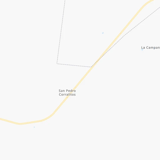
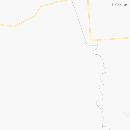
Roadmap (route) to go from Coyote to Nacozari Viejo detailed above, you can also see the course layout on the map.
While doing trip Coyote - Nacozari Viejo by car, the calculated route ends at a distance , or more straight.
Distance and duration of the route between Coyote and Nacozari Viejo
Calculation of distance and route from Nacozari Viejo to Coyote :
184.9375.2 km7h43mn
Continue 0h16mn 4.3 kmTurn right 0h3mn 755 mTurn right onto Línea QA 1h41mn 20.7 kmKeep right 0h0mn 46 mTurn left 0h6mn 4.7 kmTurn right onto Calle Independencia 0h7mn 3.6 kmTurn left 0h0mn 49 mTurn right 0h1mn 563 mTurn right 0h0mn 17 mTurn sharp left onto Camino Ejido Guadalupe Victoria 0h6mn 3.6 kmTurn right onto Carretera Janos-Nuevo Casas Grandes 1h31mn 42.9 kmTurn left onto Carretera Ascensión-Agua Prieta 0h0mn 160 mContinue onto Carretera Agua Prieta-Ascensión 0h4mn 4.3 kmTurn slight right onto Carretera Agua Prieta-Ascensión 2h14mn 155.8 kmKeep left 0h0mn 137 mTurn slight left 0h1mn 728 mTurn right onto Boulevard Los Apson (35) 0h2mn 1.7 kmTurn left onto Carretera Agua Prieta-Nacozari de García 1h7mn 69.9 kmTurn slight left onto Calle Quinta 1h52mn 45.4 kmTurn sharp left 0h1mn 324 mTurn left 0h0mn 43 mKeep right 0h0mn 64 mKeep left 0h1mn 321 mTurn left onto Calle Aquiles Serdán 0h0mn 39 mKeep right onto Calle Aquiles Serdán 0h0mn 162 mTurn left onto Calle Oaxaca 0h0mn 14 mTurn right onto Calle Aquiles Serdán 0h0mn 176 mKeep left onto Fronteras 0h0mn 80 mTurn right onto Calle del Mercado 0h0mn 152 mKeep left onto Calle Luis Donaldo Colosio Murrieta 0h0mn 191 mTurn left onto Calle Sudpacífico 0h1mn 371 mTurn left 0h11mn 9.2 kmTurn left 0h8mn 2.1 kmTurn right 0h4mn 1.2 kmTurn sharp right 0h5mn 1.4 kmArrive at destination 0h0mn 0 m
Travel from Coyote (Sonora) to a selection of major cities.
Distances from Coyote to biggest cities in Chihuahua
Other major cities in country :
- Coyoacan [09], 628,063 inhabitants. 1,531 km
- Santiago de Queretaro [22], 626,495 inhabitants. 1,346 km
- Saltillo [07], 621,250 inhabitants. 885 km
- Tlalpan [09], 607,545 inhabitants. 1,536 km
- Mexicali [02], 597,099 inhabitants. 761 km
- Hermosillo [26], 595,811 inhabitants. 359 km
- Morelia [16], 592,797 inhabitants. 1,391 km
- Veracruz [30], 568,313 inhabitants. 1,734 km
- Cancun [23], 542,043 inhabitants. 2,340 km
- Santa Maria Chimalhuacan [15], 525,389 inhabitants. 1,536 km
- Torreon [07], 524,066 inhabitants. 714 km
- Cuauhtemoc [09], 521,348 inhabitants. 1,523 km
- Ciudad Lopez Mateos [15], 521,034 inhabitants. 1,506 km
- Toluca [15], 505,881 inhabitants. 1,509 km
- Reynosa [28], 498,654 inhabitants. 1,059 km
- Tlaquepaque [14], 493,646 inhabitants. 1,205 km
- Tuxtla [05], 481,128 inhabitants. 2,148 km
- Cuautitlan Izcalli [15], 475,179 inhabitants. 1,500 km
- Victoria de Durango [10], 457,140 inhabitants. 804 km
- Heroica Matamoros [28], 449,815 inhabitants. 1,138 km
Route from Nacozari Viejo to major cities (Mexico).
- Distance Nacozari Viejo Mexico City1,617 km
- Distance Nacozari Viejo Iztapalapa1,627 km
- Distance Nacozari Viejo Ecatepec de Morelos1,606 km
- Distance Nacozari Viejo Guadalajara1,252 km
- Distance Nacozari Viejo Puebla1,712 km
- Distance Nacozari Viejo Juarez338 km
- Distance Nacozari Viejo Tijuana736 km
- Distance Nacozari Viejo Ciudad Nezahualcoyotl1,627 km
- Distance Nacozari Viejo Gustavo Adolfo Madero1,612 km
- Distance Nacozari Viejo Monterrey1,056 km
- Distance Nacozari Viejo Leon de los Aldama1,305 km
- Distance Nacozari Viejo Zapopan1,247 km
- Distance Nacozari Viejo Naucalpan de Juarez1,605 km
- Distance Nacozari Viejo Chihuahua397 km
- Distance Nacozari Viejo Alvaro Obregon1,618 km
- Distance Nacozari Viejo Guadalupe1,062 km
- Distance Nacozari Viejo Merida2,262 km
- Distance Nacozari Viejo Tlalnepantla1,603 km
- Distance Nacozari Viejo San Luis Potosi1,261 km
- Distance Nacozari Viejo Culiacan663 km
Nearest cities to Coyote :
- Juarez, 1,512,354 inhabitants. 167 km
- Chihuahua, 809,232 inhabitants. 280 km
- Ciudad Delicias, 102,969 inhabitants. 356 km
- Cuauhtemoc, 90,835 inhabitants. 269 km
- Agua Prieta, 77,254 inhabitants. 185 km
- Nuevo Casas Grandes, 51,356 inhabitants. 35 km
- Cananea, 33,433 inhabitants. 245 km
- Jimenez, 31,054 inhabitants. 348 km
- Meoqui, 21,179 inhabitants. 348 km
- Madera, 16,087 inhabitants. 172 km
- Nacozari Viejo, 11,872 inhabitants. 185 km
- Ascencion, 11,781 inhabitants. 50 km
- Anahuac, 10,696 inhabitants. 265 km
- Saucillo, 10,595 inhabitants. 381 km
- Adolfo Lopez Mateos, 8,770 inhabitants. 252 km
- Miguel Ahumada, 8,575 inhabitants. 119 km
- Ampliacion Colonia Lazaro Cardenas, 8,161 inhabitants. 330 km
- San Buenaventura, 6,168 inhabitants. 99 km
- Benito Juarez, 6,138 inhabitants. 108 km
- Esqueda, 6,119 inhabitants. 176 km
- Ejido Benito Juarez, 5,778 inhabitants. 103 km
- Puerto Palomas, 5,659 inhabitants. 120 km
- Naica, 5,494 inhabitants. 385 km
- Valentin Gomez Farias, 5,404 inhabitants. 299 km
- Rosales, 5,217 inhabitants. 351 km
- Naco, 5,193 inhabitants. 221 km
- Creel, 5,011 inhabitants. 329 km
- Ejido El Largo, 4,964 inhabitants. 124 km
- Ures, 4,199 inhabitants. 291 km
- Casas Grandes, 4,124 inhabitants. 40 km
- Sahuaripa, 4,038 inhabitants. 233 km
- Moctezuma, 4,028 inhabitants. 211 km
- Colonia Revolucion, 3,995 inhabitants. 353 km
- Praxedis Guerrero, 3,787 inhabitants. 181 km
- Ignacio Zaragoza, 3,455 inhabitants. 262 km
Location Coyote (Chihuahua) :
| Country flag |  |
| Location | Coyote |
| State | Chihuahua |
| County | Nuevo Casas Grandes |
| Country | Mexico |
| Country code / ISO 2 | MX |
| Latitude | 30.7000000 |
| Longitude | -107.7500000 |
| Altitude | 0 meters |
| Time zone | America/Chihuahua |
Location Nacozari Viejo (Sonora) :
| Country flag | |
| Location | Nacozari Viejo |
| State | Sonora |
| County | Nacozari de García |
| Country | Mexico |
| Country code / ISO 2 | MX |
| Latitude | 30.4000000 |
| Longitude | -109.6500000 |
| Altitude | 0 meters |
| Time zone | America/Hermosillo |