

How to get from Estación Conexión Vía A.C (Hidalgo) to Tezontepec de Aldama (Hidalgo)
Calculate route from Estación Conexión Vía A.C (Hidalgo, Mexico) to Tezontepec de Aldama (Hidalgo, Mexico).
The flight distance (as the crow flies) between Estación Conexión Vía A.C and Tezontepec de Aldama is 57.5 km.
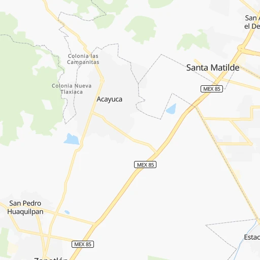
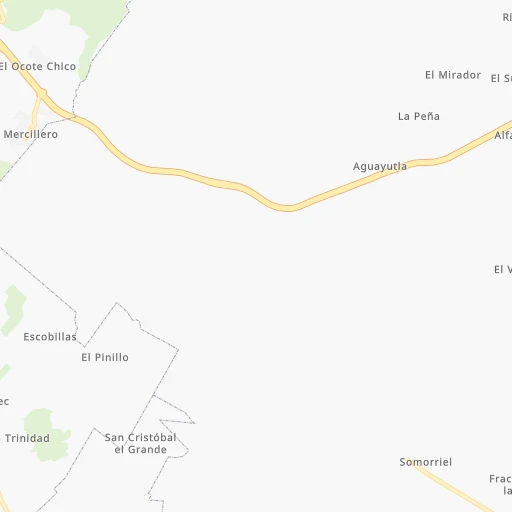
Roadmap (route) to go from Estación Conexión Vía A.C to Tezontepec de Aldama detailed above, you can also see the course layout on the map.
While doing trip Estación Conexión Vía A.C - Tezontepec de Aldama by car, the calculated route ends at a distance , or more straight.
Distance and duration of the route between Estación Conexión Vía A.C and Tezontepec de Aldama
Calculation of distance and route from Tezontepec de Aldama to Estación Conexión Vía A.C :
57.582.3 km1h3mn
Continue 0h0mn 32 mTurn sharp left onto Avenida La Calandria 0h2mn 1.1 kmTurn right 0h0mn 248 mTurn left onto Boulevard Libramiento Las Torres 0h4mn 3.9 kmKeep left 0h2mn 2.7 kmKeep right onto Carretera México-Pachuca 0h11mn 14.5 kmKeep right and take MEX M40D toward Guadalajara, Morelia, Queretaro, Atlacomulco, Puebla 0h1mn 887 mKeep left and take MEX M40D toward Guadalajara, Morelia, Queretaro, Atlacomulco 0h25mn 41.7 kmKeep right 0h1mn 604 mAt roundabout, take exit 1 0h2mn 2.6 kmTurn right 0h0mn 45 mTurn left onto Calle Plaza Juárez 0h4mn 4.8 kmTurn left onto Avenida San Francisco 0h0mn 213 mTurn right onto Calle Nicolás Bravo 0h0mn 294 mTurn right onto Avenida Sergio Butrón Casas 0h1mn 736 mTurn left onto Avenida 16 de Enero de 1869 0h1mn 544 mTurn right onto Calle Teodomiro Manzano 0h1mn 429 mTurn left onto Avenida Revolución 0h0mn 17 mTurn right 0h3mn 2.5 kmContinue onto General Pedro María Anaya- Tezontepec de Aldama 0h4mn 4.0 kmTurn left onto Calle Benito Juárez 0h1mn 284 mTurn slight left onto General Pedro María Anaya- Tezontepec de Aldama 0h0mn 12 mTurn sharp right onto Calle Emiliano Zapata 0h0mn 149 mArrive at destination 0h0mn 0 m
Travel from Estación Conexión Vía A.C (Hidalgo) to a selection of major cities.
Distances from Estación Conexión Vía A.C to biggest cities in Hidalgo
Other major cities in country :
- Aguascalientes [01], 658,179 inhabitants. 421 km
- Acapulco de Juarez [12], 652,136 inhabitants. 374 km
- Coyoacan [09], 628,063 inhabitants. 87 km
- Santiago de Queretaro [22], 626,495 inhabitants. 182 km
- Saltillo [07], 621,250 inhabitants. 644 km
- Tlalpan [09], 607,545 inhabitants. 92 km
- Mexicali [02], 597,099 inhabitants. 2,173 km
- Hermosillo [26], 595,811 inhabitants. 1,596 km
- Morelia [16], 592,797 inhabitants. 257 km
- Veracruz [30], 568,313 inhabitants. 289 km
- Cancun [23], 542,043 inhabitants. 1,247 km
- Santa Maria Chimalhuacan [15], 525,389 inhabitants. 70 km
- Torreon [07], 524,066 inhabitants. 779 km
- Cuauhtemoc [09], 521,348 inhabitants. 77 km
- Ciudad Lopez Mateos [15], 521,034 inhabitants. 74 km
- Toluca [15], 505,881 inhabitants. 125 km
- Reynosa [28], 498,654 inhabitants. 676 km
- Tlaquepaque [14], 493,646 inhabitants. 479 km
- Tuxtla [05], 481,128 inhabitants. 698 km
- Cuautitlan Izcalli [15], 475,179 inhabitants. 64 km
Route from Tezontepec de Aldama to major cities (Mexico).
- Distance Tezontepec de Aldama Mexico City86 km
- Distance Tezontepec de Aldama Iztapalapa96 km
- Distance Tezontepec de Aldama Ecatepec de Morelos69 km
- Distance Tezontepec de Aldama Guadalajara433 km
- Distance Tezontepec de Aldama Puebla171 km
- Distance Tezontepec de Aldama Juarez1,470 km
- Distance Tezontepec de Aldama Tijuana2,232 km
- Distance Tezontepec de Aldama Ciudad Nezahualcoyotl92 km
- Distance Tezontepec de Aldama Gustavo Adolfo Madero79 km
- Distance Tezontepec de Aldama Monterrey620 km
- Distance Tezontepec de Aldama Leon de los Aldama271 km
- Distance Tezontepec de Aldama Zapopan433 km
- Distance Tezontepec de Aldama Naucalpan de Juarez79 km
- Distance Tezontepec de Aldama Chihuahua1,166 km
- Distance Tezontepec de Aldama Alvaro Obregon93 km
- Distance Tezontepec de Aldama Guadalupe619 km
- Distance Tezontepec de Aldama Merida1,010 km
- Distance Tezontepec de Aldama Tlalnepantla73 km
- Distance Tezontepec de Aldama San Luis Potosi281 km
- Distance Tezontepec de Aldama Culiacan979 km
Nearest cities to Estación Conexión Vía A.C :
- Mexico City, 12,294,193 inhabitants. 77 km
- Iztapalapa, 1,820,888 inhabitants. 81 km
- Ecatepec de Morelos, 1,806,226 inhabitants. 57 km
- Puebla, 1,590,256 inhabitants. 124 km
- Ciudad Nezahualcoyotl, 1,232,220 inhabitants. 75 km
- Gustavo Adolfo Madero, 1,193,161 inhabitants. 70 km
- Leon de los Aldama, 1,114,626 inhabitants. 328 km
- Naucalpan de Juarez, 846,185 inhabitants. 79 km
- Alvaro Obregon, 727,034 inhabitants. 88 km
- Tlalnepantla, 715,767 inhabitants. 71 km
- San Luis Potosi, 677,704 inhabitants. 331 km
- Coyoacan, 628,063 inhabitants. 87 km
- Santiago de Queretaro, 626,495 inhabitants. 182 km
- Tlalpan, 607,545 inhabitants. 92 km
- Morelia, 592,797 inhabitants. 257 km
- Veracruz, 568,313 inhabitants. 289 km
- Santa Maria Chimalhuacan, 525,389 inhabitants. 70 km
- Cuauhtemoc, 521,348 inhabitants. 77 km
- Ciudad Lopez Mateos, 521,034 inhabitants. 74 km
- Toluca, 505,881 inhabitants. 125 km
- Cuautitlan Izcalli, 475,179 inhabitants. 64 km
- Venustiano Carranza, 447,459 inhabitants. 75 km
- Azcapotzalco, 425,298 inhabitants. 75 km
- Xalapa de Enriquez, 425,148 inhabitants. 200 km
- Xochimilco, 404,458 inhabitants. 93 km
- Iztacalco, 384,326 inhabitants. 79 km
- Xico, 365,777 inhabitants. 87 km
- Benito Juarez, 355,017 inhabitants. 82 km
- Miguel Hidalgo, 353,534 inhabitants. 81 km
- Ixtapaluca, 351,001 inhabitants. 80 km
- Tlahuac, 344,106 inhabitants. 86 km
- Cuernavaca, 343,769 inhabitants. 132 km
- Irapuato, 339,554 inhabitants. 281 km
- Pachuca de Soto, 319,581 inhabitants. 10 km
- Coacalco, 313,405 inhabitants. 58 km
- Tampico, 309,003 inhabitants. 265 km
- Celaya, 305,901 inhabitants. 222 km
- Oaxaca, 262,566 inhabitants. 393 km
- Los Reyes Acaquilpan, 251,168 inhabitants. 77 km
- Colonia del Valle, 250,000 inhabitants. 83 km
- Nicolas Romero, 245,383 inhabitants. 72 km
- Ojo de Agua, 242,272 inhabitants. 47 km
- Tehuacan, 241,429 inhabitants. 225 km
- Magdalena Contreras, 228,927 inhabitants. 91 km
- Buenavista, 206,081 inhabitants. 64 km
- Soledad de Graciano Sanchez, 194,006 inhabitants. 331 km
- Ciudad Madero, 192,736 inhabitants. 268 km
- Ciudad Valles, 176,935 inhabitants. 221 km
- Poza Rica de Hidalgo, 174,526 inhabitants. 146 km
- Delegacion Cuajimalpa de Morelos, 173,625 inhabitants. 92 km
Location Estación Conexión Vía A.C (Hidalgo) :
| Country flag |  |
| Location | Estación Conexión Vía A.C |
| State | Hidalgo |
| County | Mineral de la Reforma |
| Country | Mexico |
| Country code / ISO 2 | MX |
| Latitude | 20.0250000 |
| Longitude | -98.7527800 |
| Altitude | 0 meters |
| Time zone | America/Mexico_City |
Location Tezontepec de Aldama (Hidalgo) :
| Country flag | |
| Location | Tezontepec de Aldama |
| State | Hidalgo |
| County | Tezontepec de Aldama |
| Country | Mexico |
| Country code / ISO 2 | MX |
| Latitude | 20.1907300 |
| Longitude | -99.2742900 |
| Altitude | 0 meters |
| Time zone | America/Mexico_City |