

How to get from Huauchinango (Puebla) to Xicotepec de Juárez (Puebla)
Calculate route from Huauchinango (Puebla, Mexico) to Xicotepec de Juárez (Puebla, Mexico).
The flight distance (as the crow flies) between Huauchinango and Xicotepec de Juárez is 15.0 km.
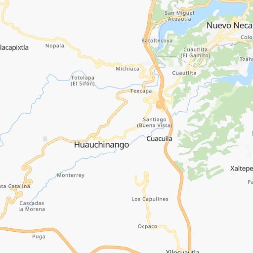
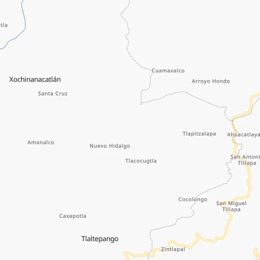
Roadmap (route) to go from Huauchinango to Xicotepec de Juárez detailed above, you can also see the course layout on the map.
While doing trip Huauchinango - Xicotepec de Juárez by car, the calculated route ends at a distance , or more straight.
Distance and duration of the route between Huauchinango and Xicotepec de Juárez
Calculation of distance and route from Xicotepec de Juárez to Huauchinango :
15.020.9 km0h19mn
Continue onto Rafaél Cravioto 0h0mn 13 mTurn right onto Calle Corregidora 0h0mn 114 mTurn left onto Calle Nicolás Bravo 0h0mn 195 mTurn slight right onto Calle José María Morelos Y Pavón 0h0mn 54 mTurn right onto Calle José María Morelos Y Pavón 0h0mn 65 mTurn sharp left 0h0mn 124 mTurn right 0h16mn 18.6 kmTurn slight left onto MEX 130 0h1mn 1.4 kmTurn right onto Calle Guerrero 0h0mn 76 mTurn left onto Calle Tulipanes 0h0mn 81 mTurn right onto Avenida Hidalgo 0h0mn 240 mArrive at destination 0h0mn 0 m
Travel from Huauchinango (Puebla) to a selection of major cities.
Distances from Huauchinango to biggest cities in Puebla
Other major cities in country :
- Acapulco de Juarez [12], 652,136 inhabitants. 419 km
- Coyoacan [09], 628,063 inhabitants. 148 km
- Santiago de Queretaro [22], 626,495 inhabitants. 248 km
- Saltillo [07], 621,250 inhabitants. 658 km
- Tlalpan [09], 607,545 inhabitants. 152 km
- Mexicali [02], 597,099 inhabitants. 2,215 km
- Hermosillo [26], 595,811 inhabitants. 1,640 km
- Morelia [16], 592,797 inhabitants. 332 km
- Veracruz [30], 568,313 inhabitants. 229 km
- Cancun [23], 542,043 inhabitants. 1,172 km
- Santa Maria Chimalhuacan [15], 525,389 inhabitants. 126 km
- Torreon [07], 524,066 inhabitants. 812 km
- Cuauhtemoc [09], 521,348 inhabitants. 140 km
- Ciudad Lopez Mateos [15], 521,034 inhabitants. 143 km
- Toluca [15], 505,881 inhabitants. 194 km
- Reynosa [28], 498,654 inhabitants. 658 km
- Tlaquepaque [14], 493,646 inhabitants. 549 km
- Tuxtla [05], 481,128 inhabitants. 645 km
- Cuautitlan Izcalli [15], 475,179 inhabitants. 135 km
- Victoria de Durango [10], 457,140 inhabitants. 804 km
Route from Xicotepec de Juárez to major cities (Mexico).
- Distance Xicotepec de Juárez Mexico City154 km
- Distance Xicotepec de Juárez Iztapalapa154 km
- Distance Xicotepec de Juárez Ecatepec de Morelos137 km
- Distance Xicotepec de Juárez Guadalajara568 km
- Distance Xicotepec de Juárez Juarez1,530 km
- Distance Xicotepec de Juárez Tijuana2,330 km
- Distance Xicotepec de Juárez Ciudad Nezahualcoyotl147 km
- Distance Xicotepec de Juárez Gustavo Adolfo Madero149 km
- Distance Xicotepec de Juárez Monterrey648 km
- Distance Xicotepec de Juárez Leon de los Aldama398 km
- Distance Xicotepec de Juárez Zapopan568 km
- Distance Xicotepec de Juárez Naucalpan de Juarez161 km
- Distance Xicotepec de Juárez Chihuahua1,242 km
- Distance Xicotepec de Juárez Alvaro Obregon165 km
- Distance Xicotepec de Juárez Guadalupe646 km
- Distance Xicotepec de Juárez Merida873 km
- Distance Xicotepec de Juárez Tlalnepantla153 km
- Distance Xicotepec de Juárez San Luis Potosi376 km
- Distance Xicotepec de Juárez Culiacan1,091 km
- Distance Xicotepec de Juárez Aguascalientes483 km
Nearest cities to Huauchinango :
- Mexico City, 12,294,193 inhabitants. 140 km
- Iztapalapa, 1,820,888 inhabitants. 139 km
- Ecatepec de Morelos, 1,806,226 inhabitants. 123 km
- Puebla, 1,590,256 inhabitants. 127 km
- Ciudad Nezahualcoyotl, 1,232,220 inhabitants. 132 km
- Gustavo Adolfo Madero, 1,193,161 inhabitants. 134 km
- Naucalpan de Juarez, 846,185 inhabitants. 146 km
- Alvaro Obregon, 727,034 inhabitants. 151 km
- Tlalnepantla, 715,767 inhabitants. 139 km
- San Luis Potosi, 677,704 inhabitants. 375 km
- Coyoacan, 628,063 inhabitants. 148 km
- Santiago de Queretaro, 626,495 inhabitants. 248 km
- Tlalpan, 607,545 inhabitants. 152 km
- Veracruz, 568,313 inhabitants. 229 km
- Santa Maria Chimalhuacan, 525,389 inhabitants. 126 km
- Cuauhtemoc, 521,348 inhabitants. 140 km
- Ciudad Lopez Mateos, 521,034 inhabitants. 143 km
- Toluca, 505,881 inhabitants. 194 km
- Cuautitlan Izcalli, 475,179 inhabitants. 135 km
- Venustiano Carranza, 447,459 inhabitants. 137 km
- Azcapotzalco, 425,298 inhabitants. 141 km
- Xalapa de Enriquez, 425,148 inhabitants. 139 km
- Xochimilco, 404,458 inhabitants. 150 km
- Iztacalco, 384,326 inhabitants. 139 km
- Xico, 365,777 inhabitants. 138 km
- Benito Juarez, 355,017 inhabitants. 144 km
- Miguel Hidalgo, 353,534 inhabitants. 145 km
- Ixtapaluca, 351,001 inhabitants. 129 km
- Tlahuac, 344,106 inhabitants. 140 km
- Cuernavaca, 343,769 inhabitants. 186 km
- Pachuca de Soto, 319,581 inhabitants. 71 km
- Coacalco, 313,405 inhabitants. 126 km
- Tampico, 309,003 inhabitants. 232 km
- Celaya, 305,901 inhabitants. 291 km
- Los Reyes Acaquilpan, 251,168 inhabitants. 132 km
- Colonia del Valle, 250,000 inhabitants. 145 km
- Nicolas Romero, 245,383 inhabitants. 144 km
- Ojo de Agua, 242,272 inhabitants. 114 km
- Tehuacan, 241,429 inhabitants. 202 km
- Magdalena Contreras, 228,927 inhabitants. 153 km
- Buenavista, 206,081 inhabitants. 133 km
- Soledad de Graciano Sanchez, 194,006 inhabitants. 374 km
- Ciudad Madero, 192,736 inhabitants. 235 km
- Ciudad Valles, 176,935 inhabitants. 226 km
- Poza Rica de Hidalgo, 174,526 inhabitants. 74 km
- Delegacion Cuajimalpa de Morelos, 173,625 inhabitants. 157 km
- San Pablo de las Salinas, 173,557 inhabitants. 123 km
- Metepec, 172,982 inhabitants. 191 km
- Chilpancingo, 165,250 inhabitants. 330 km
- Chalco, 163,996 inhabitants. 135 km
Location Huauchinango (Puebla) :
| Country flag |  |
| Location | Huauchinango |
| State | Puebla |
| County | Huauchinango |
| Country | Mexico |
| Country code / ISO 2 | MX |
| Latitude | 20.1737600 |
| Longitude | -98.0549100 |
| Altitude | 0 meters |
| Time zone | America/Mexico_City |
Location Xicotepec de Juárez (Puebla) :
| Country flag | |
| Location | Xicotepec de Juárez |
| State | Puebla |
| County | Xicotepec |
| Country | Mexico |
| Country code / ISO 2 | MX |
| Latitude | 20.2760500 |
| Longitude | -97.9611100 |
| Altitude | 0 meters |
| Time zone | America/Mexico_City |


