


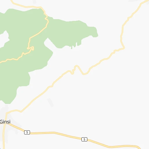

How to get from Ādīs ‘Alem (Oromiya) to Nejo (Oromiya)
Calculate route from Ādīs ‘Alem (Oromiya, Ethiopia) to Nejo (Oromiya, Ethiopia).
The flight distance (as the crow flies) between Ādīs ‘Alem and Nejo is 322.2 km.
Roadmap (route) to go from Ādīs ‘Alem to Nejo detailed above, you can also see the course layout on the map.
While doing trip Ādīs ‘Alem - Nejo by car, the calculated route ends at a distance , or more straight.
Distance and duration of the route between Ādīs ‘Alem and Nejo
Calculation of distance and route from Nejo to Ādīs ‘Alem :
322.2448.5 km8h33mn
Continue 0h1mn 300 mTurn right 0h4mn 1.8 kmTurn left onto New Ambo Road 1h12mn 80.1 kmTurn right 0h1mn 462 mTurn right onto Nekemte - Ambo Road 0h0mn 317 mTurn left 1h51mn 45.4 kmKeep left 0h8mn 3.9 kmTurn right 0h0mn 60 mTurn left onto Nekemte - Ambo Road 0h3mn 2.9 kmTurn sharp left 0h6mn 3.2 kmTurn slight left onto Nekemte - Ambo Road 0h25mn 22.1 kmKeep right onto Nekemte - Ambo Road 0h30mn 27.0 kmKeep right 0h0mn 60 mKeep left 0h1mn 414 mTurn left 0h0mn 17 mTurn right 0h0mn 133 mTurn right onto Nekemte - Ambo Road 1h25mn 75.7 kmAt roundabout, take exit 2 onto Moroda Bekere Street 0h0mn 335 mTurn right onto Moroda Bekere Street 0h1mn 780 mAt roundabout, take exit 2 onto A 4 2h52mn 125.2 kmAt roundabout, take exit 1 onto Nekemte - Asosa Road 1h49mn 56.8 kmTurn left 0h0mn 41 mKeep right 0h2mn 1.0 kmTurn right 0h0mn 189 mTurn left 0h0mn 42 mTurn right 0h0mn 178 mTurn sharp left 0h0mn 44 mArrive at destination 0h0mn 0 m
Travel from Ādīs ‘Alem (Oromiya) to a selection of major cities.
Distances from Ādīs ‘Alem to biggest cities in Oromiya
- Metahara,23,403 inhabitants.167 km
- Dodola,23,116 inhabitants.244 km
- Hagere Maryam,22,105 inhabitants.379 km
- Bedele,20,293 inhabitants.234 km
- Nejo,20,166 inhabitants.323 km
Other major cities in country :
Route from Nejo to major cities (Ethiopia).
- Distance Nejo Addis Ababa361 km
- Distance Nejo Dire Dawa699 km
- Distance Nejo Mek'ele621 km
- Distance Nejo Bahir Dar312 km
- Distance Nejo Gondar407 km
- Distance Nejo Dese488 km
- Distance Nejo Hawassa426 km
- Distance Nejo Kombolcha497 km
- Distance Nejo Harar727 km
- Distance Nejo Sodo385 km
- Distance Nejo Hosa'ina338 km
- Distance Nejo Arba Minch447 km
- Distance Nejo Adigrat685 km
- Distance Nejo Debre Mark'os263 km
- Distance Nejo Debre Birhan443 km
- Distance Nejo Jijiga802 km
- Distance Nejo Inda Silase595 km
Nearest cities to Ādīs ‘Alem :
- Addis Ababa, 2,757,729 inhabitants. 38 km
- Nazret, 213,995 inhabitants. 109 km
- Bahir Dar, 168,899 inhabitants. 306 km
- Dese, 136,056 inhabitants. 270 km
- Hawassa, 133,097 inhabitants. 220 km
- Jimma, 128,306 inhabitants. 229 km
- Bishoftu, 104,215 inhabitants. 71 km
- Kombolcha, 93,605 inhabitants. 271 km
- Sodo, 86,050 inhabitants. 252 km
- Shashemene, 85,871 inhabitants. 205 km
- Hosa'ina, 75,963 inhabitants. 176 km
- Arba Minch, 69,622 inhabitants. 347 km
- Debre Mark'os, 59,920 inhabitants. 164 km
- Debre Birhan, 57,787 inhabitants. 144 km
- Ziway, 49,416 inhabitants. 127 km
- Dila, 47,021 inhabitants. 291 km
- Hagere Hiywet, 43,920 inhabitants. 61 km
- Waliso, 38,394 inhabitants. 73 km
- Yirga `Alem, 36,292 inhabitants. 254 km
- Mojo, 34,547 inhabitants. 94 km
- Goba, 34,369 inhabitants. 284 km
- Felege Neway, 33,429 inhabitants. 347 km
- Areka, 33,150 inhabitants. 232 km
- Boditi, 32,997 inhabitants. 237 km
- Debre Tabor, 32,659 inhabitants. 316 km
- Gimbi, 31,809 inhabitants. 282 km
- Asbe Teferi, 30,772 inhabitants. 271 km
- Butajira, 30,502 inhabitants. 102 km
- Metu, 29,648 inhabitants. 321 km
- Agaro, 28,268 inhabitants. 233 km
- Werota, 26,813 inhabitants. 330 km
- Dubti, 26,370 inhabitants. 420 km
- Fiche, 25,758 inhabitants. 93 km
- K'olito, 25,614 inhabitants. 194 km
- Tippi, 24,169 inhabitants. 384 km
- Kemise, 23,861 inhabitants. 247 km
- Asasa, 23,790 inhabitants. 233 km
- Genet, 23,753 inhabitants. 12 km
- Finote Selam, 23,463 inhabitants. 223 km
- Metahara, 23,403 inhabitants. 167 km
- Dodola, 23,116 inhabitants. 244 km
- Addiet Canna, 22,946 inhabitants. 268 km
- Bure, 22,038 inhabitants. 236 km
- Robit, 20,679 inhabitants. 358 km
- Bedele, 20,293 inhabitants. 234 km
- Nejo, 20,166 inhabitants. 323 km
- Sebeta, 19,533 inhabitants. 27 km
- Bati, 19,260 inhabitants. 299 km
- Bonga, 18,973 inhabitants. 308 km
- Bedesa, 17,526 inhabitants. 262 km
Location Ādīs ‘Alem (Oromiya) :
| Country flag |  |
| Location | Ādīs ‘Alem |
| State | Oromiya |
| County | |
| Country | Ethiopia |
| Country code / ISO 2 | ET |
| Latitude | 9.0333300 |
| Longitude | 38.4000000 |
| Altitude | 0 meters |
| Time zone | Africa/Addis_Ababa |
Location Nejo (Oromiya) :
| Country flag | |
| Location | Nejo |
| State | Oromiya |
| County | |
| Country | Ethiopia |
| Country code / ISO 2 | ET |
| Latitude | 9.5000000 |
| Longitude | 35.5000000 |
| Altitude | 0 meters |
| Time zone | Africa/Addis_Ababa |