


How to get from Malabang (airport) (Autonomous Region in Muslim Mindanao) to Venice of the Philippines (Autonomous Region in Muslim Mindanao)
Calculate route from Malabang (airport) (Autonomous Region in Muslim Mindanao, Philippines) to Venice of the Philippines (Autonomous Region in Muslim Mindanao, Philippines).
The flight distance (as the crow flies) between Malabang (airport) and Venice of the Philippines is 610.9 km.
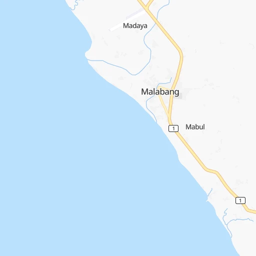
Roadmap (route) to go from Malabang Airport to Venice of the Philippines detailed above, you can also see the course layout on the map.
While doing trip Malabang (airport) - Venice of the Philippines by car, the calculated route ends at a distance , or more straight.
Distance and duration of the route between Malabang (airport) and Venice of the Philippines
Calculation of distance and route from Venice of the Philippines to Malabang (airport) :
610.9822.5 km83h44mn
Continue 0h1mn 683 mTurn left onto Narciso Ramos Highway 0h0mn 15 mKeep left onto Malabang-Tukuran Road 1h6mn 73.6 kmTurn right onto Rizal Avenue 0h1mn 601 mTurn slight right onto Aurora-Tukuran Highway and drive toward Pagadian, Iligan 0h1mn 984 mTurn left onto Tukuran-Pagadian Highway 0h16mn 17.7 kmTurn sharp right 0h1mn 413 mTurn left 0h2mn 1.8 kmTurn left 0h0mn 305 mTurn right onto J. P. Rizal Avenue 0h3mn 2.7 kmTurn right 0h0mn 60 mTurn slight left onto Pagadian Bypass Road 2h3mn 110.6 kmContinue onto Pagadian-Zamboanga City Highway 0h22mn 19.2 kmAt roundabout, take exit 2 onto Ipil-Zamboanga City Highway 0h1mn 438 mContinue onto Pagadian-Zamboanga City Highway 2h15mn 121.6 kmTurn right onto Zamboanga City Bypass Road 0h9mn 7.8 kmTurn right 0h1mn 324 mTurn left 0h1mn 967 mTurn right onto Tuamga-Lunzuran Road 0h2mn 2.0 kmTurn left 0h2mn 1.8 kmContinue onto 1 0h1mn 1.5 kmTurn right onto Tomas Claudio Street 0h0mn 334 mTurn left onto Saavedra Street 0h0mn 61 mTurn right onto Governor Lim Avenue 0h0mn 297 mTurn left onto N. S. Valderosa Street 0h0mn 153 mTurn right onto Corcuerra Street 0h0mn 202 mTurn right onto 1 0h0mn 192 mTurn left onto 1 0h0mn 155 mTurn left onto 1 0h0mn 282 mKeep left onto Zamboanga – Bongao 59h9mn 354.9 kmTurn left 0h11mn 374 mTurn sharp right 9h12mn 54.5 kmKeep left 4h2mn 24.2 kmKeep left 1h56mn 5.6 kmTurn right 1h52mn 5.2 kmTurn right 1h53mn 5.3 kmTurn right 1h59mn 5.9 kmArrive at destination 0h0mn 0 m
Travel from Malabang (airport) (Autonomous Region in Muslim Mindanao) to a selection of major cities.
Distances from Malabang Airport to biggest cities in Autonomous Region in Muslim Mindanao
Other major cities in country :
- Bacoor [40], 356,974 inhabitants. 835 km
- Lapu-Lapu City [07], 350,467 inhabitants. 300 km
- Iligan [10], 342,618 inhabitants. 71 km
- Mandaue City [07], 331,320 inhabitants. 302 km
- Calamba [40], 316,612 inhabitants. 799 km
- Iligan City [12], 312,323 inhabitants. 80 km
- Butuan [13], 309,709 inhabitants. 221 km
- Cabuyao [40], 308,745 inhabitants. 807 km
- Mandaluyong City [NCR], 305,576 inhabitants. 843 km
- Binan [40], 300,000 inhabitants. 816 km
- Angeles City [03], 299,391 inhabitants. 920 km
- Santol [03], 298,976 inhabitants. 922 km
- Cainta [40], 283,172 inhabitants. 839 km
- Baguio [15], 272,714 inhabitants. 1,050 km
- San Pedro [40], 270,216 inhabitants. 819 km
- Mantampay [10], 265,032 inhabitants. 64 km
- San Fernando [03], 251,248 inhabitants. 904 km
- Libertad [13], 250,353 inhabitants. 217 km
- Navotas [NCR], 249,463 inhabitants. 855 km
- Tacloban [08], 242,089 inhabitants. 417 km
Route from Venice of the Philippines to major cities (Philippines).
- Distance Venice of the Philippines Quezon City1,127 km
- Distance Venice of the Philippines Manila1,120 km
- Distance Venice of the Philippines Caloocan City1,125 km
- Distance Venice of the Philippines Davao739 km
- Distance Venice of the Philippines Malingao627 km
- Distance Venice of the Philippines Cebu City801 km
- Distance Venice of the Philippines General Santos660 km
- Distance Venice of the Philippines Taguig1,113 km
- Distance Venice of the Philippines Pasig City1,120 km
- Distance Venice of the Philippines Las Pinas1,104 km
- Distance Venice of the Philippines Antipolo1,125 km
- Distance Venice of the Philippines Makati City1,115 km
- Distance Venice of the Philippines Zamboanga388 km
- Distance Venice of the Philippines Bacolod City775 km
- Distance Venice of the Philippines Mansilingan773 km
- Distance Venice of the Philippines Cagayan de Oro720 km
- Distance Venice of the Philippines Dasmarinas1,089 km
- Distance Venice of the Philippines Pasay1,113 km
- Distance Venice of the Philippines Iloilo757 km
- Distance Venice of the Philippines San Jose del Monte1,145 km
Nearest cities to Malabang (airport) :
- Budta, 1,273,715 inhabitants. 62 km
- Davao, 1,212,504 inhabitants. 182 km
- Malingao, 1,121,974 inhabitants. 68 km
- Cebu City, 798,634 inhabitants. 301 km
- General Santos, 679,588 inhabitants. 208 km
- Zamboanga, 457,623 inhabitants. 233 km
- Cagayan de Oro, 445,103 inhabitants. 116 km
- Lapu-Lapu City, 350,467 inhabitants. 300 km
- Iligan, 342,618 inhabitants. 71 km
- Mandaue City, 331,320 inhabitants. 302 km
- Iligan City, 312,323 inhabitants. 80 km
- Butuan, 309,709 inhabitants. 221 km
- Mantampay, 265,032 inhabitants. 64 km
- Libertad, 250,353 inhabitants. 217 km
- Magugpo Poblacion, 233,254 inhabitants. 194 km
- Pagadian, 186,852 inhabitants. 72 km
- Cotabato, 179,433 inhabitants. 48 km
- Toledo, 156,916 inhabitants. 311 km
- Bago City, 150,250 inhabitants. 351 km
- Marawi City, 143,627 inhabitants. 50 km
- Kabankalan, 136,483 inhabitants. 297 km
- Talisay, 133,148 inhabitants. 293 km
- Muricay, 132,094 inhabitants. 68 km
- Koronadal, 125,502 inhabitants. 152 km
- Digos, 116,122 inhabitants. 173 km
- Dumaguete, 113,541 inhabitants. 206 km
- Mati, 105,908 inhabitants. 249 km
- Dipolog, 93,549 inhabitants. 132 km
- Ozamiz City, 93,082 inhabitants. 64 km
- Surigao, 87,832 inhabitants. 289 km
- Tagbilaran City, 86,411 inhabitants. 228 km
- Panabo, 84,749 inhabitants. 183 km
- NIA Valencia, 83,591 inhabitants. 119 km
- Kidapawan, 79,652 inhabitants. 132 km
- Mariano, 70,516 inhabitants. 179 km
- Danao, 70,270 inhabitants. 323 km
- Bislig, 67,567 inhabitants. 258 km
- City of Isabela, 67,336 inhabitants. 252 km
- Bais, 65,594 inhabitants. 243 km
- Polomolok, 63,987 inhabitants. 191 km
- Minglanilla, 62,058 inhabitants. 294 km
- Malaybalay, 61,524 inhabitants. 132 km
- Ualog, 60,548 inhabitants. 337 km
- Banga, 58,855 inhabitants. 155 km
- Tacurong, 54,648 inhabitants. 123 km
- Malungun, 52,248 inhabitants. 201 km
- Monkayo, 51,393 inhabitants. 221 km
- Dapitan, 50,514 inhabitants. 135 km
- Liloan, 49,198 inhabitants. 310 km
- Consolacion, 48,638 inhabitants. 307 km
Location Malabang (airport) (Autonomous Region in Muslim Mindanao) :
| Country flag |  |
| Location | Malabang (airport) |
| State | Autonomous Region in Muslim Mindanao |
| County | Province of Lanao del Sur |
| Country | Philippines |
| Country code / ISO 2 | PH |
| Latitude | 7.6170000 |
| Longitude | 124.0590000 |
| Altitude | 0 meters |
| Time zone | Asia/Manila |
Location Venice of the Philippines (Autonomous Region in Muslim Mindanao) :
| Country flag | |
| Location | Venice of the Philippines |
| State | Autonomous Region in Muslim Mindanao |
| County | Province of Tawi-Tawi |
| Country | Philippines |
| Country code / ISO 2 | PH |
| Latitude | 4.6611500 |
| Longitude | 119.3964700 |
| Altitude | 0 meters |
| Time zone | Asia/Manila |