
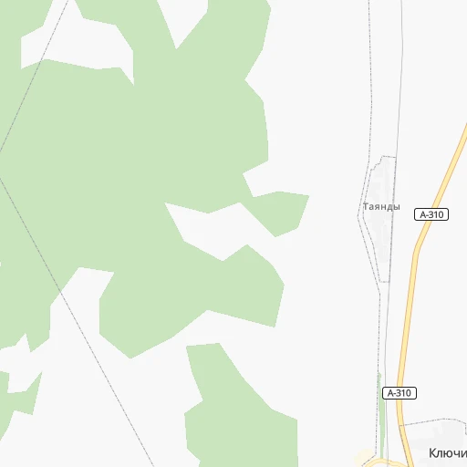

How to get from Stantsiya Tayandy (Chelyabinsk) to Reftinskiy (Sverdlovsk)
Calculate route from Stantsiya Tayandy (Chelyabinsk, Russia) to Reftinskiy (Sverdlovsk, Russia).
The flight distance (as the crow flies) between Stantsiya Tayandy and Reftinskiy is 266.7 km.
Roadmap (route) to go from Stantsiya Tayandy to Reftinskiy detailed above, you can also see the course layout on the map.
While doing trip Stantsiya Tayandy - Reftinskiy by car, the calculated route ends at a distance , or more straight.
Distance and duration of the route between Stantsiya Tayandy and Reftinskiy
Calculation of distance and route from Reftinskiy to Stantsiya Tayandy :
266.7325.8 km5h7mn
Continue 0h0mn 69 mTurn right onto Станционная улица 0h0mn 9 mTurn slight right onto Станционная улица 0h15mn 4.3 kmContinue onto Северная улица 0h2mn 1.0 kmContinue 0h0mn 53 mTurn left onto А-310 0h27mn 32.5 kmKeep left onto А-310 0h11mn 11.2 kmKeep left onto Троицкий тракт 0h0mn 121 mKeep right onto Троицкий тракт 0h4mn 3.8 kmKeep right onto Троицкий тракт 0h2mn 2.3 kmTurn left onto Резервная улица 0h0mn 138 mTurn right onto улица Шаумяна 0h1mn 669 mTurn left onto Омская улица 0h1mn 548 mTurn right onto улица Блюхера 0h1mn 965 mContinue onto Свердловский проспект 0h9mn 8.5 kmContinue onto Свердловский тракт 0h11mn 10.7 kmKeep right 0h4mn 4.2 kmAt roundabout, take exit 3 onto Подъезд к селу Долгодеревенское 0h0mn 244 mContinue onto 75К-220 0h2mn 2.4 kmTurn left onto 75К-138 0h0mn 509 mKeep right and take М-5 toward Екатеринбург 2h1mn 141.1 kmKeep left and drive toward Челябинск, Сысерть 0h1mn 705 mKeep right onto 65К-2501000 and drive toward Екатеринбург, Кашино, Сысерть, Арамиль 0h0mn 54 mKeep left and drive toward Екатеринбург, Арамиль 0h1mn 658 mKeep right onto г. Арамиль — д. Андреевка and drive toward Арамиль 0h1mn 1.1 kmKeep right onto 65К-2501130 0h7mn 5.6 kmTurn left onto 65К-2511120 0h1mn 580 mTurn right onto 65К-2511000 0h4mn 5.3 kmKeep left onto 65К-2504000 0h6mn 6.1 kmTurn right onto 65К-2504110 0h1mn 949 mContinue onto 65К-2504110 0h1mn 723 mKeep left 0h5mn 2.7 kmKeep left 0h3mn 2.1 kmTurn right onto улица Ленина 0h1mn 1.1 kmTurn left onto Р-354 and drive toward Екатеринбург, Тюмень 0h2mn 2.0 kmKeep right onto Р-354 and take Р-351 toward Тюмень 0h21mn 26.6 kmTurn left onto 65К-0611000 0h16mn 20.1 kmAt roundabout, take exit 2 0h1mn 998 mTurn right onto Промышленная улица 0h6mn 6.0 kmTurn right onto Луговая улица 0h17mn 16.7 kmTurn right onto улица Гагарина 0h0mn 174 mTurn right 0h0mn 144 mArrive at destination 0h0mn 0 m
Travel from Stantsiya Tayandy (Sverdlovsk) to a selection of major cities.
Distances from Stantsiya Tayandy to biggest cities in Chelyabinsk
Other major cities in country :
- Barnaul [04], 599,579 inhabitants. 1,473 km
- Vladivostok [59], 587,022 inhabitants. 5,094 km
- Irkutsk [20], 586,695 inhabitants. 2,818 km
- Khabarovsk [30], 579,000 inhabitants. 4,913 km
- Khabarovsk Vtoroy [30], 578,303 inhabitants. 4,919 km
- Orenburg [55], 550,204 inhabitants. 523 km
- Novokuznetsk [29], 539,616 inhabitants. 1,677 km
- Ryazan' [62], 520,173 inhabitants. 1,382 km
- Tyumen [78], 519,119 inhabitants. 382 km
- Lipetsk [43], 515,655 inhabitants. 1,443 km
- Penza [57], 512,602 inhabitants. 1,074 km
- Naberezhnyye Chelny [73], 509,870 inhabitants. 572 km
- Kalininskiy [42], 504,641 inhabitants. 1,924 km
- Astrakhan [07], 502,533 inhabitants. 1,314 km
- Makhachkala [17], 497,959 inhabitants. 1,642 km
- Tomsk [75], 485,519 inhabitants. 1,498 km
- Kemerovo [29], 477,090 inhabitants. 1,578 km
- Tula [76], 468,825 inhabitants. 1,523 km
- Kirov [33], 457,383 inhabitants. 829 km
- Cheboksary [16], 446,781 inhabitants. 897 km
Route from Reftinskiy to major cities (Russia).
- Distance Reftinskiy Moscow1,481 km
- Distance Reftinskiy Saint Petersburg1,833 km
- Distance Reftinskiy Novosibirsk1,335 km
- Distance Reftinskiy Nizhniy Novgorod1,080 km
- Distance Reftinskiy Samara850 km
- Distance Reftinskiy Omsk762 km
- Distance Reftinskiy Kazan785 km
- Distance Reftinskiy Rostov-na-Donu1,844 km
- Distance Reftinskiy Chelyabinsk216 km
- Distance Reftinskiy Ufa441 km
- Distance Reftinskiy Volgograd1,475 km
- Distance Reftinskiy Perm340 km
- Distance Reftinskiy Krasnoyarsk1,901 km
- Distance Reftinskiy Saratov1,186 km
- Distance Reftinskiy Voronezh1,569 km
- Distance Reftinskiy Tol'yatti874 km
- Distance Reftinskiy Krasnodar2,061 km
- Distance Reftinskiy Ulyanovsk887 km
- Distance Reftinskiy Izhevsk514 km
- Distance Reftinskiy Yaroslavl1,305 km
Nearest cities to Stantsiya Tayandy :
- Yekaterinburg, 1,349,772 inhabitants. 243 km
- Chelyabinsk, 1,062,919 inhabitants. 52 km
- Magnitogorsk, 413,351 inhabitants. 203 km
- Zlatoust, 191,366 inhabitants. 115 km
- Kamensk-Ural'skiy, 182,500 inhabitants. 196 km
- Miass, 167,500 inhabitants. 82 km
- Pervoural'sk, 133,600 inhabitants. 258 km
- Novoural'sk, 93,849 inhabitants. 292 km
- Troitsk, 82,338 inhabitants. 71 km
- Ozersk, 81,023 inhabitants. 122 km
- Shadrinsk, 79,479 inhabitants. 216 km
- Asbest, 74,583 inhabitants. 257 km
- Kopeysk, 70,780 inhabitants. 52 km
- Beloretsk, 70,468 inhabitants. 202 km
- Polevskoy, 65,770 inhabitants. 205 km
- Revda, 61,785 inhabitants. 248 km
- Sibay, 61,590 inhabitants. 279 km
- Verkhnyaya Pyshma, 59,061 inhabitants. 256 km
- Lesnoy, 55,100 inhabitants. 344 km
- Snezhinsk, 50,086 inhabitants. 157 km
- Satka, 49,384 inhabitants. 146 km
- Beryozovsky, 47,000 inhabitants. 247 km
- Chebarkul', 46,502 inhabitants. 64 km
- Irbit, 41,647 inhabitants. 349 km
- Kyshtym, 41,625 inhabitants. 121 km
- Korkino, 40,046 inhabitants. 23 km
- Yuzhnoural'sk, 39,200 inhabitants. 29 km
- Uchaly, 37,788 inhabitants. 123 km
- Rezh, 37,420 inhabitants. 297 km
- Sukhoy Log, 36,329 inhabitants. 251 km
- Trekhgornyy, 34,500 inhabitants. 179 km
- Artemovskiy, 33,700 inhabitants. 298 km
- Verkhniy Ufaley, 33,245 inhabitants. 164 km
- Bogdanovich, 32,270 inhabitants. 237 km
- Yemanzhelinsk, 29,849 inhabitants. 8 km
- Kartaly, 28,503 inhabitants. 188 km
- Kamyshlov, 28,006 inhabitants. 255 km
- Zarechnyy, 27,758 inhabitants. 235 km
- Nev'yansk, 25,900 inhabitants. 318 km
- Kirovgrad, 22,685 inhabitants. 312 km
- Sysert', 21,942 inhabitants. 202 km
- Bakal, 21,762 inhabitants. 159 km
- Sredneuralsk, 20,169 inhabitants. 259 km
- Kusa, 19,818 inhabitants. 135 km
- Talitsa, 19,100 inhabitants. 254 km
- Talitsa, 18,602 inhabitants. 300 km
- Shumikha, 18,499 inhabitants. 143 km
- Kasli, 17,911 inhabitants. 136 km
- Reftinskiy, 17,673 inhabitants. 267 km
- Baymak, 17,493 inhabitants. 304 km
Location Stantsiya Tayandy (Chelyabinsk) :
| Country flag |  |
| Location | Stantsiya Tayandy |
| State | Chelyabinsk |
| County | |
| Country | Russia |
| Country code / ISO 2 | RU |
| Latitude | 54.7020000 |
| Longitude | 61.2456000 |
| Altitude | 0 meters |
| Time zone | Asia/Yekaterinburg |
Location Reftinskiy (Sverdlovsk) :
| Country flag | |
| Location | Reftinskiy |
| State | Sverdlovsk |
| County | |
| Country | Russia |
| Country code / ISO 2 | RU |
| Latitude | 57.0901300 |
| Longitude | 61.6769200 |
| Altitude | 0 meters |
| Time zone | Asia/Yekaterinburg |