

How to get from Hashtrūd (East Azerbaijan) to Āstāneh-ye Ashrafīyeh (Gīlān)
Calculate route from Hashtrūd (East Azerbaijan, Iran) to Āstāneh-ye Ashrafīyeh (Gīlān, Iran).
The flight distance (as the crow flies) between Hashtrūd and Āstāneh-ye Ashrafīyeh is 256.5 km.
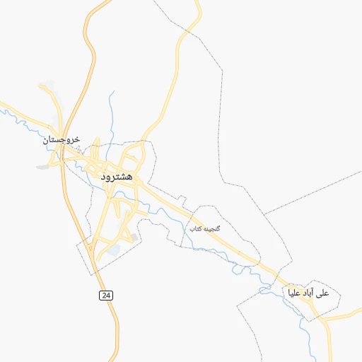
Roadmap (route) to go from Hashtrūd to Āstāneh-ye Ashrafīyeh detailed above, you can also see the course layout on the map.
While doing trip Hashtrūd - Āstāneh-ye Ashrafīyeh by car, the calculated route ends at a distance , or more straight.
Distance and duration of the route between Hashtrūd and Āstāneh-ye Ashrafīyeh
Calculation of distance and route from Āstāneh-ye Ashrafīyeh to Hashtrūd :
256.5347.3 km5h7mn
Continue onto شهید بهشتی شمالی 0h0mn 221 mAt roundabout, take exit 3 onto امام خمینی (ره) 0h0mn 351 mAt roundabout, take exit 1 onto امام خمینی (ره) 0h2mn 1.9 kmContinue onto امام خمینی (ره) 0h1mn 568 mTurn slight right onto امام 0h3mn 2.7 kmTurn left 0h0mn 91 mTurn slight right onto میانه - هشترود 1h57mn 57.4 kmKeep right onto شهدای خاتون آباد 0h1mn 1.3 kmAt roundabout, take exit 2 onto سرچشمه جنوبی 0h0mn 418 mTurn right onto شهید بهشتی 0h1mn 570 mTurn left onto قدس 0h0mn 182 mAt roundabout, take exit 2 onto ارتش 0h1mn 1.2 kmKeep right onto ارتش 0h0mn 241 mAt roundabout, take exit 1 onto زینبیه 0h0mn 529 mAt roundabout, take exit 1 onto زینبیه 0h1mn 1.1 kmAt roundabout, take exit 4 onto زینبیه 0h2mn 2.7 kmContinue onto زنجان - میانه 0h1mn 776 mTurn left onto 316 0h0mn 40 mTurn slight right onto جاده خلخال - میانه 0h9mn 9.0 kmKeep left onto جاده خلخال - میانه 1h52mn 51.6 kmTurn right onto 316 0h4mn 3.7 kmAt roundabout, take exit 2 0h2mn 2.5 kmTurn sharp left 0h0mn 165 mTurn slight right onto اردبیل - سرچم 0h2mn 2.9 kmTurn right onto سرچم - خلخال 0h0mn 88 mTurn slight right onto خلخال - سرچم 0h20mn 27.0 kmKeep left 0h0mn 49 mTurn left onto جاده خلخال - هشجین 0h2mn 2.6 kmAt roundabout, take exit 1 onto خیابان شهید محمدعلی رجایی 0h1mn 740 mAt roundabout, take exit 2 onto رجایی 0h0mn 253 mTurn left 0h0mn 110 mTurn sharp right onto آیت الله دستغیب 0h0mn 147 mTurn sharp left 0h0mn 265 mTurn right onto آیت الله طالقانی 0h0mn 311 mAt roundabout, take exit 2 onto میدان معلم 0h4mn 4.9 kmTurn slight right onto خلخال - اسالم 1h52mn 73.9 kmKeep right onto آستارا - رشت 0h15mn 18.2 kmKeep right 0h1mn 968 mTurn left onto 494 0h30mn 33.2 kmAt roundabout, take exit 1 onto بلوار رزمجو 0h3mn 3.1 kmContinue onto جاده رشت - پیربازار 0h2mn 2.6 kmAt roundabout, take exit 1 onto بلوار شهیدان یوسفی 0h1mn 598 mAt roundabout, take exit 3 onto بلوار اردشیری 0h0mn 221 mKeep right 0h0mn 272 mAt roundabout, take exit 1 onto بلوار گلسار 0h1mn 610 mAt roundabout, take exit 2 onto تختی 0h0mn 214 mTurn left onto جوان 0h0mn 302 mKeep left 0h0mn 60 mKeep right 0h0mn 30 mTurn slight right onto عاطفی 0h1mn 707 mTurn right onto امین الضرب 0h0mn 235 mAt roundabout, take exit 4 onto بلوار شهدا 0h2mn 2.0 kmKeep left onto پل جانبازان 0h12mn 12.7 kmKeep right onto مطهری غربی 0h1mn 1.1 kmAt roundabout, take exit 2 onto مطهری شرقی 0h1mn 811 mAt roundabout, take exit 2 onto بزرگراه رشت - لاهیجان 0h13mn 15.0 kmAt roundabout, take exit 7 onto بلوار مطهری 0h1mn 1.0 kmTurn right onto آیت الله مدرس 0h1mn 554 mAt roundabout, take exit 1 onto امام خمینی 0h0mn 235 mTurn sharp right onto خیابان شریعتی 0h0mn 35 mTurn left 0h0mn 50 mArrive at destination 0h0mn 0 m
Travel from Hashtrūd (Gīlān) to a selection of major cities.
Distances from Hashtrūd to biggest cities in East Azerbaijan
Other major cities in country :
- Zanjan [36], 357,471 inhabitants. 156 km
- Bandar Abbas [11], 352,173 inhabitants. 1,436 km
- Sanandaj [16], 349,176 inhabitants. 241 km
- Qazvin [38], 333,635 inhabitants. 295 km
- Khorramshahr [15], 330,606 inhabitants. 790 km
- Khorramabad [23], 329,825 inhabitants. 460 km
- Khomeyni Shahr [28], 277,334 inhabitants. 672 km
- Sari [35], 255,396 inhabitants. 544 km
- Borujerd [23], 251,958 inhabitants. 427 km
- Qarchak [26], 251,834 inhabitants. 465 km
- Gorgan [37], 244,937 inhabitants. 660 km
- Sabzevar [42], 226,183 inhabitants. 957 km
- Najafabad [28], 223,450 inhabitants. 667 km
- Neyshabur [42], 220,929 inhabitants. 1,055 km
- Nazarabad [44], 213,388 inhabitants. 360 km
- Bukan [01], 213,331 inhabitants. 130 km
- Sirjan [29], 207,645 inhabitants. 1,199 km
- Babol [35], 202,796 inhabitants. 511 km
- Amol [35], 199,382 inhabitants. 484 km
- Birjand [41], 196,982 inhabitants. 1,219 km
Route from Āstāneh-ye Ashrafīyeh to major cities (Iran).
- Distance Āstāneh-ye Ashrafīyeh Tehran219 km
- Distance Āstāneh-ye Ashrafīyeh Mashhad864 km
- Distance Āstāneh-ye Ashrafīyeh Isfahan537 km
- Distance Āstāneh-ye Ashrafīyeh Karaj185 km
- Distance Āstāneh-ye Ashrafīyeh Tabriz334 km
- Distance Āstāneh-ye Ashrafīyeh Shiraz885 km
- Distance Āstāneh-ye Ashrafīyeh Qom304 km
- Distance Āstāneh-ye Ashrafīyeh Ahvaz672 km
- Distance Āstāneh-ye Ashrafīyeh Pasragad Branch307 km
- Distance Āstāneh-ye Ashrafīyeh Kahriz413 km
- Distance Āstāneh-ye Ashrafīyeh Kermanshah419 km
- Distance Āstāneh-ye Ashrafīyeh Kerman1,019 km
- Distance Āstāneh-ye Ashrafīyeh Orumiyeh432 km
- Distance Āstāneh-ye Ashrafīyeh Zahedan1,332 km
- Distance Āstāneh-ye Ashrafīyeh Hamadan303 km
- Distance Āstāneh-ye Ashrafīyeh Azadshahr302 km
- Distance Āstāneh-ye Ashrafīyeh Arak353 km
- Distance Āstāneh-ye Ashrafīyeh Yazd722 km
- Distance Āstāneh-ye Ashrafīyeh Ardabil182 km
- Distance Āstāneh-ye Ashrafīyeh Abadan786 km
Nearest cities to Hashtrūd :
- Tabriz, 1,424,641 inhabitants. 95 km
- Pasragad Branch, 787,878 inhabitants. 327 km
- Rasht, 594,590 inhabitants. 226 km
- Orumiyeh, 577,307 inhabitants. 175 km
- Hamadan, 528,256 inhabitants. 326 km
- Azadshahr, 514,102 inhabitants. 329 km
- Ardabil, 410,753 inhabitants. 139 km
- Zanjan, 357,471 inhabitants. 156 km
- Sanandaj, 349,176 inhabitants. 241 km
- Qazvin, 333,635 inhabitants. 295 km
- Bukan, 213,331 inhabitants. 130 km
- Khowy, 175,370 inhabitants. 219 km
- Mahabad, 162,434 inhabitants. 142 km
- Saqqez, 151,237 inhabitants. 153 km
- Miandoab, 132,819 inhabitants. 101 km
- Marand, 124,191 inhabitants. 154 km
- Bandar-e Anzali, 110,826 inhabitants. 213 km
- Baneh, 104,799 inhabitants. 195 km
- Parsabad, 101,661 inhabitants. 253 km
- Ahar, 94,348 inhabitants. 111 km
- Marivan, 91,664 inhabitants. 232 km
- Qorveh, 87,953 inhabitants. 266 km
- Salmas, 81,606 inhabitants. 216 km
- Bonab, 80,359 inhabitants. 89 km
- Alvand, 74,889 inhabitants. 228 km
- Naqadeh, 73,528 inhabitants. 158 km
- Takestan, 71,499 inhabitants. 283 km
- Abhar, 69,889 inhabitants. 243 km
- Piranshahr, 61,973 inhabitants. 190 km
- Kamyaran, 61,642 inhabitants. 299 km
- Asadabad, 59,617 inhabitants. 315 km
- Bijar, 53,871 inhabitants. 186 km
- Kangavar, 53,414 inhabitants. 341 km
- Takab, 51,541 inhabitants. 120 km
- Khalkhal, 51,024 inhabitants. 131 km
- Oshnaviyeh, 50,661 inhabitants. 180 km
- Khorramdarreh, 50,528 inhabitants. 238 km
- Hashtpar, 45,305 inhabitants. 167 km
- Sonqor, 43,174 inhabitants. 304 km
- Astaneh-ye Ashrafiyeh, 42,784 inhabitants. 257 km
- Shahin Dezh, 41,442 inhabitants. 99 km
- Astara, 39,065 inhabitants. 192 km
- Javanrud, 38,657 inhabitants. 302 km
- Qarah Zia' od Din, 31,947 inhabitants. 237 km
- `Ajab Shir, 29,675 inhabitants. 102 km
- Bahar, 28,645 inhabitants. 312 km
- Fuman, 27,763 inhabitants. 202 km
- Paveh, 17,779 inhabitants. 278 km
- Padegan-e Manjil, 17,396 inhabitants. 225 km
- Hashtrud, 16,888 inhabitants. 0 km
Location Hashtrūd (East Azerbaijan) :
| Country flag |  |
| Location | Hashtrūd |
| State | East Azerbaijan |
| County | |
| Country | Iran |
| Country code / ISO 2 | IR |
| Latitude | 37.4779000 |
| Longitude | 47.0508000 |
| Altitude | 0 meters |
| Time zone | Asia/Tehran |
Location Āstāneh-ye Ashrafīyeh (Gīlān) :
| Country flag | |
| Location | Āstāneh-ye Ashrafīyeh |
| State | Gīlān |
| County | |
| Country | Iran |
| Country code / ISO 2 | IR |
| Latitude | 37.2631800 |
| Longitude | 49.9432500 |
| Altitude | 0 meters |
| Time zone | Asia/Tehran |