

How to get from Golra Junction Railway Station (Islāmābād) to Gujranwala (Punjab)
Calculate route from Golra Junction Railway Station (Islāmābād, Pakistan) to Gujranwala (Punjab, Pakistan).
The flight distance (as the crow flies) between Golra Junction Railway Station and Gujranwala is 204.2 km.
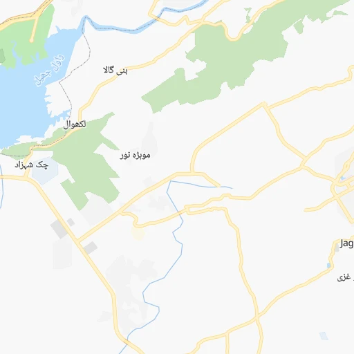
Roadmap (route) to go from Golra Junction Railway Station to Gujranwala detailed above, you can also see the course layout on the map.
While doing trip Golra Junction Railway Station - Gujranwala by car, the calculated route ends at a distance , or more straight.
Distance and duration of the route between Golra Junction Railway Station and Gujranwala
Calculation of distance and route from Gujranwala to Golra Junction Railway Station :
204.2223.3 km3h49mn
Continue 0h2mn 588 mTurn right onto Golra Road 0h2mn 1.3 kmTurn right onto اسٹریٹ 589 0h1mn 615 mTurn left onto Street 588 0h2mn 882 mTurn left onto Street 687 0h12mn 12.5 kmKeep right onto Mall Road 0h0mn 345 mKeep right onto N-5 0h0mn 163 mTurn right onto گرینڈ ٹرنک روڈ 1h16mn 104.5 kmKeep left 0h0mn 73 mContinue onto GTS Road 0h4mn 4.5 kmTurn left onto گرینڈ ٹرنک روڈ 1h40mn 57.4 kmContinue onto گرینڈ ٹرنک روڈ 0h2mn 2.2 kmKeep right onto Wazirabad Bypass 0h6mn 9.3 kmAt roundabout, take exit 2 onto گرینڈ ٹرنک روڈ 0h19mn 27.7 kmTurn right onto Gondalanwala Road 0h0mn 91 mAt roundabout, take exit 2 onto Bazaar Kharadan 0h1mn 787 mTurn left 0h1mn 501 mArrive at destination 0h0mn 0 m
Travel from Golra Junction Railway Station (Punjab) to a selection of major cities.
Distances from Golra Junction Railway Station to biggest cities in Islāmābād
Other major cities in country :
- Jhang Sadr [04], 341,210 inhabitants. 274 km
- Gujrat [04], 301,506 inhabitants. 161 km
- Mardan [03], 300,424 inhabitants. 102 km
- Malir Cantonment [05], 300,000 inhabitants. 1,119 km
- Kasur [04], 290,643 inhabitants. 317 km
- Mingora [03], 279,914 inhabitants. 135 km
- Dera Ghazi Khan [04], 236,093 inhabitants. 459 km
- Sahiwal [04], 235,695 inhabitants. 335 km
- Nawabshah [05], 229,504 inhabitants. 936 km
- Okara [04], 223,648 inhabitants. 322 km
- Mirpur Khas [05], 215,657 inhabitants. 983 km
- Chiniot [04], 201,781 inhabitants. 217 km
- Shahkot [04], 200,000 inhabitants. 239 km
- Kamoke [04], 199,531 inhabitants. 223 km
- Saddiqabad [04], 189,876 inhabitants. 655 km
- Burewala [04], 183,915 inhabitants. 391 km
- Jacobabad [05], 170,588 inhabitants. 738 km
- Muzaffargarh [04], 165,192 inhabitants. 433 km
- Muridke [04], 164,246 inhabitants. 241 km
- Jhelum [04], 164,080 inhabitants. 110 km
Route from Gujranwala to major cities (Pakistan).
- Distance Gujranwala Karachi1,073 km
- Distance Gujranwala Hyderabad942 km
- Distance Gujranwala Peshawar319 km
- Distance Gujranwala Quetta719 km
- Distance Gujranwala Muzaffarabad255 km
- Distance Gujranwala Battagram301 km
- Distance Gujranwala Kotli154 km
- Distance Gujranwala Islamabad204 km
- Distance Gujranwala Sukkur714 km
- Distance Gujranwala Larkana771 km
- Distance Gujranwala Bhimbar92 km
- Distance Gujranwala Mardan302 km
- Distance Gujranwala Malir Cantonment1,053 km
- Distance Gujranwala Mingora338 km
- Distance Gujranwala Nawabshah865 km
- Distance Gujranwala Mirpur Khas894 km
- Distance Gujranwala Jacobabad701 km
- Distance Gujranwala Shikarpur710 km
- Distance Gujranwala Kohat301 km
- Distance Gujranwala Khuzdar876 km
Nearest cities to Golra Junction Railway Station :
- Lahore, 6,310,888 inhabitants. 269 km
- Faisalabad, 2,506,595 inhabitants. 251 km
- Rawalpindi, 1,743,101 inhabitants. 12 km
- Gujranwala, 1,384,471 inhabitants. 205 km
- Peshawar, 1,218,773 inhabitants. 132 km
- Muzaffarabad, 725,000 inhabitants. 92 km
- Battagram, 700,000 inhabitants. 112 km
- Kotli, 640,000 inhabitants. 90 km
- Islamabad, 601,600 inhabitants. 11 km
- Sargodha, 542,603 inhabitants. 178 km
- Sialkot, 477,396 inhabitants. 198 km
- Shekhupura, 361,303 inhabitants. 239 km
- Bhimbar, 342,900 inhabitants. 131 km
- Jhang Sadr, 341,210 inhabitants. 274 km
- Gujrat, 301,506 inhabitants. 161 km
- Mardan, 300,424 inhabitants. 102 km
- Kasur, 290,643 inhabitants. 317 km
- Mingora, 279,914 inhabitants. 135 km
- Okara, 223,648 inhabitants. 322 km
- Chiniot, 201,781 inhabitants. 217 km
- Shahkot, 200,000 inhabitants. 239 km
- Kamoke, 199,531 inhabitants. 223 km
- Muridke, 164,246 inhabitants. 241 km
- Jhelum, 164,080 inhabitants. 110 km
- Hafizabad, 153,656 inhabitants. 191 km
- Kohat, 151,427 inhabitants. 139 km
- Gojra, 139,726 inhabitants. 282 km
- Mandi Bahauddin, 129,733 inhabitants. 131 km
- Daska Kalan, 126,924 inhabitants. 199 km
- Abbottabad, 120,000 inhabitants. 58 km
- Jaranwala, 119,785 inhabitants. 264 km
- Kamalia, 112,426 inhabitants. 329 km
- Khushab, 102,793 inhabitants. 163 km
- Wazirabad, 102,444 inhabitants. 175 km
- Dera Ismail Khan, 101,616 inhabitants. 280 km
- Chakwal, 101,200 inhabitants. 83 km
- Swabi, 97,363 inhabitants. 67 km
- Nowshera Cantonment, 96,766 inhabitants. 95 km
- Charsadda, 95,319 inhabitants. 124 km
- Jalalpur Jattan, 93,883 inhabitants. 164 km
- Mianwali, 89,570 inhabitants. 180 km
- Mianke Mor, 86,900 inhabitants. 290 km
- Attock City, 85,479 inhabitants. 55 km
- Bhakkar, 81,950 inhabitants. 288 km
- Kharian, 81,435 inhabitants. 129 km
- Layyah, 78,954 inhabitants. 356 km
- Bhalwal, 74,744 inhabitants. 156 km
- Pattoki, 70,436 inhabitants. 307 km
- Chenab Nagar, 70,000 inhabitants. 213 km
- Gujar Khan, 69,374 inhabitants. 57 km
Location Golra Junction Railway Station (Islāmābād) :
| Country flag |  |
| Location | Golra Junction Railway Station |
| State | Islāmābād |
| County | |
| Country | Pakistan |
| Country code / ISO 2 | PK |
| Latitude | 33.6705400 |
| Longitude | 72.9477600 |
| Altitude | 0 meters |
| Time zone | Asia/Karachi |
Location Gujranwala (Punjab) :
| Country flag | |
| Location | Gujranwala |
| State | Punjab |
| County | |
| Country | Pakistan |
| Country code / ISO 2 | PK |
| Latitude | 32.1556700 |
| Longitude | 74.1870500 |
| Altitude | 0 meters |
| Time zone | Asia/Karachi |

