
How to get from Sirnapalli (Telangana) to Bijapur (Karnataka)
Calculate route from Sirnapalli (Telangana, India) to Bijapur (Karnataka, India).
The flight distance (as the crow flies) between Sirnapalli and Bijapur is 327.7 km.
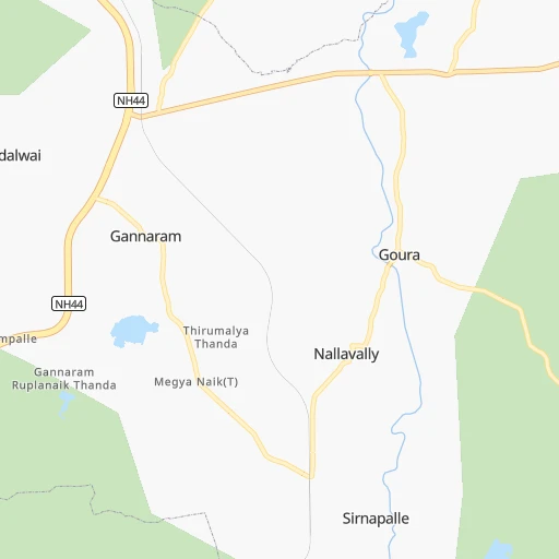
Roadmap (route) to go from Sirnapalli to Bijapur detailed above, you can also see the course layout on the map.
While doing trip Sirnapalli - Bijapur by car, the calculated route ends at a distance , or more straight.
Distance and duration of the route between Sirnapalli and Bijapur
Calculation of distance and route from Bijapur to Sirnapalli :
327.7400.4 km6h15mn
Continue 0h0mn 83 mTurn sharp left 0h1mn 523 mContinue 0h6mn 4.9 kmTurn left 0h0mn 236 mTurn slight right 0h1mn 324 mTurn slight right 0h2mn 850 mKeep right 0h1mn 336 mTurn left onto NH44 0h11mn 12.5 kmTurn right 0h27mn 27.4 kmTurn left 0h21mn 17.3 kmTurn left onto NH765D 0h0mn 491 mKeep right onto Jukkal Kallakal Road 0h4mn 3.8 kmTurn left 0h8mn 6.5 kmKeep right 0h1mn 1.0 kmTurn left 0h1mn 870 mTurn right 0h2mn 1.5 kmTurn left 0h6mn 6.3 kmKeep left 0h1mn 921 mKeep right 0h2mn 2.0 kmTurn right onto NH161B 0h11mn 13.0 kmTurn left 0h0mn 402 mTurn right 0h1mn 596 mContinue onto NH161B 0h6mn 6.5 kmContinue 0h7mn 7.1 kmTurn left 0h8mn 7.6 kmTurn right 0h0mn 19 mTurn left 0h4mn 3.0 kmTurn left 0h0mn 20 mTurn left 0h0mn 91 mTurn left 0h0mn 33 mTurn sharp right 0h0mn 10 mTurn left 0h0mn 156 mTurn slight left 0h6mn 4.8 kmKeep left 0h4mn 3.7 kmTurn slight right 0h2mn 1.7 kmKeep right 0h0mn 337 mKeep right 0h2mn 1.5 kmTurn left 0h0mn 236 mTurn right onto Udgir Road 0h4mn 4.9 kmTurn left onto Bidar - Humnabad Road 1h39mn 45.4 kmAt roundabout, take exit 2 onto Ramachandra Veerappa Chowk 0h2mn 1.8 kmKeep left onto Bidar - Lakshmisagara Highway 0h1mn 962 mTurn left onto Bidar - Lakshmisagara Highway 1h47mn 54.9 kmContinue onto Nehru Ganj 0h2mn 2.7 kmAt roundabout, take exit 2 0h1mn 922 mAt roundabout, take exit 5 onto Tank Bund Road 0h1mn 1.2 kmTurn sharp left 0h0mn 183 mKeep right 0h0mn 214 mTurn left 0h2mn 1.8 kmAt roundabout, take exit 1 onto Ring Road 0h1mn 1.4 kmKeep right onto Gulbarga - Solapur Highway 0h25mn 28.8 kmTurn left 0h26mn 29.1 kmTurn right onto Bidar - Lakshmisagara Highway 0h21mn 24.5 kmKeep right 0h2mn 2.0 kmTurn sharp left 0h1mn 652 mTurn right onto SH16 0h0mn 223 mTurn left onto Vivekananda Circle 0h0mn 18 mTurn left onto SH16 0h1mn 863 mTurn left onto Vijayapur - Sindagi Road 0h2mn 2.3 kmKeep right onto Vijayapur - Sindagi Road 0h0mn 62 mTurn slight right onto Sindagi Bypass 1h47mn 54.3 kmTurn left 0h0mn 260 mTurn right onto Jama Masjid Road 0h3mn 2.5 kmArrive at destination 0h0mn 0 m
Travel from Sirnapalli (Karnataka) to a selection of major cities.
Distances from Sirnapalli to biggest cities in Telangana
- Nirmal,80,982 inhabitants.68 km
- Kottagudem,79,247 inhabitants.269 km
- Mancheral,77,998 inhabitants.129 km
- Paloncha,75,224 inhabitants.276 km
- Bodhan,73,938 inhabitants.45 km
- Sirsilla,71,499 inhabitants.58 km
- Kamareddi,71,042 inhabitants.20 km
- Palwancha,68,561 inhabitants.274 km
- Bellampalli,66,660 inhabitants.143 km
- Mandamarri,66,176 inhabitants.138 km
- Siddipet,64,562 inhabitants.74 km
- Tandur,63,239 inhabitants.156 km
- Koratla,60,231 inhabitants.60 km
- Sangareddi,59,199 inhabitants.98 km
- Kodar,59,170 inhabitants.244 km
- Gadwal,55,952 inhabitants.256 km
- Wanparti,55,182 inhabitants.237 km
- Gaddi Annaram,53,622 inhabitants.128 km
- Bhongir,50,094 inhabitants.126 km
- Jangaon,47,558 inhabitants.126 km
Other major cities in country :
- Gorakhpur [10], 1,324,570 inhabitants. 1,248 km
- Nashik [16], 1,289,497 inhabitants. 500 km
- Pimpri [16], 1,284,606 inhabitants. 471 km
- Kalyan [16], 1,262,255 inhabitants. 547 km
- Thane [16], 1,261,517 inhabitants. 565 km
- Meerut [36], 1,223,184 inhabitants. 1,169 km
- Nowrangapur [21], 1,220,946 inhabitants. 458 km
- Faridabad [10], 1,220,229 inhabitants. 1,109 km
- Ghaziabad [36], 1,199,191 inhabitants. 1,136 km
- Dombivli [16], 1,193,000 inhabitants. 552 km
- Rajkot [09], 1,177,362 inhabitants. 888 km
- Varanasi [36], 1,164,404 inhabitants. 904 km
- Amritsar [23], 1,092,450 inhabitants. 1,501 km
- Allahabad [36], 1,073,438 inhabitants. 858 km
- Visakhapatnam [02], 1,063,178 inhabitants. 529 km
- Teni [25], 1,034,724 inhabitants. 947 km
- Jabalpur [35], 1,030,168 inhabitants. 549 km
- Haora [28], 1,027,672 inhabitants. 1,142 km
- Aurangabad [16], 1,016,441 inhabitants. 345 km
- Shivaji Nagar [16], 1,000,000 inhabitants. 466 km
Route from Bijapur to major cities (India).
- Distance Bijapur Mumbai391 km
- Distance Bijapur Delhi1,326 km
- Distance Bijapur Kolkata1,470 km
- Distance Bijapur Chennai643 km
- Distance Bijapur Ahmedabad764 km
- Distance Bijapur Hyderabad298 km
- Distance Bijapur Pune273 km
- Distance Bijapur Surat574 km
- Distance Bijapur Kanpur1,175 km
- Distance Bijapur Jaipur1,124 km
- Distance Bijapur Navi Mumbai377 km
- Distance Bijapur Lucknow1,237 km
- Distance Bijapur Nagpur598 km
- Distance Bijapur Indore656 km
- Distance Bijapur Patna1,381 km
- Distance Bijapur Bhopal737 km
- Distance Bijapur Ludhiana1,568 km
- Distance Bijapur Tirunelveli926 km
- Distance Bijapur Agra1,177 km
- Distance Bijapur Vadodara664 km
Nearest cities to Sirnapalli :
- Hyderabad, 3,597,816 inhabitants. 124 km
- Nagpur, 2,228,018 inhabitants. 308 km
- Aurangabad, 1,016,441 inhabitants. 345 km
- Solapur, 997,281 inhabitants. 266 km
- Vijayawada, 874,587 inhabitants. 335 km
- Amravati, 603,837 inhabitants. 278 km
- Warangal, 557,802 inhabitants. 149 km
- Nanded, 550,564 inhabitants. 126 km
- Guntur, 530,577 inhabitants. 337 km
- Gulbarga, 483,615 inhabitants. 199 km
- Kurnool, 460,184 inhabitants. 297 km
- Ramgundam, 452,261 inhabitants. 129 km
- Jalgaon, 429,298 inhabitants. 398 km
- Akola, 428,857 inhabitants. 281 km
- Latur, 348,967 inhabitants. 180 km
- Kukatpalli, 341,709 inhabitants. 113 km
- Chanda, 328,351 inhabitants. 195 km
- Nizamabad, 305,438 inhabitants. 27 km
- Parbhani, 289,629 inhabitants. 180 km
- Bijapur, 271,064 inhabitants. 328 km
- Jalna, 262,034 inhabitants. 293 km
- Lal Bahadur Nagar, 261,987 inhabitants. 130 km
- Ramagundam, 235,000 inhabitants. 130 km
- Karimnagar, 228,745 inhabitants. 91 km
- Raichur, 225,962 inhabitants. 272 km
- Quthbullapur, 225,816 inhabitants. 112 km
- Secunderabad, 204,182 inhabitants. 113 km
- Bidar, 204,071 inhabitants. 101 km
- Burhanpur, 202,695 inhabitants. 380 km
- Machilipatnam, 192,827 inhabitants. 398 km
- Ellore, 183,387 inhabitants. 360 km
- Bhusaval, 183,001 inhabitants. 386 km
- Ongole, 172,872 inhabitants. 382 km
- Khammam, 170,503 inhabitants. 242 km
- Adoni, 163,631 inhabitants. 336 km
- Raj-Nandgaon, 150,755 inhabitants. 410 km
- Serilingampalle, 150,525 inhabitants. 111 km
- Malkajgiri, 150,000 inhabitants. 119 km
- Mahbubnagar, 136,135 inhabitants. 196 km
- Yavatmal, 128,175 inhabitants. 213 km
- Gondia, 124,897 inhabitants. 387 km
- Nalgonda, 121,826 inhabitants. 191 km
- Adilabad, 118,526 inhabitants. 135 km
- Uppal Kalan, 118,259 inhabitants. 124 km
- Gudivada, 116,161 inhabitants. 369 km
- Wardha, 113,759 inhabitants. 253 km
- Suriapet, 111,729 inhabitants. 207 km
- Achalpur, 111,278 inhabitants. 318 km
- Barsi, 110,983 inhabitants. 274 km
- Mirialguda, 101,234 inhabitants. 226 km
Location Sirnapalli (Telangana) :
| Country flag |  |
| Location | Sirnapalli |
| State | Telangana |
| County | Nizamabad |
| Country | India |
| Country code / ISO 2 | IN |
| Latitude | 18.4874800 |
| Longitude | 78.2711300 |
| Altitude | 0 meters |
| Time zone | Asia/Kolkata |
Location Bijapur (Karnataka) :
| Country flag | |
| Location | Bijapur |
| State | Karnataka |
| County | Bijāpur |
| Country | India |
| Country code / ISO 2 | IN |
| Latitude | 16.8244200 |
| Longitude | 75.7153700 |
| Altitude | 0 meters |
| Time zone | Asia/Kolkata |


