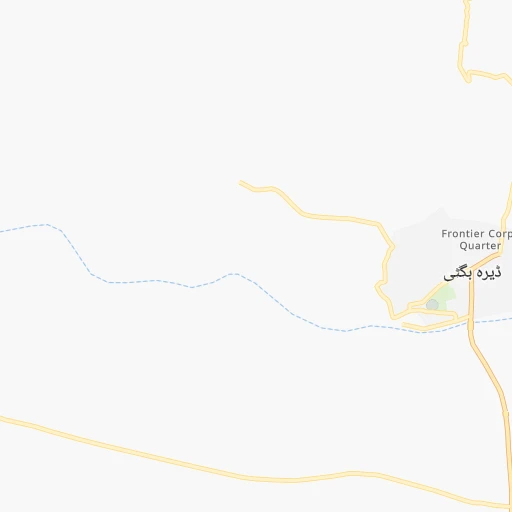
How to get from Dera Bugti (Balochistān) to Quetta (Balochistān)
Calculate route from Dera Bugti (Balochistān, Pakistan) to Quetta (Balochistān, Pakistan).
The flight distance (as the crow flies) between Dera Bugti and Quetta is 244.3 km.
Roadmap (route) to go from Dera Bugti to Quetta detailed above, you can also see the course layout on the map.
While doing trip Dera Bugti - Quetta by car, the calculated route ends at a distance , or more straight.
Distance and duration of the route between Dera Bugti and Quetta
Calculation of distance and route from Quetta to Dera Bugti :
244.3341.5 km6h2mn
Continue 0h1mn 515 mTurn right onto Main Bazaar 0h1mn 602 mTurn left onto Main Bazaar 0h0mn 102 mTurn right 0h0mn 48 mKeep left 0h6mn 2.9 kmTurn sharp right 2h20mn 116.4 kmTurn right 0h1mn 973 mTurn sharp left 0h20mn 16.7 kmTurn slight left 1h49mn 40.6 kmTurn left 0h4mn 3.2 kmTurn left 0h0mn 130 mKeep right 0h1mn 650 mTurn right 0h6mn 6.1 kmKeep right 0h1mn 615 mKeep left 0h0mn 94 mTurn slight right onto کوئٹہ - جیکب آباد شاہراہ 0h13mn 15.7 kmKeep left onto Dadhar Road 0h5mn 5.1 kmContinue onto Dadhar Road 0h0mn 184 mContinue onto کوئٹہ - جیکب آباد شاہراہ 2h51mn 129.1 kmTurn right onto Double Road Bridge 0h0mn 432 mTurn right onto Zarghun Road 0h0mn 95 mTurn left 0h1mn 398 mTurn right onto Jan Muhammad Road 0h0mn 103 mTurn left onto Jan Muhammad Road 0h1mn 663 mTurn left onto New Al-Gellani Road Quetta 0h1mn 273 mArrive at destination 0h0mn 0 m
Travel from Dera Bugti (Balochistān) to a selection of major cities.
Distances from Dera Bugti to biggest cities in Balochistān
Other major cities in country :
- Jhang Sadr [04], 341,210 inhabitants. 393 km
- Gujrat [04], 301,506 inhabitants. 613 km
- Mardan [03], 300,424 inhabitants. 637 km
- Malir Cantonment [05], 300,000 inhabitants. 495 km
- Kasur [04], 290,643 inhabitants. 560 km
- Mingora [03], 279,914 inhabitants. 707 km
- Dera Ghazi Khan [04], 236,093 inhabitants. 182 km
- Sahiwal [04], 235,695 inhabitants. 422 km
- Nawabshah [05], 229,504 inhabitants. 320 km
- Okara [04], 223,648 inhabitants. 459 km
- Mirpur Khas [05], 215,657 inhabitants. 391 km
- Chiniot [04], 201,781 inhabitants. 473 km
- Shahkot [04], 200,000 inhabitants. 502 km
- Kamoke [04], 199,531 inhabitants. 586 km
- Saddiqabad [04], 189,876 inhabitants. 124 km
- Burewala [04], 183,915 inhabitants. 361 km
- Jacobabad [05], 170,588 inhabitants. 110 km
- Muzaffargarh [04], 165,192 inhabitants. 228 km
- Muridke [04], 164,246 inhabitants. 578 km
- Jhelum [04], 164,080 inhabitants. 615 km
Route from Quetta to major cities (Pakistan).
- Distance Quetta Karachi593 km
- Distance Quetta Lahore719 km
- Distance Quetta Faisalabad598 km
- Distance Quetta Rawalpindi686 km
- Distance Quetta Multan431 km
- Distance Quetta Hyderabad550 km
- Distance Quetta Gujranwala719 km
- Distance Quetta Peshawar606 km
- Distance Quetta Rahim Yar Khan376 km
- Distance Quetta Muzaffarabad766 km
- Distance Quetta Battagram755 km
- Distance Quetta Kotli750 km
- Distance Quetta Islamabad693 km
- Distance Quetta Bahawalpur460 km
- Distance Quetta Sargodha580 km
- Distance Quetta Sialkot760 km
- Distance Quetta Sukkur330 km
- Distance Quetta Larkana315 km
- Distance Quetta Shekhupura688 km
- Distance Quetta Bhimbar739 km
Nearest cities to Dera Bugti :
- Multan, 1,437,230 inhabitants. 259 km
- Rahim Yar Khan, 788,915 inhabitants. 131 km
- Quetta, 733,675 inhabitants. 245 km
- Bahawalpur, 552,607 inhabitants. 248 km
- Sukkur, 417,767 inhabitants. 151 km
- Larkana, 364,033 inhabitants. 189 km
- Dera Ghazi Khan, 236,093 inhabitants. 182 km
- Nawabshah, 229,504 inhabitants. 320 km
- Saddiqabad, 189,876 inhabitants. 124 km
- Jacobabad, 170,588 inhabitants. 110 km
- Muzaffargarh, 165,192 inhabitants. 228 km
- Shikarpur, 156,901 inhabitants. 131 km
- Khanpur, 142,426 inhabitants. 152 km
- Khuzdar, 141,227 inhabitants. 284 km
- Dadu, 139,784 inhabitants. 290 km
- Khairpur Mir's, 124,602 inhabitants. 172 km
- Ahmadpur East, 116,579 inhabitants. 205 km
- Kot Addu, 104,217 inhabitants. 237 km
- Dera Ismail Khan, 101,616 inhabitants. 353 km
- Lodhran, 97,249 inhabitants. 247 km
- Chaman, 88,568 inhabitants. 335 km
- Kandhkot, 88,468 inhabitants. 88 km
- Bhakkar, 81,950 inhabitants. 342 km
- Layyah, 78,954 inhabitants. 275 km
- Kambar, 77,481 inhabitants. 197 km
- Moro, 76,765 inhabitants. 288 km
- Shahdad Kot, 75,411 inhabitants. 180 km
- Pano Aqil, 72,881 inhabitants. 131 km
- Kahror Pakka, 69,743 inhabitants. 275 km
- Kot Malik Barkhurdar, 69,359 inhabitants. 247 km
- Shorkot, 67,439 inhabitants. 360 km
- Shujaabad, 65,952 inhabitants. 227 km
- Ghotki, 64,295 inhabitants. 116 km
- Sibi, 64,069 inhabitants. 137 km
- Jampur, 63,791 inhabitants. 155 km
- Sanghar, 62,033 inhabitants. 333 km
- Kabirwala, 60,782 inhabitants. 303 km
- Rajanpur, 50,682 inhabitants. 114 km
- Rohri, 50,649 inhabitants. 152 km
- Zhob, 50,537 inhabitants. 258 km
- Mirpur Mathelo, 49,311 inhabitants. 119 km
- Dullewala, 48,682 inhabitants. 381 km
- Ratodero, 47,819 inhabitants. 162 km
- Jatoi Shimali, 47,144 inhabitants. 172 km
- Taunsa, 44,869 inhabitants. 235 km
- Usta Muhammad, 43,983 inhabitants. 145 km
- Sehwan, 41,150 inhabitants. 318 km
- Khairpur, 40,083 inhabitants. 121 km
- New Badah, 38,855 inhabitants. 219 km
- Loralai, 37,787 inhabitants. 158 km
Location Dera Bugti (Balochistān) :
| Country flag |  |
| Location | Dera Bugti |
| State | Balochistān |
| County | |
| Country | Pakistan |
| Country code / ISO 2 | PK |
| Latitude | 29.0361900 |
| Longitude | 69.1584900 |
| Altitude | 0 meters |
| Time zone | Asia/Karachi |
Location Quetta (Balochistān) :
| Country flag |  |
| Location | Quetta |
| State | Balochistān |
| County | |
| Country | Pakistan |
| Country code / ISO 2 | PK |
| Latitude | 30.1841400 |
| Longitude | 67.0014100 |
| Altitude | 0 meters |
| Time zone | Asia/Karachi |


