
How to get from Bheramara Railway Station (Khulna) to Feni (Chittagong)
Calculate route from Bheramara Railway Station (Khulna, Bangladesh) to Feni (Chittagong, Bangladesh).
The flight distance (as the crow flies) between Bheramara Railway Station and Feni is 269.4 km.
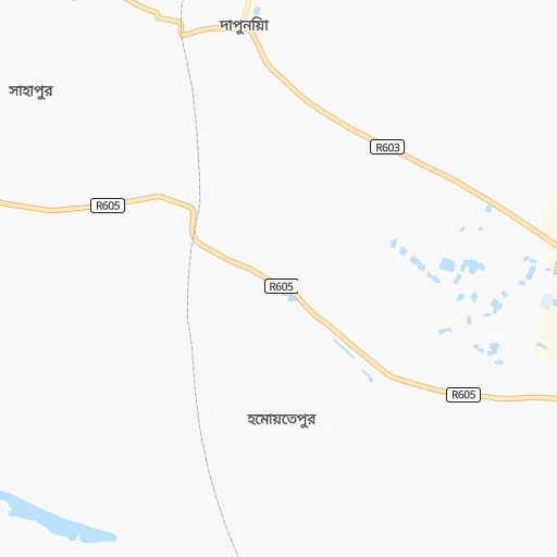
Roadmap (route) to go from Bheramara Railway Station to Feni detailed above, you can also see the course layout on the map.
While doing trip Bheramara Railway Station - Feni by car, the calculated route ends at a distance , or more straight.
Distance and duration of the route between Bheramara Railway Station and Feni
Calculation of distance and route from Feni to Bheramara Railway Station :
269.4359.2 km5h48mn
Continue onto দাউদ মন্ডল সড়ক 0h0mn 168 mTurn left 0h1mn 475 mTurn left 0h3mn 2.5 kmTurn right onto কুষ্টিয়া রাজশাহী মহাসড়ক 0h21mn 18.5 kmAt roundabout, take exit 1 onto RA Khan Chowdhury Road 0h2mn 1.4 kmTurn right onto নুরুদ্দীন আহমেদ সড়ক 0h4mn 2.7 kmTurn sharp left onto Dhaka - Kushtia Highway 1h54mn 59.0 kmAt roundabout, take exit 3 onto ফরিদপুর - রাজবাড়ী মহাসড়ক 0h2mn 2.2 kmTurn slight left onto Faridpur - Rajbari Highway 0h13mn 7.8 kmAt roundabout, take exit 2 onto ফরিদপুর-রাজবাড়ি হাইওয়ে 0h14mn 15.8 kmAt roundabout, take exit 1 onto N803 0h0mn 92 mTurn right onto Faridpur Bypass Road 0h5mn 5.3 kmKeep right onto N808 0h0mn 62 mTurn right onto Faridpur-Bhanga Highway 0h21mn 24.9 kmKeep left 0h18mn 30.4 kmKeep right onto মাওয়া-ভাঙ্গা এক্সপ্রেসওয়ে 0h6mn 9.6 kmAt roundabout, take exit 2 onto ঢাকা-মাওয়া এক্সপ্রেসওয়ে 0h19mn 32.1 kmKeep left 0h1mn 810 mTurn sharp right onto Shahid Faruk Road 0h0mn 14 mKeep right 0h0mn 36 mAt roundabout, take exit 1 onto ঢাকা-চট্টগ্রাম মহাসড়ক 0h8mn 9.4 kmContinue onto ঢাকা-চট্টগ্রাম মহাসড়ক 0h12mn 13.9 kmKeep right onto ঢাকা-চট্টগ্রাম মহাসড়ক 1h19mn 117.0 kmTurn left onto ট্রাঙ্ক রোড 0h3mn 3.0 kmKeep right onto ট্রাঙ্ক রোড 0h2mn 2.1 kmTurn left onto Sohid Selina Parbin Road 0h1mn 151 mArrive at destination 0h0mn 0 m
Travel from Bheramara Railway Station (Chittagong) to a selection of major cities.
Distances from Bheramara Railway Station to biggest cities in Khulna
Other major cities in country :
- Paltan [81], 184,492 inhabitants. 148 km
- Tangail [81], 180,144 inhabitants. 97 km
- Jamalpur [H], 167,900 inhabitants. 139 km
- Puthia [83], 159,406 inhabitants. 41 km
- Nawabganj [83], 142,361 inhabitants. 96 km
- Sonargaon [81], 130,000 inhabitants. 171 km
- Sirajganj [83], 127,481 inhabitants. 87 km
- Faridpur [81], 112,187 inhabitants. 98 km
- Sherpur [H], 107,419 inhabitants. 152 km
- Bhairab Bazar [81], 105,457 inhabitants. 202 km
- Shahzadpur [83], 102,420 inhabitants. 64 km
- Bhola [85], 99,079 inhabitants. 225 km
- Azimpur [81], 96,641 inhabitants. 146 km
- Kishorganj [81], 90,690 inhabitants. 188 km
- Bibir Hat [84], 89,030 inhabitants. 323 km
- Habiganj [86], 88,760 inhabitants. 249 km
- Madaripur [81], 84,789 inhabitants. 156 km
- Feni [84], 84,028 inhabitants. 270 km
- Laksham [84], 82,290 inhabitants. 234 km
- Ishurdi [83], 81,995 inhabitants. 14 km
Route from Feni to major cities (Bangladesh).
- Distance Feni Dhaka127 km
- Distance Feni Khulna189 km
- Distance Feni Rajshahi323 km
- Distance Feni Shibganj306 km
- Distance Feni Natore291 km
- Distance Feni Rangpur374 km
- Distance Feni Tungi141 km
- Distance Feni Narsingdi123 km
- Distance Feni Bagerhat169 km
- Distance Feni Jessore224 km
- Distance Feni Nagarpur194 km
- Distance Feni Sylhet215 km
- Distance Feni Mymensingh219 km
- Distance Feni Narayanganj113 km
- Distance Feni Bogra290 km
- Distance Feni Dinajpur404 km
- Distance Feni Barisal111 km
- Distance Feni Saidpur399 km
- Distance Feni Par Naogaon319 km
- Distance Feni Pabna247 km
Nearest cities to Bheramara Railway Station :
- Dhaka, 10,356,500 inhabitants. 148 km
- Chittagong, 3,920,222 inhabitants. 346 km
- Khulna, 1,342,339 inhabitants. 147 km
- Rajshahi, 700,133 inhabitants. 56 km
- Comilla, 389,411 inhabitants. 232 km
- Shibganj, 378,701 inhabitants. 114 km
- Natore, 369,138 inhabitants. 43 km
- Rangpur, 343,122 inhabitants. 194 km
- Tungi, 337,579 inhabitants. 144 km
- Narsingdi, 281,080 inhabitants. 176 km
- Bagerhat, 266,388 inhabitants. 173 km
- Jessore, 243,987 inhabitants. 98 km
- Nagarpur, 238,422 inhabitants. 90 km
- Sylhet, 237,000 inhabitants. 308 km
- Mymensingh, 225,126 inhabitants. 165 km
- Narayanganj, 223,622 inhabitants. 160 km
- Bogra, 210,000 inhabitants. 100 km
- Dinajpur, 206,234 inhabitants. 182 km
- Barisal, 202,242 inhabitants. 203 km
- Saidpur, 199,422 inhabitants. 196 km
- Par Naogaon, 192,464 inhabitants. 87 km
- Pabna, 186,781 inhabitants. 25 km
- Paltan, 184,492 inhabitants. 148 km
- Tangail, 180,144 inhabitants. 97 km
- Jamalpur, 167,900 inhabitants. 139 km
- Puthia, 159,406 inhabitants. 41 km
- Nawabganj, 142,361 inhabitants. 96 km
- Kushtia, 135,724 inhabitants. 19 km
- Sonargaon, 130,000 inhabitants. 171 km
- Satkhira, 128,918 inhabitants. 147 km
- Sirajganj, 127,481 inhabitants. 87 km
- Faridpur, 112,187 inhabitants. 98 km
- Sherpur, 107,419 inhabitants. 152 km
- Bhairab Bazar, 105,457 inhabitants. 202 km
- Shahzadpur, 102,420 inhabitants. 64 km
- Bhola, 99,079 inhabitants. 225 km
- Azimpur, 96,641 inhabitants. 146 km
- Kishorganj, 90,690 inhabitants. 188 km
- Bibir Hat, 89,030 inhabitants. 323 km
- Habiganj, 88,760 inhabitants. 249 km
- Madaripur, 84,789 inhabitants. 156 km
- Feni, 84,028 inhabitants. 270 km
- Laksham, 82,290 inhabitants. 234 km
- Ishurdi, 81,995 inhabitants. 14 km
- Sarishabari, 81,325 inhabitants. 118 km
- Netrakona, 79,016 inhabitants. 200 km
- Joypur Hat, 73,068 inhabitants. 120 km
- Thakurgaon, 71,096 inhabitants. 230 km
- Palang, 67,652 inhabitants. 165 km
- Lalmonirhat, 65,127 inhabitants. 216 km
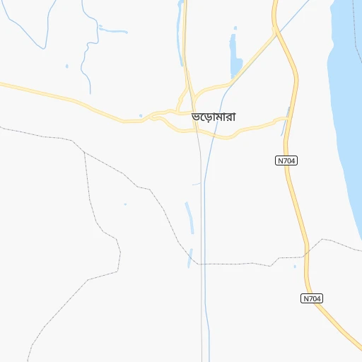
Location Bheramara Railway Station (Khulna) :
| Country flag |  |
| Location | Bheramara Railway Station |
| State | Khulna |
| County | Kushtia |
| Country | Bangladesh |
| Country code / ISO 2 | BD |
| Latitude | 24.0231500 |
| Longitude | 88.9919700 |
| Altitude | 0 meters |
| Time zone | Asia/Dhaka |
Location Feni (Chittagong) :
| Country flag | |
| Location | Feni |
| State | Chittagong |
| County | Feni |
| Country | Bangladesh |
| Country code / ISO 2 | BD |
| Latitude | 23.0144000 |
| Longitude | 91.3966000 |
| Altitude | 0 meters |
| Time zone | Asia/Dhaka |
