


How to get from Shorkot (Khyber Pakhtunkhwa) to Shahkot (Punjab)
Calculate route from Shorkot (Khyber Pakhtunkhwa, Pakistan) to Shahkot (Punjab, Pakistan).
The flight distance (as the crow flies) between Shorkot and Shahkot is 249.3 km.
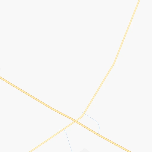
Roadmap (route) to go from Shorkot to Shahkot detailed above, you can also see the course layout on the map.
While doing trip Shorkot - Shahkot by car, the calculated route ends at a distance , or more straight.
Distance and duration of the route between Shorkot and Shahkot
Calculation of distance and route from Shahkot to Shorkot :
249.3310.6 km5h32mn
Continue 0h0mn 77 mTurn left 0h0mn 151 mTurn right 0h0mn 44 mTurn sharp right 0h1mn 598 mTurn left onto قومی شاہراہ 55 0h13mn 15.6 kmAt roundabout, take exit 2 onto قومی شاہراہ 55 0h12mn 13.7 kmTurn right 0h4mn 3.5 kmKeep left 0h13mn 10.9 kmTurn right onto Karor-Bhakkar Road 0h0mn 120 mTurn left 0h0mn 373 mTurn right 0h1mn 1.1 kmTurn left 0h0mn 58 mKeep left onto Jhang Bhakkar Road 2h41mn 119.0 kmTurn left onto Jhang Bhakkar road 0h1mn 1.3 kmTurn left onto Jhang Bhakkar Road 0h20mn 23.8 kmContinue onto خانیوال روڈ 0h1mn 819 mAt roundabout, take exit 4 onto Faisalabad Road 0h6mn 7.3 kmContinue 1h58mn 65.6 kmKeep right onto Rajbah Road 0h3mn 2.9 kmAt roundabout, take exit 3 onto Abdullahpur Overpass 0h2mn 1.3 kmKeep left 0h11mn 9.5 kmKeep left onto West Canal Road 0h0mn 22 mTurn left 0h0mn 55 mTurn right onto Civic Centre 0h0mn 141 mTurn right 0h0mn 49 mTurn right onto فیصل آباد - شیخو پورہ - لاہور روڈ 0h23mn 31.6 kmTurn right onto Shahkot Road 0h1mn 959 mTurn right 0h1mn 155 mArrive at destination 0h0mn 0 m
Travel from Shorkot (Punjab) to a selection of major cities.
Distances from Shorkot to biggest cities in Khyber Pakhtunkhwa
- Lakki,36,391 inhabitants.78 km
- Topi,36,340 inhabitants.290 km
- Hangu,36,150 inhabitants.181 km
- Upper Dir,29,869 inhabitants.379 km
- Tangi,29,444 inhabitants.276 km
- Utmanzai,29,423 inhabitants.267 km
- Thal,29,331 inhabitants.417 km
- Zaida,26,787 inhabitants.282 km
- Aman Garh,25,723 inhabitants.253 km
- Akora,23,288 inhabitants.261 km
- Kulachi,22,376 inhabitants.40 km
Other major cities in country :
- Gujrat [04], 301,506 inhabitants. 310 km
- Malir Cantonment [05], 300,000 inhabitants. 855 km
- Kasur [04], 290,643 inhabitants. 350 km
- Dera Ghazi Khan [04], 236,093 inhabitants. 209 km
- Sahiwal [04], 235,695 inhabitants. 253 km
- Nawabshah [05], 229,504 inhabitants. 676 km
- Okara [04], 223,648 inhabitants. 274 km
- Mirpur Khas [05], 215,657 inhabitants. 733 km
- Chiniot [04], 201,781 inhabitants. 200 km
- Shahkot [04], 200,000 inhabitants. 250 km
- Kamoke [04], 199,531 inhabitants. 316 km
- Saddiqabad [04], 189,876 inhabitants. 407 km
- Burewala [04], 183,915 inhabitants. 257 km
- Jacobabad [05], 170,588 inhabitants. 467 km
- Muzaffargarh [04], 165,192 inhabitants. 207 km
- Muridke [04], 164,246 inhabitants. 320 km
- Jhelum [04], 164,080 inhabitants. 291 km
- Shikarpur [05], 156,901 inhabitants. 490 km
- Hafizabad [04], 153,656 inhabitants. 266 km
- Khanpur [04], 142,426 inhabitants. 364 km
Route from Shahkot to major cities (Pakistan).
- Distance Shahkot Karachi980 km
- Distance Shahkot Hyderabad850 km
- Distance Shahkot Peshawar325 km
- Distance Shahkot Quetta638 km
- Distance Shahkot Muzaffarabad312 km
- Distance Shahkot Battagram348 km
- Distance Shahkot Kotli220 km
- Distance Shahkot Islamabad243 km
- Distance Shahkot Sukkur621 km
- Distance Shahkot Larkana678 km
- Distance Shahkot Bhimbar166 km
- Distance Shahkot Mardan322 km
- Distance Shahkot Malir Cantonment960 km
- Distance Shahkot Mingora372 km
- Distance Shahkot Nawabshah773 km
- Distance Shahkot Mirpur Khas802 km
- Distance Shahkot Jacobabad609 km
- Distance Shahkot Shikarpur617 km
- Distance Shahkot Kohat294 km
- Distance Shahkot Khuzdar785 km
Nearest cities to Shorkot :
- Faisalabad, 2,506,595 inhabitants. 217 km
- Rawalpindi, 1,743,101 inhabitants. 277 km
- Multan, 1,437,230 inhabitants. 199 km
- Peshawar, 1,218,773 inhabitants. 243 km
- Muzaffarabad, 725,000 inhabitants. 365 km
- Battagram, 700,000 inhabitants. 367 km
- Islamabad, 601,600 inhabitants. 286 km
- Bahawalpur, 552,607 inhabitants. 290 km
- Sargodha, 542,603 inhabitants. 171 km
- Jhang Sadr, 341,210 inhabitants. 154 km
- Mardan, 300,424 inhabitants. 277 km
- Mingora, 279,914 inhabitants. 348 km
- Dera Ghazi Khan, 236,093 inhabitants. 209 km
- Sahiwal, 235,695 inhabitants. 253 km
- Okara, 223,648 inhabitants. 274 km
- Chiniot, 201,781 inhabitants. 200 km
- Shahkot, 200,000 inhabitants. 250 km
- Burewala, 183,915 inhabitants. 257 km
- Muzaffargarh, 165,192 inhabitants. 207 km
- Jhelum, 164,080 inhabitants. 291 km
- Hafizabad, 153,656 inhabitants. 266 km
- Kohat, 151,427 inhabitants. 194 km
- Gojra, 139,726 inhabitants. 191 km
- Mandi Bahauddin, 129,733 inhabitants. 257 km
- Pakpattan, 126,706 inhabitants. 296 km
- Bahawalnagar, 126,700 inhabitants. 283 km
- Bahawalnagar, 126,617 inhabitants. 311 km
- Chishtian, 122,199 inhabitants. 302 km
- Abbottabad, 120,000 inhabitants. 331 km
- Jaranwala, 119,785 inhabitants. 249 km
- Ahmadpur East, 116,579 inhabitants. 310 km
- Vihari, 112,840 inhabitants. 251 km
- Kamalia, 112,426 inhabitants. 214 km
- Kot Addu, 104,217 inhabitants. 161 km
- Khushab, 102,793 inhabitants. 146 km
- Dera Ismail Khan, 101,616 inhabitants. 9 km
- Chakwal, 101,200 inhabitants. 218 km
- Swabi, 97,363 inhabitants. 287 km
- Lodhran, 97,249 inhabitants. 274 km
- Nowshera Cantonment, 96,766 inhabitants. 255 km
- Charsadda, 95,319 inhabitants. 262 km
- Mianwali, 89,570 inhabitants. 96 km
- Hasilpur, 88,031 inhabitants. 294 km
- Arifwala, 87,360 inhabitants. 276 km
- Attock City, 85,479 inhabitants. 249 km
- Chichawatni, 82,762 inhabitants. 231 km
- Bhakkar, 81,950 inhabitants. 36 km
- Layyah, 78,954 inhabitants. 106 km
- Mian Channun, 76,226 inhabitants. 216 km
- Bhalwal, 74,744 inhabitants. 195 km
Location Shorkot (Khyber Pakhtunkhwa) :
| Country flag |  |
| Location | Shorkot |
| State | Khyber Pakhtunkhwa |
| County | |
| Country | Pakistan |
| Country code / ISO 2 | PK |
| Latitude | 31.9102300 |
| Longitude | 70.8775700 |
| Altitude | 0 meters |
| Time zone | Asia/Karachi |
Location Shahkot (Punjab) :
| Country flag | |
| Location | Shahkot |
| State | Punjab |
| County | Nankāna Sāhib District |
| Country | Pakistan |
| Country code / ISO 2 | PK |
| Latitude | 31.5709000 |
| Longitude | 73.4853100 |
| Altitude | 190 meters |
| Time zone | Asia/Karachi |